-
 Royal Geographical Society (RGS), Sakhalin, 1872£ 245.00
 -
James Wyld, The Caspian Sea and Environs during the Russo-Khivan War, 1873£ 925.00
-
Justus Perthes, Taimyr Peninsula in the Russian Arctic, 1873£ 245.00
-
Royal Geographical Society (RGS), Western Mongolia, 1873£ 525.00
-
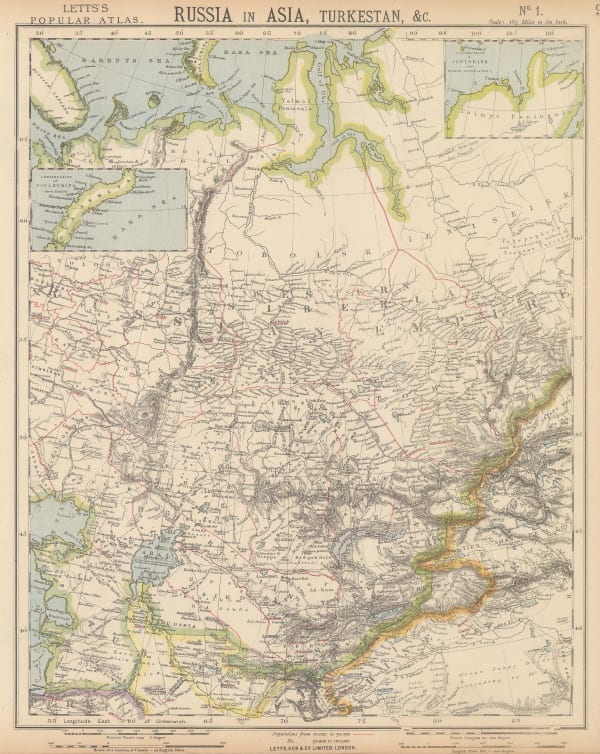
James Wyld, Russia in Asia, 1874£ 77.00
-
Royal Geographical Society (RGS), Central Asia, 1875£ 550.00
-
Royal Geographical Society (RGS), Khanate of Khiva, 1875£ 325.00
-
Royal Geographical Society (RGS), Map of Central Asia, 1878£ 575.00
-
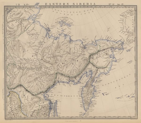
Society for the Diffusion of Useful Knowledge (SDUK), Eastern Siberia, 1879£ 85.00
-
Royal Geographical Society (RGS), Map of Kuldja District and the Russo-Chinese Frontier in Turkistan, 1880£ 145.00
-
Royal Geographical Society (RGS), Part of Central Asia, 1884£ 285.00
-
Royal Geographical Society (RGS), The Pamir, 1884£ 165.00
-
Royal Geographical Society (RGS), The Pamir: Illustrating the Russian Explorations in 1883, 1884£ 185.00
-
Royal Geographical Society (RGS), Central Asia, 1888£ 1,850.00
-
Arbuckle Brothers Company, Siberia, 1889£ 98.00
-
Royal Geographical Society (RGS), Map to Illustrate the paper by Colonel Mark S. Bell on The Great Central Asian Trade Route, 1890£ 495.00
-
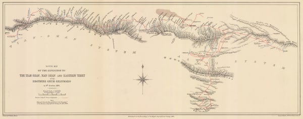
Royal Geographical Society (RGS), Route Map of the Expedition to The Tian-Shan, Nan-Shan and Eastern Tibet of the Brothers Grum Grijimailo, 1891£ 150.00
-
Letts & Son, Central Asia & Asiatic Russia, 1892£ 95.00
-
Royal Geographical Society (RGS), The Pamir, 1892£ 125.00
-
Royal Geographical Society (RGS), Map of Central Asia, 1893£ 485.00
-
Royal Geographical Society (RGS), Chinese Turkistan, 1893£ 225.00
-
Justus Perthes, Sakhalin, 1894£ 78.00
-
Royal Geographical Society (RGS), Map to Illustrate the Journey of Mr. St. George R. Littledale, 1894£ 145.00
-
Scottish Geographical Society (SGS), The Mountain Systems of Central Asia, 1894£ 88.00
-
Justus Perthes, Die Wanderung des Lop-Nor Beckens in Neuerer Zeit von Dr. Sven Hedin, 1896£ 62.00
-
George Philip & Son Ltd., Siberia, or Asiatic Russia, 1896£ 32.00
-
Justus Perthes, Karte vom untern Laufe des Sir Darja, 1896£ 65.00
-
Royal Geographical Society (RGS), The Pamirs and Adjoining Territories of Central Asia and India, 1896£ 475.00
-
Royal Geographical Society (RGS), The Mouths of the Obi & Yenisei Rivers, 1898£ 175.00
-
Royal Geographical Society (RGS), Sketch Map of Central Asia, 1898£ 425.00
-
Royal Geographical Society (RGS), Sketch map of Tibet and Northern China, 1898£ 350.00
-
Royal Geographical Society (RGS), Geological map of the Transcaspian Depression, 1898£ 95.00
-
Scottish Geographical Society (SGS), Kamchatka Peninsula, 1899£ 145.00
-
Royal Geographical Society (RGS), Sketch map of Bokhara, 1899£ 125.00
-
Royal Geographical Society (RGS), Map Showing Portions of Chinese Turkestan, 1902£ 445.00
-
Royal Geographical Society (RGS), Kun-Lun Range, Chinese Turkestan, 1911£ 375.00
-
Royal Geographical Society (RGS), Map Showing Portions of Chinese Turkestan and Kansu, 1911£ 1,350.00
-
Royal Geographical Society (RGS), Western and Central Nan-Shan, 1911£ 375.00
-
Royal Geographical Society (RGS), Sketch map Showing the Route from Kashgar to Kowlun, 1912£ 115.00
-
Royal Geographical Society (RGS), The Basin of the Upper Yenisei, 1913£ 245.00
-
Royal Geographical Society (RGS), Map of the Turgun or Kundelun Mountains in North-West Mongolia, 1914£ 195.00
-
Royal Geographical Society (RGS), Routes Through Barga and North Eastern Mongolia, 1915£ 155.00
-
Alexander Gross, Central Asia, 1935 c.£ 295.00


Page
2
of 2