-
 Giovanni Maria Cassini, L'America secondo le ultime osservazioni, 1788£ 875.00
 -
Emanuel Bowen, A New & Accurate Chart of the Discoveries made by the late Capt. Js. Cook, 1790 c.£ 895.00
-
Laurie & Whittle, A New Chart of the Southern Ocean, 1794£ 750.00
-
Laurie & Whittle, America North and South and the West Indies, 1794£ 525.00
-
Charles Francois Delamarche, L'Amerique, 1795£ 495.00
-
John Meares, The North Pacific Ocean, 1795 c.£ 675.00
-
Samuel John Neele, A New Map of America, 1797£ 125.00
-
Jean Francois de La Perouse, Partie de la Mer du Sud Comprise Entre les Philipinnes et la Californie, 1797£ 430.00
-
Count Jean-Francois de la Perouse, Carte de Cotes de L'Amerique et de L'Asie depuis la Californie jusqu'a Macao, 1797£ 750.00
-
William Heather, Sea Chart of the South Atlantic & South America, 1799£ 2,250.00
-
Daniel Friedrich Sotzmann, Karte von einem Theil der Nordwestlichen Kuste von America, 1800£ 795.00
-
Charles Francois Delamarche, L'Amerique, 1800£ 1,950.00
-
J.C. & J.A. Dezauche, Carte d'Amerique, 1801£ 850.00
-
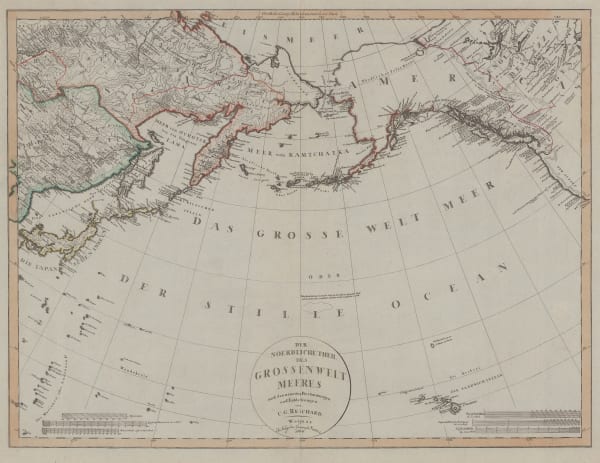
Cadell & Davies, Alaska, Kamchatka & the Bering Strait, 1802£ 295.00
-
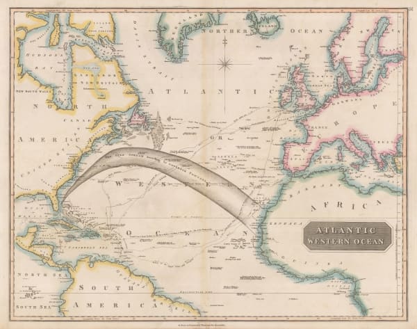
Laurie & Whittle, A New and Correct Chart exhibiting the Atlantic and Western Ocean and the greatest part of the Ethiopic or Southern Ocean, 1802£ 4,450.00
-
Isidoro de Antillon, El Oceano Atlantico, 1802£ 2,800.00
-
Johann Christoph Reinecke, Charte America, 1803£ 730.00
-
Christian Gottlieb Reichard, Chart of the North Pacific Ocean, 1804£ 785.00
-
Charles Francois Delamarche, Amerique or Indes Occidentales, 1804 c.£ 1,250.00
-
Laurie & Whittle, New General Map of America, 1805£ 495.00
-
William Heather, A New Chart of the Atlantic or the Western Ocean, 1807£ 4,500.00
-
William Faden, James Cook's Voyage to Alaska & the Bering Strait, 1808£ 2,850.00
-
-
John Thomson, Southern Hemisphere, 1814£ 675.00
-
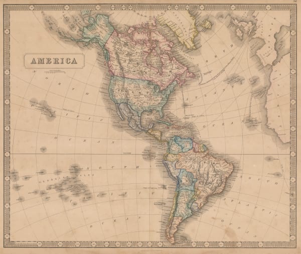
John Thomson, America, 1815 c.£ 875.00
-
Christian Gottlieb Reichard, America, 1816£ 225.00
-
John Thomson, Chart of the Northern Passage between Asia & America, 1816£ 525.00
-
John Thomson, Map of the Islands in the Pacific Ocean, 1817£ 445.00
-
Felix Delamarche, Carte Generale De L'Amerique, 1818£ 675.00
-
Jean Francois de La Perouse, Carte Reduite du Grand Ocean, 1818£ 725.00
-
John Cary, A New Map of America, 1819£ 1,250.00
-
Eustache Herisson, Carte D'Amerique Septentrionale et Meridionale, 1820£ 595.00
-
Johann Walch, Charte Von America, 1820£ 155.00
-
William Darton, The Western Hemisphere or New World, 1820 c.£ 115.00
-
John Thomson, Atlantic or Western Ocean, 1820 c.£ 525.00
-
Carey & Lea, Geographical, Statistical, and Historial Map of America, 1822£ 525.00
-
Jean Buchon, Carte Geographique, Statistique et Historique de L'Amerique, 1825£ 125.00
-
Carl Weiland, America, 1828£ 595.00
-
C.V. Lavoisne, Geographical, Historical, and Statistical Map of America, 1828£ 395.00
-
Carl Weiland, Australien, 1830£ 875.00
-
Thomas Starling, South Sea Islands, 1830 c.£ 115.00
-
James Wyld, Map of America, 1840£ 875.00
-
Daniel & William Lizars, Chart of the Atlantic Ocean, 1840 c.£ 145.00
-
W. & A.K. Johnston, Islands in the Pacific Ocean, 1840 c.£ 80.00
-
James Wyld, Map of America, 1842£ 750.00
-
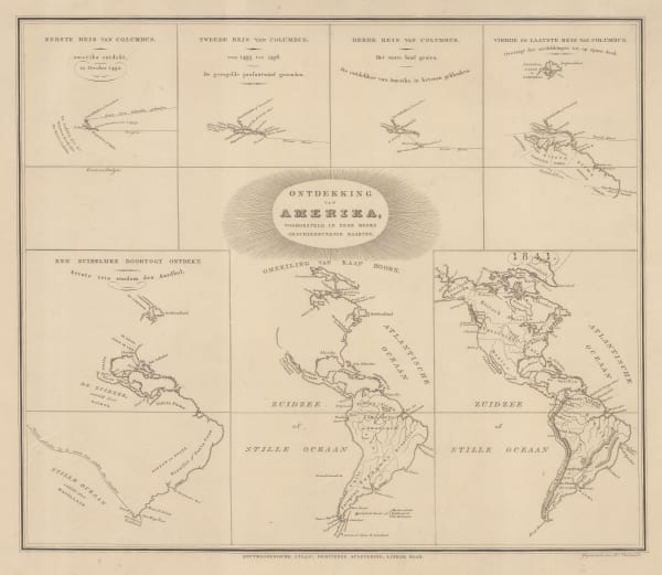
Daniel Veelward, The Discovery of America, 1842£ 350.00
-
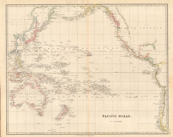
John Arrowsmith, Pacific Ocean, 1842£ 185.00
-
John Arrowsmith, America, 1844£ 1,950.00
-
Henry Teesdale, America, 1845 c.£ 445.00
-
Joseph Meyer, Neuste Karte von Australien, 1846£ 165.00
-
Samuel Augustus Mitchell, Oceana or Pacific Ocean, 1846£ 225.00
-
Joseph Meyer, Der Grosse Ocean und Australien, 1849£ 120.00
-
Justus Perthes, Ost-Polynesien, 1849£ 88.00
-
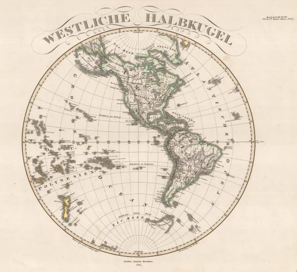
Justus Perthes, Westliche Halbkugel, 1850£ 165.00
-
George Philip, America, 1850 c.£ 495.00
-
Joseph Meyer, America, 1850 c.£ 85.00
-
Gall & Inglis, Map of Islands in the Pacific Ocean, 1850 c.£ 88.00
-
James Wyld, The Basin of the Pacific, 1850 c.£ 875.00
-
John Tallis, Western Hemisphere, 1851£ 425.00
-
George Philip & Son Ltd., Alaska, Kamchatka & the Bering Strait, 1853£ 575.00
-
Charles V. Monin, Oceanie, 1853£ 125.00
-
Aimé Robiquet, Carte Generale de L'Ocean Atlantique Septentrional, 1855£ 785.00
-
George Philip, Islands in the Pacific Ocean, 1856£ 250.00
-
Carl Christian Franz Radefeld, Der Warme Meeresstrom des Atlantischen und Der Kalte Strom des Grossen Oceans, 1858£ 88.00
-
Carl Christian Franz Radefeld, Karte von Atlantischen Ocean, 1858£ 68.00
-
F.A. Garnier, Oceanie, 1860£ 225.00
-
Daniel & William Lizars, America, 1860 c.£ 350.00
-
Victor Levasseur, Océanie, 1860 c.£ 275.00
-
Justus Perthes, Edbeben-Fluth im Pacifischen Ocean, 13-16 August 1868, 1869£ 65.00
-
Justus Perthes, Overview Map of Alexander von Humboldt's Travels, 1869£ 225.00
-
Justus Perthes, Die Inneln des Grossen Oceans, 1870£ 50.00
-
Royal Geographical Society (RGS), Surface Temperatures of the North Atlantic between Shetland & Greenland, 1870£ 155.00
-
Archibald Fullarton, Oceania and Pacific Ocean, 1870 c.£ 115.00
-
John Dower, Pacific Ocean, 1871£ 80.00
-
Royal Geographical Society (RGS), Sketch Map of the Countries Referred to in the Zeno Narrative, 1873£ 95.00
-
Adrien Brue, Carte Generale de L'Oceanie, 1876£ 145.00
-
G. & J. Bartholomew, North Atlantic Ocean, 1887£ 44.00
-
G. & J. Bartholomew, Oceania, 1887£ 38.00
-
Scottish Geographical Society (SGS), Coral Reefs in the Pacific Ocean, 1888£ 195.00
-
Justus Perthes, Atlantischer Ocean, 1895£ 36.00


Page
2
of 3