-
 Royal Geographical Society (RGS), Map to Illustrate The Report of an Expedition into The Interior of Western Australia, 1856£ 85.00
 -
Royal Geographical Society (RGS), A.C. Gregory's North Australian Exploring Expedition, 1858£ 675.00
-
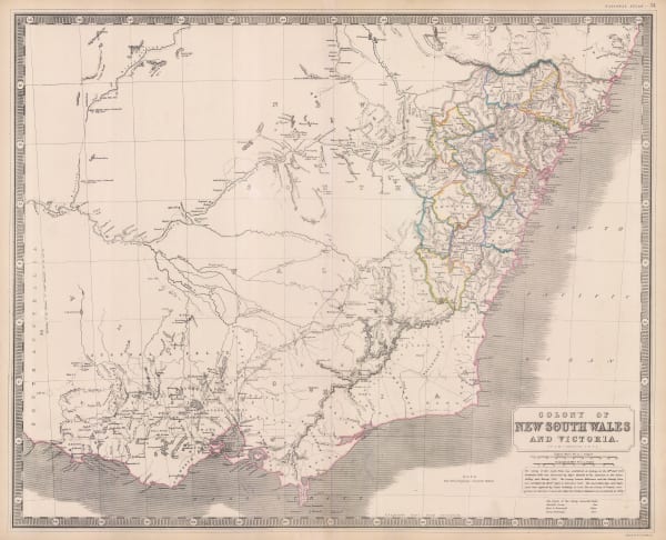
Alexander Keith Johnston, New South Wales and Victoria, 1858 c.£ 495.00
-
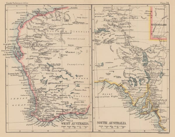
Justus Perthes, Die Entdeckungen im Innern von Sud-Australien, 1860£ 72.00
-
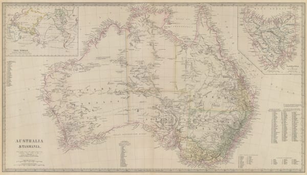
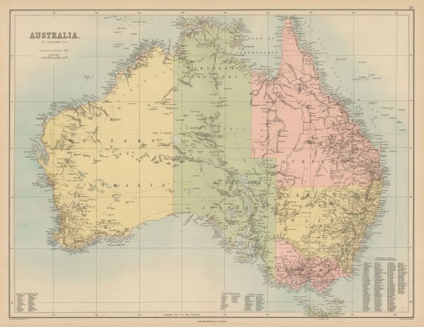
John Dower, Australia, 1860 c.£ 150.00
-
William Hughes, Queensland, 1860 c.£ 60.00
-
William Hughes, Victoria, 1860 c.£ 68.00
-
Justus Perthes, The Colony of Queensland, 1861£ 68.00
-
Royal Geographical Society (RGS), Map to Illustrate Diaries of Exploration of Central Australia by John McDouall Stuart Esq., 1861£ 375.00
-
Justus Perthes, Karte von J. McD. Stuart's 2ter Reise Innern von Australien, April bis Juli 1861, 1862£ 68.00
-
Royal Geographical Society (RGS), Map of North Western Australia, 1862£ 285.00
-
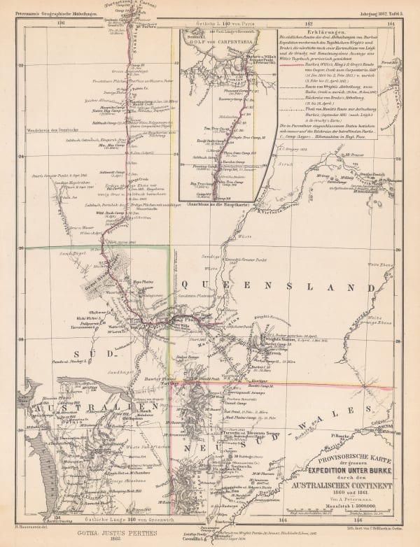
Justus Perthes, The Doomed Burke & Wills Expedition, 1862£ 68.00
-
Justus Perthes, Provisorische Karte von Frank Gregory's Reisen in Nordwest-Australien, 1862£ 78.00
-
Royal Geographical Society (RGS), Expeditions in Search of Burke and Wills, 1863£ 1,250.00
-
Johnson & Ward, Johnson's Australia, 1863£ 325.00
-
Royal Geographical Society (RGS), Map to Complete 'Diaries of Exploration Across Australia (from South to North)', 1863£ 195.00
-
Justus Perthes, Karte der Reiserouten von W. Landsborough, J. McKinlay u.A. in Nord-Australien, 1864£ 68.00
-
Justus Perthes, Karte eines Theil's von J. McD. Stuart's 3ter Reise in Australien, 1864£ 74.00
-
Justus Perthes, West Tasmania nach Charles Gould, 1865£ 72.00
-
Justus Perthes, Entdeckungen von Warburton, Walder, Kramer & Meissel im Cooper Delta, 1867£ 88.00
-
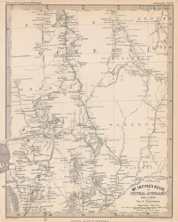
Justus Perthes, McIntyre's Expedition in search of Ludwig Leichhardt, 1867£ 68.00
-
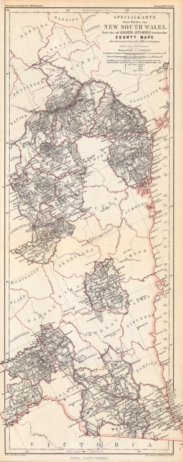
Justus Perthes, New South Wales, 1867£ 88.00
-
Justus Perthes, Warburton's Entdeckung des Nordendes von Lake Eyre 1866, 1867£ 65.00
-
Justus Perthes, Ubersicht der Neuesten Reisen & Aufnahmen in Seecebiet von Central-Australien, 1870£ 52.00
-
Royal Geographical Society (RGS), Map Shewing the Overland tracks from Perth to Eucla & Adelaide, 1871£ 695.00
-
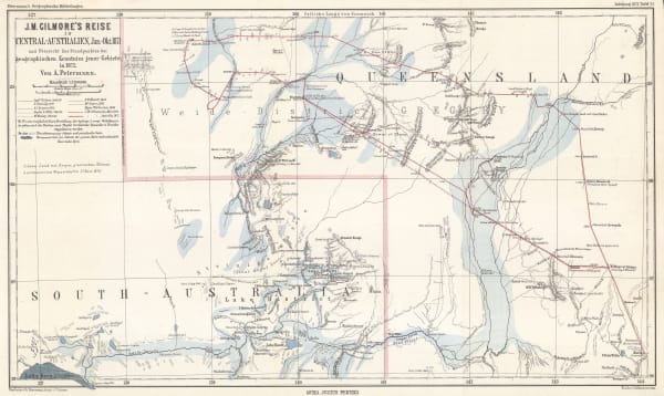
Justus Perthes, J.M. Gilmore's Expeditions in Southwest Queensland, 1872£ 68.00
-
Royal Geographical Society (RGS), Western Australia, 1872£ 195.00
-
James Wyld, Van Diemens Land, 1874£ 155.00
-
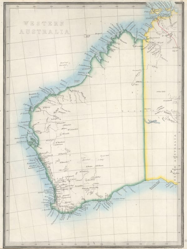
James Wyld, Western Australia, 1874£ 145.00
-
Reginald A.F. Murray, Geological Map of Gipps Land, 1875£ 825.00
-
Justus Perthes, J. W. Lewis' Aufnahman im Norden und Osten des Eyre Sees, 1874/5, 1875£ 64.00
-
Justus Perthes, Specialkarte von Australien in 9 Blattern, 1875£ 1,850.00
-
Society for the Diffusion of Useful Knowledge (SDUK), The Australian Colonies, 1875£ 595.00
-
Justus Perthes, West-Australien, 1875£ 125.00
-
Ferdinand Moritz Krause, Ararat Gold Field, 1876£ 495.00
-
Royal Geographical Society (RGS), Map of the Explorations from Beltana Station to the City of Perth, 1876£ 585.00
-
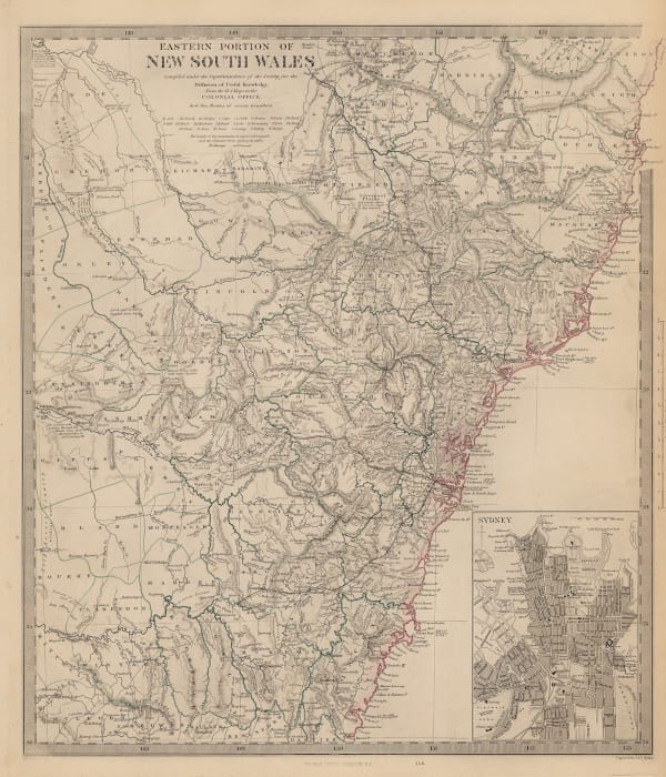
Thomas Richards, Sketch Map of New South Wales, 1876£ 885.00
-
Justus Perthes, Thomas Elders' Expedition durch Inner Australia, 1876£ 195.00
-
Society for the Diffusion of Useful Knowledge (SDUK), Australia & Tasmania, 1879£ 495.00
-
Aimé Robiquet, Carte de L'Australe ou Nouvelle Hollande dresée d'aprés les dernier document Anglais, 1879£ 1,750.00
-
Society for the Diffusion of Useful Knowledge (SDUK), New South Wales, 1879£ 345.00
-
-
A. & C. Black, Australia, 1880 c.£ 295.00
-
James Wyld, New Map of Australia Compiled from the latest nautical surveys made by order of the Admiralty, 1880 c.£ 1,750.00
-
Justus Perthes, Thomas Elders' Expedition durch Inner-Australien, 1880 c.£ 185.00
-
Reginald A.F. Murray, Geological Survey of Gipps Land, 1884£ 125.00
-
Royal Geographical Society (RGS), Part of Central Australia, 1884£ 115.00
-
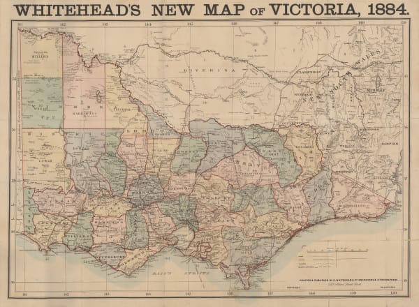
E. Whitehead, Whitehead's New Map of Victoria, 1884£ 625.00
-
Justus Perthes, Der Kimberley Distrikt in Nordwest Australien, 1884£ 68.00
-
Scottish Geographical Society (SGS), Physical Sketch Map of North-West Australia, 1885£ 275.00
-
John Bartholomew, Victoria, 1887£ 58.00
-
John Bartholomew, West Australia | South Australia, 1887£ 58.00
-
Arbuckle Brothers Company, Australia, 1889£ 155.00
-
John Bartholomew & Co., Map of the City of Sydney, 1890£ 3,750.00
-
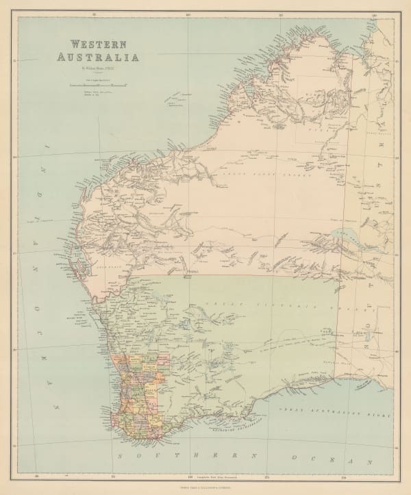
George Philip & Son Ltd., Western Australia, 1890£ 145.00
-
G. & J. Bartholomew, Queensland, 1890 c.£ 32.00
-
W. & A.K. Johnston, South Australia, New South Wales and Victoria, 1890 c.£ 95.00
-
Stuart Murray, Victorian Water Supply Plan, 1890 c.£ 750.00
-
G. & J. Bartholomew, Victoria, 1891£ 64.00
-
Letts & Son, Australia, 1892£ 82.00
-
Letts & Son, Northern New South Wales & Southern Queensland, 1892£ 66.00
-
Gill's School Series, Australia & Tasmania, 1892£ 185.00
-
William Saville-Kent, Great Barrier Reef of Australia, 1893£ 1,400.00
-
Justus Perthes, Thomas Elder's Expedition across Southwest Australia, 1893£ 295.00
-
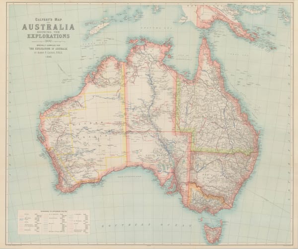
Albert Frederick Calvert, Australia Showing the Explorations, 1895£ 950.00
-
Edward Stanford, Australia, 1896£ 145.00
-
George Philip & Son Ltd., Queensland, 1896£ 32.00
-
G. & J. Bartholomew, Queensland, 1896£ 48.00
-
George Philip & Son Ltd., Victoria, 1896£ 38.00
-
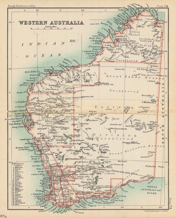
G. & J. Bartholomew, Western Australia, 1896£ 62.00
-
Scottish Geographical Society (SGS), General Map of Queensland, 1897£ 165.00
-
Royal Geographical Society (RGS), Eastern Part of West Australia, 1898£ 295.00
-
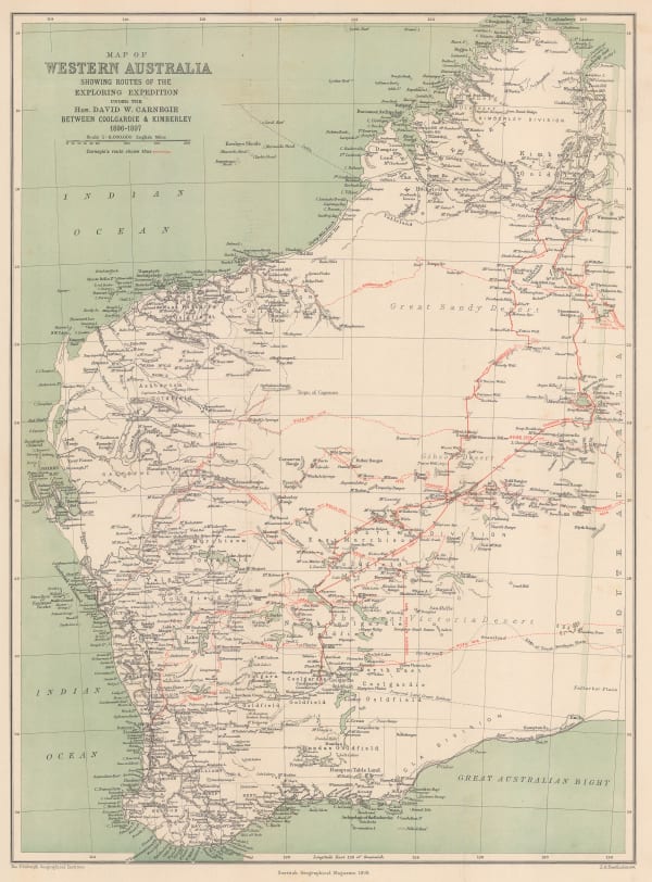
Scottish Geographical Society (SGS), Map of Western Australia Showing Routes of the Exploring Expedition, 1898£ 495.00
-
Edward Stanford, South Australia, 1898£ 58.00
-
Royal Geographical Society (RGS), Artesian Wells in Queensland, 1902£ 95.00
-
G. & J. Bartholomew, Reduced Survey Map of Australia, 1906 c.£ 775.00
-
Royal Geographical Society (RGS), Map to Illustrate the paper by Prof. J.W. Gregory on the Development of Australia, 1910£ 325.00
-
Joseph Pearson, Pearson's Cycling, Motoring, and Traveller's Road Map of 50 Miles around Sydney, 1910 c.£ 395.00
-
Joseph Pearson, Road Map of 50 Miles around Sydney, 1910 c.£ 395.00
-
Joseph Pearson, Road Map of 50 Miles around Sydney, 1910 c.£ 295.00


Page
2
of 3