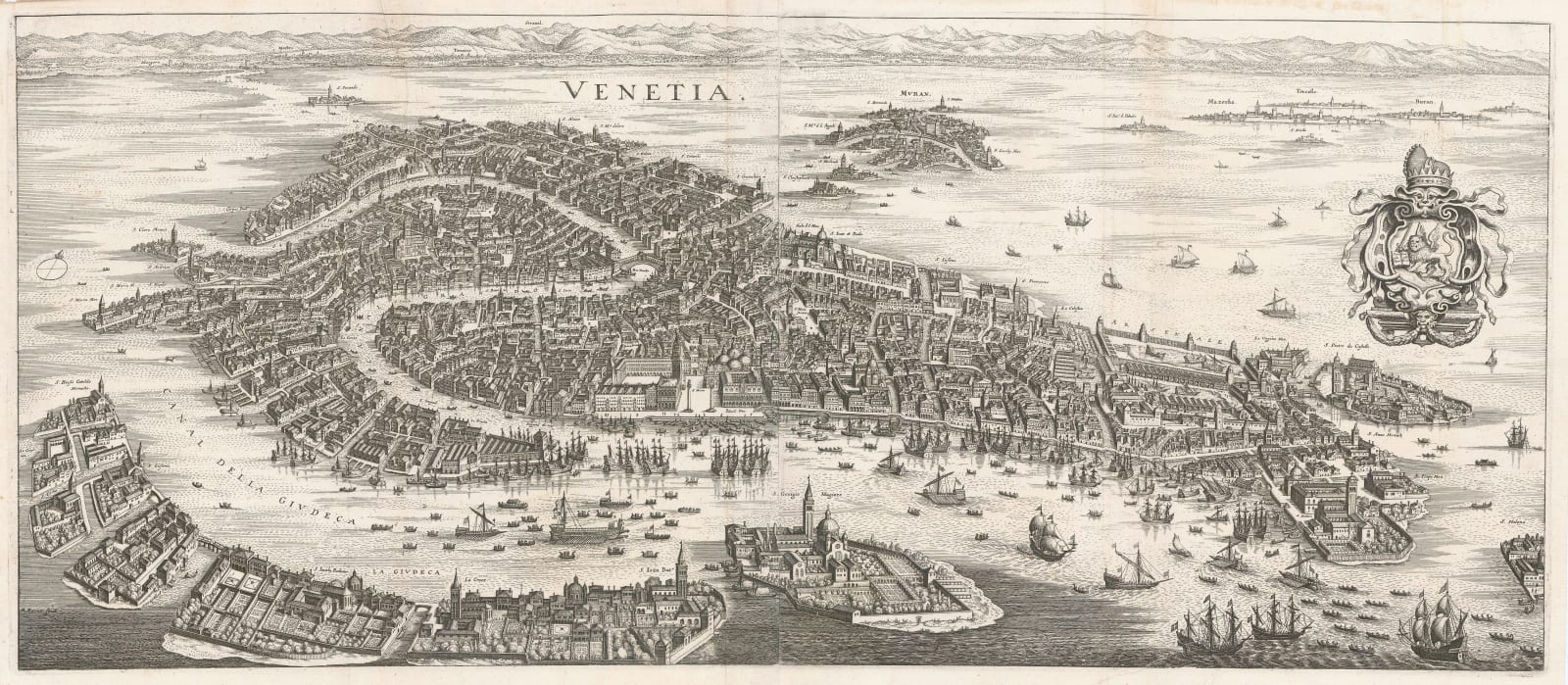
Matthäus Merian
31 x 71 cm
Merian's beautiful panoramic map is was first issued in 1635 but proved so enduring that issues have been traced as late as 1815. The source material for the image goes back even further, most likely from a very grand wall map published by Joseph di Barbari in 1500. De Barbari's map was used as a source for many maps of Venice in the 16th century and early 17th century.
As with its source, Merian uses the same angle to illustrate the city as a metropolitan centre of bustling commerce with a vast quantity of ships and boats of all types and sizes moored in its harbour, the famous canal winding its way through the city with the Piazza San Marco in the central foreground. Despite the fact that it shows north to the left of the sheet, this cartographic model for the city persisted well into the 19th century.
The example offered here is from the 1646 edition of the "Archologia Cosmica". [IT3613]


