John Cary
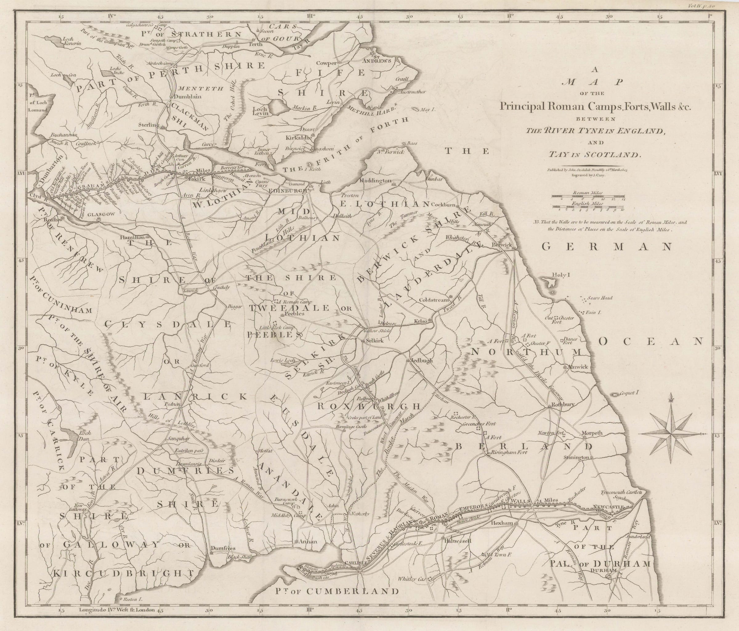
A Map of the Principal Roman Camps, Forts and Walls & c between the River Tyne in England and Tay in Scotland, 1805
16 x 19 1/2 in
41 x 49 cm
41 x 49 cm
GB1917
Interesting map concetrating on the Roman remains in Northern Britain including the course of Hadrian's Wall and the Antonine Wall in Scotland. Together with the walls it also tracks the...
Interesting map concetrating on the Roman remains in Northern Britain including the course of Hadrian's Wall and the Antonine Wall in Scotland. Together with the walls it also tracks the Roman road system in the region including the Devil's Causeway. [GB1917]
Join our mailing list
* denotes required fields
We will process the personal data you have supplied to communicate with you in accordance with our Privacy Policy. You can unsubscribe or change your preferences at any time by clicking the link in our emails.
![]()
Join our mailing list
* denotes required fields
We will process the personal data you have supplied to communicate with you in accordance with our Privacy Policy. You can unsubscribe or change your preferences at any time by clicking the link in our emails.