-

-
Valk & Schenk, Nova Belgica et Anglia Nova, 1710 c.£ 2,300.00
-
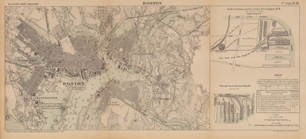
Jacques-Nicolas Bellin, Grundriss von der Stadt Boston und ihren Gegenden, 1750 c.£ 545.00
-
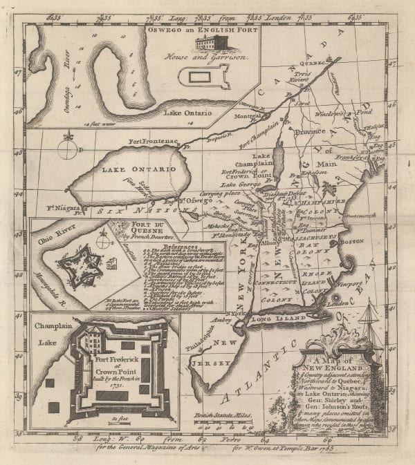
William Owen, French & Indian War Map of New England, 1755£ 950.00
-
London Magazine, A chart of the Coast of New England from Beverly to Scituate Harbour, 1774£ 1,650.00
-
-
-
Antonio Zatta, L'Acadia le Provincie di Sagadahook E Main, La Nuova Hampshire, La Rhode Island, E Parte Di Massachusset E Connecticut, 1779£ 675.00
-
John Bew, New York and part of the Jerseys, New England and Canada, 1780£ 1,495.00
-
Tardieu, Carte de L'Ile de Nantucket, 1787£ 2,250.00
-
Antoine de Sartine, Carte Reduite des Cotes Orientales de L'Amerique Septentrionale, 1792 (c.)£ 3,250.00
-
John Reid, The State of Massachusetts from the Best Information, 1796£ 1,550.00
-
Tardieu, Carte de la Partie Septentrionale des Etats Unis, 1810 c.£ 495.00
-
J. Freeman & Samuel Dana, A Geological Map of Boston and its Vicinity, 1818£ 1,450.00
-
Matthew Carey, The State of Massachusetts, 1818£ 1,850.00
-
Carey & Lea, Geographical, Statistical and Historical map of Massachusetts, 1822£ 1,950.00
-
Philippe Vandermaelen, Partie des Etats-Unis, 1827£ 450.00
-
Society for the Diffusion of Useful Knowledge (SDUK), Boston, 1842£ 695.00
-
Joseph Meyer, Neuste Karte von Massachusetts und Rhode Island, 1845£ 275.00
-
Samuel Augustus Mitchell, Massachusetts and Rhode Island, 1847 c.£ 295.00
-
John Tallis, Boston, 1851£ 975.00
-
Alexander Dallas Bache, Preliminary Chart of Plymouth Harbor, 1854£ 125.00
-
Henry Francis Walling, A New Map of the Vicinity of Boston, 1860£ 950.00
-
Samuel Augustus Mitchell, County map of the States of New York, New Hampshire, Vermont, Massachusetts, Rhode Island and Connecticut., 1860£ 185.00
-
Johnson & Ward, [North East United States], 1864£ 185.00
-
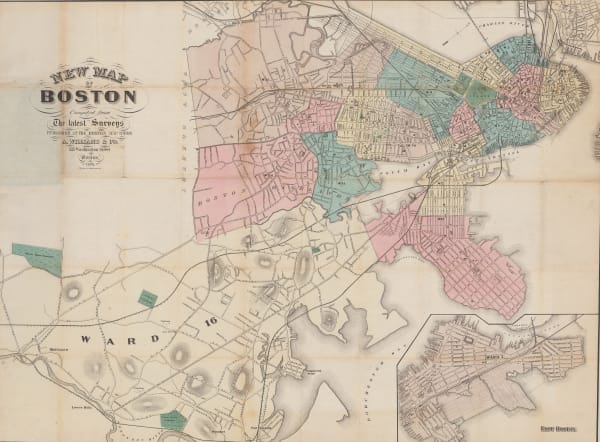
A. Williams & Co., New Map of Boston from the Latest Surveys, 1870£ 1,450.00
-
D. Appleton & Company, Map of Boston, 1874£ 375.00
-
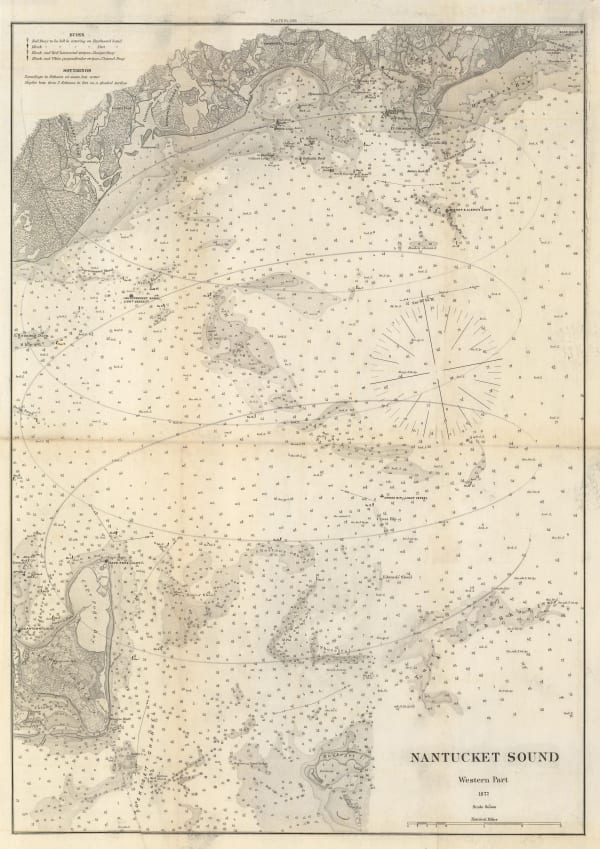
Atlantic Coast Pilot, Nantucket Sound, 1877£ 395.00
-
Atlantic Coast Pilot, Gulf of Maine - Current Stations, 1879£ 225.00
-
Atlantic Coast Pilot, Entrance to Nantucket Sound, 1880£ 395.00
-
Atlantic Coast Pilot, Provincetown Harbor, 1880£ 195.00
-
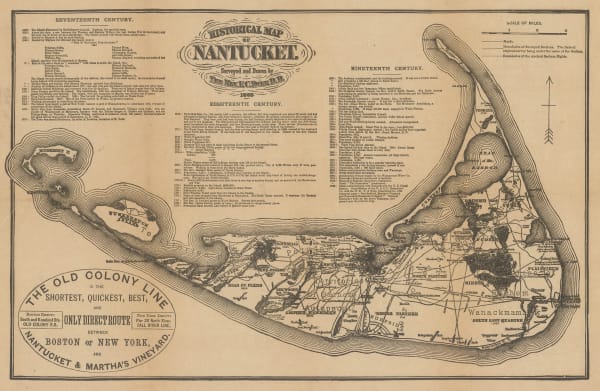
Edward K. Godfrey, Historical Map Nantucket, 1882 c.£ 1,250.00
-
Wright & Polter, Map of Railroads of the State of Massachusetts, 1883£ 675.00
-
A. Simon, Boston, 1884£ 495.00
-
Letts & Son, Boston, 1889£ 325.00
-
Arbuckle Brothers Company, [Massachusetts], 1889£ 145.00
-
John F. Murphy, Historical Map of Nantucket, 1890£ 595.00
-
John F. Murphy, Map of the Old Colony Railroad and Connections, 1891£ 92.00
-
George G. Crocker, Map of the Railroads in the State of Massachusetts, 1891£ 675.00
-
John F. Murphy, Historical Map of Nantucket, 1892£ 695.00
-
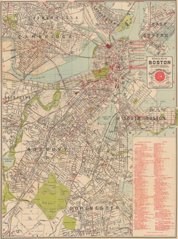
George H. Walker & Co, Official Map of Boston, 1895£ 645.00
-
British Admiralty, Bay of Fundy to Block Island, 1896£ 2,150.00
-
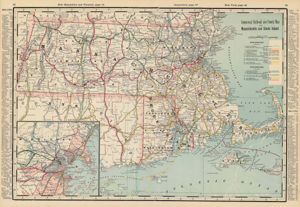
Commercial Railroad and County Map of Massachusetts and Rhode Island, 1897George CramSeries: ChicagoGeorge Cram, Commercial Railroad and County Map of Massachusetts and Rhode Island, 1897£ 275.00
-
Walker Lith. & Pub. Co., Boston Harbor, 1897 c.£ 325.00
-
US Geological Survey, [Nantucket], 1905£ 525.00
-
Karl Baedeker, Boston II, 1909£ 78.00
-
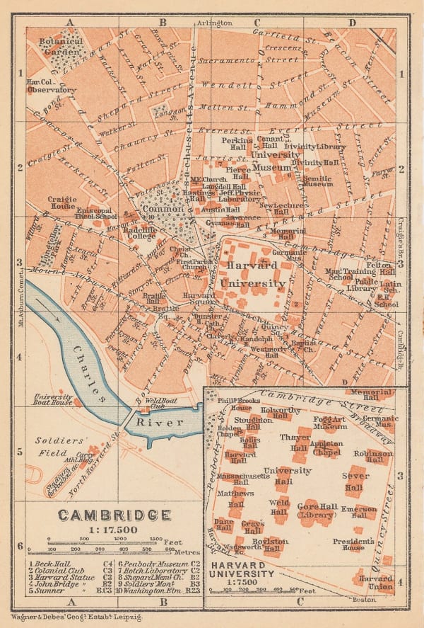
Karl Baedeker, Cambridge, 1909£ 88.00
-
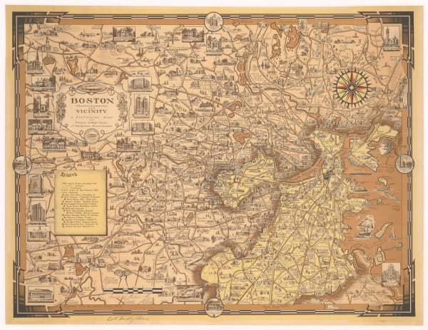
Ernest Dudley Chase, Boston (Massachusetts) and Vicinity, 1938£ 950.00
-
G. Frank Hooker, Map of the City of Cambridge, 1938£ 495.00
-
Anonymous, Map of Marthas Vineyard Island, 1940 c.£ 195.00
-
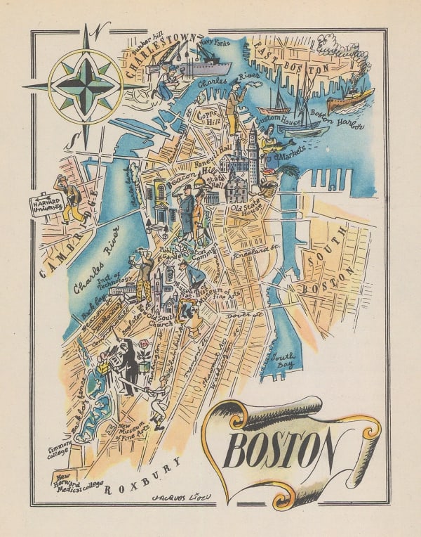
Dore Ogrizek, Boston, 1946£ 65.00
-
Zorigian Studios, City of Boston Visitor's Map and Directory, 1950 c.£ 145.00
-
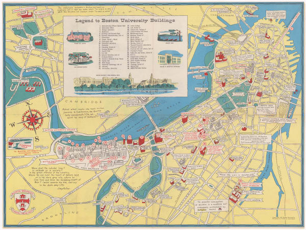
Frederick Larrabee, Boston University, 1953£ 245.00
-
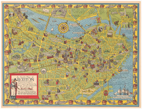
Alva Scott Garfield, A Scott-Map of Boston Massachusetts, 1959£ 625.00
Close
Search Inventory
Our entire inventory of over 10,000 antique and vintage maps is now available to browse by region, date, cartographer, and subject


![Johnson & Ward, [North East United States], 1864](https://artlogic-res.cloudinary.com/w_600,c_limit,f_auto,fl_lossy,q_auto/artlogicstorage/themaphouse/images/view/16ede5bc2f2dc1486da808a41437ed6fj/themaphouse-johnson-ward-north-east-united-states-1864.jpg)


![Arbuckle Brothers Company, [Massachusetts], 1889](https://artlogic-res.cloudinary.com/w_600,c_limit,f_auto,fl_lossy,q_auto/artlogicstorage/themaphouse/images/view/ac984f6fcb29f3bb8b14eb062e848b08j/themaphouse-arbuckle-brothers-company-massachusetts-1889.jpg)


![US Geological Survey, [Nantucket], 1905](https://artlogic-res.cloudinary.com/w_600,c_limit,f_auto,fl_lossy,q_auto/artlogicstorage/themaphouse/images/view/b689e67f1907c9903980f3f6b527149ej/themaphouse-us-geological-survey-nantucket-1905.jpg)


Join our mailing list
* denotes required fields
We will process the personal data you have supplied to communicate with you in accordance with our Privacy Policy. You can unsubscribe or change your preferences at any time by clicking the link in our emails.
![]()