-
 Jacques-Nicolas Bellin, Carte Reduite Des Costes de la Louisiane et de la Floride, 1764£ 4,950.00
 -
London Magazine, A New Map of North & South Carolina, & Georgia, 1765£ 595.00
-
Gentleman's Magazine, A Map of Part of West Florida, 1772£ 495.00
-
-
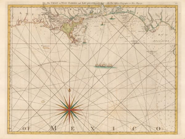
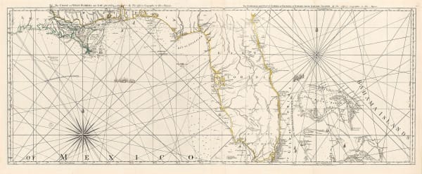
Thomas Jefferys, The Coast of West Florida and Louisiana, 1775£ 1,250.00
-
Francois Santini, Partie Meridionale de la Louisiane, avec la Floride la Caroline et la Virginie, 1776£ 985.00
-
Antonio Zatta, Luigiana Inglese Colla Parte Occidentale Della Florida, Della Giorgia, E Carolina Meridonale, 1778£ 545.00
-
-
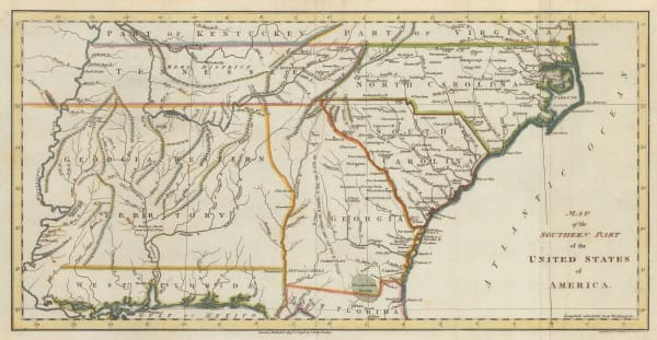
Joseph Purcell, A Map of the States of Virginia, North Carolina, South Carolina and Georgia, 1788£ 1,925.00
-
Laurie & Whittle, A New and General Map of the Southern Dominions Belonging to The United States of America, 1794£ 3,500.00
-
Abraham Bradley, Map of the Southern United States of America, 1797£ 850.00
-
John Russell, Map of the Southern Part of the United States of America, 1798£ 745.00
-
Thomas and Andrews, Mississippi Territory, 1805£ 345.00
-
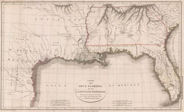
Jean-Baptiste Poirson, Texas, Louisiana, Alabama, Mississippi, Florida and Georgia, 1807£ 2,500.00
-
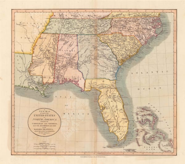
John Pinkerton, United States of America - Southern Part, 1809£ 1,350.00
-
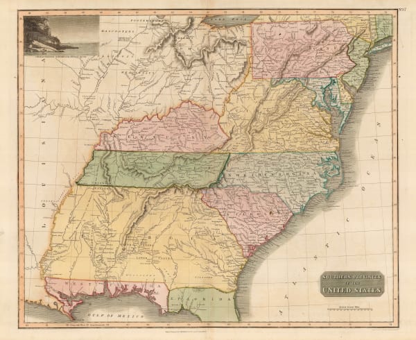
John Thomson, Southern Provinces of the United States, 1817£ 1,250.00
-
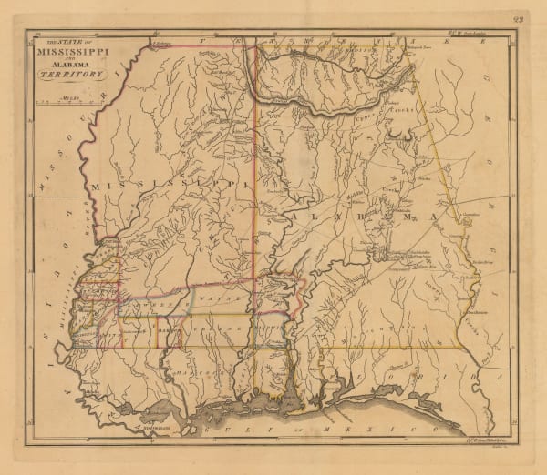
Matthew Carey, The State of Mississippi and Alabama Territory, 1818£ 1,250.00
-
Carey & Lea, Geographical, Statistical and Historical Map of Mississippi, 1823£ 725.00
-
John Cary, A New Map of Part of the United States of America, 1825£ 1,675.00
-
Jean Buchon, Carte Geographique, Statistique et Historique du Mississipi, 1825£ 175.00
-
Philippe Vandermaelen, Amer. Sep. Partie des Etats Unis, 1827£ 650.00
-
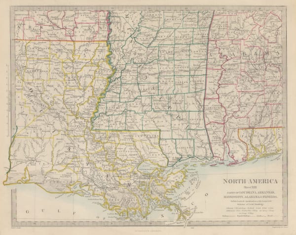
Society for the Diffusion of Useful Knowledge (SDUK), North America Sheet X, 1833£ 76.00
-
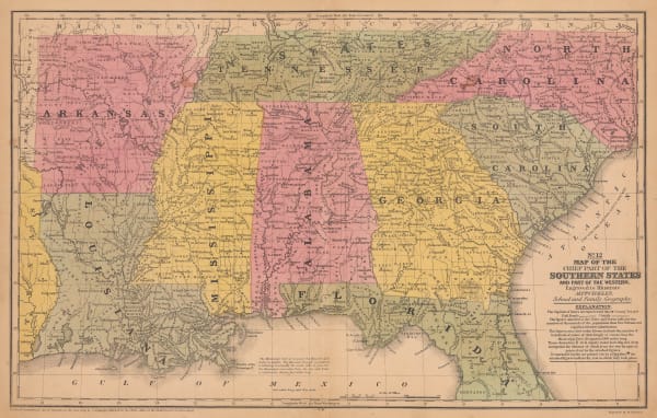
Samuel Augustus Mitchell, Map of the Chief Part of the Southern United States, 1839£ 145.00
-
Samuel Augustus Mitchell, A New Map of Mississippi, 1846£ 145.00
-
Joseph Meyer, Neueste Karte von Mississippi, 1852£ 245.00
-
George Woolworth Colton, Mississippi, 1855£ 85.00
-
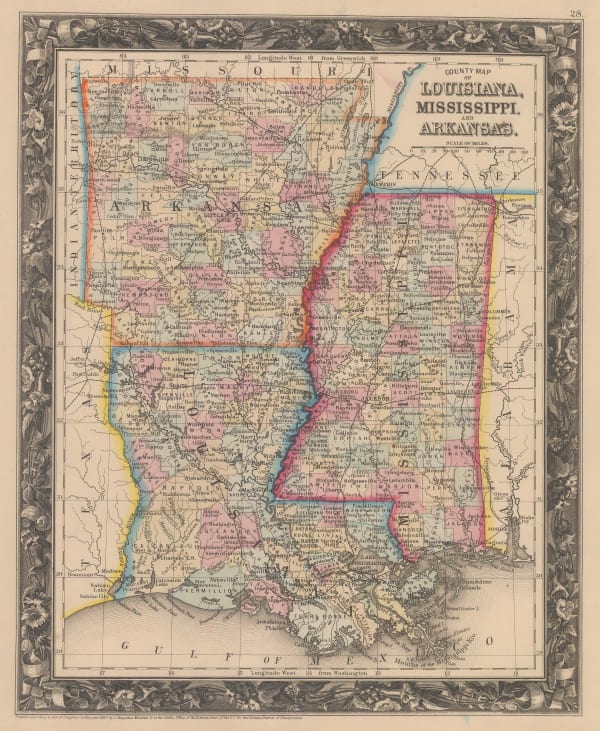
Samuel Augustus Mitchell, County Map of Louisiana, Mississippi and Arkansas, 1860£ 145.00
-
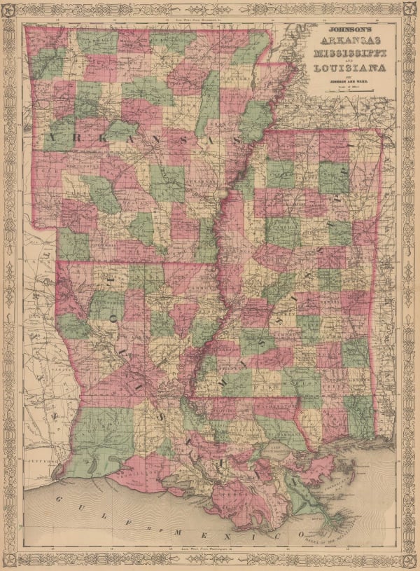
Johnson & Ward, Johnson's Arkansas, Mississippi and Louisiana, 1866£ 295.00
-
Archibald Fullarton, United States - North America, 1870 c.£ 78.00
-
Frank Arnold Gray, Gray's New Map of Mississippi, 1878 c.£ 160.00
-
Society for the Diffusion of Useful Knowledge (SDUK), North America, 1879£ 195.00
-
Samuel Augustus Mitchell, County Map of the States of Arkansas, Mississippi and Louisiana, 1882£ 160.00
-
Arbuckle Brothers Company, Mississippi, 1889£ 125.00
-
General Land Office, State of Mississippi, 1890£ 695.00
-
George Philip & Son Ltd., United States - Central Division, 1896£ 36.00
-
George Cram, Mississippi, 1897£ 185.00
-
W. & A.K. Johnston, United States (S.E.), 1908£ 125.00
-
Mississippi Coast Hotel Association, The Gulf Coast of Mississippi, 1935 (c.)£ 180.00
-
British Admiralty, Cape San Blas to Vermilion Bay, 1942£ 750.00
-
Dore Ogrizek, Mississippi, 1946£ 55.00
Close
Search Inventory
Our entire inventory of over 10,000 antique and vintage maps is now available to browse by region, date, cartographer, and subject


Join our mailing list
* denotes required fields
We will process the personal data you have supplied to communicate with you in accordance with our Privacy Policy. You can unsubscribe or change your preferences at any time by clicking the link in our emails.
![]()