-
 Mercator Hondius, Lombardiae alpestris pars occidentalis cum Valesia, 1635£ 165.00
 -
Willem & Jan Blaeu, Sabaudia Ducatus. Savoye, 1640 c.£ 695.00
-
Willem & Jan Blaeu, Territorio di Brescia et di Crema, 1650£ 550.00
-
John Thomson, Swisserland, 1814£ 225.00
-
Royal Geographical Society (RGS), Sketch of the Valley of Beaufort & the adjacent portions of Upper Savoy, 1856£ 175.00
-
Jean Joseph Mieulet, Massif du Mont Blanc, 1865£ 1,750.00
-
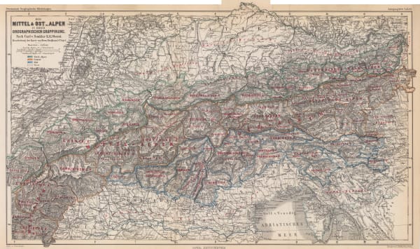
Justus Perthes, The Swiss Alps, 1869£ 195.00
-
Justus Perthes, Karte der Zillerthaler Alpen, 1872£ 245.00
-
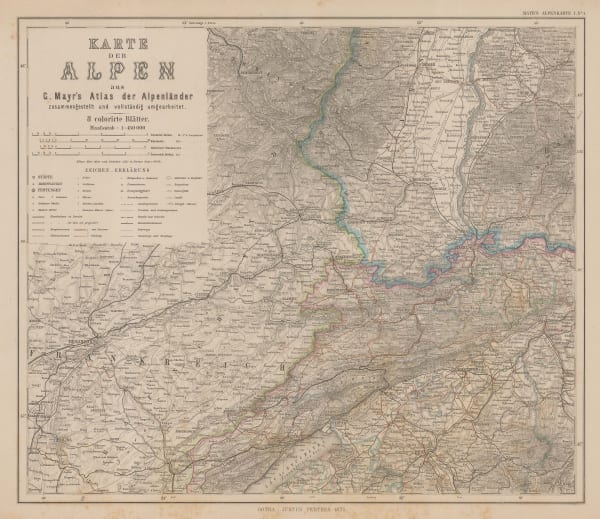
Justus Perthes, Carte der Alpen, 1875£ 145.00
-
Justus Perthes, [Chiavenna and Tessin], 1875£ 185.00
-
Justus Perthes, [Salzburg], 1875£ 125.00
-
Justus Perthes, [Trieste and Udine], 1875£ 165.00
-
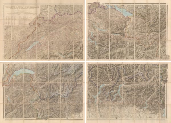
Edward Stanford, The Alpine Club Map of Switzerland, 1876£ 2,500.00
-
Justus Perthes, The Alps, 1880 c£ 175.00
-
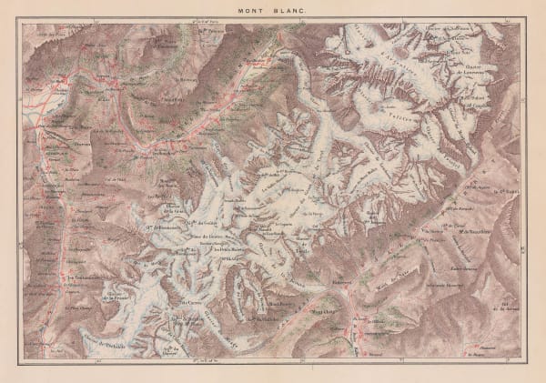
George Virtue, Mont Blanc, 1890 c.£ 98.00
-
Chocolat d'Aiguebelle, Les Departments: Isere, 1900 c.£ 48.00
-
Service Géographique de l'Armée, Tignes/Val d'Isere, 1911£ 2,450.00
-
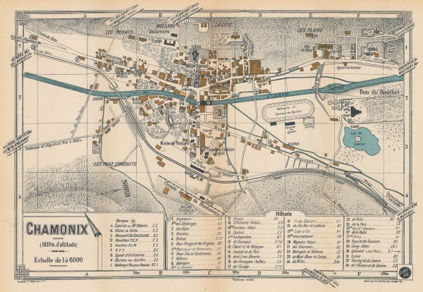
E. Fonne, Chamonix, 1920 c.£ 140.00
-
Ente Nazionale Industrie Turistiche (ENIT), Carta di Laghi - The Italian Lakes, 1927£ 78.00
-
Xaver Imfeld, La Chaine du Mont-Blanc, 1929£ 2,250.00
-
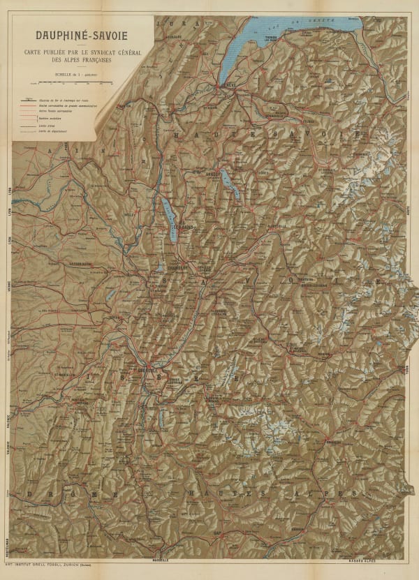
Orell Füssli, Dauphine-Savoie, 1930 c£ 650.00
Close
Search Inventory
Our entire inventory of over 10,000 antique and vintage maps is now available to browse by region, date, cartographer, and subject


![Justus Perthes, [Chiavenna and Tessin], 1875](https://artlogic-res.cloudinary.com/w_600,c_limit,f_auto,fl_lossy,q_auto/artlogicstorage/themaphouse/images/view/ba5919e1b5212e29fe7e9d2b898d7e39j/themaphouse-justus-perthes-chiavenna-and-tessin-1875.jpg)
![Justus Perthes, [Salzburg], 1875](https://artlogic-res.cloudinary.com/w_600,c_limit,f_auto,fl_lossy,q_auto/artlogicstorage/themaphouse/images/view/8cb6b77e374acf5ec7ccc84907f14ab0j/themaphouse-justus-perthes-salzburg-1875.jpg)
![Justus Perthes, [Trieste and Udine], 1875](https://artlogic-res.cloudinary.com/w_600,c_limit,f_auto,fl_lossy,q_auto/artlogicstorage/themaphouse/images/view/06c6e201daae54a58412082816e17dbbj/themaphouse-justus-perthes-trieste-and-udine-1875.jpg)


Join our mailing list
* denotes required fields
We will process the personal data you have supplied to communicate with you in accordance with our Privacy Policy. You can unsubscribe or change your preferences at any time by clicking the link in our emails.
![]()