-
 Lucas Waghenaer, Description des Costes Marines d'Angleterre, entre Pleymouth & Portlandt, avec les principaulx haures d'icelles, 1590£ 3,500.00
 -
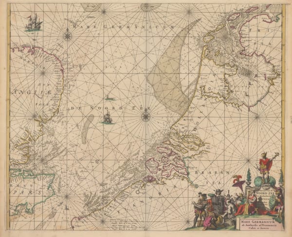
Frederick De Wit, Pascaert van de Noord Zee | Mare Germanicum ad Amelandia ad Promontoria Caleti et Doverae, 1675£ 1,650.00
-
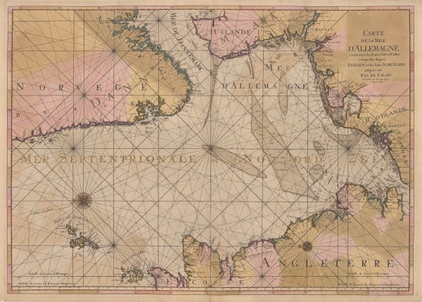
Pierre Mortier, Carte de la Mer d'Allemagne, 1693£ 950.00
-
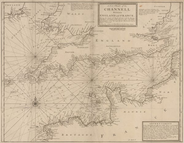
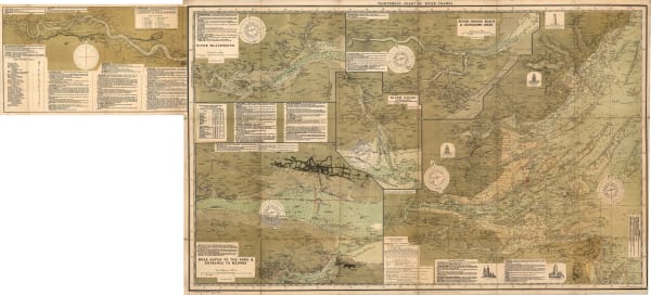
Herman Moll, A New Chart of the Channell between England and France, 1705 c.£ 625.00
-
Capt. Greenvile Collins, [The coast of east Anglia], 1720 c.£ 950.00
-
Nicolas Berey, Carte Particuliere des Costes Meridionales d'Angleterre qui comprend l'Isle de Wicht, 1740 c£ 1,650.00
-
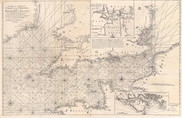
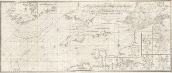
Mount & Page, A New and Correct Chart of the Channel, 1740 c.£ 1,750.00
-
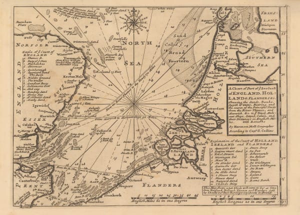
Herman Moll, A Chart of Part of ye Sea Coast of England, Holland & Flanders, 1755 c.£ 195.00
-
Jacques-Nicolas Bellin, Carte des Entrees de la Tamise, 1759£ 625.00
-
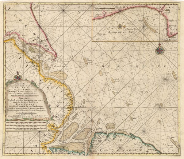
Gerard van Keulen, A New - Enereasing Compass Map of Part of the East-Coast of England; extending from Eckles to Flamborough-Head; containing the River of Hull; with their Shallow nesses and depths by Claas de Vries Geometra, 1760 c.£ 485.00
-
Gerard van Keulen, De Reede van Harwich, Handford - Water en Wood Bridg Haaven, 1760 c.£ 565.00
-
Johannes [II] van Keulen, Nieuwe Paskaert Van d'Ooft Kust van Engelandt, 1760 c.£ 825.00
-
Gerard van Keulen, [River Thames][Suffolk Coastline], 1760 c.£ 765.00
-
Jacques-Nicolas Bellin, Essex, Kent & the Mouth of the Thames, 1764£ 165.00
-
Capt. Greenvile Collins, [North Sea & East Coast of England], 1785£ 785.00
-
Capt. Greenvile Collins, [St. George's Channel], 1785£ 445.00
-
Capt. Greenvile Collins, [The North Sea], 1785£ 745.00
-
Robert Sayer, A New Hydrographic Sketch of the North, South and Middle Channels, 1786£ 495.00
-
William Faden, The North Sea with the Kattegat, 1796£ 1,450.00
-
Laurie & Whittle, A New Chart of the British Channel, 1800£ 1,750.00
-
William Heather, [Plymouth Sound, Portland and Falmouth and Helford], 1800 c.£ 950.00
-
William Heather, The Entrances to the River Thames, 1801£ 1,650.00
-
William Heather, Chart of the East Coast of England, 1802£ 950.00
-
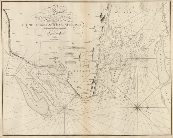
William Heather, The Downs and Margate Roads, 1802£ 750.00
-
William Heather, A New Chart of the Bristol Channel, 1803£ 1,450.00
-
William Heather, [British Isles], 1804£ 1,850.00
-
-
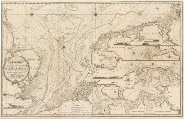
William Heather, New Chart of the Coasts of England and Holland from the Latest Surveys, 1805£ 1,750.00
-
John William Norie, A New Chart of the Coasts of England and Holland, 1824£ 2,250.00
-
James Imray, Bristol Channel, 1868£ 765.00
-
Alexander George Findlay, Chart of the North Sea, 1868£ 1,200.00
-
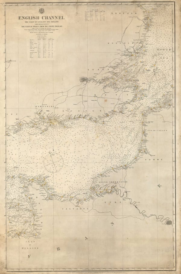
British Admiralty, English Channel, 1879£ 275.00
-
Ole Theodor Olsen, North Sea Bottom, 1883£ 185.00
-
Ole Theodor Olsen, North Sea Fishing Grounds, 1883£ 185.00
-
Ole Theodor Olsen, North Sea Soundings, 1883£ 185.00
-
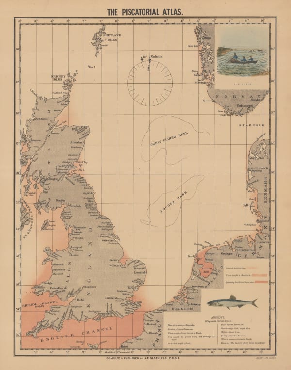
Ole Theodor Olsen, The Piscatorial Atlas - Anchovy, 1883£ 95.00
-
Ole Theodor Olsen, Sole Fishing in the North Sea, 1883£ 95.00
-
Ole Theodor Olsen, The Set of Tides at Half Ebb and Half Flood, 1883£ 185.00
-
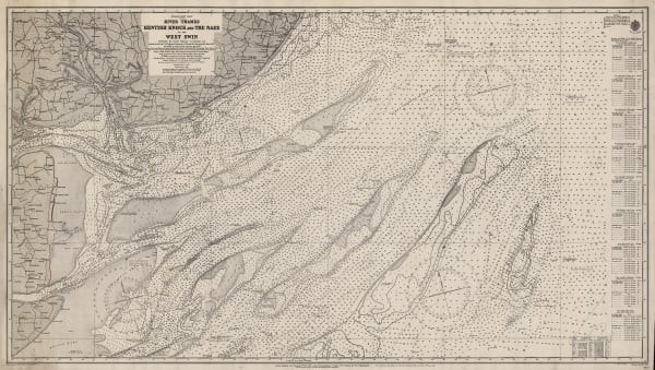
British Admiralty, River Thames, Kentish Knock and the Naze, 1913£ 175.00
-
Ordnance Survey, Heligoland 28th August 1914 General Chart of the Action, 1919£ 225.00
-
James Reynolds, Reynolds's New Chart of the Thames Estuary, 1923£ 265.00
-
James Imray, Mouth of the River Thames, 1924£ 525.00
-
Edward Stanford, Chart of the Thames Estuary, 1936£ 345.00
Close
Search Inventory
Our entire inventory of over 10,000 antique and vintage maps is now available to browse by region, date, cartographer, and subject

![Capt. Greenvile Collins, [The coast of east Anglia], 1720 c.](https://artlogic-res.cloudinary.com/w_600,c_limit,f_auto,fl_lossy,q_auto/artlogicstorage/themaphouse/images/view/c6bd1fe163c15b398ca251424bb29ed0j/themaphouse-capt.-greenvile-collins-the-coast-of-east-anglia-1720-c..jpg)


![Johannes [II] van Keulen, Nieuwe Paskaert Van d'Ooft Kust van Engelandt, 1760 c.](https://artlogic-res.cloudinary.com/w_600,c_limit,f_auto,fl_lossy,q_auto/artlogicstorage/themaphouse/images/view/b85698e11ad3b355a2ff9937c6dc3befj/themaphouse-johannes-ii-van-keulen-nieuwe-paskaert-van-d-ooft-kust-van-engelandt-1760-c..jpg)
![Gerard van Keulen, [River Thames][Suffolk Coastline], 1760 c.](https://artlogic-res.cloudinary.com/w_600,c_limit,f_auto,fl_lossy,q_auto/artlogicstorage/themaphouse/images/view/a7825455b2b140129b1f50ed7b79ffc6j/themaphouse-gerard-van-keulen-river-thames-suffolk-coastline-1760-c..jpg)

![Capt. Greenvile Collins, [North Sea & East Coast of England], 1785](https://artlogic-res.cloudinary.com/w_600,c_limit,f_auto,fl_lossy,q_auto/artlogicstorage/themaphouse/images/view/55f0a75a81ef615a6ebefa7947734800j/themaphouse-capt.-greenvile-collins-north-sea-east-coast-of-england-1785.jpg)
![Capt. Greenvile Collins, [St. George's Channel], 1785](https://artlogic-res.cloudinary.com/w_600,c_limit,f_auto,fl_lossy,q_auto/artlogicstorage/themaphouse/images/view/bb351a79df775923becf1c3d125bfeebj/themaphouse-capt.-greenvile-collins-st.-george-s-channel-1785.jpg)
![Capt. Greenvile Collins, [The North Sea], 1785](https://artlogic-res.cloudinary.com/w_600,c_limit,f_auto,fl_lossy,q_auto/artlogicstorage/themaphouse/images/view/db4a463c01a4ebeb9f3eb03b21bc6614j/themaphouse-capt.-greenvile-collins-the-north-sea-1785.jpg)


![William Heather, [Plymouth Sound, Portland and Falmouth and Helford], 1800 c.](https://artlogic-res.cloudinary.com/w_600,c_limit,f_auto,fl_lossy,q_auto/artlogicstorage/themaphouse/images/view/d94f8edbc0f1b0e38d81e1b1ce6c6972j/themaphouse-william-heather-plymouth-sound-portland-and-falmouth-and-helford-1800-c..jpg)


![William Heather, [British Isles], 1804](https://artlogic-res.cloudinary.com/w_600,c_limit,f_auto,fl_lossy,q_auto/artlogicstorage/themaphouse/images/view/d2dff7ea80a7bf292a8a07b32057a766j/themaphouse-william-heather-british-isles-1804.jpg)


Join our mailing list
* denotes required fields
We will process the personal data you have supplied to communicate with you in accordance with our Privacy Policy. You can unsubscribe or change your preferences at any time by clicking the link in our emails.
![]()