-

-
Claudius Ptolemy & Laurent Fries, Ptolemaic Map of North Africa & Egypt, 1535£ 750.00
-
Martin Waldseemüller & Laurent Fries, West Africa, 1541£ 2,550.00
-
Claudius Ptolemy & Laurent Fries, Algeria, Tunisia & Libya, 1541£ 695.00
-
Early woodcut map of West Africa and the Gulf of Guinea, 1556Giovanni Battista RamusioSeries: VeniceGiovanni Battista Ramusio, Early woodcut map of West Africa and the Gulf of Guinea, 1556£ 3,650.00
-
Girolamo Ruscelli, Early map of Egypt, Libya and Nubia (Sudan), 1561£ 235.00
-
Antoine Du Pinet, Very early woodcut view of Algiers, 1564£ 425.00
-
Heinrich Petri, Ptolemaic Map of Africa, 1564 c.£ 195.00
-
Giulio & Livio Sanuto, Rare Ptolemaic Map of North Africa, 1588£ 985.00
-
Giovanni Antonio Magini, North Africa, 1596£ 145.00
-
Giuseppe Rosaccio, North Africa, 1599£ 165.00
-
Abraham Ortelius, Northern Africa or Barbary Coast, 1601£ 1,850.00
-
Mercator Hondius, Dutch Golden Age map of Morocco, 1620 c£ 845.00
-
Samuel Purchas, North Africa, Egypt and Tunis, 1625£ 325.00
-
Samuel Purchas, Early map of Morocco, 1625£ 285.00
-
Samuel Purchas, Early map of southern Morocco, 1625£ 295.00
-
Mercator Hondius, North Africa, Egypt and Tunis, 1635£ 245.00
-
Willem & Jan Blaeu, Morocco orientated east to west, 1650 c.£ 925.00
-
Nicolas Sanson, Kingdom of Morocco, 1655£ 675.00
-
Jan Jansson, North Africa during the Classical Era, 1661£ 145.00
-
Olfert Dapper, Morocco orientated east to west, 1670£ 425.00
-
Nicolas & Guillaume Sanson, Egypt & Libya, 1683£ 325.00
-
Robert Morden, Miniature map of Morocco, 1688£ 225.00
-
Robert Morden, Of Barbary, 1688£ 165.00
-
Johannes van Keulen, Western Sahara coast, 1690 c.£ 525.00
-
Johannes van Keulen, Chart of the Western coast of Morocco, 1690 c.£ 525.00
-
Johann Ulrich Muller, Miniature map of Libya and Egypt, 1692£ 120.00
-
Johann Ulrich Muller, Ancient kingdoms of Biledulgerid and Zara, 1692£ 150.00
-
Partie de la Barbarie ou son les Royaumes de Tunis et Tripoli, 1692Nicolas & Guillaume SansonSeries: ParisNicolas & Guillaume Sanson, Partie de la Barbarie ou son les Royaumes de Tunis et Tripoli, 1692£ 165.00
-
Nicolas & Guillaume Sanson, Southern Morocco, 1692£ 195.00
-
Johann Ulrich Muller, Northern Africa, 1692£ 145.00
-
Nicolas Sanson, West and Northwest Africa, 1692£ 375.00
-
Pierre Duval, Miniature map of the coast of North Africa, 1694£ 92.00
-
Nicolas Sanson, Kingdom of Fez (northern Morocco), 1700£ 345.00
-
Nicolas & Guillaume Sanson, Southern Morocco and Western Sahara, 1700£ 325.00
-
Nicolas & Guillaume Sanson, Partie de Barbarie en est le Royaume d'Alger., 1700£ 350.00
-
Robert Morden, North & West Africa, 1702£ 175.00
-
Nicolas de Fer, Northeast Africa, 1705£ 420.00
-
Nicolas de Fer, West Africa, 1705£ 295.00
-
Guillaume De L'Isle, North & West Africa, 1707£ 445.00
-
Pierre Mortier, Sea Chart of West Africa & Atlantic Islands, 1708£ 1,350.00
-
Pierre Mortier, Chart of the southern Mediterranean and coast of North Africa, 1708£ 3,000.00
-
Samuel Thornton, Northwest coast of Africa, 1711£ 950.00
-
Philipp Cluver, North-western Africa, 1711£ 98.00
-
Guillaume De L'Isle, De L'Isle's famous map of Senegal, 1727£ 475.00
-
Herman Moll, The Turkish Empire in Europe, Asia and Africa, 1730 c£ 4,450.00
-
Herman Moll, North Africa, 1755 c.£ 155.00
-
London Magazine, Morocco divided into the four historic kingdoms, 1760£ 85.00
-
Robert de Vaugondy, North and West Africa, 1762£ 165.00
-
Jacques-Nicolas Bellin, Gulf of Tunis, 1764£ 115.00
-
Jacques-Nicolas Bellin, Chart of Tabarka Island, Tunisia, 1764£ 60.00
-
Jacques-Nicolas Bellin, Arguin Island, Mauritania, 1764£ 85.00
-
Jacques-Nicolas Bellin, Chart of Tripoli harbour, 1764£ 125.00
-
Jacques-Nicolas Bellin, Chart of Mers El Kébir harbour and castle, 1764£ 65.00
-
Jacques-Nicolas Bellin, Chart of the Cape Verde Islands and the coast of Africa , 1765£ 225.00
-
Emanuel Bowen, West Africa, 1766£ 645.00
-
Malachy Postlethwayt, West Africa with a list of European Settlements, 1766£ 1,450.00
-
Thomas Jefferys, Western Africa from Cape Blanco to Cape Virga, 1768£ 1,250.00
-
Rigobert Bonne, Coast of North Africa and southern Mediterranean, 1771 c.£ 225.00
-
Rigobert Bonne, Northwest Africa coast, Tangier to Sierra Leone, 1780 c.£ 90.00
-
Willem Albert Bachiene, Coast of North Africa, 1783£ 485.00
-
William Faden, North Africa from Morocco to Libya, 1798£ 92.00
-
John Pinkerton, Northern Africa, 1811£ 325.00
-
John Pinkerton, Western Africa, 1813£ 475.00
-
John Thomson, North Africa, 1814£ 315.00
-
Christian Gottlieb Reichard, North-western Africa, 1818£ 75.00
-
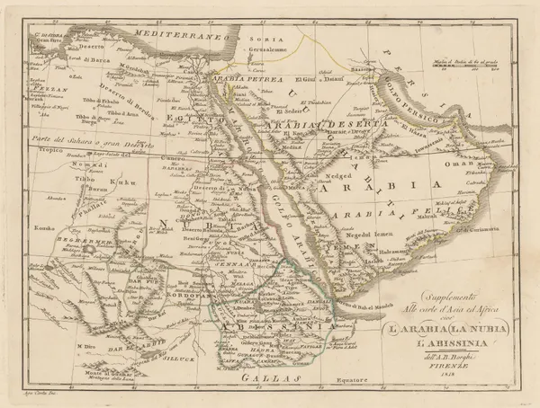
Bartolomeo Borghi, Arabia, Nubia, and Abyssinia, 1818£ 395.00
-
French Admiralty, Chart of the town and harbour of Tripoli, Libya, 1823£ 285.00
-
Map of the Travels and Discoveries made in Northern and Central Africa, 1826Maj. Dixon DenhamSeries: LondonMaj. Dixon Denham, Map of the Travels and Discoveries made in Northern and Central Africa, 1826£ 395.00
-
Map of North Africa Intended to Illustrate the Progress of Discovery in that Country, 1828Charles SmithSeries: LondonCharles Smith, Map of North Africa Intended to Illustrate the Progress of Discovery in that Country, 1828£ 495.00
-
Royal Geographical Society (RGS), Morocco and Marrakesh, 1831£ 395.00
-
Algerian coast from Bonah to Magrowah, 1834Society for the Diffusion of Useful Knowledge (SDUK)Series: LondonSociety for the Diffusion of Useful Knowledge (SDUK), Algerian coast from Bonah to Magrowah, 1834£ 86.00
-
British Admiralty, Plan of the Harbour of Tripoli, 1835£ 300.00
-
Royal Geographical Society (RGS), Coast of Morocco and Western Sahara, 1836£ 65.00
-
Route of Sir Grenville Temple from Bonah to Kostantinah, 1838Royal Geographical Society (RGS)Series: LondonRoyal Geographical Society (RGS), Route of Sir Grenville Temple from Bonah to Kostantinah, 1838£ 58.00
-
Royal Geographical Society (RGS), West Coast of Africa, 1840 c.£ 125.00
-
Joseph Meyer, Tunisia, 1844£ 175.00
-
Joseph Meyer, Morocco, 1844£ 195.00
-
John Tallis, Northern Africa, 1851£ 275.00
-
Victor Levasseur, Algérie (Northern Algeria), 1860 c.£ 195.00


Page
1
of 2