-
 Andre Thevet, Early map of Trinidad, 1575£ 850.00
 -
Cornelis Wytfliet, Caribbean and Nothern South America, 1597 c£ 1,150.00
-
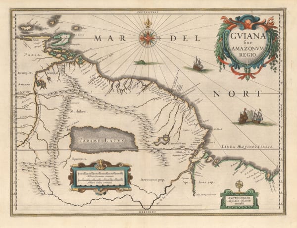
Willem & Jan Blaeu, Guyana, Suriname and French Guiana, 1640 c.£ 700.00
-
-
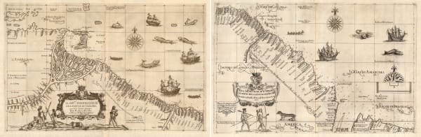
Jan Blaeu, Venezuela and the Windward Islands, 1650 c.£ 1,925.00
-
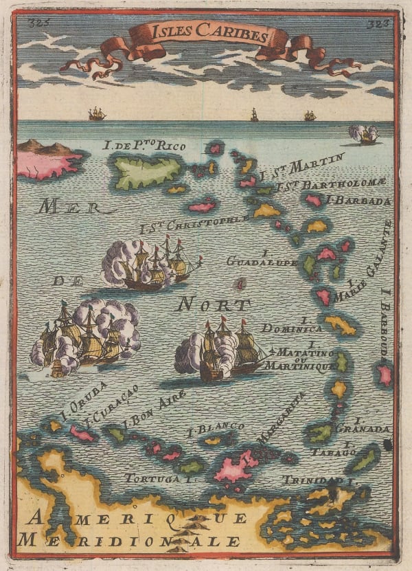
Alain Manesson Mallet, Puerto Rico and the Lesser Antilles, 1683£ 365.00
-
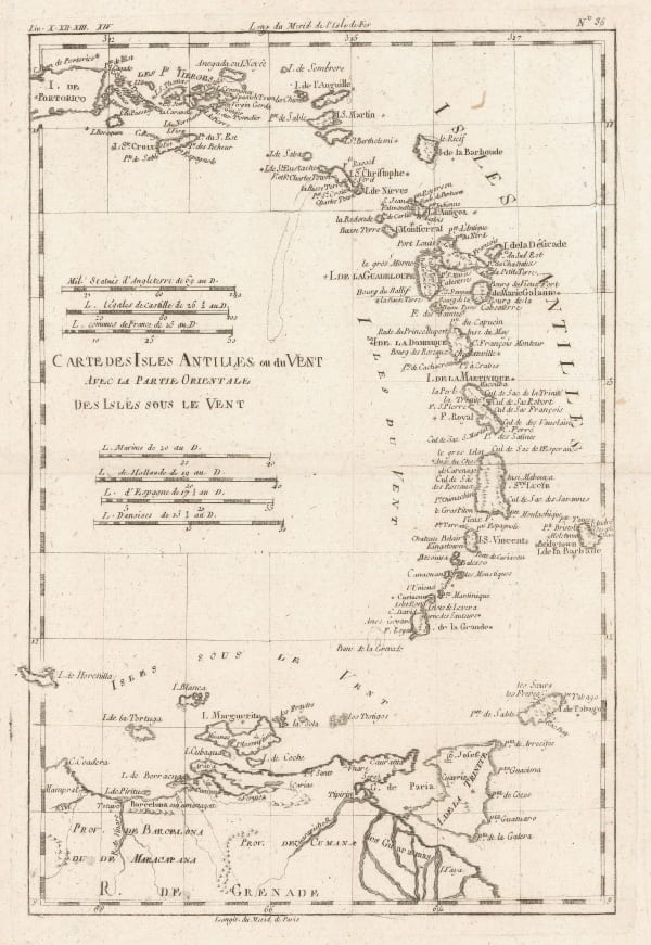
Johannes [II] van Keulen, Trinidad and Tobago, Grenada, St Vincent and the Grenadines, 1740 c.£ 1,650.00
-
Jacques-Nicolas Bellin, South American coast from Venezuela to the Guianas, 1750 c£ 245.00
-
Rigobert Bonne, The Lesser Antilles, 1780 c£ 295.00
-
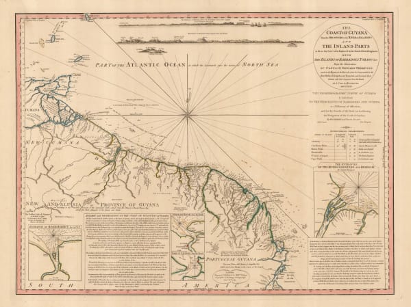
William Faden, The Coast of Guyana from the Oroonoko to the River of Amazons, 1783£ 825.00
-
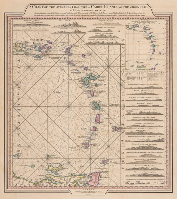
William Faden, Leeward and Windward Islands, 1784£ 3,650.00
-
William Heather, Caribbean Islands from the Virgin Islands to Trinidad and Tobago, 1795£ 1,950.00
-
Laurie & Whittle, Plan of the Isle of Trinidad, 1800£ 2,850.00
-
British Admiralty, A Survey of the Island of Trinidad, 1816£ 1,450.00
-
John Thomson, Tobago, 1816£ 165.00
-
Carey & Lea, Geographical, Statistical and Historical map of The Windward Islands, 1822£ 985.00
-
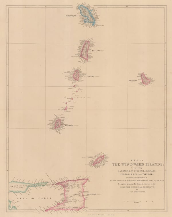
John Arrowsmith, Windward Isles, 1842£ 495.00
-
Archibald Fullarton, Trinidad and Guyana, 1860 c.£ 295.00
-
Edward Stanford, Grenada, St. Vincent and Tobago, 1925 c.£ 32.00
-
British Admiralty, Chart of the Windward Islands from Guadeloupe to Trinidad, 1941£ 445.00
-
Geographical Section, General Staff (GSGS), Trinidad, 1943£ 285.00
Close
Search Inventory
Our entire inventory of over 10,000 antique and vintage maps is now available to browse by region, date, cartographer, and subject


![Johannes [II] van Keulen, Trinidad and Tobago, Grenada, St Vincent and the Grenadines, 1740 c.](https://artlogic-res.cloudinary.com/w_600,c_limit,f_auto,fl_lossy,q_auto/artlogicstorage/themaphouse/images/view/6795550fbc71158152aed9dee911c501j/themaphouse-johannes-ii-van-keulen-trinidad-and-tobago-grenada-st-vincent-and-the-grenadines-1740-c..jpg)


Join our mailing list
* denotes required fields
We will process the personal data you have supplied to communicate with you in accordance with our Privacy Policy. You can unsubscribe or change your preferences at any time by clicking the link in our emails.
![]()
Join our mailing list
* denotes required fields
We will process the personal data you have supplied to communicate with you in accordance with our Privacy Policy. You can unsubscribe or change your preferences at any time by clicking the link in our emails.