-
 John Speed, Cornwall, 1611£ 3,750.00
 -
Michael Drayton, Devon and Cornwall, 1612£ 895.00
-
Jan Jansson, Cornubia sive Cornwallia, 1650 (c.)£ 1,200.00
-
Willem & Jan Blaeu, Cornubia sive Cornwallia, 1650 c.£ 1,600.00
-
Capt. Greenvile Collins, The Islands of Scilly, 1700 c.£ 1,450.00
-
Robert Morden, Cornwall, 1701£ 295.00
-
Christopher Saxton & Philip Lea, Cornwall, 1749£ 3,250.00
-
Emanuel Bowen, A New Improved Map of Cornwall, 1760 c£ 2,200.00
-
-
Carington Bowles, Bowles's New Medium Map of Cornwall, Divided into its Hundreds, 1785£ 295.00
-
Capt. Greenvile Collins, Sea Chart of Land's End & the Scilly Isles, 1785£ 445.00
-
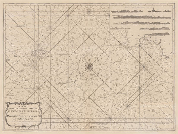
A Chart of the Chops of the Channel, to the South of Scilly Islands: Containing the West Coast of Cornwall and Scilly Islands, 1795Laurie & WhittleSeries: LondonLaurie & Whittle, A Chart of the Chops of the Channel, to the South of Scilly Islands: Containing the West Coast of Cornwall and Scilly Islands, 1795£ 545.00
-
John Wilkes, Cornwall, 1802£ 115.00
-
Charles Smith, A New Map of the County of Cornwall, 1804£ 395.00
-
John Cary, Cornwall, 1809£ 155.00
-
John Pinkerton, Scilly Isles, Shetland and Channel Islands, 1814£ 225.00
-
John Thomson, Isles of Scilly, 1815 c.£ 64.00
-
Christopher & John Greenwood, Map of the County of Cornwall, 1829£ 975.00
-
James Pigot, Cornwall, 1840£ 225.00
-
Thomas Moule, Cornwall, 1840 c.£ 195.00
-
Samuel Lewis, Cornwall, 1848£ 95.00
-
Archibald Fullarton, Scilly Isles, 1860 (c.)£ 75.00
-
Thomas Martyn, A New and Accurate Map of the County of Cornwall, 1870 c.£ 1,550.00
-
Ordnance Survey, Cornwall - Padstow to Camelford, 1880 (c.)£ 145.00
-
J. & C. Walker, Cornwall, 1880 c.£ 125.00
-
W. & A.K. Johnston, Cornwall, 1880 c.£ 65.00
-
George W. Bacon, Cornwall, 1895£ 115.00
-
Baddeley and Ward, Penzance, 1903£ 45.00
-
George W. Bacon, Map of Cornwall, 1910 c.£ 485.00
-
Ordnance Survey, Ordnance Survey Road Map of S.W. Cornwall & Scilly Isles, 1929£ 125.00
-
William Harding Thompson, Map of Cornwall, 1929£ 125.00
-
William Harding Thompson, Map of Cornwall, 1929£ 145.00
-
J.W. Harding & Co., Touring Map of the Cornish Riviera, 1930 c.£ 375.00
-
Ordnance Survey, Bodmin - O.S.Sheet 136, 1942£ 125.00
-
War Office, Looe, 1943£ 45.00
-
War Office, St. Ives / Hayle, 1943£ 55.00
-
Ward, Lock & Co, Newquay, 1946£ 52.00
-
Ward, Lock & Co, Bude, 1946£ 55.00
-
William Bowyer, Cornwall, 1950c£ 2,500.00
-
War Office, Newquay and Padstow, 1962£ 350.00
All Maps
Our entire inventory of over 10,000 antique and vintage maps is now available to browse by region, date, cartographer, and subject