-
 Cumberland and the Ancient Citie Carlile Described with many Memorable Antiqvities Therein Found Observed, 1614John SpeedSeries: LondonJohn Speed, Cumberland and the Ancient Citie Carlile Described with many Memorable Antiqvities Therein Found Observed, 1614£ 1,150.00
 -
Westmorlandiae Comitatus qui olim Spectaint ad Brigantas, 1637Christopher Saxton & William KipSeries: LondonChristopher Saxton & William Kip, Westmorlandiae Comitatus qui olim Spectaint ad Brigantas, 1637£ 385.00
-
Westmorlandiae Comitatus qui olim Spectiant ad Brigantas, 1637Christopher Saxton & William KipSeries: LondonChristopher Saxton & William Kip, Westmorlandiae Comitatus qui olim Spectiant ad Brigantas, 1637£ 495.00
-
Cumbria sive Cumberlandia quoe olim pars Brigantum, 1637Christopher Saxton & William KipSeries: LondonChristopher Saxton & William Kip, Cumbria sive Cumberlandia quoe olim pars Brigantum, 1637£ 595.00
-
Willem & Jan Blaeu, Westmorland, 1640 c£ 595.00
-
Willem & Jan Blaeu, Cumbria, 1648£ 895.00
-
Richard Blome, A General Mapp of the Countie of Cumberland, 1673£ 275.00
-
John Speed, The Countie Westmorland and Kendale the Chief Towne Described, 1676£ 1,150.00
-
John Seller, Cumberland, 1690 c.£ 140.00
-
John Seller, Westmorland County, 1690 c.£ 155.00
-
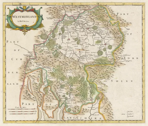
Robert Morden, Westmorland, 1695£ 225.00
-
Robert Morden, Cumberland, 1708£ 185.00
-
Robert Morden, Westmorland, 1708£ 115.00
-
Emanuel Bowen & John Owen, Westmoreland, 1720£ 88.00
-
John Cowley, An Improved Map of Westmoreland, 1744£ 45.00
-
Emanuel Bowen, A New Map of the Counties of Cumberland and Westmoreland, 1760£ 695.00
-
Thomas Kitchin, A New Map of Westmoreland, 1760 c.£ 55.00
-
Russell & Price, Westmorland, 1769£ 62.00
-
Emanuel Bowen, An Improved map of the Counties of Cumberland and Westmoreland, 1777£ 475.00
-
John Cary, Westmoreland, 1793£ 72.00
-
John Cary, Cumberland, 1793£ 88.00
-
John Cary, A New Map of Cumberland, 1801£ 295.00
-
John Cary, A New Map of Westmoreland, 1801£ 245.00
-
John Wilkes, Cumberland, 1802£ 75.00
-
Charles Smith, The Lake District, 1802£ 485.00
-
Cole & Roper, Cumberland, 1805£ 78.00
-
Cole & Roper, Westmoreland, 1807£ 62.00
-
Richard Phillips, Cumberland, 1808£ 38.00
-
Richard Phillips, Westmoreland, 1808£ 24.00
-
Langley & Belch, Langley's New Map of Cumberland, 1817£ 98.00
-
William Darton, Westmoreland, 1820£ 30.00
-
Christopher & John Greenwood, Map of the County of Westmoreland, 1824£ 825.00
-
Map of the County of Cumberland from an Actual Survey, 1830Christopher & John GreenwoodSeries: LondonChristopher & John Greenwood, Map of the County of Cumberland from an Actual Survey, 1830£ 350.00
-
Christopher & John Greenwood, Map of the County of Westmoreland, 1830£ 395.00
-
James Pigot, Cumberland, 1830 c.£ 85.00
-
Henry Teesdale, Cumberland, 1830 c.£ 95.00
-
Joshua Archer, Westmoreland, 1833£ 20.00
-
J. & C. Walker, Cumberland, 1836£ 68.00
-
James Pigot, Westmoreland, 1840 c.£ 88.00
-
Thomas Moule, Westmoreland, 1840 c.£ 55.00
-
Thomas Moule, Cumberland, 1840 c.£ 85.00
-
J. & C. Walker, Westmorland, 1845£ 62.00
-
Henry George Collins, Cumberland, 1850 c.£ 72.00
-
Henry George Collins, Westmoreland, 1850 c.£ 72.00
All Maps
Our entire inventory of over 10,000 antique and vintage maps is now available to browse by region, date, cartographer, and subject