-
 Richard Blome, Isles of Wight, Channel Islands, Isle of Man, Orkneys and Shetland, 1673£ 265.00
 -
Gerard van Keulen, The Shetland Islands, 1730 c£ 950.00
-
Capt. Greenvile Collins, The Islands of Orkney, 1740 c.£ 895.00
-
Johannes [II] van Keulen, Nieuwe Generaale Caart von de Orcades, 1760 c.£ 685.00
-
Jacques-Nicolas Bellin, Carte des Isles de Hetland ou Schetland, 1764£ 275.00
-
Jacques-Nicolas Bellin, Carte des Isles d'Orkney ou Orcades, 1764£ 245.00
-
Sayer & Bennett, Inverness, Skye & the Outer Hebrides, 1777£ 125.00
-
Sayer & Bennett, The Orkneys and Shetland Islands, 1777£ 125.00
-
Sayer & Bennett, Argyll and Bute, 1777£ 125.00
-
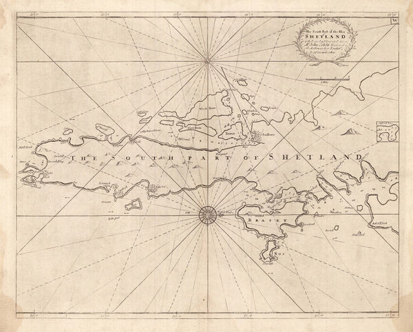
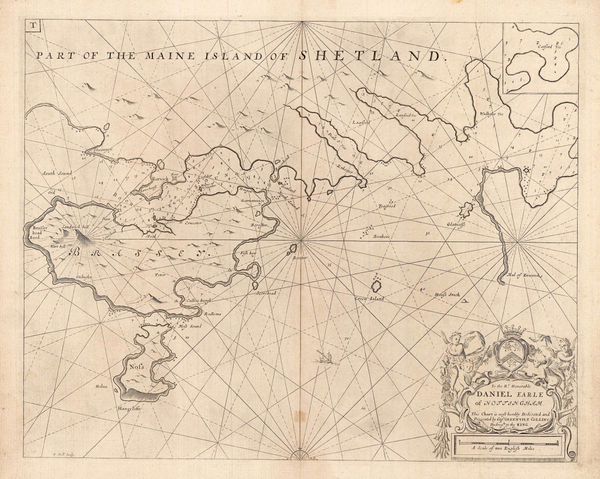
Capt. Greenvile Collins, The South Part of the Isles of Shetland, 1785£ 385.00
-
Capt. Greenvile Collins, Shetland - Lerwick, Bressay & Noss, 1785£ 345.00
-
Heather's New and Improved Chart of the Orkney Isles. Drawn from the Most Accurate Surveys., 1804William HeatherSeries: LondonWilliam Heather, Heather's New and Improved Chart of the Orkney Isles. Drawn from the Most Accurate Surveys., 1804£ 1,650.00
-
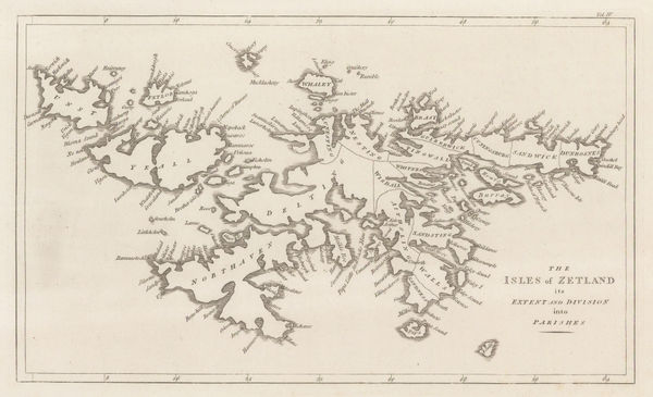
John Cary, The Isles of Zetland, 1805£ 125.00
-
John Pinkerton, Scilly Isles, Shetland and Channel Islands, 1814£ 225.00
-
John Thomson, Western Isles (North Sheet), 1822£ 495.00
-
John Thomson, Western Isles [Southern Section], 1823£ 425.00
-
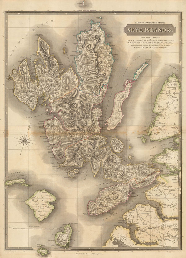
John Thomson, Skye Island &c., 1824£ 1,450.00
-
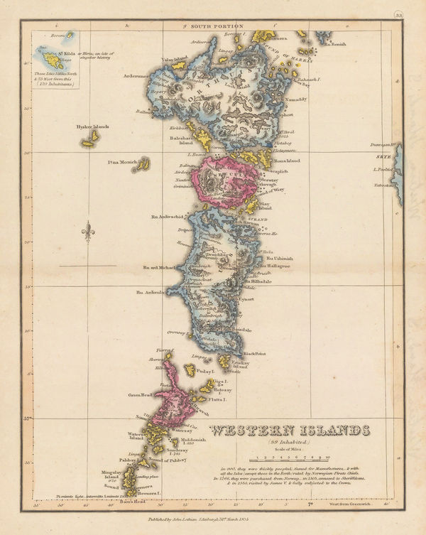
John Lothian, Western Isles (South Portion), 1835£ 145.00
-
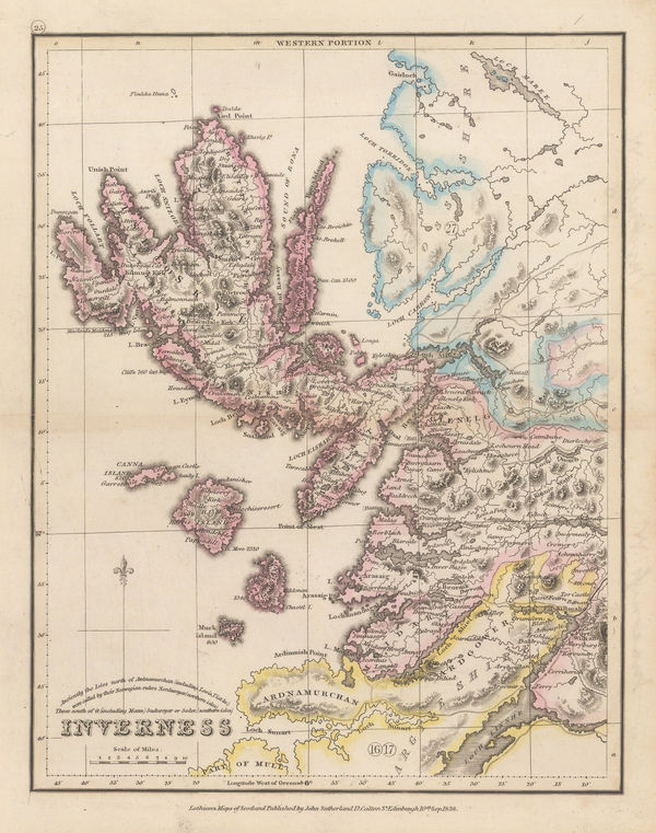
John Lothian, Inverness - Western Portion, 1838£ 175.00
-
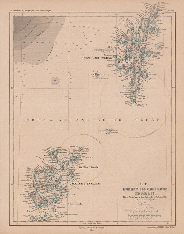
Justus Perthes, Orkney & Shetland Islands, 1855£ 75.00
-
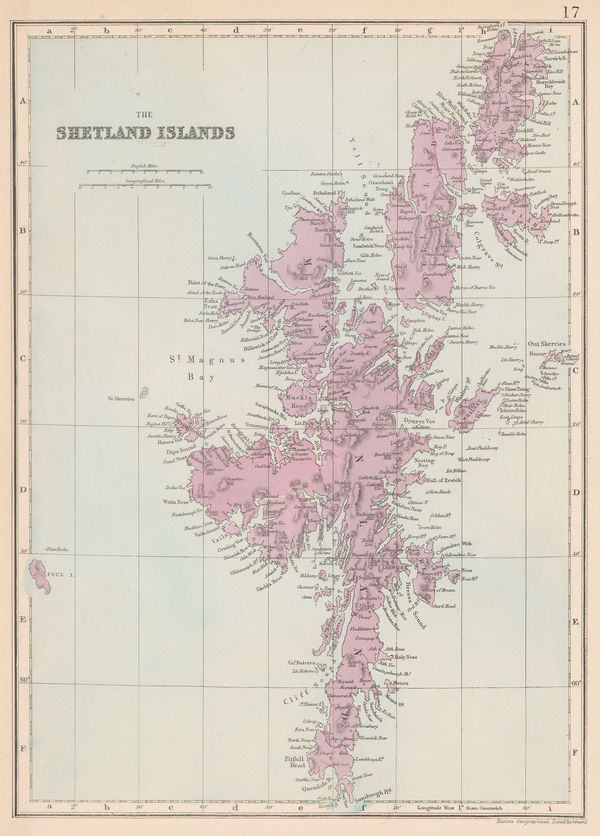
Edward Weller, The Shetland Islands, 1863 (c.)£ 115.00
-
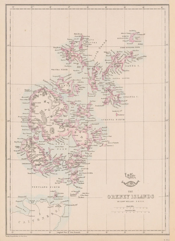
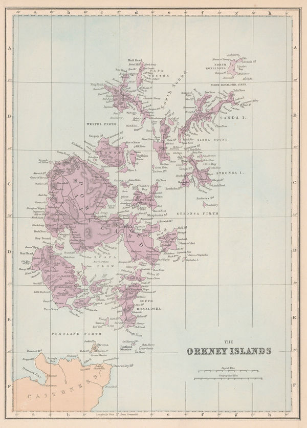
Edward Weller, The Orkney Islands, 1863 (c.)£ 115.00
-
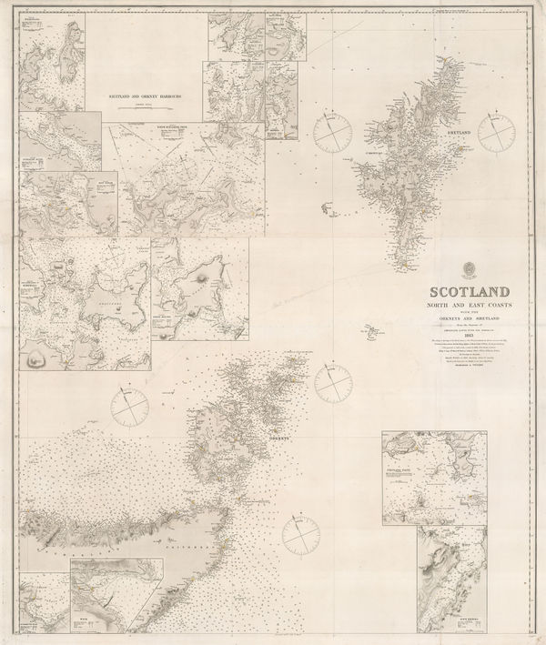
British Admiralty, Orkneys and Shetland Isles, 1872£ 325.00
-
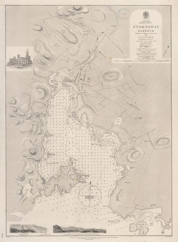
British Admiralty, Stornoway Harbour, 1874£ 150.00
-
British Admiralty, Isle of Skye, 1878£ 695.00
-
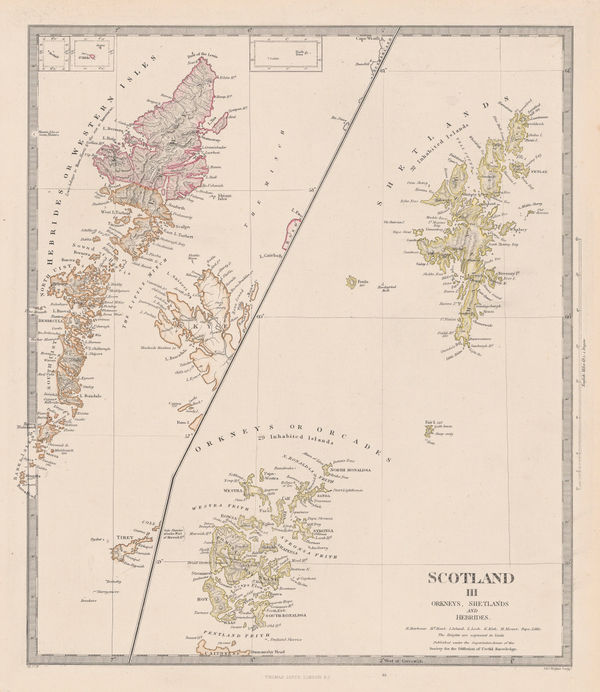
Letts & Son, Orkney, Shetland & Hebrides, 1880 (c.)£ 185.00
-
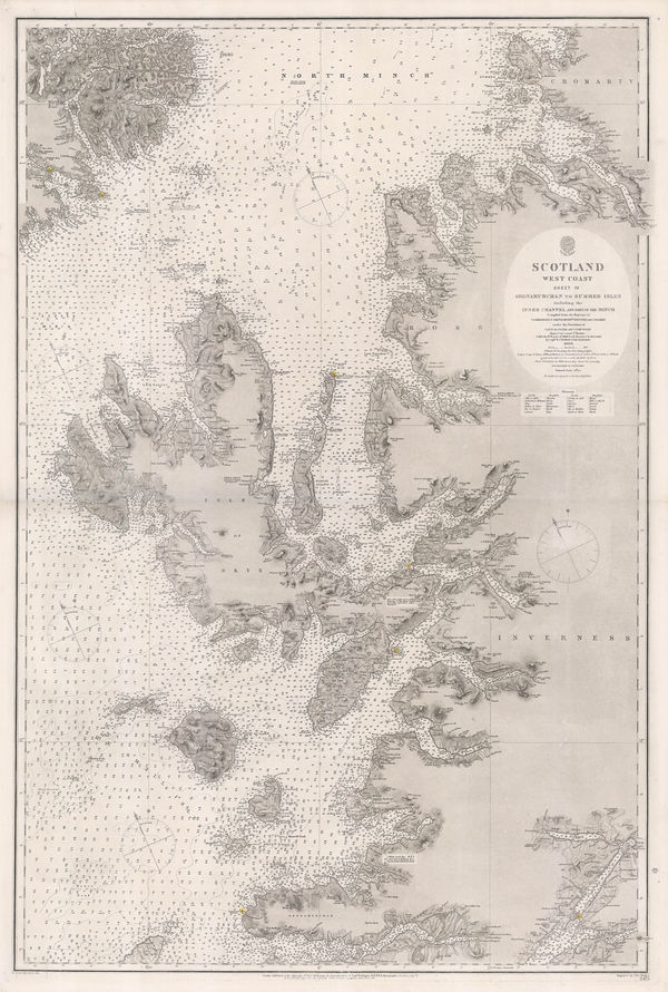
British Admiralty, Western Scotland, 1882£ 885.00
-
George W. Bacon, Shetland Islands, 1885 (c.)£ 125.00
-
George W. Bacon, Orkney Islands, 1885 (c.)£ 125.00
-
John Bartholomew & Co., Skye, 1920 (c.)£ 375.00
All Maps
Our entire inventory of over 10,000 antique and vintage maps is now available to browse by region, date, cartographer, and subject


![Johannes [II] van Keulen, Nieuwe Generaale Caart von de Orcades, 1760 c.](https://static-assets.artlogic.net/w_600,c_limit,f_auto,fl_lossy,q_auto/artlogicstorage/themaphouse/images/view/bfbbfe45b2f627581400a21685aee561j/themaphouse-johannes-ii-van-keulen-nieuwe-generaale-caart-von-de-orcades-1760-c..jpg)


![John Thomson, Western Isles [Southern Section], 1823](https://static-assets.artlogic.net/w_600,c_limit,f_auto,fl_lossy,q_auto/artlogicstorage/themaphouse/images/view/bbdfddc34eefb201bcd8a736788ff46cj/themaphouse-john-thomson-western-isles-southern-section-1823.jpg)