-
 Laurent Fries, Early Map of Southeast Asia, 1541£ 4,250.00
 -
Claudius Ptolemy & Laurent Fries, Rare and early map of the Malay Peninsula, 1541£ 2,450.00
-
Tomaso Porcacchi, Early map of Southeast Asia, 1576£ 820.00
-
Petrus Bertius, Description de Malacca, 1618£ 495.00
-
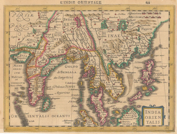
Mercator Hondius, India and Southeast Asia, 1630£ 825.00
-
-
-
-
Robert Morden, Borneo, Sumatra, Java and Malacca, 1688£ 225.00
-
Nicolas Sanson, Sumatra, Java and Borneo, 1692£ 695.00
-
Pierre Duval, Indonesia, 1694 c.£ 345.00
-
Myanmar, Laos, Thailand, Cambodia, Vietnam and Malay Peninsula, 1700Nicolas & Guillaume SansonSeries: AmsterdamNicolas & Guillaume Sanson, Myanmar, Laos, Thailand, Cambodia, Vietnam and Malay Peninsula, 1700£ 595.00
-
Robert Morden, Malaysia, Thailand, Vietnam, Laos, Cambodia & Myanmar, 1700 c£ 395.00
-
-
Herman Moll, Myanmar, Thailand, Cambodia, Vietnam, Laos and Malaysia, 1725£ 795.00
-
Jacques-Nicolas Bellin, Malacca, 1764£ 295.00
-
Jacques-Nicolas Bellin, Thailand, Vietnam, Laos, Cambodia & Myanmar, 1764£ 745.00
-
Jacques-Nicolas Bellin, Sumatra, Singapore & Malaysia, 1764£ 395.00
-
Rigobert Bonne, Indonesia, Malaysia and New Guinea, 1790 c£ 395.00
-
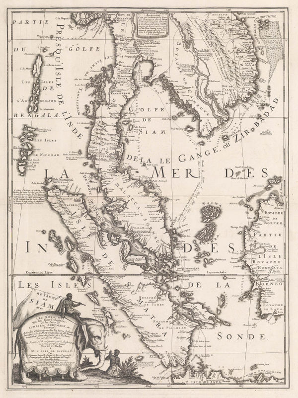
Laurie & Whittle, Rare chart of the Gulf of Thailand and the South China Sea, 1794£ 1,350.00
-
Giovanni Maria Cassini, Peninsular Southeast Asia, 1797£ 1,850.00
-
John Walker, Thailand, Malaysia, Singapore, Vietnam, Laos and Cambodia., 1828£ 1,150.00
-
John Tallis, Malay Archipelago, or East India Islands, 1851£ 745.00
-
Adrian J. Bogaerts, Wall Map of the Dutch East Indies (Indonesia), 1857£ 2,850.00
-
Justus Perthes, Malacca Province, 1857£ 72.00
-
Archibald Fullarton, British Possessions in the Indian Seas, 1860 c.£ 475.00
-
Map of the Northern Part of Perak (Malay Peninsula), 1882Royal Geographical Society (RGS)Series: LondonRoyal Geographical Society (RGS), Map of the Northern Part of Perak (Malay Peninsula), 1882£ 365.00
-
British Admiralty, Strait of Malacca. From Diamond Pt. to the North Sands, 1882£ 795.00
-
Henry Cuthbert Tunison, Southeast Asia, 1885 (c.)£ 125.00
-
Royal Geographical Society (RGS), Johore Territory and Singapore, 1894£ 795.00
-
Sketch Map of the Malay States, Kelantan & Trengganu, 1896Royal Geographical Society (RGS)Series: LondonRoyal Geographical Society (RGS), Sketch Map of the Malay States, Kelantan & Trengganu, 1896£ 245.00
-
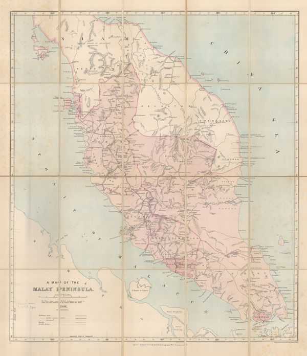
Edward Stanford, A Map of the Malay Peninsula, 1906£ 1,250.00
-
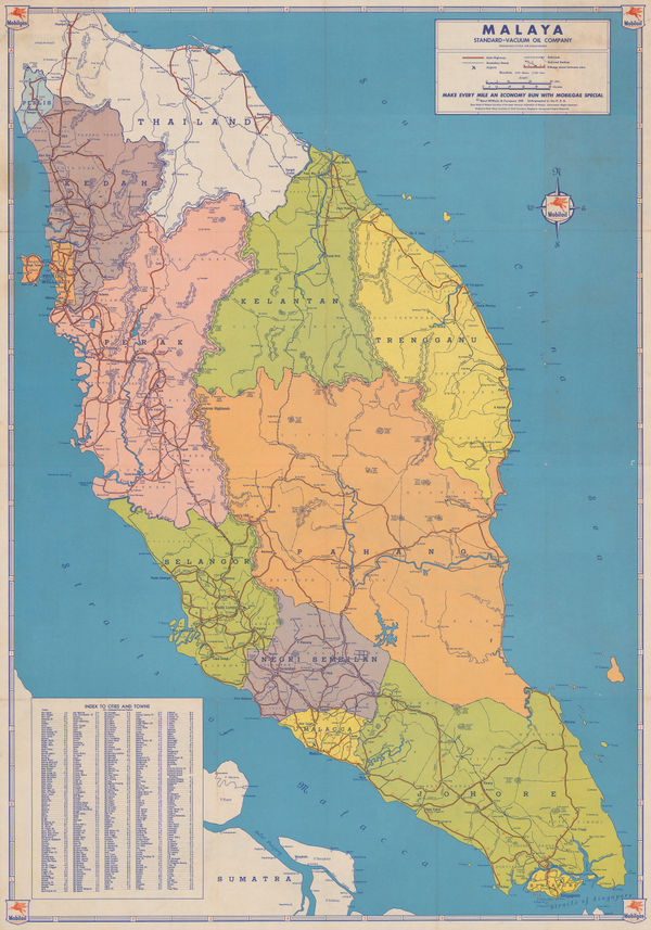
The Financial Times Map showing the position of the Rubber Estates in British Malaya, 1910 (c.)The Financial TimesSeries: LondonThe Financial Times, The Financial Times Map showing the position of the Rubber Estates in British Malaya, 1910 (c.)£ 950.00
-
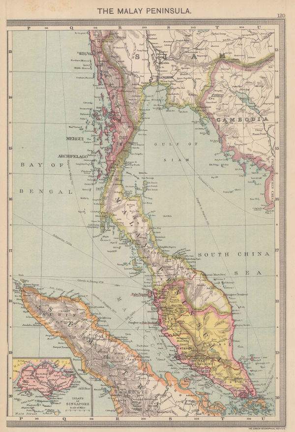
George Philip & Son Ltd., The Malay Peninsula, 1910 c.£ 195.00
-
-
Survey Dept. F.M.S., Wall map of the Malaysian Peninsula and Singapore, 1921£ 1,650.00
-
British Admiralty, Malacca Straits, 1923£ 1,150.00
-
Fed. Malay States, Folding map of the Malay Peninsula, 1929£ 675.00
-
British Admiralty, Bassein River to Pulo Penang, 1932£ 1,550.00
-
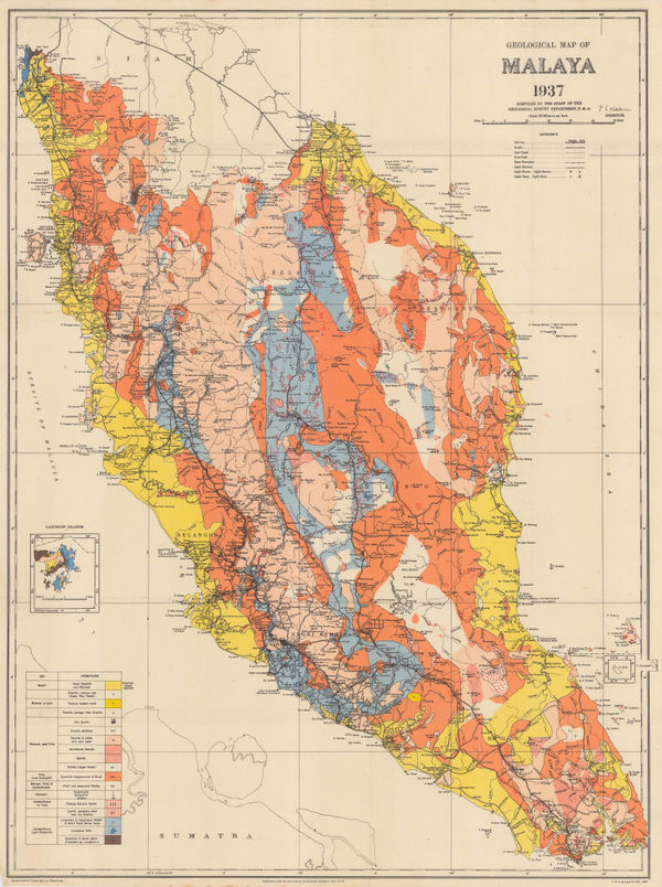
Fed. Malay States, Geological map of the Malay Peninsula, 1937£ 695.00
-
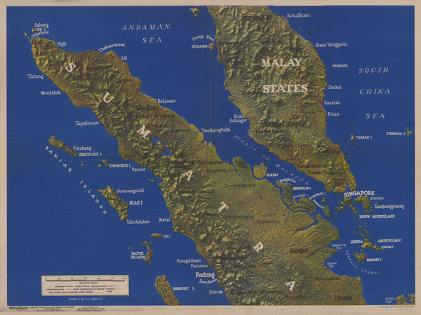
WW2-era terrain map of the Malay Peninsula, Singapore, and Sumatra, 1945US GovernmentSeries: New YorkUS Government, WW2-era terrain map of the Malay Peninsula, Singapore, and Sumatra, 1945£ 575.00
-
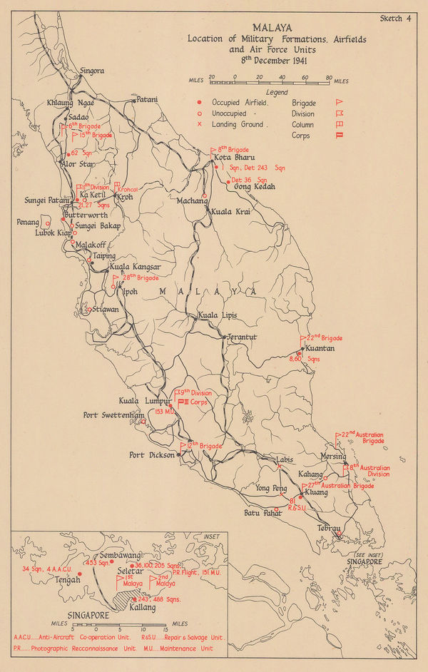
Allied Land Forces South East Asia (ALFSEA), WWII map of southwest Malaysia, 1945£ 295.00
-
Survey of India, Port Dickson, 1945£ 125.00
-
-
-
Automobile Association of Malaya, Kuala Lumpur, 1951£ 95.00
-
Automobile Association of Malaya, Penang Town, 1951£ 85.00
-
Automobile Association of Malaya, Ipoh, 1951£ 65.00
-
Automobile Association of Malaya, Seremban, 1951£ 65.00
-
Peter Kents, Penang, 1951£ 325.00
-
LPE, Ltd., Kuala Lumpur, 1956£ 145.00
-
LPE, Ltd., Road Map of West Malaysia, 1956£ 1,150.00
-
Her Majesty's Stationery Office (HMSO), WWII battle plan of Selangor, 1957£ 145.00
-
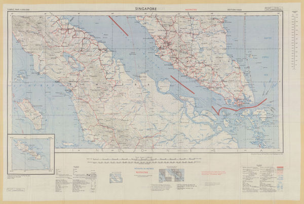
Singapore and Southern Malay Peninsula, 1957Geographical Section, General Staff (GSGS)Series: LondonGeographical Section, General Staff (GSGS), Singapore and Southern Malay Peninsula, 1957£ 595.00
-
Her Majesty's Stationery Office (HMSO), Kedah, 1957£ 75.00
-
Her Majesty's Stationery Office (HMSO), WW2 Map of Malaysia, 1957£ 195.00
-
Road and rail network of the Malay Peninsula, 1957Her Majesty's Stationery Office (HMSO)Series: LondonHer Majesty's Stationery Office (HMSO), Road and rail network of the Malay Peninsula, 1957£ 115.00
-
Rand, McNally & Co., Vintage folding road map of Malaysia and Singapore, 1959£ 325.00
-
Malaysian Government Department of Tourism, Kuala Lumpur, 1965£ 825.00
-
Directorate of National Mapping Malaysia, Kuala Lumpur, 1966£ 550.00
-
Malaysian Government Department of Tourism, Kuala Lumpur, 1968£ 695.00
-
Kuala Lumpur Tourist, Kuala Lumpur Tourist Map, 1973£ 80.00
All Maps
Our entire inventory of over 10,000 antique and vintage maps is now available to browse by region, date, cartographer, and subject