-
 Royal Geographical Society (RGS), Sketch Map of Sikhim and the Nipalese Frontier, 1850£ 145.00
 -
Justus Perthes, Prince Waldemar of Prussia's route to Kathmandu, 1855£ 225.00
-
Map Showing Routes of Native Explorers in Tibet and Nepal, 1875Royal Geographical Society (RGS)Series: LondonRoyal Geographical Society (RGS), Map Showing Routes of Native Explorers in Tibet and Nepal, 1875£ 745.00
-
The Journey of the Pundit Nain Singh through Great Tibet, 1877Royal Geographical Society (RGS)Series: LondonRoyal Geographical Society (RGS), The Journey of the Pundit Nain Singh through Great Tibet, 1877£ 425.00
-
W. & A.K. Johnston, Himalaya, 1880 (c.)£ 72.00
-
Royal Geographical Society (RGS), Map of Tibet, 1887£ 395.00
-
John Bartholomew & Co., Nepal & Part of Tibet, 1909£ 125.00
-
Survey of India, The Himalaya Mountains and Surrounding Regions, 1920£ 4,450.00
-
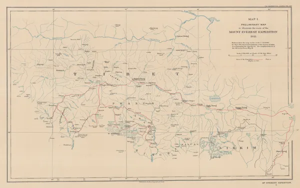
Preliminary Map to Illustrate the Route of the Mount Everest Expedition, 1922Royal Geographical Society (RGS)Series: LondonRoyal Geographical Society (RGS), Preliminary Map to Illustrate the Route of the Mount Everest Expedition, 1922£ 675.00
-
Royal Geographical Society (RGS), The Geology of the Mount Everest Region, 1922£ 675.00
-
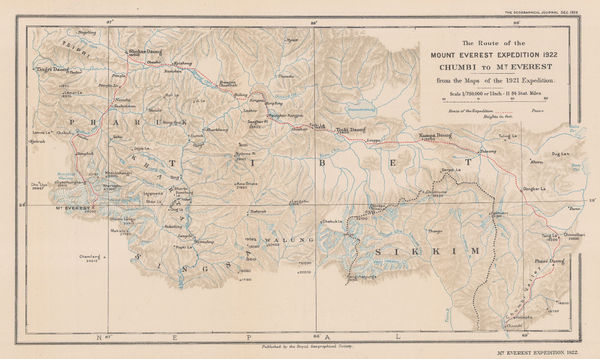
The Route of the Mount Everest Expedition 1922, Chumbi to Mt. Everest from the maps of the 1921 Expedition, 1922Royal Geographical Society (RGS)Series: LondonRoyal Geographical Society (RGS), The Route of the Mount Everest Expedition 1922, Chumbi to Mt. Everest from the maps of the 1921 Expedition, 1922£ 675.00
-
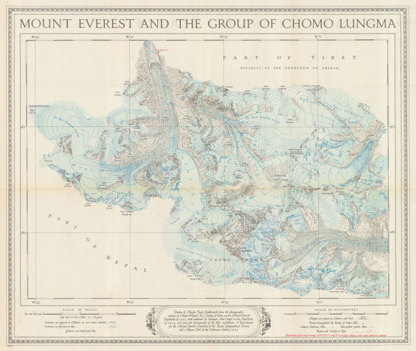
Ordnance Survey, Mount Everest and the Group of Chomo Lungma, 1934£ 1,500.00
-
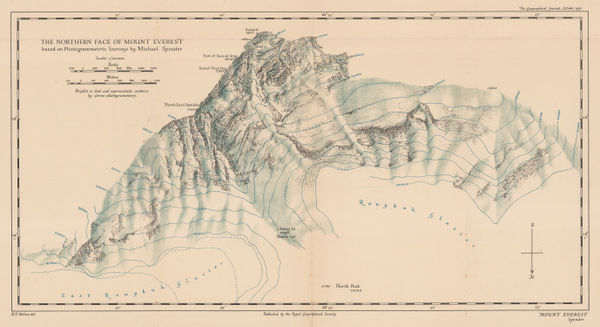
Royal Geographical Society (RGS), The Northern Face of Mount Everest, 1936£ 675.00
-
Erwin Schneider, Chomolongma - Mount Everest, 1957£ 4,450.00
-
Kummerly & Frey, Relief Map of Nepal, 1960£ 295.00
-
Indian Government, The Himalayas, 1960£ 175.00
-
Pradyumna Karan, The Kingdom of Bhutan, 1965£ 1,275.00
-
Vidya Chitr Prakashan, Nepal Political, 1973£ 450.00
-
Nepalese Dept. of Tourism, Kathmandu City, 1974£ 450.00
-
Natraj Tours & Travels, Nepal, 1975£ 495.00
-
Madhab Lal Maharjan, Kathmandu Patan, 1986£ 750.00
All Maps
Our entire inventory of over 10,000 antique and vintage maps is now available to browse by region, date, cartographer, and subject