-
 Hartmann Schedel, Damascus, 1493£ 650.00
 -
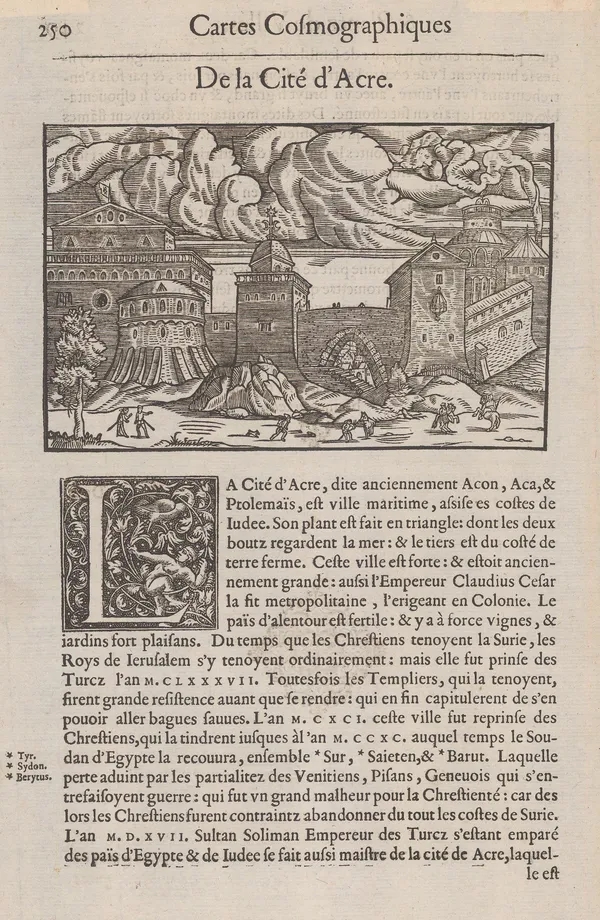
Antoine Du Pinet, Wood-cut view of the fortress at Acre, Israel, 1564£ 345.00
-
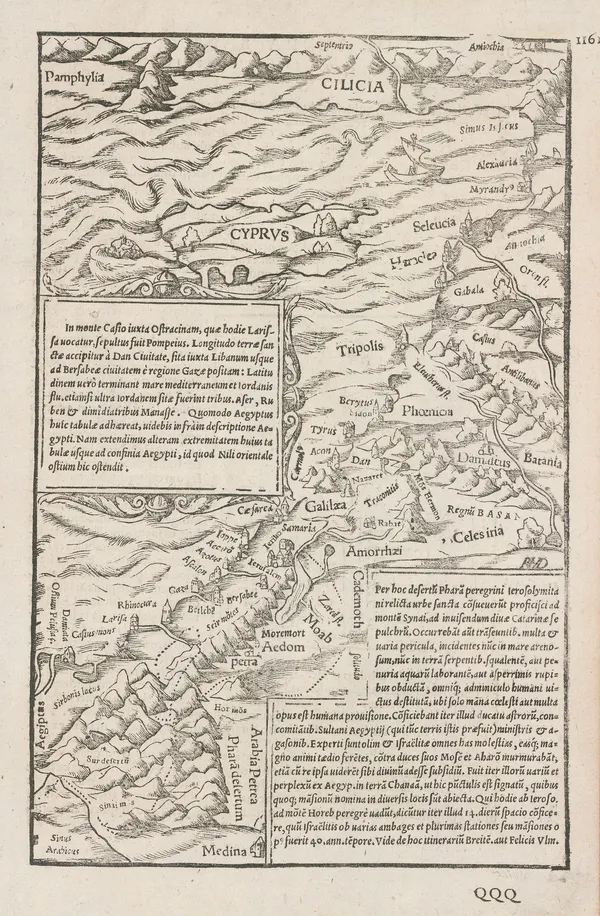
Sebastian Münster, Cyprus and the Holy Land, 1572£ 575.00
-
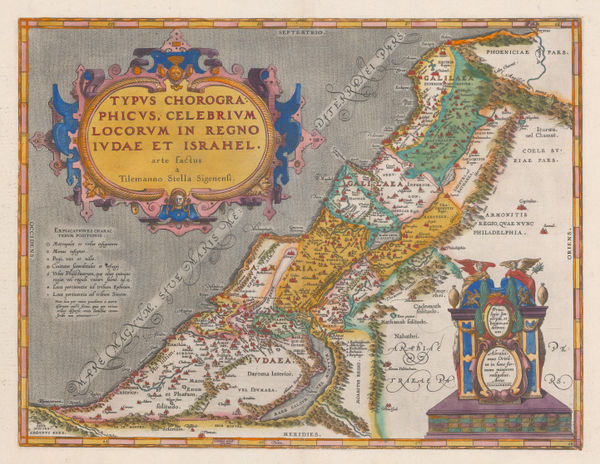
Abraham Ortelius, Kingdom of Judea and Israel, 1595£ 3,250.00
-
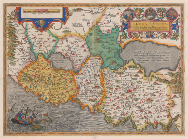
Abraham Ortelius, Holy Land, 1595£ 3,450.00
-
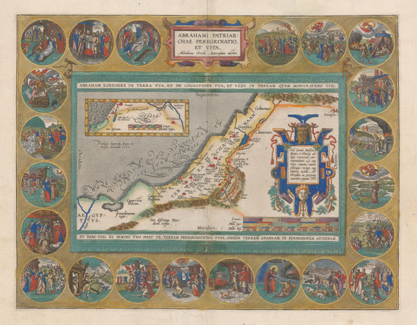
Abraham Ortelius, Journey of Abraham, 1595£ 3,950.00
-
Mercator Hondius, Dutch Golden Age map of the Middle East , 1620 c.£ 2,750.00
-
Samuel Purchas, Holy Land during Biblical times, 1625£ 395.00
-
Jan Jansson, Dutch Golden Age map of the Holy Land, 1661£ 295.00
-
C. & N. Visscher, Holy Land, 1665 c£ 750.00
-
-
John Speed, Famous map of the Holy Land with Biblical vignettes, 1676£ 3,950.00
-
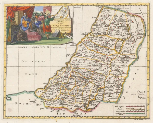
Nicolas Sanson, Geographiae Sacrae Tabula, 1683£ 285.00
-
Johann Ulrich Muller, Early miniature map of the Holy Land, 1692£ 220.00
-
Valk & Schenk, Lebanon and Syria, 1700 c.£ 825.00
-
Robert Morden, Canaan, 1701£ 395.00
-
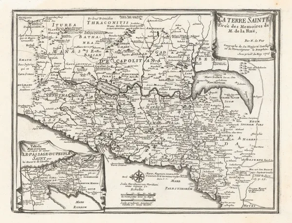
Nicolas de Fer, The Holy Land, 1705£ 595.00
-
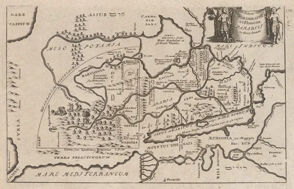
John Senex, Map of the Garden of Eden or the Levant, Arabia, Egypt and the Nile, 1711£ 395.00
-
-
Jacques-Nicolas Bellin, Acre & Haifa, Israel, 1764£ 115.00
-
Jacques-Nicolas Bellin, Tripoli, Lebanon, 1764£ 125.00
-
Jacques-Nicolas Bellin, Sidon, Lebanon, 1764£ 145.00
-
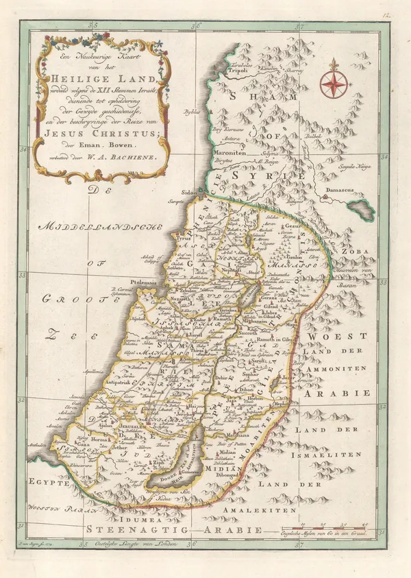
Willem Albert Bachiene, Holy Land, 1774£ 445.00
-
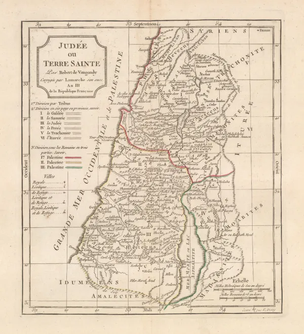
Charles Francois Delamarche, Holy Land, 1795£ 175.00
-
Robert Wilkinson, Palaestina seu Terra Sancta, 1806£ 275.00
-
Robert Wilkinson, Kingdom of Jerusalem, 1807£ 125.00
-
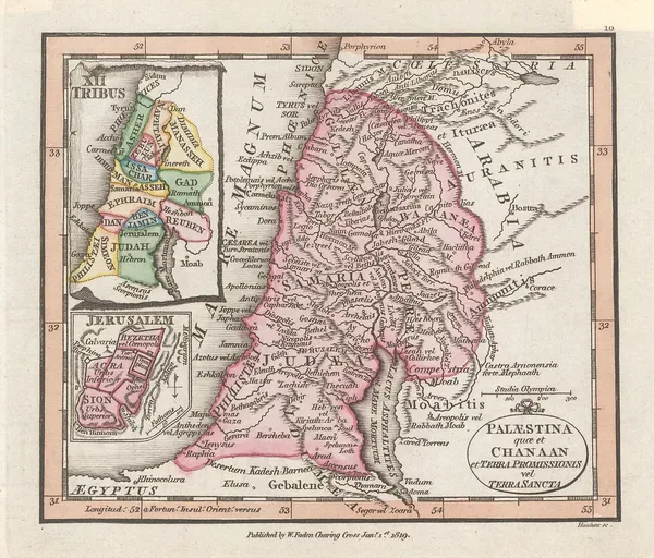
William Faden, Miniature atlas map of the Holy Land, 1819£ 195.00
-
George Washington Boynton, Turkey, Arabia & Persia, 1835 c.£ 145.00
-
Royal Geographical Society (RGS), Part of Arabia Petraea and Palestine, 1839£ 525.00
-
Robert Wilkinson, Six Chrono-Genealogical Charts of Biblical History, 1842£ 240
-
Robert Wilkinson, Syria and Assyria, 1842£ 85.00
-
Robert Wilkinson, King Solomon's Twelve Purveyors, 1842£ 85.00
-
Robert Wilkinson, Canaan from the Time of Joshua to the Babylonish Captivity, 1842£ 195.00
-
Joseph Meyer, Karte von Klein Asien, 1848£ 225.00
-
Royal Geographical Society (RGS), Palestine, 1854£ 295.00
-
Sir Archibald Alison, Siege of St. Jean d'Acre, 1855£ 65.00
-
Joseph Hutchins Colton, Middle East, 1858£ 245.00
-
Royal Geographical Society (RGS), Map of Syria &c., 1863£ 150.00
-
Blackie & Son, Syria, 1866£ 78.00
-
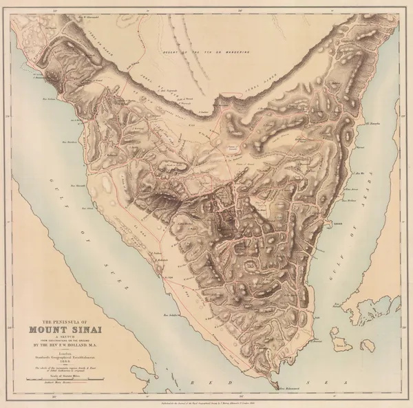
Royal Geographical Society (RGS), Sinai Peninsula, 1868£ 345.00
-
Royal Geographical Society (RGS), Route Map of the Tulul el Safa, 1872£ 185.00
-
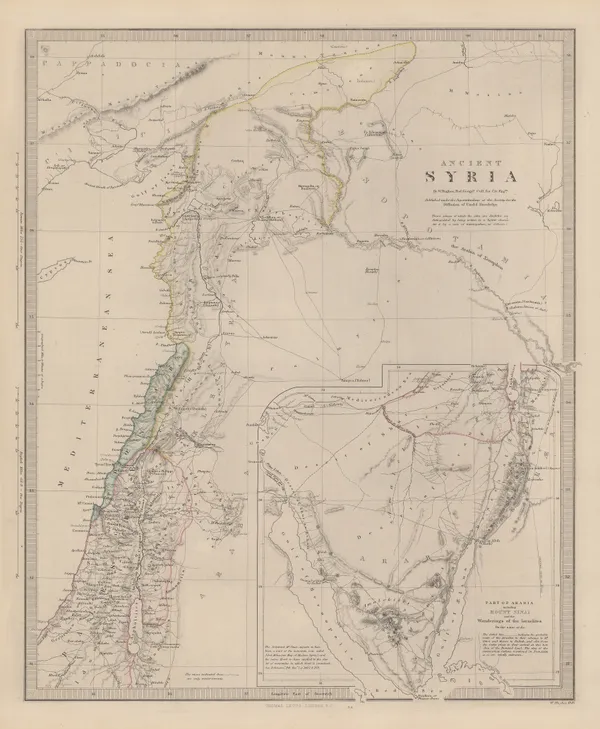
Society for the Diffusion of Useful Knowledge (SDUK), Ancient Syria, 1879£ 325.00
-
W. & A.K. Johnston, The Middle East, 1880 c£ 75.00
-
W. & A.K. Johnston, The Levant, 1880 c£ 75.00
-
Friedrich Boemches, Beirut - Plan for a new Harbour, 1882£ 125.00
-
W. & A.K. Johnston, Jerusalem, 1890 c.£ 75.00
-
-
Edward Stanford, The Country Around Jerusalem, 1901£ 65.00
-
Edward Stanford, Damascus, 1901£ 55.00
-
Edward Stanford, Jerusalem, 1901£ 145.00
-
Edward Stanford, Palestine, 1904£ 200.00
-
Edward Stanford, Beirut, 1904£ 68.00
-
Sketch map of the overland route from Baghdad to Damascus, 1909Royal Geographical Society (RGS)Series: LondonRoyal Geographical Society (RGS), Sketch map of the overland route from Baghdad to Damascus, 1909£ 295.00
-
W. & A.K. Johnston, Cook's Plan of Jerusalem, 1911£ 95.00
-
John Bartholomew & Co., Palestine, 1922£ 195.00
-
J.G. Bartholomew, Middle East, 1922£ 425.00
-
Royal Geographical Society (RGS), Air Mosaic of Petra, 1924£ 275.00
-
Thomas Cook, Jerusalem, 1925£ 78.00
-
Royal Geographical Society (RGS), Petra, 1930£ 275.00
-
John Bartholomew & Son, Damascus, 1934£ 68.00
-
Zev Vilnay, Haifa and Mt. Carmel, 1935£ 95.00
-
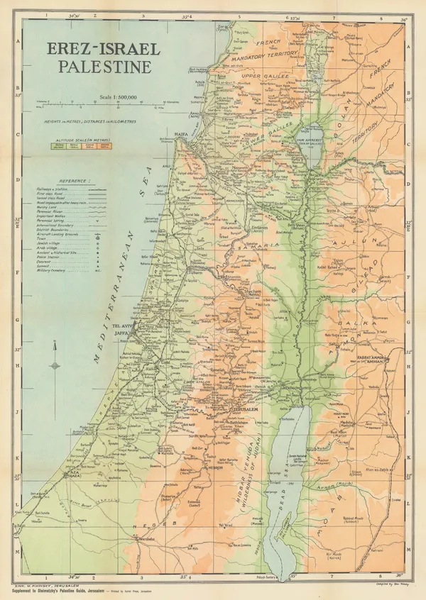
Zev Vilnay, Israel, 1935£ 295.00
-
George Philip & Son Ltd., The Middle East, 1935 (c.)£ 195.00
-
Christina Phelps Grant, The Syrian Desert Caravan Routes, 1937£ 250.00
-
Steimatzky's Publishing, Beirut, 1941£ 225.00
-
Steimatzky's Publishing, Damascus, 1941£ 85.00
-
Survey of Palestine, Tel Aviv, 1944£ 745.00
-
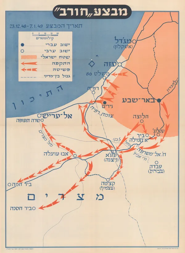
Israel Defense Forces (IDF), Operation Horev, 1950£ 450.00
-
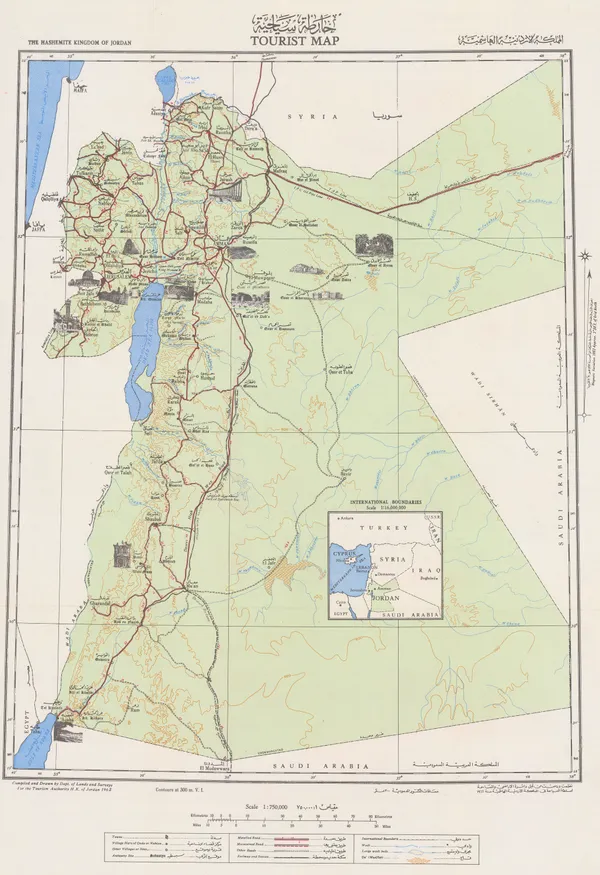
The Hashemite Kingdom of Jordan Tourist Map | المملكة الاردنية الهاشمية, 1955Tourism Authority H.K. of JordanSeries: AmmanTourism Authority H.K. of Jordan, The Hashemite Kingdom of Jordan Tourist Map | المملكة الاردنية الهاشمية, 1955£ 550.00
-
Survey of Palestine, Jerusalem, 1956£ 365.00
-
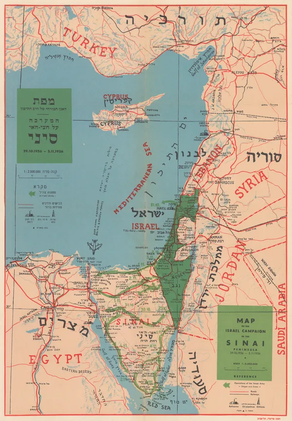
Dr. J Shapiro, Map of the Israel Campaign in the Sinai Peninsula, 1956£ 585.00
-
Geographical Section, General Staff (GSGS), Persian Gulf, 1956£ 750.00
-
Ibrahim Hilmi al-Ghouri, Palestine, Transjordan, Lebanon, Syria and Egypt, 1959 c£ 950.00
-
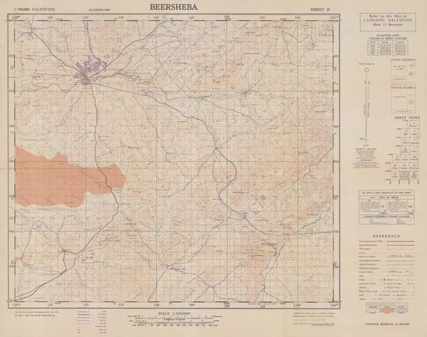
Survey of Palestine, Beersheba, 1960£ 295.00
-
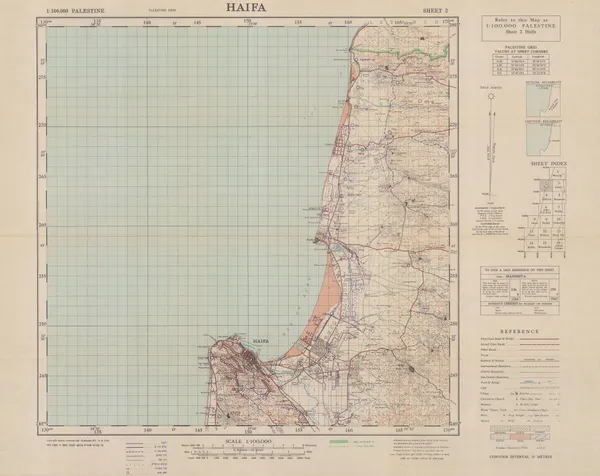
Survey of Palestine, Haifa, 1960£ 295.00
-
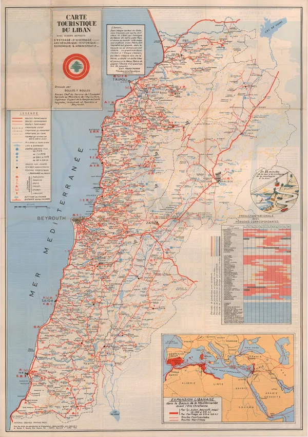
Boulos F. Boulos, Vintage map of Lebanon, 1964£ 2,500.00
-
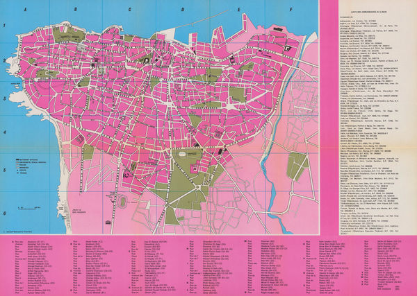
Liban Conseil Nation, Beirut, Lebanon, 1972 c.£ 300.00
All Maps
Our entire inventory of over 10,000 antique and vintage maps is now available to browse by region, date, cartographer, and subject