-
 Charles Edward Goad, Battersea - Church Rd & Bolingbroke Walk, 1903£ 250.00
 -
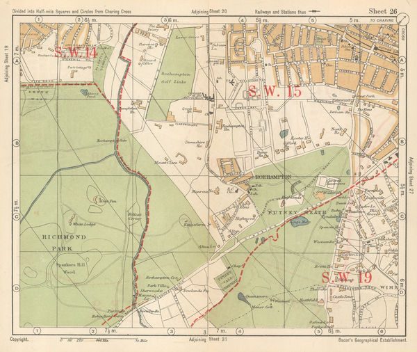
George Philip & Son Ltd., Wimbledon, Roehampton & Putney Heath, 1904£ 85.00
-
Edward Stanford, Central London, South West, 1904£ 1,750.00
-
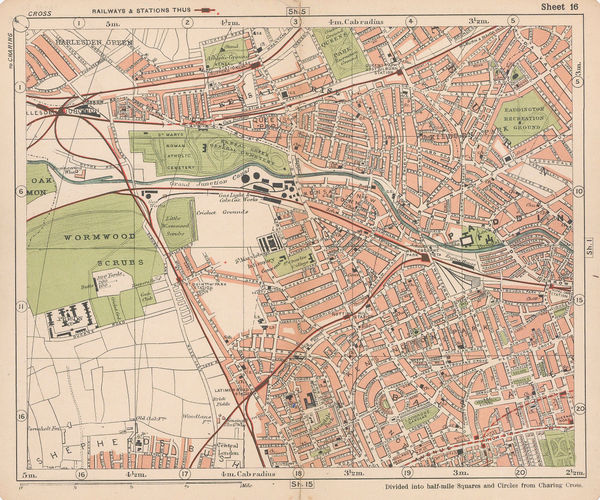
George Philip & Son Ltd., Notting Hill, Shepherd's Bush & Holland Park, 1904£ 85.00
-
George Philip & Son Ltd., Streatham, Lower Streatham and Norwood, 1904£ 55.00
-
Edward Stanford, Central London, North West, 1904£ 745.00
-
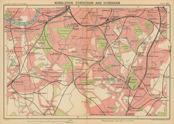
Streatham Hill, Tooting Common, Tulse Hill & Brixton Hill, 1904George Philip & Son Ltd.Series: LondonGeorge Philip & Son Ltd., Streatham Hill, Tooting Common, Tulse Hill & Brixton Hill, 1904£ 65.00
-
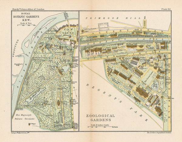
George Philip & Son Ltd., Kew Gardens & London Zoo, 1904£ 58.00
-
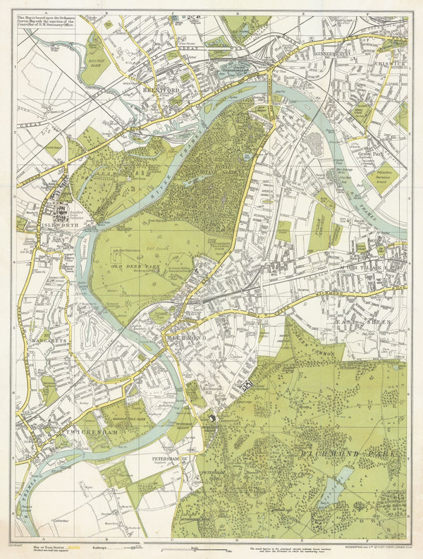
George Philip & Son Ltd., Kew, Richmond, Twickenham, Kingston & Hampton Court, 1904£ 68.00
-
George Philip & Son Ltd., Wimbledon, 1904£ 74.00
-
A. & C. Black, St James Park & Green Park, 1907£ 75.00
-
'The Motor' Magazine, Map of the West End of London, 1910£ 495.00
-
George W. Bacon, Norbiton, Surbiton, Hampton Court, Bushy Park, New Malden, 1910 c£ 425.00
-
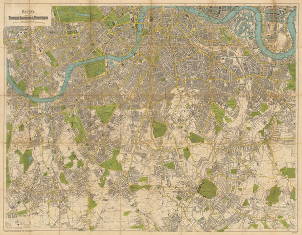
George W. Bacon, West and Southwest London, 1910 c£ 695.00
-
George W. Bacon, Large Scale Plan of Wimbledon, 1910 c.£ 795.00
-
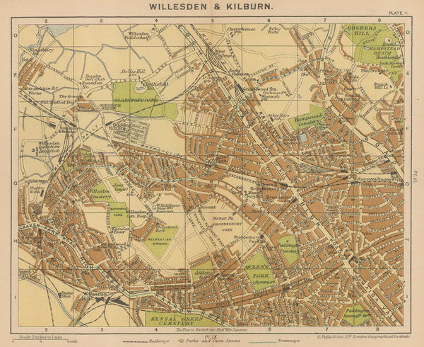
George Philip & Son Ltd., Willesden & Kilburn, 1912 c.£ 64.00
-
Ordnance Survey, Nine Elms, 1918 c.£ 850.00
-
Ordnance Survey, Holland Park to Shepherds Bush, 1919 c.£ 1,350.00
-
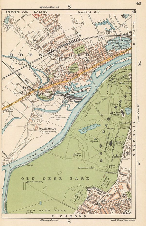
Edward Stanford, Brentford & Kew Gardens, 1920£ 42.00
-
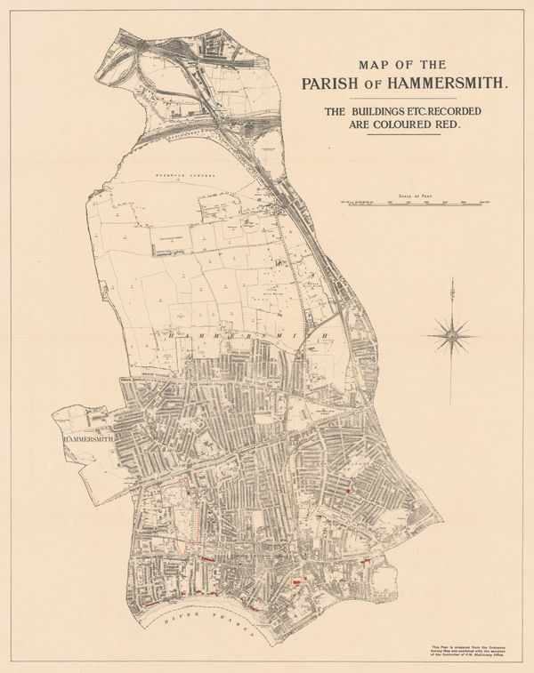
Ordnance Survey, Map of the Parish of Hammersmith, 1920 c£ 325.00
-
George W. Bacon, Richmond Park & Putney Heath, 1920 c.£ 36.00
-
Kennedy North, British Empire Exhibition 1924, 1923£ 650.00
-
Geographia Ltd., Kew, Richmond, Brentford & Twickenham, 1923£ 250.00
-
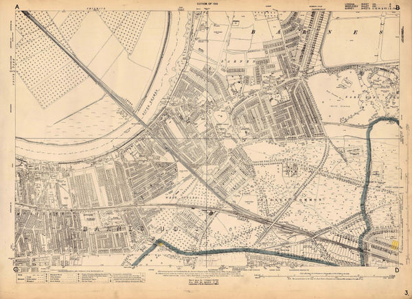
Ordnance Survey, Barnes, 1925 c.£ 1,450.00
-
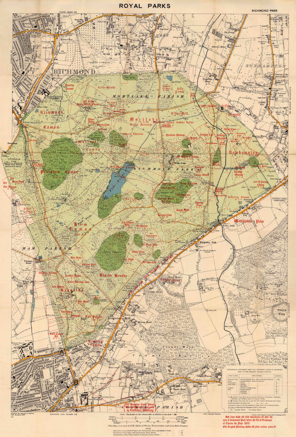
Ordnance Survey, Richmond Park, 1926£ 495.00
-
George W. Bacon, Bayswater, Notting Hill, Kensal Green & Paddington, 1928£ 78.00
-
J.G. Bartholomew, Wimbledon, Streatham and Sydenham, 1929£ 44.00
-
J.G. Bartholomew, Kew, Richmond and Hampton Court, 1929£ 75.00
-
Chelsea, Fulham, Earl's Court, Battersea, and Hammersmith, 1929John Bartholomew & SonSeries: EdinburghJohn Bartholomew & Son, Chelsea, Fulham, Earl's Court, Battersea, and Hammersmith, 1929£ 125.00
-
Thomas Kelly, Richmond, Teddington, Kew, Chiswick, Twickenham & Isleworth, 1929£ 795.00
-
Ordnance Survey, Pimlico, 1929 c.£ 1,350.00
-
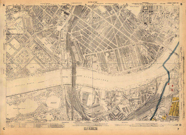
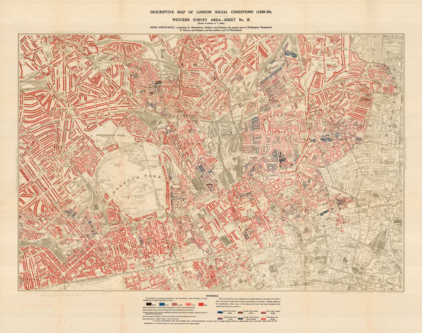
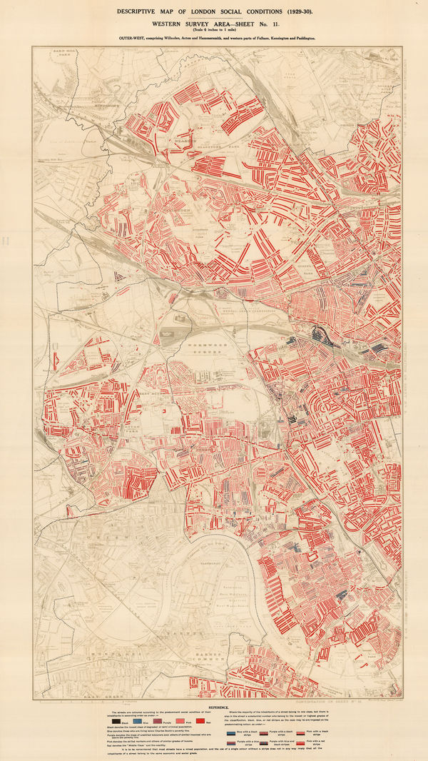
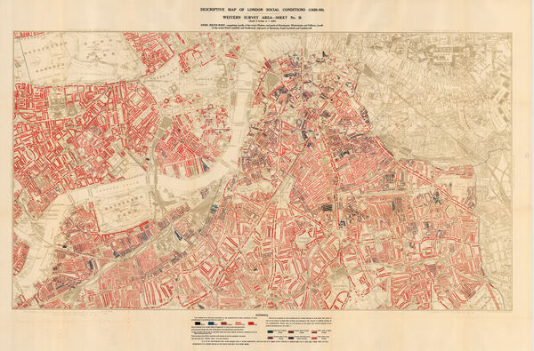
Charles Booth, Descriptive Map of London Social Conditions (1929-1930), 1930£ 1,950.00
-
Charles Booth, Descriptive Map of London Social Conditions (1929-1930), 1930£ 1,550.00
-
Charles Booth, Descriptive Map of London Social Conditions (1929-1930), 1930£ 2,500.00
-
Geographers' Map Co., London, 1930 c.£ 145.00
-
George W. Bacon, South London & Suburbs, 1930 c.£ 650.00
-
Edward Stanford, Hyde Park Corner Tube Station and 1/4 Miles Around, 1932£ 1,250.00
-
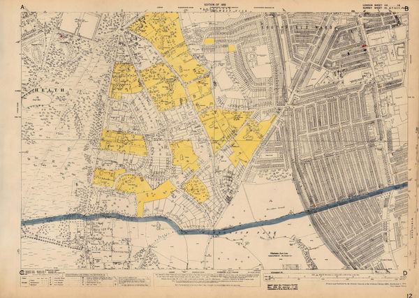
Ordnance Survey, Southfields & Wimbledon, 1933 c.£ 745.00
-
Clifford & Rosemary Ellis, Christmas Shopping by Underground Poster, 1935£ 4,000.00
-
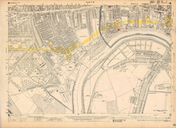
Ordnance Survey, Fulham, 1935 c.£ 1,250.00
-
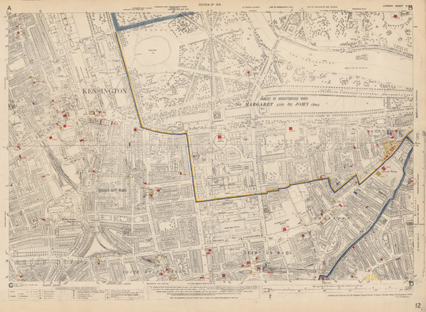
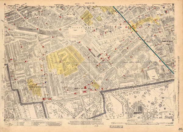
Ordnance Survey, Knightsbridge and Kensington, 1936£ 1,550.00
-
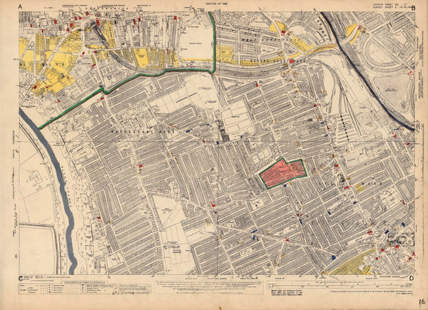
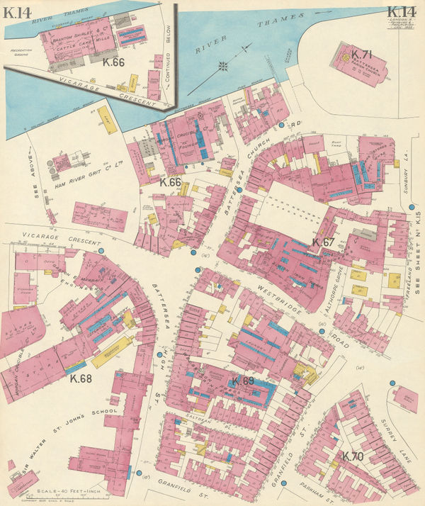
Ordnance Survey, Battersea, 1936 c.£ 1,450.00
-
Ordnance Survey, Bayswater, 1936 c.£ 1,450.00
-
Ordnance Survey, Chiswick, 1936 c.£ 695.00
-
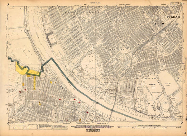
Ordnance Survey, Fulham, 1936 c.£ 1,350.00
-
RHS Calendar of Shows & Application for Fellowship, 1937Royal Horticultural Society (RHS)Series: LondonRoyal Horticultural Society (RHS), RHS Calendar of Shows & Application for Fellowship, 1937£ 200.00
-
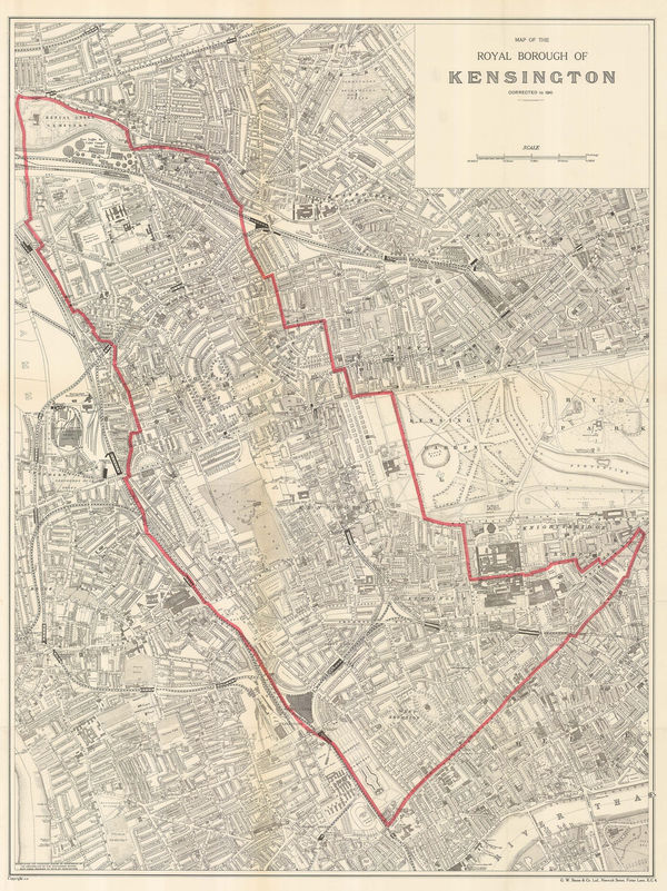
George W. Bacon, Map of the Royal Borough of Kensington, 1941£ 645.00
-
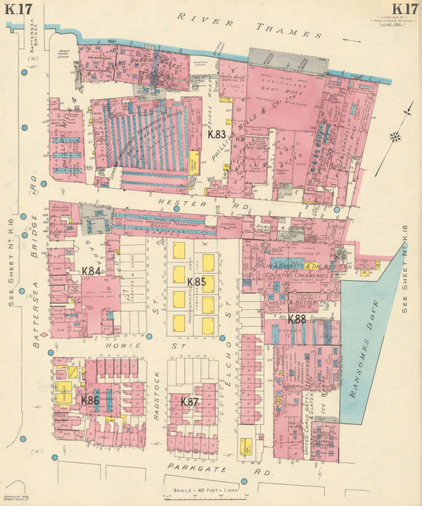
Charles Edward Goad, Battersea Bridge, Hester & Parkgate Roads, 1946£ 250.00
-
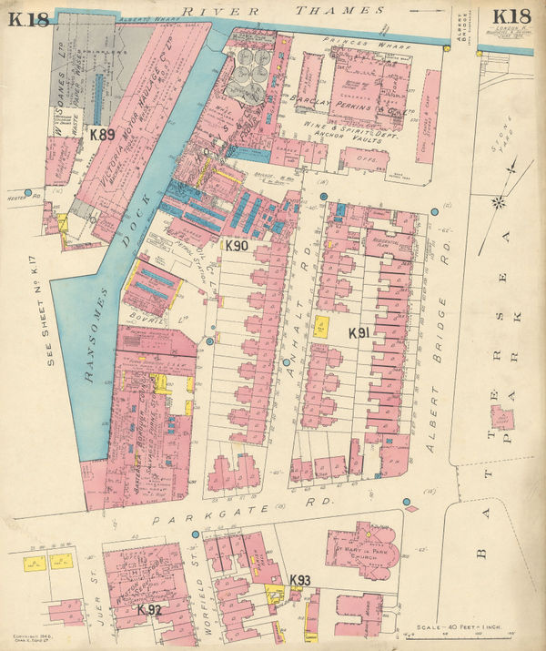
Charles Edward Goad, Battersea - Albert Bridge Rd, 1946£ 250.00
-
J.P. Sayer, Westminster, 1946£ 115.00
-
J.P. Sayer, Kensington Gardens & Hyde Park, 1946£ 115.00
-
J.P. Sayer, Mayfair, 1947£ 85.00
-
J.P. Sayer, Blackfriars Bridge and Ludgate Circus , 1947£ 75.00
-
J.P. Sayer, The Strand , 1947£ 85.00
-
J.P. Sayer, A Bird's-Eye View of Hyde Park Corner, 1947£ 95.00
-
Ordnance Survey, Holland Park and Notting Hill, 1948 c.£ 1,450.00
-
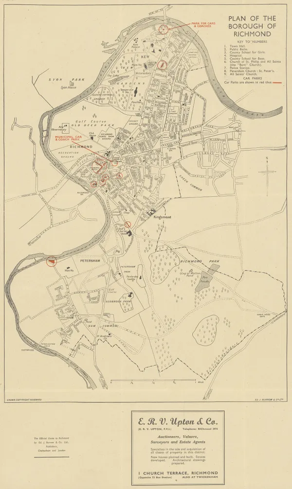
Ed. J. Burrow & Co., Ltd., Plan of the Borough of Richmond, 1950 c£ 175.00
-
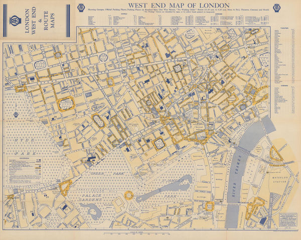
Automobile Association (AA), West End Map of London, 1950 c.£ 325.00
-
West London Road Safety Committee, The Highway Code Map of Chelsea, 1951£ 445.00
-
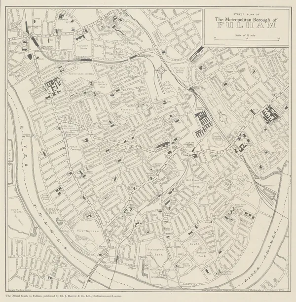
Ed. J. Burrow & Co., Ltd., Fulham, 1953£ 195.00
-
Ed. J. Burrow & Co., Ltd., Street Plan of Chelsea, 1954£ 225.00
-
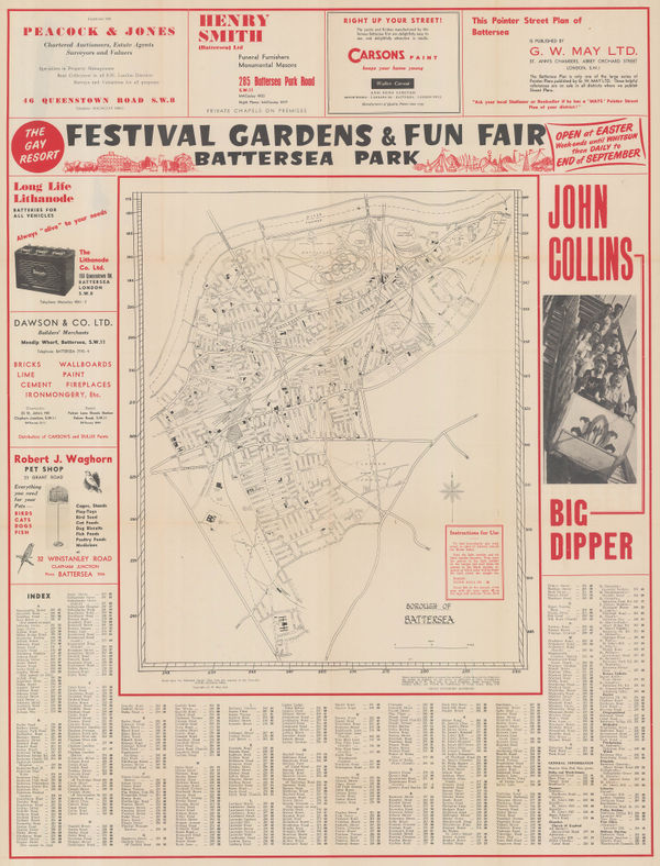
G. W. May Ltd., Borough of Battersea, 1958 c.£ 245.00
-
Charles Edward Goad, Battersea Square, 1959£ 250.00
-
Ordnance Survey, Royal Botanic Gardens Kew, 1963£ 150.00
-
London Transport, Visitor's London Quad Royal Tube Map, 1963£ 1,850.00


Page
2
of 2