-
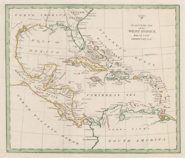
 George Cooke, The West Indies, 1810 c.£ 185.00
 -
Tardieu, North-eastern United States, 1810 c.£ 495.00
-
Tardieu, Coast of British Columbia & Graham Island, 1810 c.£ 425.00
-
John Wallis, Durham, 1810 c.£ 26.00
-
John Wallis, Middlesex, 1810 c.£ 52.00
-
John Luffman, New York, 1810 c.£ 545.00
-
John Cary, A New Map of Africa, From the Latest Authorities, 1811£ 795.00
-
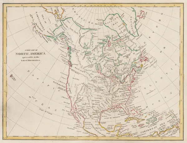
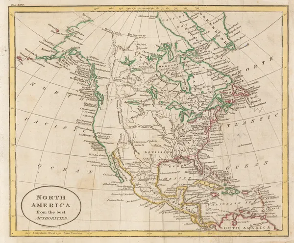
Rev'd. James Barclay, North America during the Napoleonic Wars, 1811£ 115.00
-
John Cary, Spain and Portugal, 1811£ 150.00
-
John Cary, Northeast Italy, 1811£ 275.00
-
Rev'd. James Barclay, The West Indies, 1811£ 125.00
-
Louis-Claude de Freycinet, Joseph Bonaparte Gulf, 1811£ 650.00
-
Louis-Claude de Freycinet, 80 Mile Beach, Western Australia , 1811£ 550.00
-
Louis-Claude de Freycinet, Bonaparte Archipelago, Western Australia, 1811£ 550.00
-
Louis-Claude de Freycinet, North-west coast from Exmouth Gulf to Darwin, 1811£ 950.00
-
Louis-Claude de Freycinet, Chart of Tasmania, 1811£ 1,550.00
-
John Pinkerton, Holland, 1811£ 195.00
-
John Wilkes, Lincolnshire, 1811£ 82.00
-
George Steuart MacKenzie, Southwest Coast of Iceland, 1811£ 1,250.00
-
John Pinkerton, Northern Africa, 1811£ 325.00
-
-
Louis-Claude de Freycinet, Port Jackson and Sydney Harbour, 1811£ 4,950.00
-
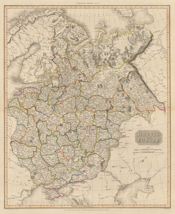
John Pinkerton, Russia in Europe, 1811£ 425.00
-
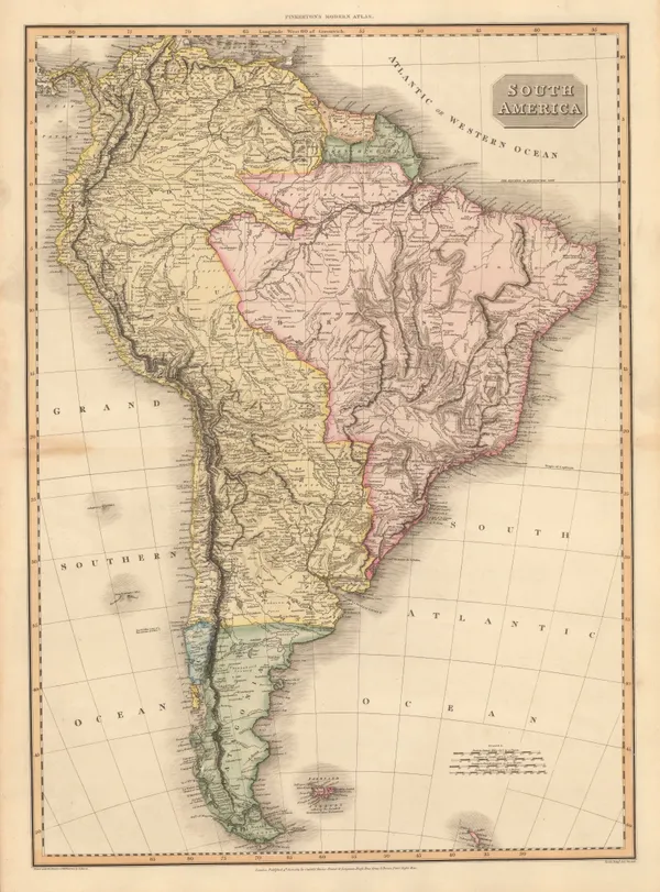
John Pinkerton, South America, 1811£ 595.00
-
John Pinkerton, Southwestern Unites States, 1811£ 3,500.00
-
John Pinkerton, Central America, 1811£ 650.00
-
Aaron Arrowsmith, Ireland, 1811£ 4,750.00
-
Johann Christoph Reinecke, Africa showing colonial possessions, 1812£ 775.00
-
Johann Christoph Reinecke, Australia and the Pacific Islands, 1812£ 1,950.00
-
William Guthrie, North America at the height of the Napoleonic Wars, 1812£ 115.00
-
Capt. James Horsburgh, Sea Chart of South Africa & Madagascar, 1812£ 785.00
-
John Pinkerton, [Western Hemisphere - Eastern Hemisphere], 1812£ 1,250.00
-
Aaron Arrowsmith & Samuel Lewis, United Kingdom, 1812£ 95.00
-
Aaron Arrowsmith & Samuel Lewis, Persia, 1812£ 125.00
-
Aaron Arrowsmith & Samuel Lewis, Japan, 1812£ 275.00
-
Aaron Arrowsmith & Samuel Lewis, New York State, 1812£ 345.00
-
Aaron Arrowsmith & Samuel Lewis, South Carolina, 1812£ 345.00
-
Aaron Arrowsmith & Samuel Lewis, Tennessee, 1812£ 375.00
-
James Clarke, Isle of Wight, 1812£ 950.00
-
Aaron Arrowsmith & Samuel Lewis, Louisiana, 1812£ 875.00
-
Aaron Arrowsmith & Samuel Lewis, Australasia, 1812£ 375.00
-
Aaron Arrowsmith & Samuel Lewis, Colombia & Ecuador, 1812£ 145.00
-
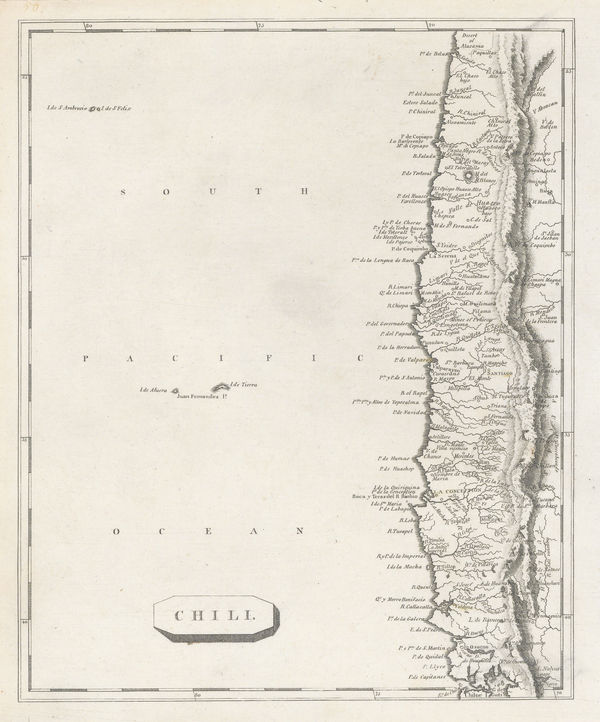
Aaron Arrowsmith & Samuel Lewis, Chile, 1812£ 195.00
-
Aaron Arrowsmith & Samuel Lewis, Hindoostan, 1812£ 125.00
-
Aaron Arrowsmith & Samuel Lewis, Vermont, 1812£ 295.00
-
Aaron Arrowsmith & Samuel Lewis, Rhode Island, 1812£ 275.00
-
Aaron Arrowsmith & Samuel Lewis, Eastern United States, 1812£ 395.00
-
-
Aaron Arrowsmith & Samuel Lewis, Pennsylvania, 1812£ 275.00
-
Aaron Arrowsmith & Samuel Lewis, New Hampshire, 1812£ 295.00
-
Matthew Carey, The Northwestern Territories of the United States, 1812£ 850.00
-
Conrad Malte-Brun, Mappe-Monde sur la Projection Reduite de Mercator, 1812£ 195.00
-
Aaron Arrowsmith & Samuel Lewis, Maine, 1812£ 375.00
-
Aaron Arrowsmith & Samuel Lewis, Massachusetts, 1812£ 295.00
-
Aaron Arrowsmith & Samuel Lewis, Ohio, 1812£ 325.00
-
Aaron Arrowsmith & Samuel Lewis, Kentucky, 1812£ 375.00
-
Aaron Arrowsmith & Samuel Lewis, New Jersey, 1812£ 275.00
-
Aaron Arrowsmith & Samuel Lewis, Maryland, 1812£ 345.00
-
Aaron Arrowsmith & Samuel Lewis, North Carolina, 1812£ 325.00
-
Aaron Arrowsmith & Samuel Lewis, Virginia, 1812£ 375.00
-
-
Aaron Arrowsmith & Samuel Lewis, Delaware, 1812£ 145.00
-
John Thomson, West Indies, 18120 c.£ 425.00
-
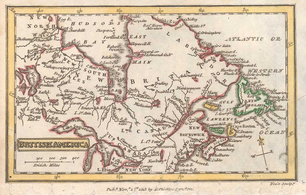
Richard Phillips, Eastern Canada, 1813£ 58.00
-
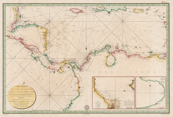
Depot de la Marine, Central America and Northern South America, 1813£ 775.00
-
Matthew Carey, Connecticut, 1813£ 285.00
-
Matthew Carey, Delaware, 1813£ 245.00
-
John Pinkerton, East India Isles, 1813£ 985.00
-
C.V. Lavoisne, Geographical and Historical Map of Greece, 1813£ 245.00
-
C.V. Lavoisne, Geographical and Historical Map of Britain, 1813£ 325.00
-
C.V. Lavoisne, Geographical and Statistical Map of Russia, 1813£ 285.00
-
C.V. Lavoisne, Geographical and Statistical Map of Spain and Portugal, 1813£ 195.00
-
R. Juigne, Geographical Map of Italy, 1813£ 140.00
-
C.V. Lavoisne, Geographical, Statistical, and Historical Map of Asia, 1813£ 245.00
-
Christian Gottlieb Reichard, Australia, Southeast Asia and Polynesia, 1813£ 1,550.00
-
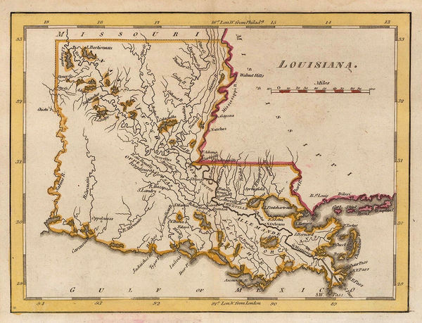
Matthew Carey, Louisiana, 1813£ 245.00
-
Aaron Arrowsmith, Monumental wall map of Iran, 1813£ 4,950.00
-
William Faden, Plan of the Town and Fortifications of Ceuta, 1813£ 140.00
-
John Pinkerton, Portugal, 1813£ 275.00
-
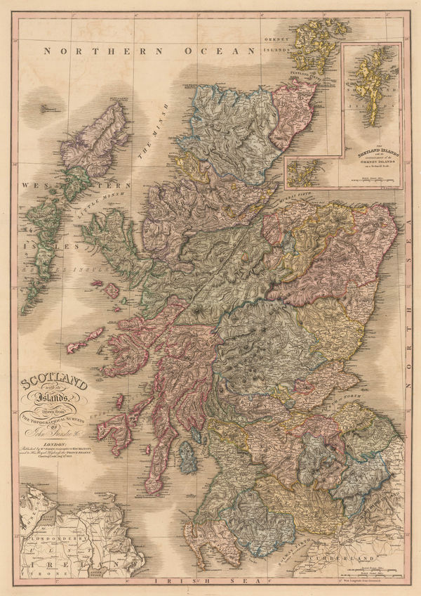
William Faden, Scotland with its Islands, 1813£ 950.00


![John Pinkerton, [Western Hemisphere - Eastern Hemisphere], 1812](https://static-assets.artlogic.net/w_600,c_limit,f_auto,fl_lossy,q_auto/artlogicstorage/themaphouse/images/view/be9fc1bd6701b9daa2e5b0a91c28b129j/themaphouse-john-pinkerton-western-hemisphere-eastern-hemisphere-1812.jpg)


Page
54
of 130