-
 Samuel Augustus Mitchell, Denmark, 1850£ 48.00
 -
Justus Perthes, European Russia & Ukraine, 1850£ 295.00
-
General Chart - Farallones Entrance to the Bay of San Francisco, 1850Cadwalader RinggoldSeries: Washington, D.C.Cadwalader Ringgold, General Chart - Farallones Entrance to the Bay of San Francisco, 1850£ 1,950.00
-
Samuel Augustus Mitchell, Holland and Belgium, 1850£ 60.00
-
Samuel Augustus Mitchell, Map of New Hampshire & Vermont, 1850£ 175.00
-
Gall & Inglis, Map of South America, 1850£ 150.00
-
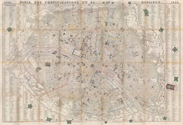
Danlos, Paris, 1850£ 675.00
-
Antoine Tessaro, Brussels (Bruxelles), 1850£ 365.00
-
Samuel Augustus Mitchell, Prussia, 1850£ 40.00
-
Lt. George Horatio Derby, Reconnaissance of the Colorado River, 1850£ 885.00
-
Samuel Augustus Mitchell, Russia in Asia and Tartary, 1850£ 95.00
-
Samuel Augustus Mitchell, European Russia divided into regions, 1850£ 75.00
-
Royal Geographical Society (RGS), Sketch Map of Sikhim and the Nipalese Frontier, 1850£ 145.00
-
General Land Office (GLO), Sketch Map of the Public Surveys in Iowa Territory, 1850£ 125.00
-
General Land Office (GLO), Sketch of the Public Surveys of Michigan, 1850£ 155.00
-
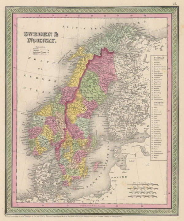
Samuel Augustus Mitchell, Sweden and Norway, 1850£ 60.00
-
The Sacramento Valley from the American River to Butte Creek, 1850Lt. George Horatio DerbySeries: Washington, D.C.Lt. George Horatio Derby, The Sacramento Valley from the American River to Butte Creek, 1850£ 2,250.00
-
Richard Holmes Laurie, The World on Mercator's Projection, 1850£ 2,750.00
-
Justus Perthes, West Indies and Central America, 1850£ 145.00
-
Justus Perthes, Westliche Halbkugel, 1850£ 165.00
-
General Land Office (GLO), South Florida, 1850£ 175.00
-
-
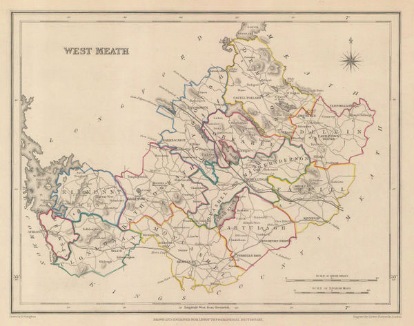
Samuel Lewis, West Meath, 1850£ 75.00
-
Samuel Lewis, Cavan, 1850£ 75.00
-
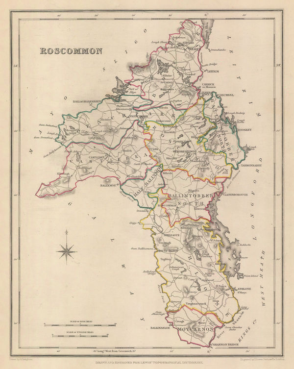
Samuel Lewis, Roscommon, 1850£ 75.00
-
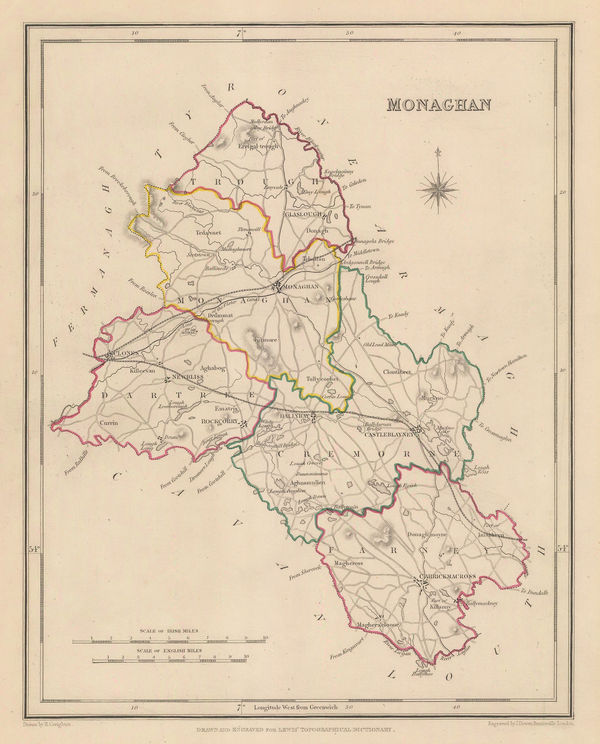
Samuel Lewis, Monaghan, 1850£ 75.00
-
A. Perret, The Pyrenees, 1850£ 395.00
-
James Wyld, Central America, 1850£ 695.00
-
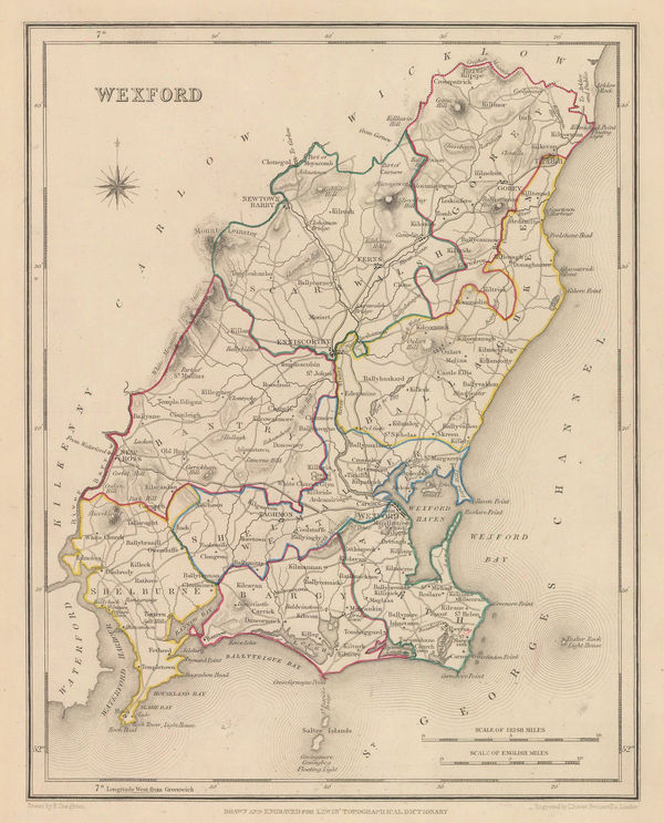
Samuel Lewis, Wexford, 1850£ 75.00
-
Samuel Lewis, Donegal, 1850£ 125.00
-
Samuel Lewis, Fermanagh, 1850£ 95.00
-
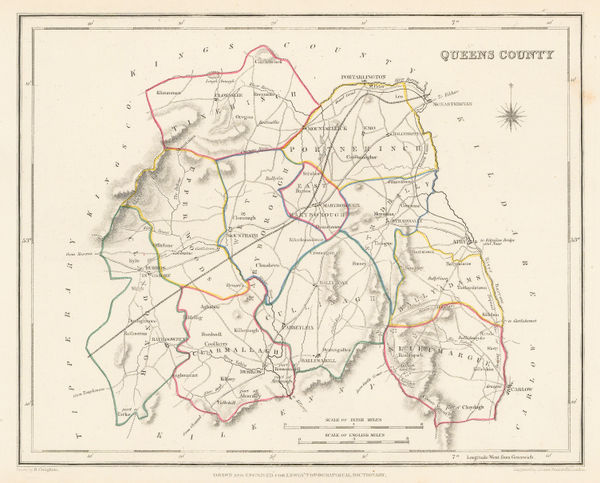
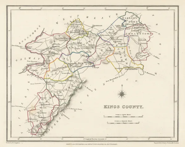
Samuel Lewis, Laois (Queen's County), 1850£ 85.00
-
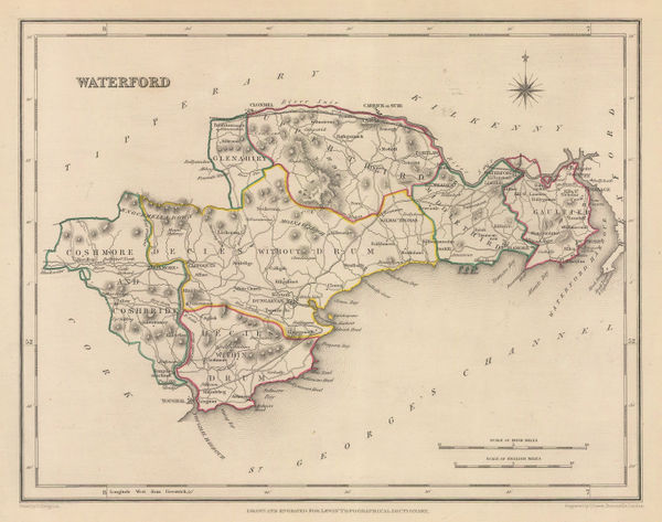
Samuel Lewis, Waterford, 1850£ 95.00
-
-
Samuel Lewis, Antrim, 1850£ 75.00
-
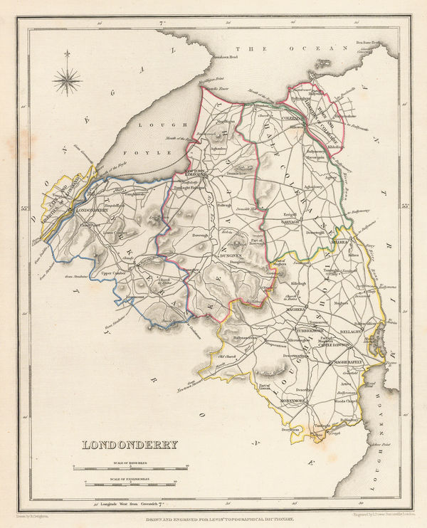
Samuel Lewis, Londonderry, 1850£ 125.00
-
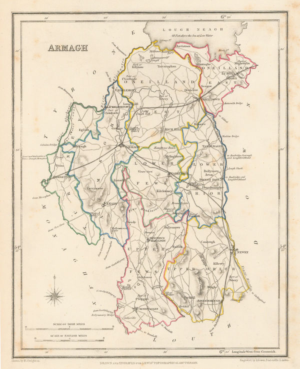
Samuel Lewis, Armagh, 1850£ 95.00
-
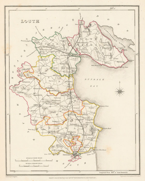
Samuel Lewis, Louth, 1850£ 95.00
-
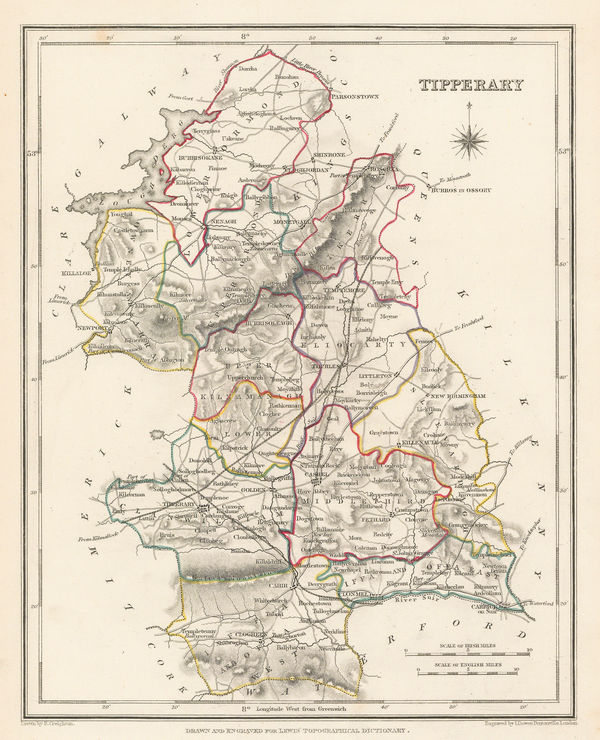
Samuel Lewis, Tipperary, 1850£ 95.00
-
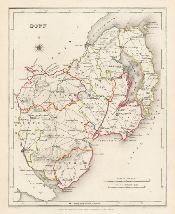
Samuel Lewis, Down, 1850£ 125.00
-
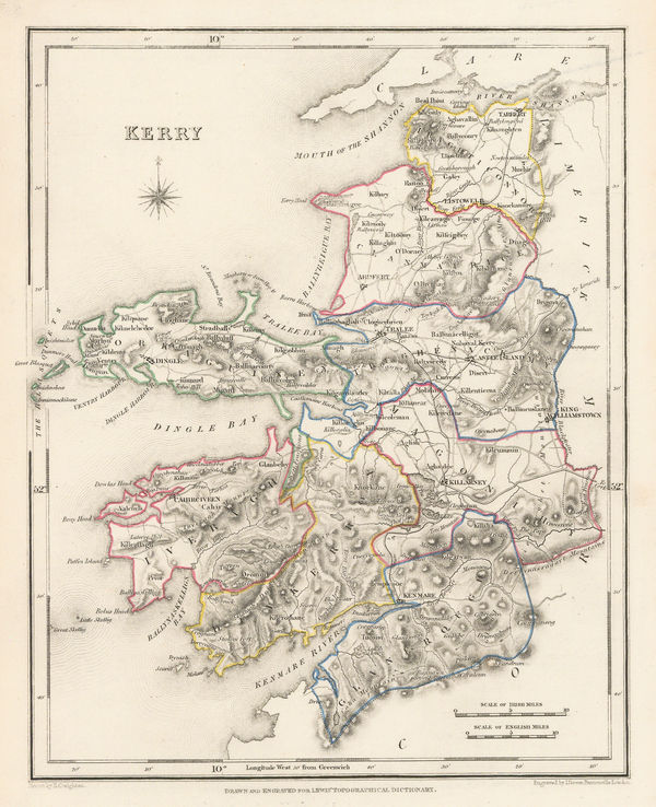
Samuel Lewis, Kerry, 1850£ 115.00
-
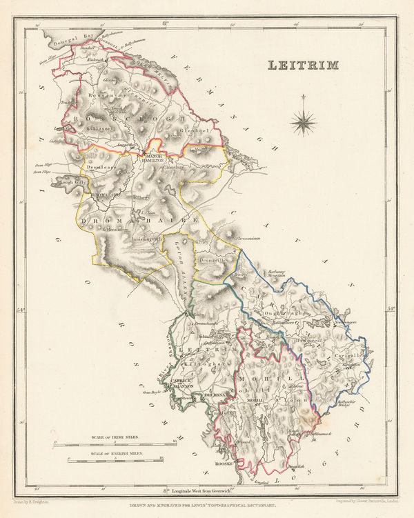
Samuel Lewis, Leitrim, 1850£ 85.00
-
Samuel Lewis, Tyrone, 1850£ 95.00
-
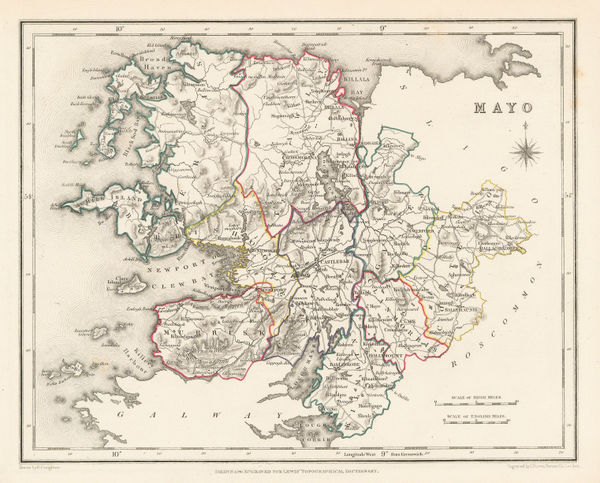
Samuel Lewis, Mayo, 1850£ 95.00
-
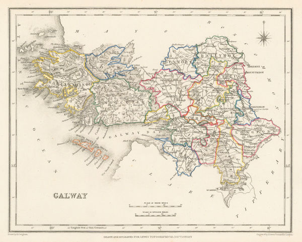
Samuel Lewis, Galway, 1850£ 145.00
-
Samuel Lewis, Map of Ireland, 1850£ 475.00
-
Robert Syer Hoggar, Oxford, 1850£ 3,200.00
-
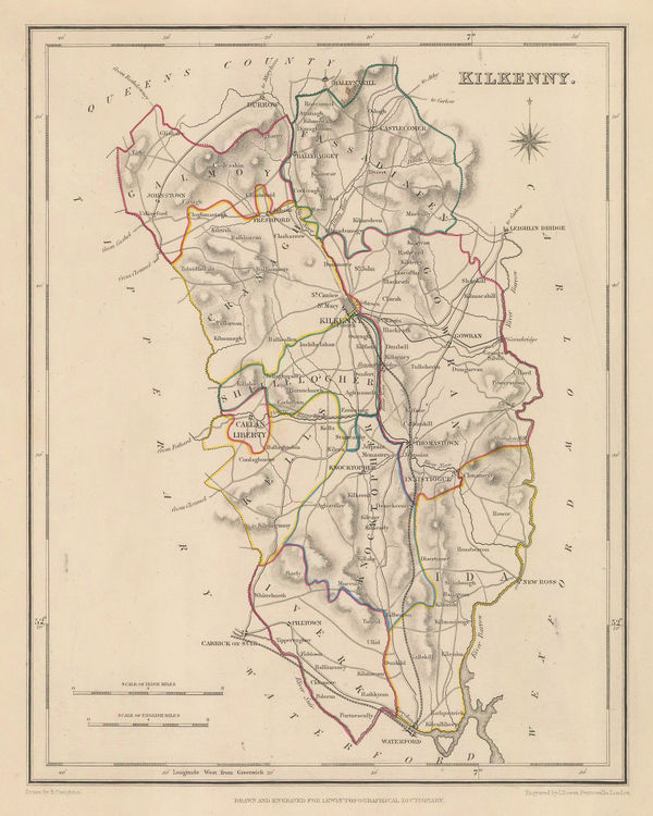
Samuel Lewis, Kilkenny, 1850£ 85.00
-
Samuel Augustus Mitchell, Asia, 1850£ 145.00
-
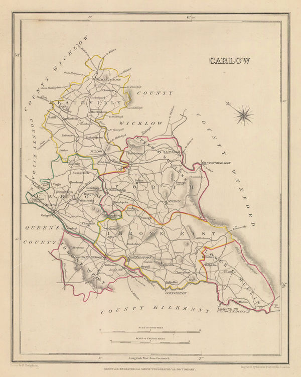
Samuel Lewis, Carlow, 1850£ 75.00
-
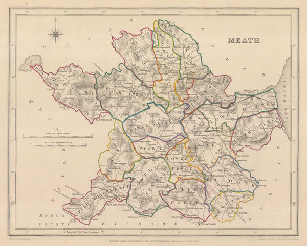
Samuel Lewis, Meath, 1850£ 95.00
-
John Arrowsmith, India, 1850 (c.)£ 850.00
-
Samuel Augustus Mitchell, A New Map of Tennessee, 1850 c£ 485.00
-
Sanyu Takashiba, Japan, 1850 c£ 2,250.00
-
W. & A.K. Johnston, India, 1850 c£ 495.00
-
James Reynolds, Geological Map of the World, 1850 c£ 545.00
-
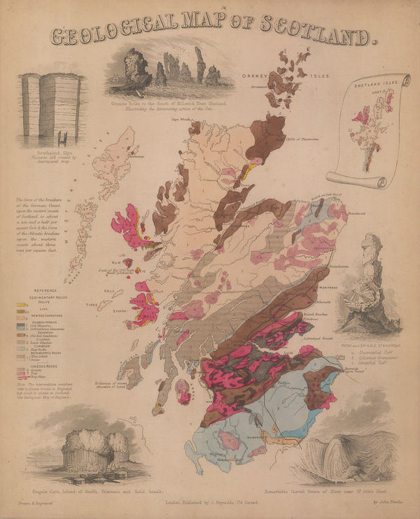
James Reynolds, Geological map of Scotland, 1850 c£ 545.00
-
John Dower, North America, 1850 c.£ 115.00
-
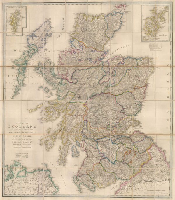
James Wyld, A Map of Scotland, 1850 c.£ 1,350.00
-
James Wyld, Ancient and modern Greece, 1850 c.£ 545.00
-
George Philip, America, 1850 c.£ 495.00
-
Henry Teesdale, Asia, 1850 c.£ 65.00
-
Joshua Archer, Asia, 1850 c.£ 95.00
-
Henry George Collins, Asia, 1850 c.£ 64.00
-
Henry George Collins, Bedfordshire, 1850 c.£ 76.00
-
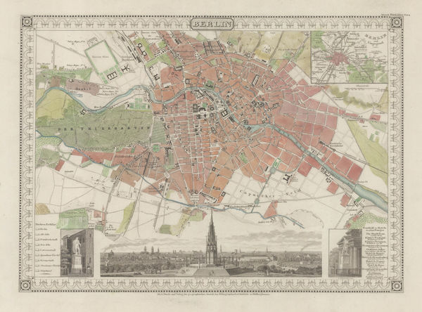
Joseph Meyer, Berlin, 1850 c.£ 645.00
-
Henry George Collins, Buckinghamshire, 1850 c.£ 86.00
-
Isaac Slater, Cambridgeshire, 1850 c.£ 95.00
-
Peter Jackson, Eastern Canada, 1850 c.£ 68.00
-
Eugene Belin, Ciel et Terre, 1850 c.£ 475.00
-
John Colbran, Tunbridge Wells, 1850 c.£ 450.00
-
James Wyld, South America with political revisions, 1850 c.£ 2,250.00
-
Henry George Collins, Cumberland, 1850 c.£ 72.00
-
Henry George Collins, Durham, 1850 c.£ 84.00
-
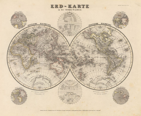
Joseph Meyer, Erd-Karte, 1850 c.£ 185.00
-
Henry George Collins, Essex, 1850 c.£ 88.00
-
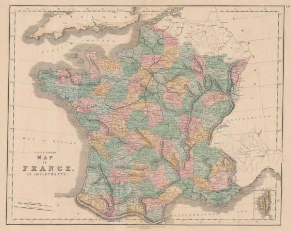
Gall & Inglis, France in Departments, 1850 c.£ 65.00
-
Henry George Collins, Gloucestershire, 1850 c.£ 115.00
-
Henry George Collins, Herefordshire, 1850 c.£ 62.00
-
Henry George Collins, Hertfordshire, 1850 c.£ 82.00


Page
73
of 130