-
 Edward Hertslet, Cameroon - Equatorial Guinea Border Commission, 1909£ 44.00
 -
Map of the Anglo-French Boundary from the Gulf of Guinea to the Niger, 1909Edward HertsletSeries: SouthamptonEdward Hertslet, Map of the Anglo-French Boundary from the Gulf of Guinea to the Niger, 1909£ 175.00
-
Map of the Anglo-French Boundary from the Gulf of Guinea to the Niger (Southern Portion), 1909Edward HertsletSeries: LondonEdward Hertslet, Map of the Anglo-French Boundary from the Gulf of Guinea to the Niger (Southern Portion), 1909£ 125.00
-
Map of the Frontier between Gold Coast and Togoland by the Boundary Commission, 1909Edward HertsletSeries: LondonEdward Hertslet, Map of the Frontier between Gold Coast and Togoland by the Boundary Commission, 1909£ 145.00
-
Edward Hertslet, Map of the Sierra Leone-Liberia Boundary, 1909£ 115.00
-
Edward Hertslet, Resolving Cameroon's Borders, 1909£ 58.00
-
Edward Hertslet, Nigeria - Cameroon Boundary Commission, 1909£ 115.00
-
Edward Hertslet, Nigeria - Cameroon Boundary Commission, 1909£ 40.00
-
Edward Hertslet, Sierra Leone - Liberia Boundary, 1909£ 85.00
-
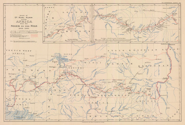
Dr. Karl Kumm's route from the Niger to the Nile, 1910Royal Geographical Society (RGS)Series: LondonRoyal Geographical Society (RGS), Dr. Karl Kumm's route from the Niger to the Nile, 1910£ 285.00
-
George Philip & Son Ltd., Goldfield Map of Ghana, 1910 c.£ 695.00
-
Southern Nigeria to Illustrate the Paper by A.E. Kitson, 1913Royal Geographical Society (RGS)Series: LondonRoyal Geographical Society (RGS), Southern Nigeria to Illustrate the Paper by A.E. Kitson, 1913£ 345.00
-
Southern Provinces of Nigeria - The Eket District, 1914Royal Geographical Society (RGS)Series: LondonRoyal Geographical Society (RGS), Southern Provinces of Nigeria - The Eket District, 1914£ 145.00
-
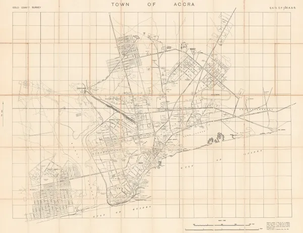
R. H. Rowe, Town of Accra, Ghana, 1923£ 575.00
-
Geographical Section, General Staff (GSGS), Folding map of West Africa, 1943£ 375.00
-
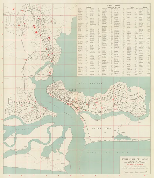
Mouton & Co., Lagos, 1960£ 1,500.00
-
Survey of Ghana, A Pocket Map of Accra, 1963£ 450.00


Page
2
of 2