-
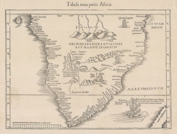
 Martin Waldseemüller & Laurent Fries, The Second Printed Map of Southern Africa, 1541£ 4,950.00
 -
Willem & Jan Blaeu, Southern & Central Africa, 1640 c.£ 1,250.00
-
Nicolas & Guillaume Sanson, Southern Africa, 1656£ 695.00
-
Athanasius Kircher, The Source of the Nile in the Mountains of the Moon, 1665£ 1,750.00
-
Robert Morden, Southern & Central Africa, 1688£ 375.00
-
Pierre Duval, Southern & Central Africa, 1694£ 295.00
-
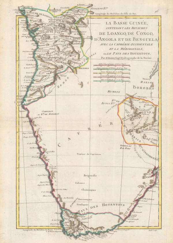
Nicolas de Fer, Southern & Central Africa, 1702£ 795.00
-
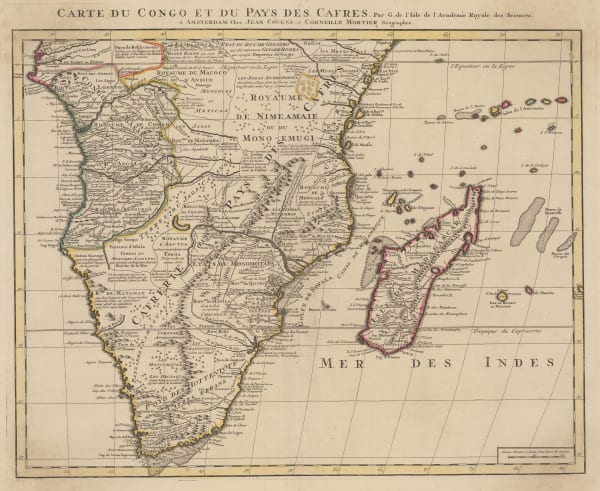
Covens (Jean) & Mortier (Cornelius), Southern & Central Africa, 1730 c.£ 1,250.00
-
Nicolas Sanson, Southern Africa and Madagascar, 1741£ 875.00
-
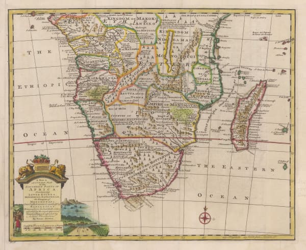
Emanuel Bowen, A New & Accurate Map of the Southern Parts of Africa, 1747£ 695.00
-
Tobias Conrad Lotter, Southern Africa & the Cape of Good Hope, 1778£ 745.00
-
Rigobert Bonne, Southern Africa, 1790 c.£ 150.00
-
Adrien Brue, Southern Africa & the Cape Colony, 1828 c.£ 250.00
-
Royal Geographical Society (RGS), Outline Map of Southern Africa, 1833£ 82.00
-
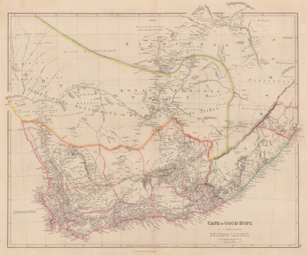
John Arrowsmith, Cape of Good Hope, 1842£ 850.00
-
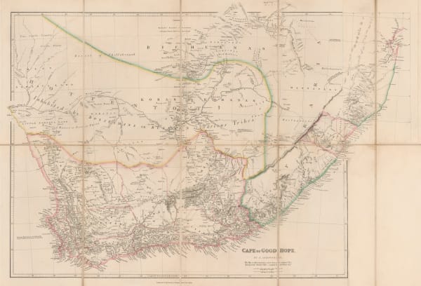
John Arrowsmith, Cape of Good Hope, 1842£ 850.00
-
Joseph Meyer, South Africa, 1846£ 225.00
-
James Wyld, South Africa, 1850 c.£ 1,275.00
-
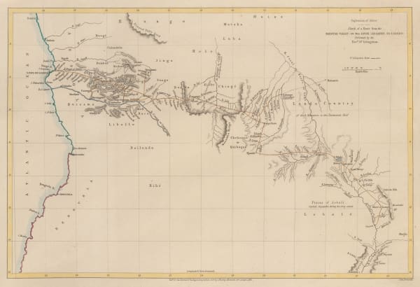
Africa between 10 and 30 degree South Latitude. Map to illustrate the routes of Galton. Livingstone, Oswell and Gassiot, 1852Royal Geographical Society (RGS)Series: LondonRoyal Geographical Society (RGS), Africa between 10 and 30 degree South Latitude. Map to illustrate the routes of Galton. Livingstone, Oswell and Gassiot, 1852£ 495.00
-
Royal Geographical Society (RGS), Livingstone's route from Angola to the Zambezi, 1855£ 175.00
-
Royal Geographical Society (RGS), Livingstone's route from Botswana to Angola, 1855£ 225.00
-
Royal Geographical Society (RGS), Southern Central Africa, 1856£ 225.00
-
Royal Geographical Society (RGS), South Africa, 1858£ 145.00
-
Joseph Hutchins Colton, Southern Africa, 1861£ 165.00
-
Justus Perthes, Interior of South Africa, Botswana, and Zimbabwe, 1870£ 345.00
-
A Sketch map of Part of South Eastern Africa to Illustrate the Journeys of Dr Lacerda (1798) the Pombeiros (1806-11) and Major Monteiro (1831-32), 1873Royal Geographical Society (RGS)Series: LondonRoyal Geographical Society (RGS), A Sketch map of Part of South Eastern Africa to Illustrate the Journeys of Dr Lacerda (1798) the Pombeiros (1806-11) and Major Monteiro (1831-32), 1873£ 395.00
-
Map to illustrate Explorations in South Africa from Walvische Bay to Lake Ngami by C Andersson., 1874Royal Geographical Society (RGS)Series: LondonRoyal Geographical Society (RGS), Map to illustrate Explorations in South Africa from Walvische Bay to Lake Ngami by C Andersson., 1874£ 275.00
-
Map of the Central Portion of South Africa Illustrating Dr. Holub's Journeys 1873-9, 1880Royal Geographical Society (RGS)Series: LondonRoyal Geographical Society (RGS), Map of the Central Portion of South Africa Illustrating Dr. Holub's Journeys 1873-9, 1880£ 165.00
-
Royal Geographical Society (RGS), The Interior of South Africa, 1884£ 795.00
-
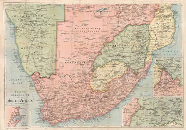
George W. Bacon, Bacon's Large-Print Map of South Africa, 1890 c.£ 775.00
-
Justus Perthes, Kalahari Desert in Botswana & South Africa, 1892£ 88.00
-
Royal Geographical Society (RGS), Botswana & the Kalahari Desert, 1893£ 98.00
-
Scottish Geographical Society (SGS), Orographical map of Southern Rhodesia, 1897£ 375.00
-
F Bianconi, Southern Africa during the Boer War, 1900£ 495.00
-
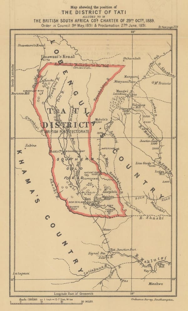
Edward Hertslet, Map Shewing the Position of The District of Tati, 1909£ 32.00
-
George Philip & Son Ltd., Cape Colony & The Diamond Fields, 1910 c.£ 125.00
-
Walter Boldero Paton, Map of the Union of South Africa, 1912£ 295.00
Botswana
Our entire inventory of over 10,000 antique and vintage maps is now available to browse by region, date, cartographer, and subject