-

-
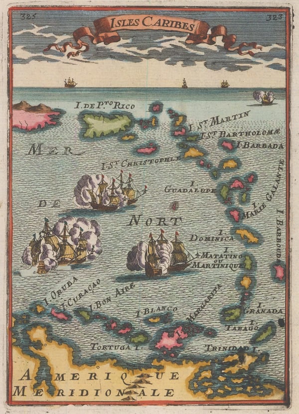
Alain Manesson Mallet, Puerto Rico and the Lesser Antilles, 1683£ 365.00
-
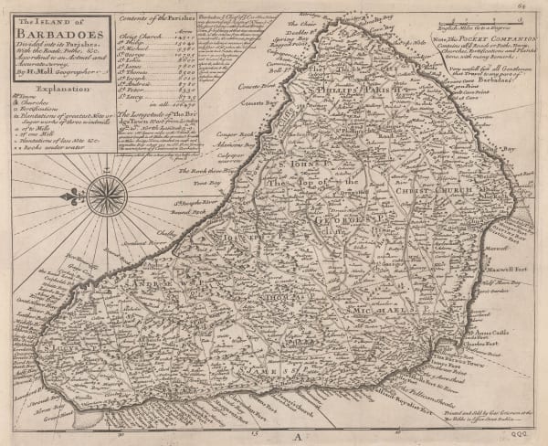
Robert Morden, The Island of Barbados, 1699£ 625.00
-
Johannes van Keulen, Chart of the Lesser Antilles, 1700 c.£ 1,550.00
-
Christoph Weigel, The Lesser Antilles, 1720 c.£ 495.00
-
Herman Moll, A New Map of Barbados, 1720 c.£ 445.00
-
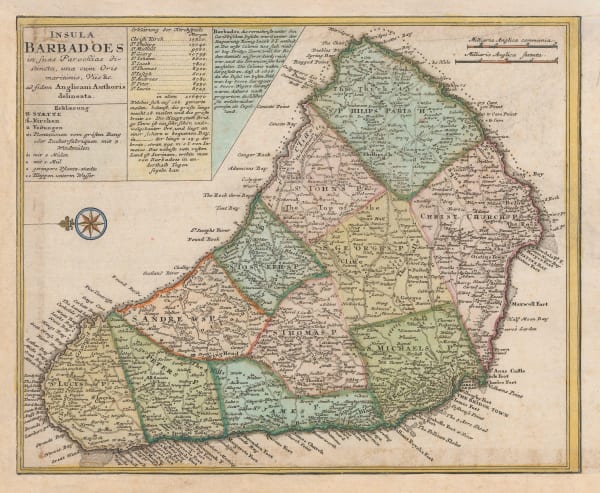
Herman Moll, Detailed map of Barbados, 1735 c.£ 885.00
-
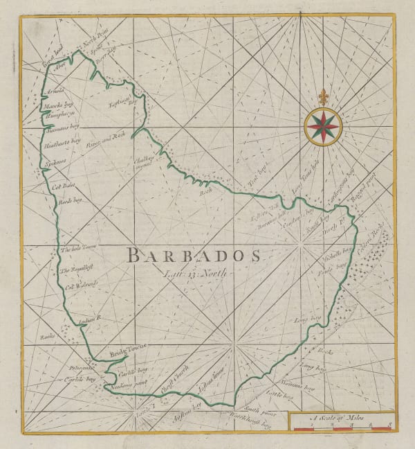
Mount & Page, Barbados, 1740 c.£ 1,175.00
-
Georges-Louis Le Rouge, Barbados and St. Kitts, 1748£ 325.00
-
Gerard van Keulen, Dutch sea chart of Barbados, 1753£ 3,850.00
-
Jacques-Nicolas Bellin, Carte de L'Isle de la Barbade, 1758£ 1,750.00
-
Covens (Jean) & Mortier (Cornelius), Chart of the Windward Islands, 1758 c.£ 795.00
-
Homann Heirs, Barbados, 1759£ 395.00
-
Veremondo Rossi, Barbados, 1763£ 495.00
-
Jacques-Nicolas Bellin, Barbados, 1764£ 395.00
-
Jacques-Nicolas Bellin, Lesser Antilles, 1764£ 245.00
-
Rigobert Bonne, Virgin Islands, Barbados, Antigua, etc., 1780 c£ 385.00
-
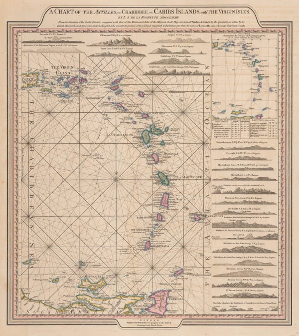
William Faden, Leeward and Windward Islands, 1784£ 3,650.00
-
Bryan Edwards, Barbados, 1794£ 465.00
-
John Thomson, Barbados with plantations and sugar mills, 1820 (c.)£ 425.00
-
Geographical, Statistical and Historical map of The Windward Islands, 1822Carey & LeaSeries: PhiladelphiaCarey & Lea, Geographical, Statistical and Historical map of The Windward Islands, 1822£ 985.00
-
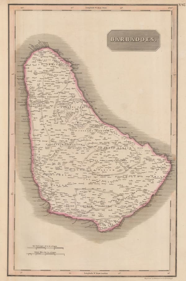
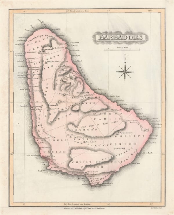
Fielding Lucas Jr, Barbados, 1823£ 275.00
-
Philippe Vandermaelen, The Lesser Antilles, 1827£ 350.00
-
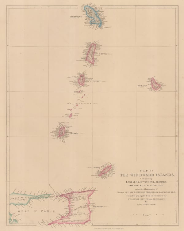
John Arrowsmith, Windward Isles, 1842£ 495.00
-
British Admiralty, Chart of the Windward Islands from Guadeloupe to Trinidad, 1941£ 445.00
Barbados
Our entire inventory of over 10,000 antique and vintage maps is now available to browse by region, date, cartographer, and subject