-
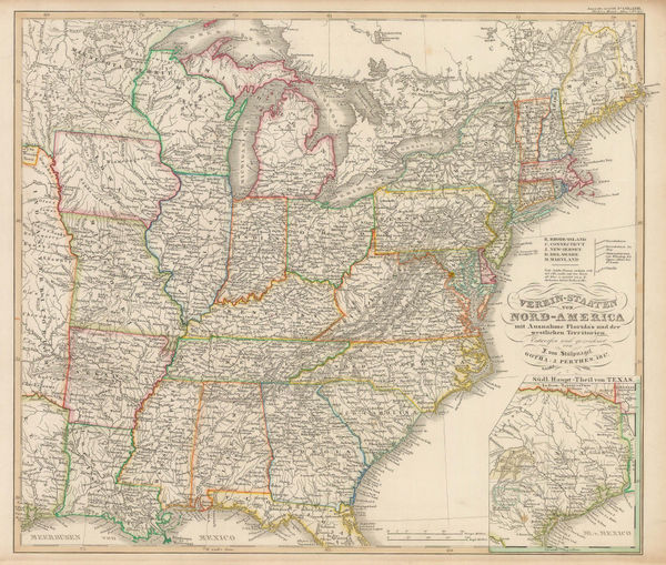
 Justus Perthes, Eastern United States, 1851£ 125.00
 -
A New Map for Travellers through the United States of America showing the Railways Canals and Stage Roads, 1855 c.George Philip & Son Ltd.Series: LiverpoolGeorge Philip & Son Ltd., A New Map for Travellers through the United States of America showing the Railways Canals and Stage Roads, 1855 c.£ 1,250.00
-
John Dower, Eastern United States, 1860 c.£ 120.00
-
Daniel & William Lizars, Eastern USA and the Caribbean, 1860 c.£ 350.00
-
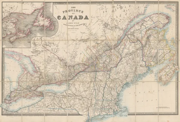
James Wyld, The Province of Canada, 1860 c.£ 1,450.00
-
James T. Lloyd, American Railroad Map, 1861£ 2,750.00
-
Edward Stanford, Civil War Map of the Eastern United States, 1861£ 2,850.00
-
W. & A.K. Johnston, Civil War Map of the United States, 1861£ 595.00
-
Magnus' Historical War Map - One Hundred & Fifty Miles Around Richmond, 1864Charles MagnusSeries: New YorkCharles Magnus, Magnus' Historical War Map - One Hundred & Fifty Miles Around Richmond, 1864£ 1,250.00
-
James T. Lloyd, Railroad, Telegraph and Express Map of the United States, 1864£ 2,750.00
-
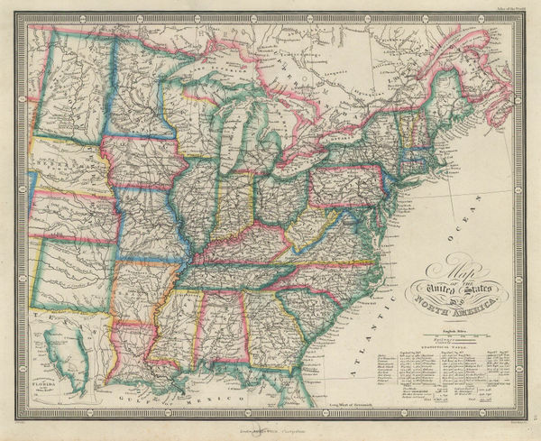
James Wyld, Map of the United States of North America, 1874£ 185.00
-
Justus Perthes, Coalfields of the United States, 1875£ 125.00
-
O.W. Gray & Son, North and South Carolina, 1881£ 495.00
-
Henry Cuthbert Tunison, Massachusetts, Connecticut & Rhode Island, 1882£ 225.00
-
Henry Cuthbert Tunison, Virginia, Maryland, Delaware & West Virginia, 1882£ 95.00
-
J.G. Bartholomew, Eastern United States, 1886£ 42.00
-
Letts & Son, United States, 1892£ 65.00
-
George Philip & Son Ltd., United States - Eastern Division, 1896£ 38.00


Page
2
of 2