-
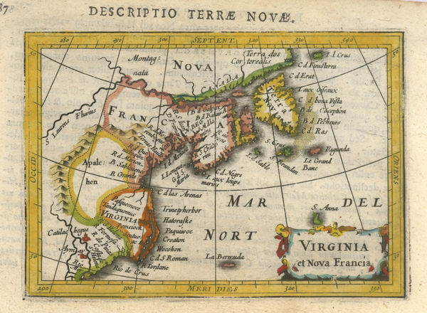
 Petrus Bertius, Early miniature map of north eastern United States, 1616£ 445.00
 -
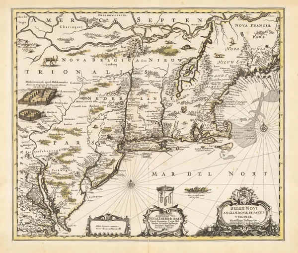
Jan Blaeu, New England, 1650 c.£ 4,250.00
-
John Ogilby, New England, 1670 c.£ 2,850.00
-
Henri Justel, Important map of the East coast of the United States , 1674£ 1,950.00
-
-
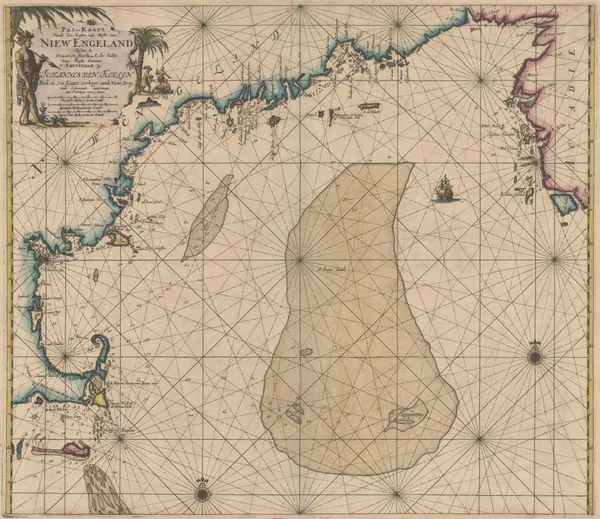
Johannes van Keulen, Early Dutch sea chart of the New England, 1690 c.£ 3,650.00
-
Valk & Schenk, New England, 1694 c.£ 4,750.00
-
Nicolas de Fer, Eastern Coast of North America, 1705£ 1,950.00
-
Valk & Schenk, New England and Virginia, 1710 c.£ 2,300.00
-
Johann Baptist Homann, New England, 1720 c.£ 3,350.00
-
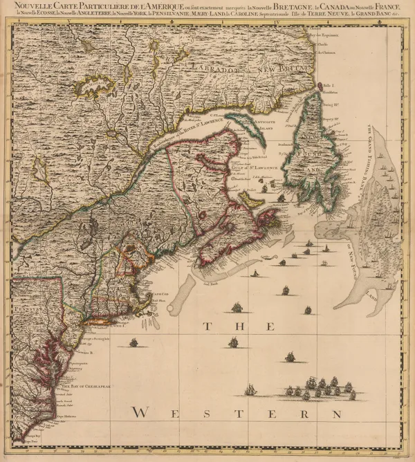
North Eastern United States, Nova Scotia, Newfoundland and Labrador, 1740Henry PoppleSeries: AmsterdamHenry Popple, North Eastern United States, Nova Scotia, Newfoundland and Labrador, 1740£ 2,750.00
-
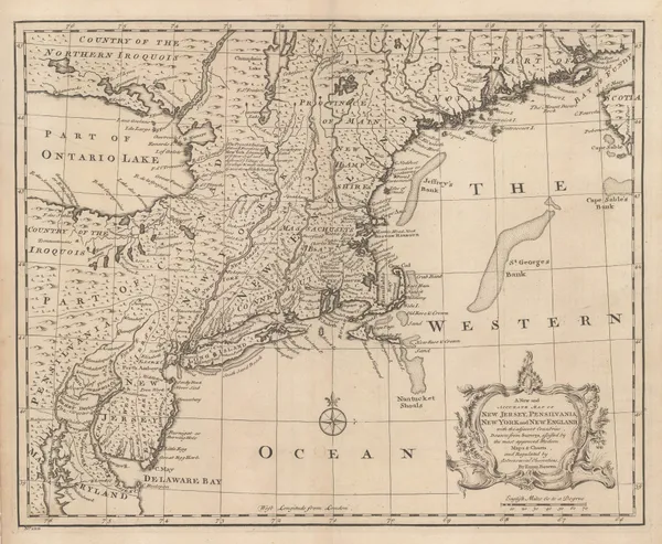
A New and Accurate Map of New Jersey, Pennsylvania, New York and New England, 1747Emanuel BowenSeries: LondonEmanuel Bowen, A New and Accurate Map of New Jersey, Pennsylvania, New York and New England, 1747£ 1,550.00
-
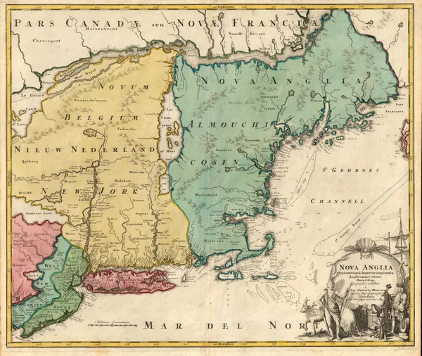
Tobias Conrad Lotter, New England and New York, 1750 c.£ 3,850.00
-
William Owen, French & Indian War Map of New England, 1755£ 950.00
-
Herman Moll, New England, New York, New Jersey and Pennsilvania, 1755 c.£ 1,750.00
-
Jacques-Nicolas Bellin, New England, 1757£ 575.00
-
Marco Coltellini, New England, 1763£ 775.00
-
Thomas Kitchin, Colonial America, 1763£ 1,350.00
-
Jacques-Nicolas Bellin, North-eastern United States, 1764£ 1,500.00
-
Jacques-Nicolas Bellin, Canada & New England, 1764£ 495.00
-
-
London Magazine, New York State during the Revolutionary War, 1778£ 950.00
-
London Magazine, New York State during the Revolutionary War, 1778£ 950.00
-
London Magazine, Battle of Rhode Island, 1778£ 525.00
-
Antonio Zatta, North-eastern North America, 1779£ 675.00
-
Antonio Zatta, New York and Pennsylvania, 1779£ 825.00
-
John Bew, New York and part of the Jerseys, New England and Canada, 1780£ 1,495.00
-
Louis Capitaine du Chesne, Northeastern USA, 1789 (c.)£ 475.00
-
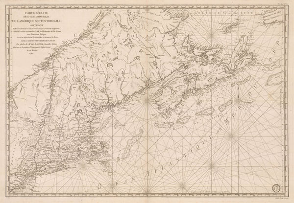
Important map of the east coast of the United States and Canada, 1792 (c.)Antoine de SartineSeries: ParisAntoine de Sartine, Important map of the east coast of the United States and Canada, 1792 (c.)£ 3,250.00
-
John Russell, Map of the Northern, or, New England States of America, 1795£ 525.00
-
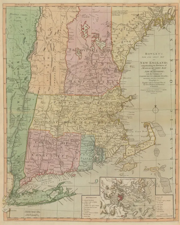
Bowles & Carver, Bowles's New One-Sheet Map of New England, 1795 c.£ 4,250.00
-
John Cary, North-eastern United States, 1806£ 1,100.00
-
John Pinkerton, North-eastern United States, 1810£ 1,350.00
-
Tardieu, North-eastern United States, 1810 c.£ 495.00
-
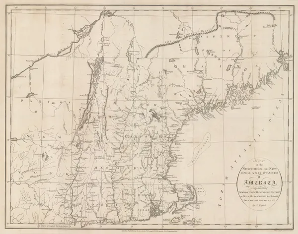
John Thomson, Northern Provinces of the United States, 1817£ 1,350.00
-
Richard Phillips, United States, 1820£ 185.00
-
Philippe Vandermaelen, Cape Cod to Chesapeake Bay, 1827£ 350.00
-
Philippe Vandermaelen, Northeastern United States, 1827£ 450.00
-
Society for the Diffusion of Useful Knowledge (SDUK), New England, 1844£ 145.00
-
Society for the Diffusion of Useful Knowledge (SDUK), Philadelphia, 1844£ 495.00
-
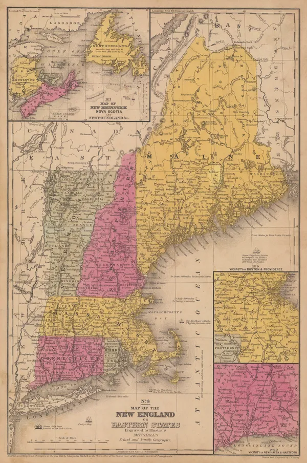
Samuel Augustus Mitchell, Map of the New England or Eastern States, 1847 (c.)£ 195.00
-
Vermont, New Hampshire, Massachusetts, Rhode Island, and Connecticut, 1864Johnson & WardSeries: New YorkJohnson & Ward, Vermont, New Hampshire, Massachusetts, Rhode Island, and Connecticut, 1864£ 185.00
-
William Veazie, New England, 1865£ 725.00
-
Henry Cuthbert Tunison, Massachusetts, Connecticut & Rhode Island, 1882£ 225.00
-
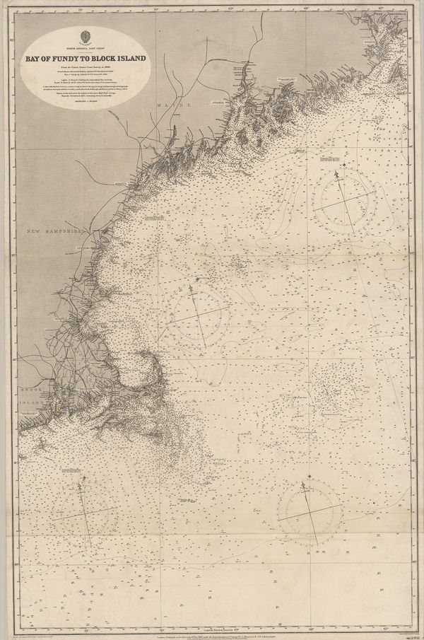
British Admiralty, Bay of Fundy to Block Island, 1896£ 2,150.00
-
Edward Stanford, Ontario, Quebec, New Brunswick & Nova Scotia, 1896£ 95.00
-
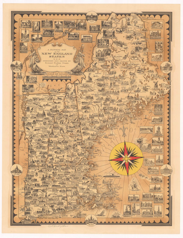
Ernest Dudley Chase, A Pictorial Map of the New England States, 1939£ 1,250.00
USA - Northeast
Our entire inventory of over 10,000 antique and vintage maps is now available to browse by region, date, cartographer, and subject