-
 Cornelis Wytfliet, American south west and Texas, 1597£ 1,675.00
 -
Cornelis Wytfliet, Pacific Northwest, the Kingdom of Anian, 1607£ 3,250.00
-
Robert Morden, California as an Island, 1688£ 1,650.00
-
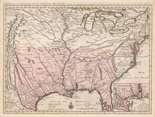
Covens (Jean) & Mortier (Cornelius), Louisiana and the Mississippi River, 1730 (c.)£ 3,450.00
-
Herman Moll, Southern America, Mexico and Central America, 1745£ 395.00
-
Robert de Vaugondy, Southwestern US and northern Mexico, 1749£ 465.00
-
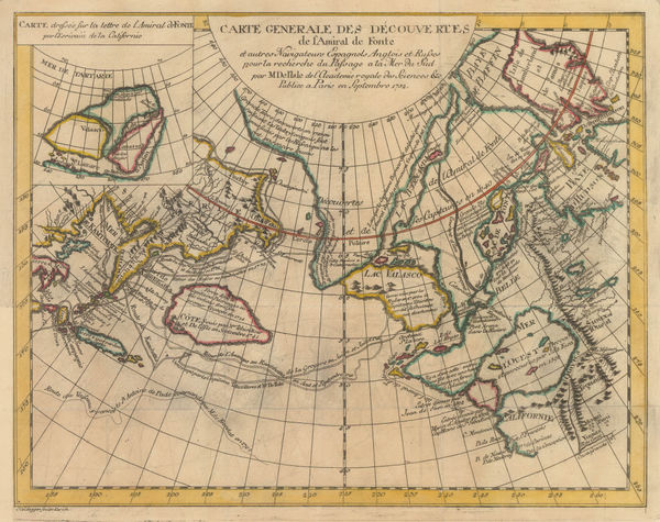
Russian Discoveries in Siberia, Alaska & the Bering Strait, 1750 c.Jacques-Nicolas BellinSeries: ParisJacques-Nicolas Bellin, Russian Discoveries in Siberia, Alaska & the Bering Strait, 1750 c.£ 725.00
-
Northwestern USA, Eastern Russia and the North Pacific, 1770 c.Johann Heinrich HeideggerSeries: ZurichJohann Heinrich Heidegger, Northwestern USA, Eastern Russia and the North Pacific, 1770 c.£ 795.00
-
Robert de Vaugondy, West coast of North America, 1772£ 695.00
-
Antonio Zatta, Alaska, the Pacific Northwest, and the Bering Strait, 1776£ 1,250.00
-
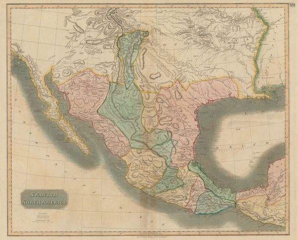
Dr. William Robertson, Southwestern United States and Mexico, 1777£ 1,150.00
-
Antonio Zatta, Mexico, Texas & the Southern USA, 1785£ 795.00
-
Jacques-Nicolas Bellin, North Pacific, Alaska & the Bering Strait, 1795 c£ 3,450.00
-
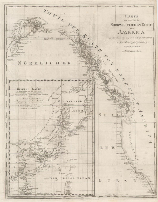
Daniel Friedrich Sotzmann, North West Pacific coast of America, 1800£ 795.00
-
Thomas and Andrews, Mexico and Southern United States, 1805£ 225.00
-
John Pinkerton, Southwestern Unites States, 1811£ 3,500.00
-
Aaron Arrowsmith & Samuel Lewis, Louisiana, 1812£ 875.00
-
John Thomson, Texas, New Mexico, Arizona and Mexico, 1814£ 2,250.00
-
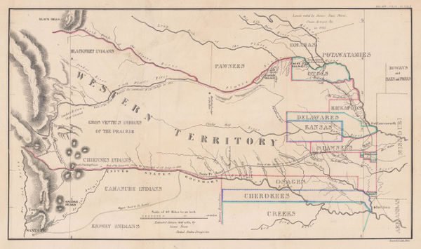
Enoch Steen, Dodge's Expedition through Kansas & Colorado, 1836£ 950.00
-
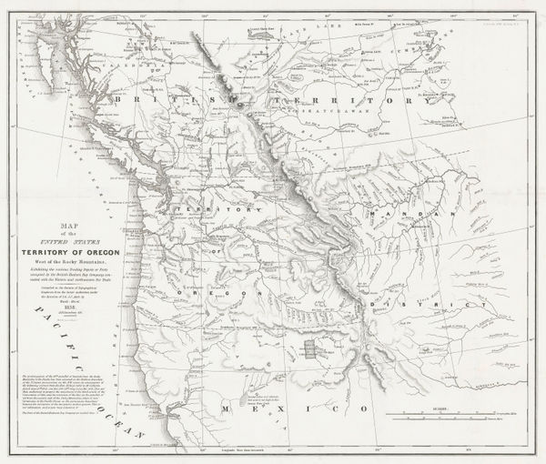
Washington Hood, Territory of Oregon West of the Rocky Mountains, 1838£ 2,450.00
-
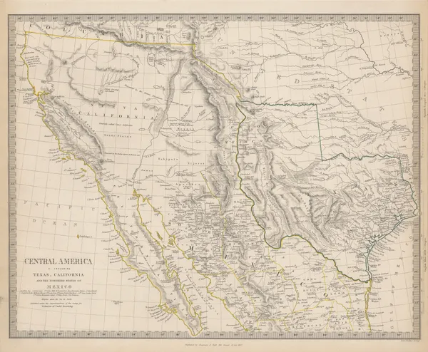
Central America II. Including Texas, California and the Northern States of Mexico, 1842Society for the Diffusion of Useful Knowledge (SDUK)Series: LondonSociety for the Diffusion of Useful Knowledge (SDUK), Central America II. Including Texas, California and the Northern States of Mexico, 1842£ 775.00
-
Map of an Exploring Expedition to the Rocky Mountains in the Year 1842 and to Oregon & North California in the Years 1845-44, 1845John C. FremontSeries: Washington, D.C.John C. Fremont, Map of an Exploring Expedition to the Rocky Mountains in the Year 1842 and to Oregon & North California in the Years 1845-44, 1845£ 3,950.00
-
-
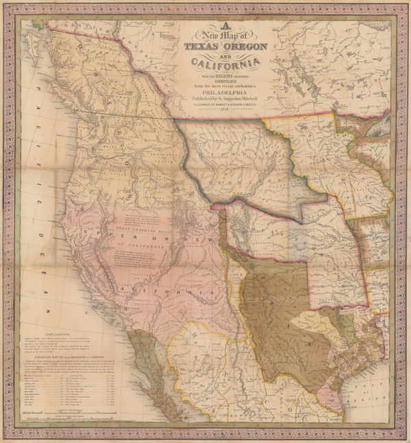
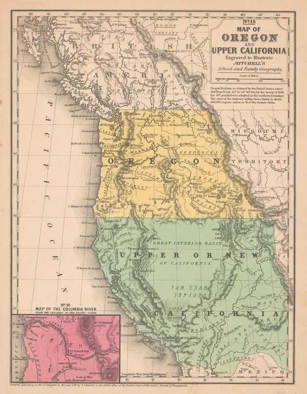
Samuel Augustus Mitchell, Map of Oregon and Upper California, 1847 (c.)£ 1,150.00
-
-
Benedetto Marzolla, Nuova California, 1851£ 2,200.00
-
Joseph Meyer, Geological Map of the United States, 1853£ 475.00
-
-
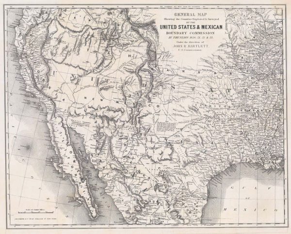
General Map Showing the Countries Explored and Surveyed by the United States & Mexican Boundary Commission, 1854John BartlettSeries: New YorkJohn Bartlett, General Map Showing the Countries Explored and Surveyed by the United States & Mexican Boundary Commission, 1854£ 950.00
-
From Fort Smith to the Rio Grande, 1855United States Pacific Railroad Expeditions (USPRR)Series: Washington, D.C.United States Pacific Railroad Expeditions (USPRR), From Fort Smith to the Rio Grande, 1855£ 1,150.00
-
Geological Map of the Mississippi River to the Pacific Ocean, 1855United States Pacific Railroad Expeditions (USPRR)Series: Washington, D.C.United States Pacific Railroad Expeditions (USPRR), Geological Map of the Mississippi River to the Pacific Ocean, 1855£ 775.00
-
Geological Section from the Mississippi River to the Pacific Ocean, 1855United States Pacific Railroad Expeditions (USPRR)Series: Washington, D.C.United States Pacific Railroad Expeditions (USPRR), Geological Section from the Mississippi River to the Pacific Ocean, 1855£ 675.00
-
Carl Flemming, California, Oregon, Utah and New Mexico, 1857£ 395.00
-
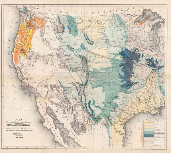
Map Illustrating the General Geological features of the Country West of the Mississippi River, 1857James HallSeries: Washington, D.C.James Hall, Map Illustrating the General Geological features of the Country West of the Mississippi River, 1857£ 1,350.00
-
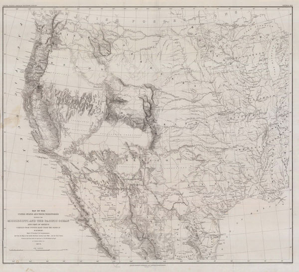
Map of the Unites States and their Territories between the Mississippi and the Pacific Ocean, 1857William Hemsley EmorySeries: Washington, D.C.William Hemsley Emory, Map of the Unites States and their Territories between the Mississippi and the Pacific Ocean, 1857£ 850.00
-
Archibald Fullarton, Oregon and California, 1860 c.£ 265.00
-
Roswell C. Smith, Civil War-Era Map of the Western US, 1861£ 745.00
-
General Land Office (GLO), Sketch of Public Surveys in New Mexico and Arizona, 1866£ 1,750.00
-
Watson's New Map of the Western States Territories, Mexico, and Central America, 1869Gaylord WatsonSeries: New YorkGaylord Watson, Watson's New Map of the Western States Territories, Mexico, and Central America, 1869£ 4,500.00
-
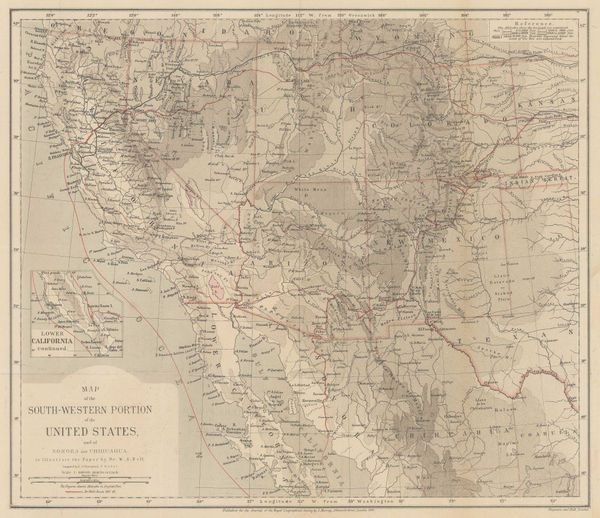
Map of the South-Western Portion of the United States, 1870Royal Geographical Society (RGS)Series: LondonRoyal Geographical Society (RGS), Map of the South-Western Portion of the United States, 1870£ 375.00
-
Alvin J. Johnson, Western States of the USA, 1870 c£ 645.00
-
H.H. Hardesty & Co., Map of California and Nevada, 1875 c.£ 275.00
-
Justus Perthes, Lt. Wheeler's Survey of California, Nevada & Arizona, 1876£ 375.00
-
Justus Perthes, Southern California and Nevada, Arizona and western New Mexico, 1877£ 245.00
-
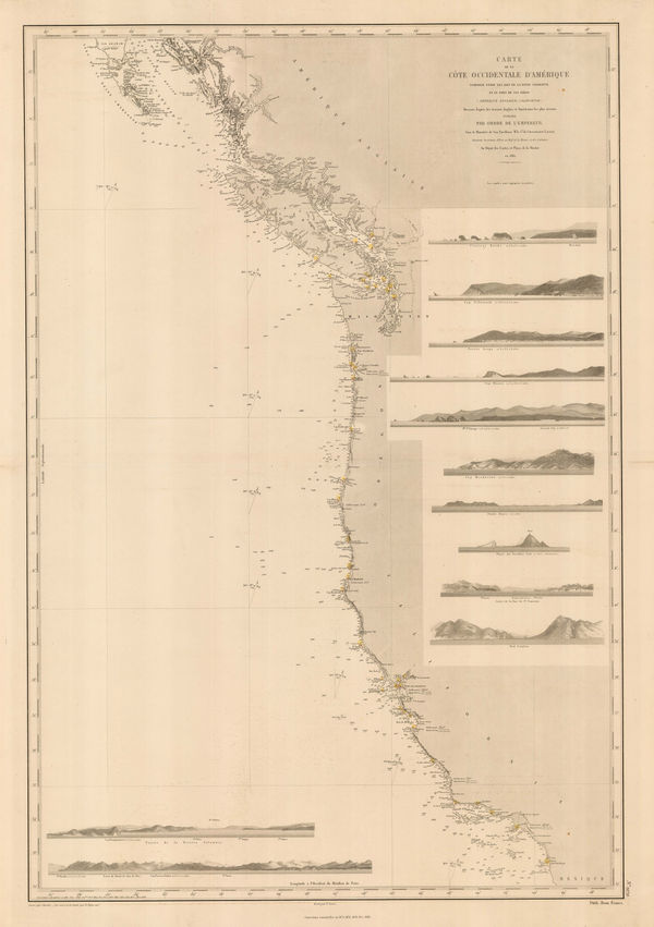
French Admiralty, Chart of the west coast of North America, 1881£ 825.00
-
Justus Perthes, Topographical map of south western USA, 1881£ 275.00
-
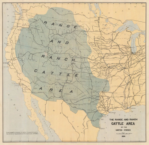
Julius Bien, The Range and Ranch Cattle Area of the United-States, 1884£ 1,650.00
-
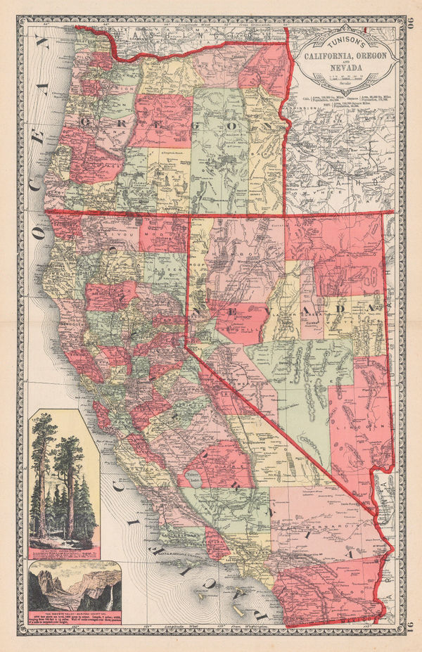
Henry Cuthbert Tunison, Tunison's California, Oregon, and Nevada, 1884£ 695.00
-
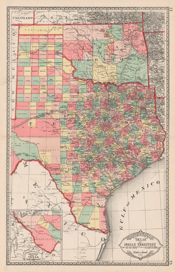
Henry Cuthbert Tunison, Tunison's Texas and Oklahoma, 1884£ 695.00
-
George W. Bacon, Western United States , 1885 (c.)£ 145.00
-
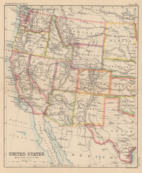
John Bartholomew, United States Western Division, 1887£ 62.00
-
G.W. & C.B. Colton & Co., Atchison, Topeka and Santa Fe Railroad System, 1889£ 595.00
-
Letts & Son, United States, West, & Mexico, North., 1889£ 375.00
-
Edward Stanford, Western United States, 1896£ 125.00
-
Indian Reservations West of the Mississippi River, 1919United States Geological Survey (USGS)Series: Washington, D.C.United States Geological Survey (USGS), Indian Reservations West of the Mississippi River, 1919£ 975.00
-
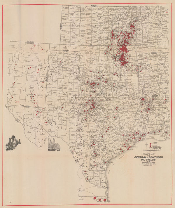
F.E. Gallup, Map of the Central-Southern Oil Fields, 1920£ 3,450.00
-
Fred Harvey, Illustrated Map of the Great Southwest, 1946£ 395.00
-
Oren Arnold, Map of the United States as Arizonans See It, 1952£ 675.00
USA - West & Southwest
Our entire inventory of over 10,000 antique and vintage maps is now available to browse by region, date, cartographer, and subject