-

-
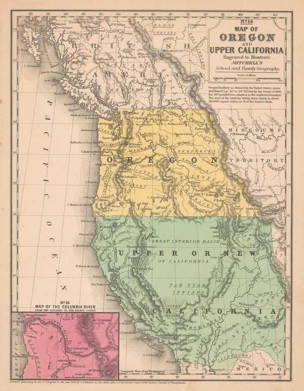
Samuel Augustus Mitchell, Map of Oregon and Upper California, 1847 (c.)£ 1,150.00
-
-
Lt. George Horatio Derby, Reconnaissance of the Colorado River, 1850£ 885.00
-
Carl Flemming, California, Oregon, Utah and New Mexico, 1857£ 395.00
-
Joseph Christmas Ives, Rio Colorado of the West, 1858£ 1,250.00
-
Joseph Christmas Ives, Rio Colorado of the West, 1858£ 1,250.00
-
Archibald Fullarton, Oregon and California, 1860 c.£ 265.00
-
Roswell C. Smith, Civil War-Era Map of the Western US, 1861£ 745.00
-
Map of Explorations and Surveys in New Mexico and Utah, 1864Capt. John Navarre MacombSeries: New YorkCapt. John Navarre Macomb, Map of Explorations and Surveys in New Mexico and Utah, 1864£ 2,750.00
-
General Land Office (GLO), Sketch of Public Surveys in New Mexico and Arizona, 1866£ 1,750.00
-
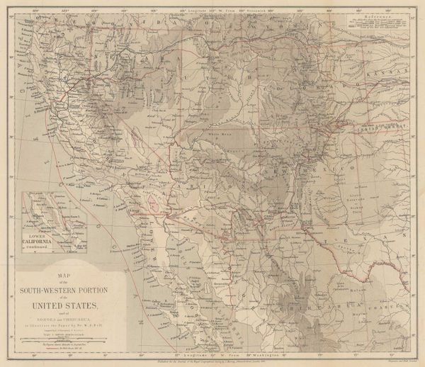
Map of the South-Western Portion of the United States, 1870Royal Geographical Society (RGS)Series: LondonRoyal Geographical Society (RGS), Map of the South-Western Portion of the United States, 1870£ 375.00
-
Alvin J. Johnson, Western States of the USA, 1870 c£ 645.00
-
Justus Perthes, Lt. Wheeler's Survey of California, Nevada & Arizona, 1876£ 375.00
-
Justus Perthes, Southern California and Nevada, Arizona and western New Mexico, 1877£ 245.00
-
Samuel Augustus Mitchell, County and Township Map of Arizona and New Mexico, 1880£ 225.00
-
Justus Perthes, Topographical map of south western USA, 1881£ 275.00
-
O.W. Gray & Son, New Mexico and Arizona, 1881£ 275.00
-
H.R. Page & Co., Page's Map of Arizona, 1886£ 595.00
-
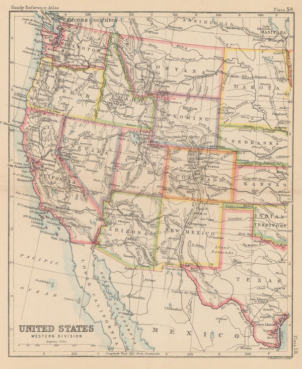
John Bartholomew, United States Western Division, 1887£ 62.00
-
G.W. & C.B. Colton & Co., Atchison, Topeka and Santa Fe Railroad System, 1889£ 595.00
-
Arbuckle Brothers Company, Arizona, 1889£ 115.00
-
Perry Mason & Co., Arizona, 1891£ 145.00
-
Rand, McNally & Co., Arizona, 1892£ 275.00
-
General Land Office (GLO), Territory of Arizona, 1896£ 950.00
-
George Cram, Railroad and County Map of Arizona, 1897£ 395.00
-
Karl Baedeker, Grand Canyon, 1909£ 52.00
-
Karl Baedeker, The Grand Canyon, 1909£ 85.00
-
I. P. Berthrong, Territory of Arizona, 1910£ 525.00
-
United States and Mexico - Sketch Map of part of Sonora and Arizona, 1912Royal Geographical Society (RGS)Series: LondonRoyal Geographical Society (RGS), United States and Mexico - Sketch Map of part of Sonora and Arizona, 1912£ 185.00
-
Rand, McNally & Co., Arizona, 1912£ 475.00
-
Fred Harvey, Illustrated Map of the Great Southwest, 1946£ 395.00
-
Dore Ogrizek, Arizona, 1946£ 85.00
-
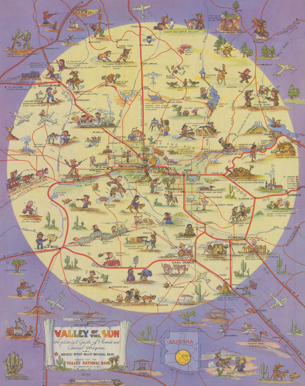
George M. Avey, Phoenix and Environs, 1947£ 325.00
-
Rand, McNally & Co., Tucson, Arizona, 1950 (c.)£ 250.00
-
McGrew Printery, Map of the City of Phoenix Arizona and Vicinity, 1952£ 295.00
-
Oren Arnold, Map of the United States as Arizonans See It, 1952£ 675.00
-
McGrew Printery, Phoenix, Arizona, 1960£ 295.00
-
Boyé De Mente, Illustrated Sightseeing Map of the Valley of the Sun, 1974£ 425.00
Arizona
Our entire inventory of over 10,000 antique and vintage maps is now available to browse by region, date, cartographer, and subject