-

-
Antonio Zatta, The confluences of the Ohio, Missouri and Mississippi Rivers, 1779£ 685.00
-
Philippe Vandermaelen, Mississippi and Alabama, 1827£ 650.00
-
Society for the Diffusion of Useful Knowledge (SDUK), North America Sheet X, 1833£ 76.00
-
Map - Illustrating the plan of the defences of the Western & North-Western Frontier, 1837Washington HoodSeries: Washington, D.C.Washington Hood, Map - Illustrating the plan of the defences of the Western & North-Western Frontier, 1837£ 625.00
-
Samuel Augustus Mitchell, Southeastern United States, 1839£ 145.00
-
Joseph Meyer, German map of Arkansas, 1844£ 245.00
-
Samuel Augustus Mitchell, A New Map of Arkansas, 1846£ 180.00
-
George Woolworth Colton, Arkansas, 1855£ 150.00
-
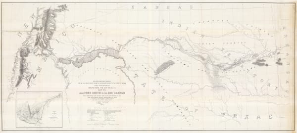
From Fort Smith to the Rio Grande, 1855United States Pacific Railroad Expeditions (USPRR)Series: Washington, D.C.United States Pacific Railroad Expeditions (USPRR), From Fort Smith to the Rio Grande, 1855£ 1,150.00
-
Morse & Gaston, Arkansas, 1857£ 32.00
-
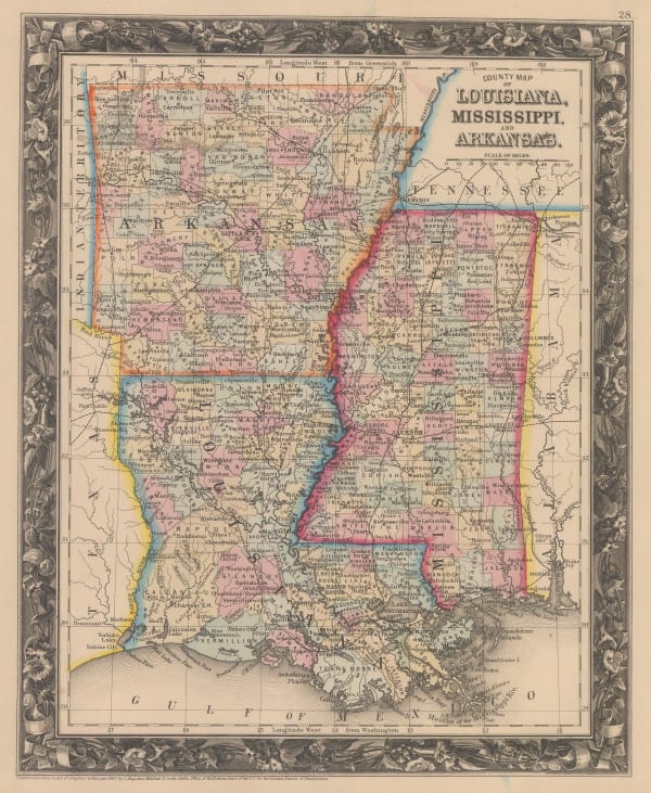
Samuel Augustus Mitchell, County Map of Louisiana, Mississippi and Arkansas, 1860£ 145.00
-
Map Illustrating the plan of the defences of the Western & North Western Frontier, 1861Washington HoodSeries: PhiladelphiaWashington Hood, Map Illustrating the plan of the defences of the Western & North Western Frontier, 1861Sold
-
Charles Magnus, Civil War Panorama of the Mississippi River, 1863 (c.)£ 950.00
-
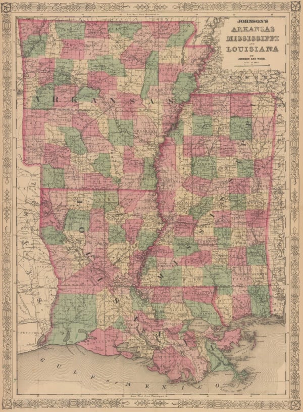
Johnson & Ward, Johnson's Arkansas, Mississippi and Louisiana, 1866£ 295.00
-
General Land Office (GLO), Arkansas, 1866£ 345.00
-
Die Hauptsaechlichsten Gebiete Der Indianer Mission in den Verein Staaten, 1871Justus PerthesSeries: GothaJustus Perthes, Die Hauptsaechlichsten Gebiete Der Indianer Mission in den Verein Staaten, 1871£ 125.00
-
County Map of the States of Arkansas, Mississippi and Louisiana, 1882Samuel Augustus MitchellSeries: PhiladelphiaSamuel Augustus Mitchell, County Map of the States of Arkansas, Mississippi and Louisiana, 1882£ 160.00
-
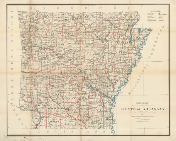
General Land Office (GLO), State of Arkansas, 1886£ 750.00
-
Perry Mason & Co., Arkansas, 1891£ 95.00
-
George Philip & Son Ltd., United States - Central Division, 1896£ 36.00
-
George Cram, Arkansas, 1897£ 185.00
-
F.E. Gallup, Map of the Central-Southern Oil Fields, 1920£ 3,450.00
-
Dore Ogrizek, Arkansas, 1946£ 45.00
Arkansas
Our entire inventory of over 10,000 antique and vintage maps is now available to browse by region, date, cartographer, and subject