-

-
Nicolas Sanson, The First Map to focus on the Island of California, 1679£ 2,750.00
-
Alain Manesson Mallet, Miniature map of the Island of California, 1683£ 1,350.00
-
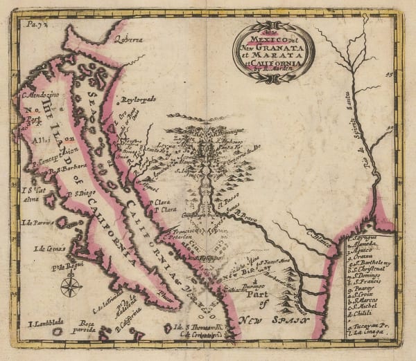
Robert Morden, California as an Island, 1688£ 1,650.00
-
Nicolas de Fer, Important map of California as an island, 1700£ 2,350.00
-
Heinrich Scherer, Baja California and Mexico, 1700 c.£ 985.00
-
-
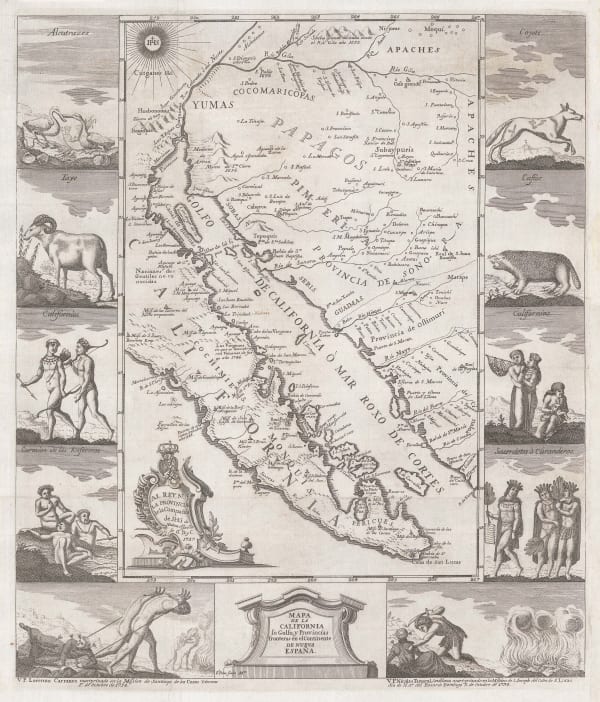
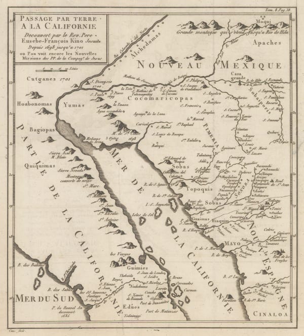
Larger and rarer version of Kino's landmark map of California, 1726Eusebio Francisco KinoSeries: AugsburgEusebio Francisco Kino, Larger and rarer version of Kino's landmark map of California, 1726£ 3,750.00
-
-
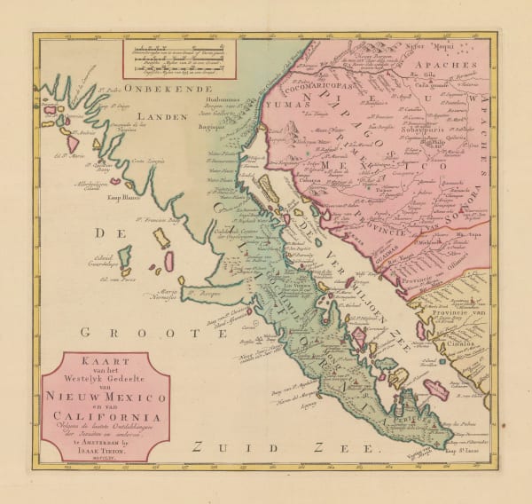
Isaac Tirion, Lower California and the Baja Peninsula, 1765£ 1,450.00
-
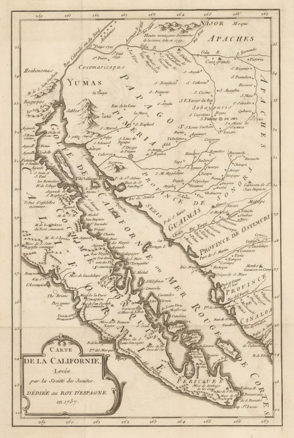
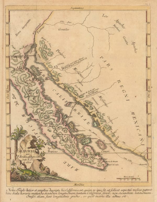
Miguel Venegas, French edition of the influential Jesuit map of California, 1767£ 1,575.00
-
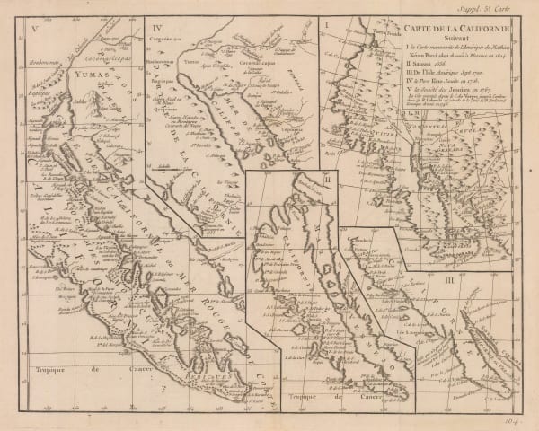
Robert de Vaugondy, Cartographic history of California, 1772£ 1,150.00
-
Robert de Vaugondy, West coast of North America, 1772£ 695.00
-
Johann Jakob Baegert, California, 1773£ 1,150.00
-
Antonio Zatta, Alaska, the Pacific Northwest, and the Bering Strait, 1776£ 1,250.00
-
Late French rendition of the important map by Eusebio Kino, 1785 c.Eusebio Francisco KinoSeries: ParisEusebio Francisco Kino, Late French rendition of the important map by Eusebio Kino, 1785 c.£ 885.00
-
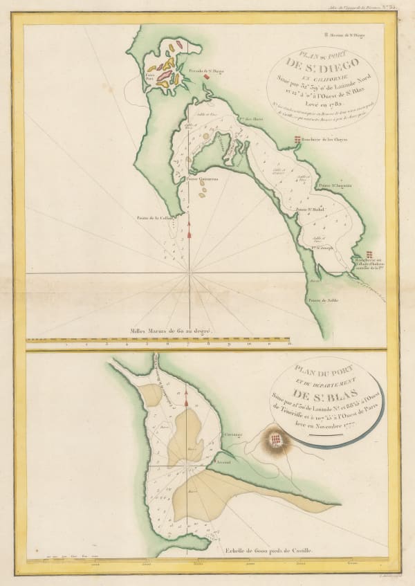
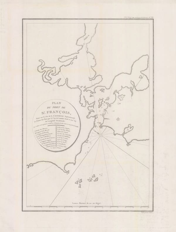
Jean Francois de La Perouse, San Diego and San Blas, 1787£ 885.00
-
Jacques-Nicolas Bellin, North Pacific, Alaska & the Bering Strait, 1795 c£ 3,450.00
-
Comte de la Perouse's voyage, western coast of North America, 1797Jean Francois de La PerouseSeries: ParisJean Francois de La Perouse, Comte de la Perouse's voyage, western coast of North America, 1797£ 675.00
-
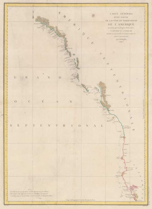
Earliest commercially available map of San Francisco Bay, 1797Jean Francois de La PerouseSeries: ParisJean Francois de La Perouse, Earliest commercially available map of San Francisco Bay, 1797£ 1,650.00
-
Daniel Friedrich Sotzmann, North West Pacific coast of America, 1800£ 795.00
-
Philippe Vandermaelen, California coast, 1825£ 1,550.00
-
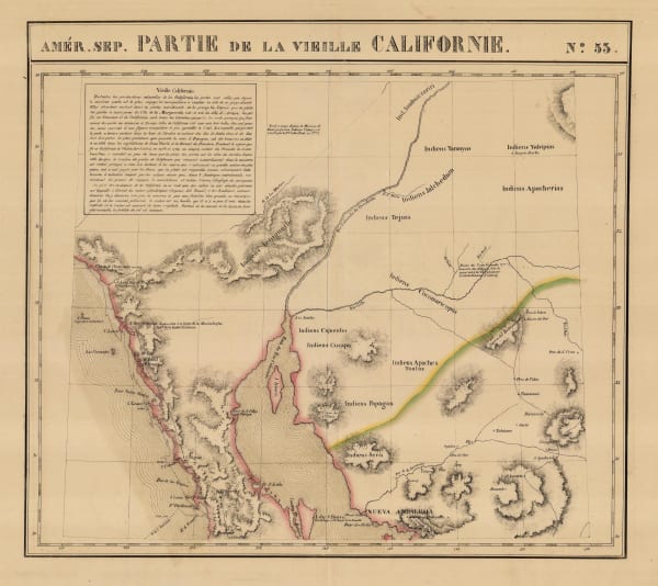
Philippe Vandermaelen, Southern California, Baja, Sonora & Arizona, 1827£ 750.00
-
Southwestern United States and Northern Mexico, 1842Society for the Diffusion of Useful Knowledge (SDUK)Series: LondonSociety for the Diffusion of Useful Knowledge (SDUK), Southwestern United States and Northern Mexico, 1842£ 625.00
-
Map of an Exploring Expedition to the Rocky Mountains in the Year 1842 and to Oregon & North California in the Years 1845-44, 1845John C. FremontSeries: Washington, D.C.John C. Fremont, Map of an Exploring Expedition to the Rocky Mountains in the Year 1842 and to Oregon & North California in the Years 1845-44, 1845£ 3,950.00
-
-
P.M. McGill, Map of Fort Hill, 1847£ 825.00
-
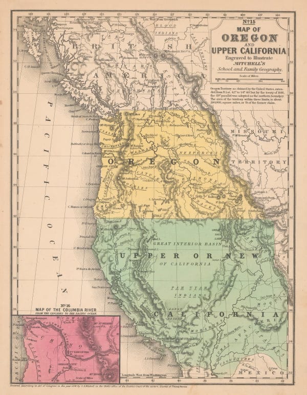
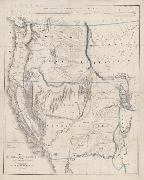
Samuel Augustus Mitchell, Map of Oregon and Upper California, 1847 (c.)£ 1,150.00
-
-
Lt. George Horatio Derby, General Riley's Route, 1849Sold
-
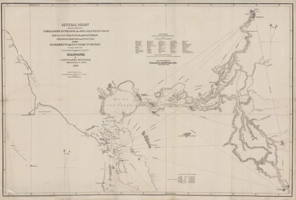
General Chart - Farallones Entrance to the Bay of San Francisco, 1850Cadwalader RinggoldSeries: Washington, D.C.Cadwalader Ringgold, General Chart - Farallones Entrance to the Bay of San Francisco, 1850£ 1,950.00
-
The Sacramento Valley from the American River to Butte Creek, 1850Lt. George Horatio DerbySeries: Washington, D.C.Lt. George Horatio Derby, The Sacramento Valley from the American River to Butte Creek, 1850£ 2,250.00
-
Benedetto Marzolla, Nuova California, 1851£ 2,200.00
-
Map of Passes in the Sierra Nevada, 1853United States Pacific Railroad Expeditions (USPRR)Series: Washington, D.C.United States Pacific Railroad Expeditions (USPRR), Map of Passes in the Sierra Nevada, 1853£ 575.00
-
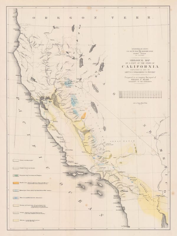
William P. Blake, Geological Map of California, 1855£ 795.00
-
Carl Flemming, California, Oregon, Utah and New Mexico, 1857£ 395.00
-
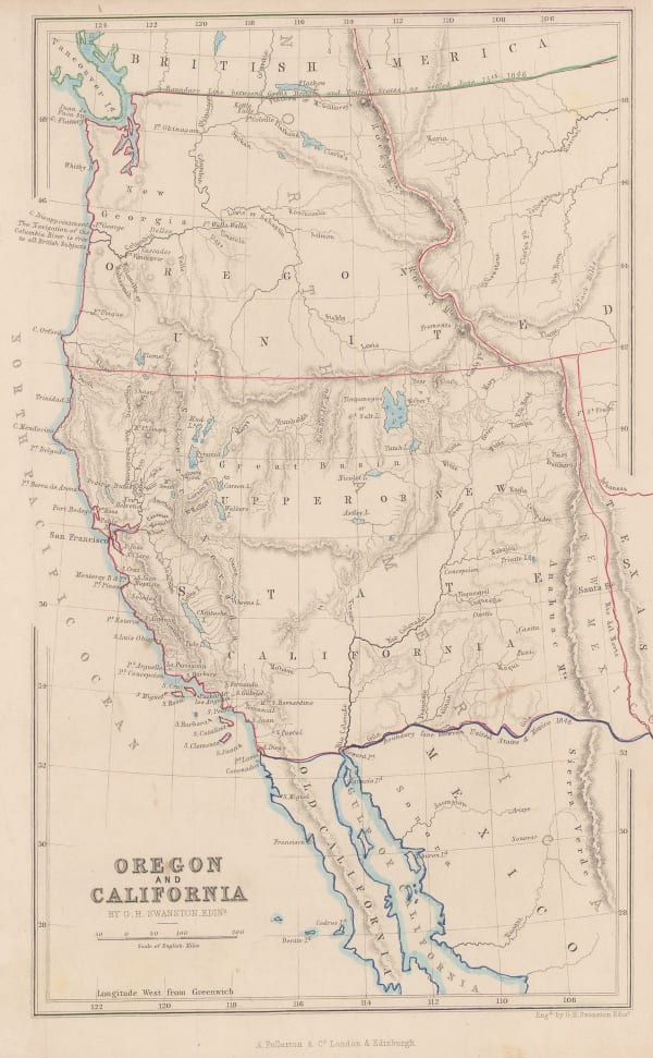
Archibald Fullarton, Oregon and California, 1860 c.£ 265.00
-
Roswell C. Smith, Civil War-Era Map of the Western US, 1861£ 745.00
-
-
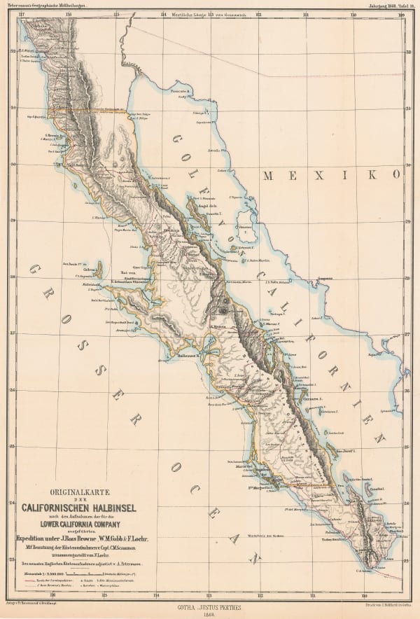
Justus Perthes, Map of the Baja California Peninsula, 1868£ 325.00
-
Map of the South-Western Portion of the United States, 1870Royal Geographical Society (RGS)Series: LondonRoyal Geographical Society (RGS), Map of the South-Western Portion of the United States, 1870£ 375.00
-
Alvin J. Johnson, Western States of the USA, 1870 c£ 645.00
-
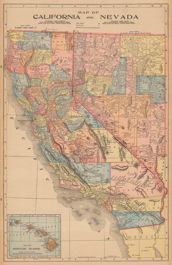
H.H. Hardesty & Co., Map of California and Nevada, 1875 c.£ 275.00
-
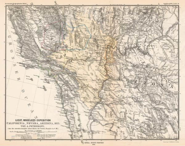
Justus Perthes, Lt. Wheeler's Survey of California, Nevada & Arizona, 1876£ 375.00
-
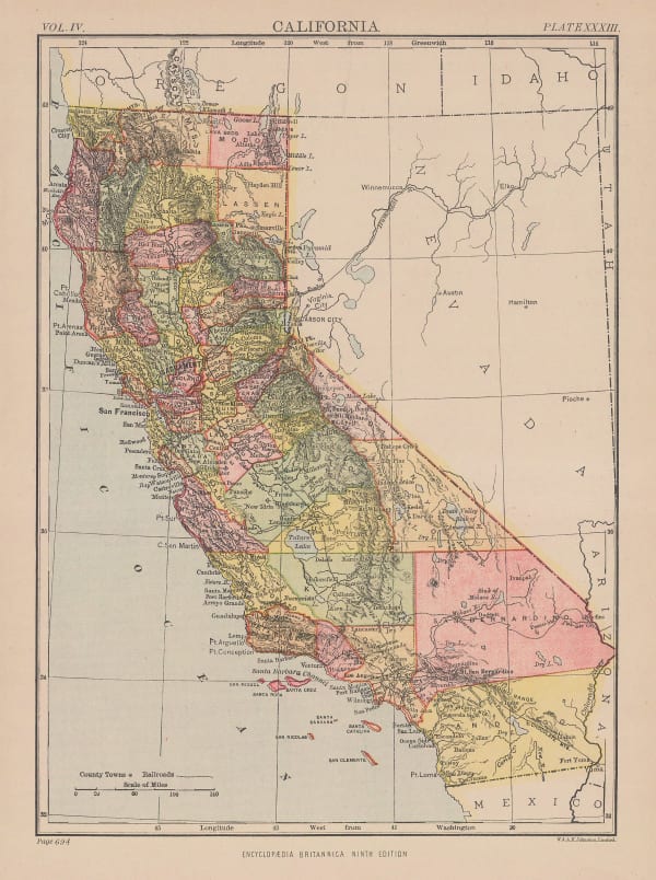
W. & A.K. Johnston, California, 1880 c.£ 95.00
-
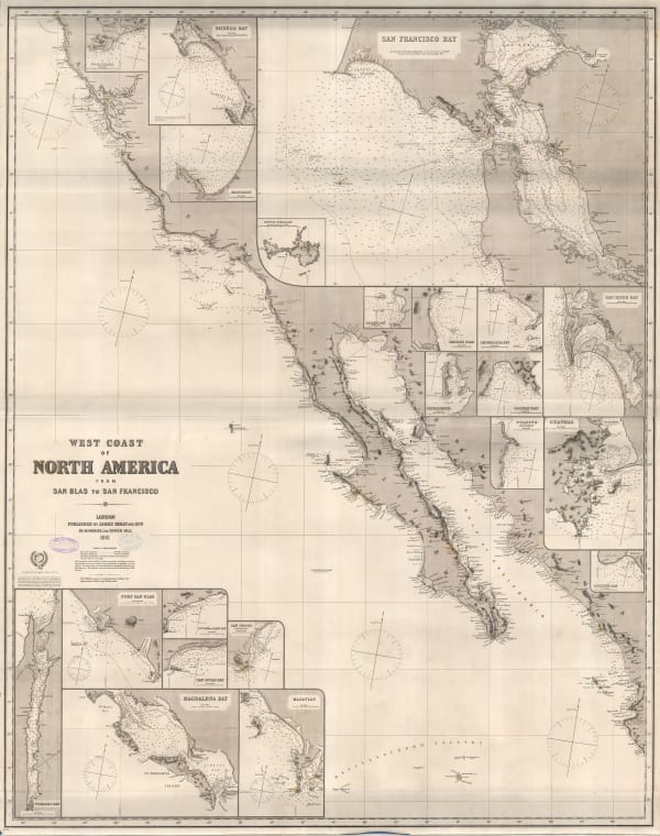
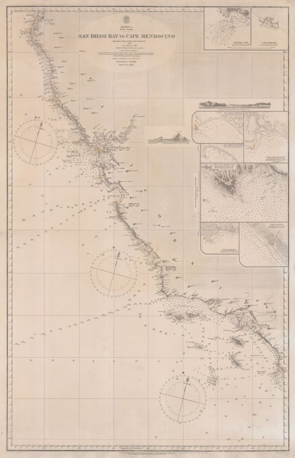
French Admiralty, Chart of the west coast of North America, 1881£ 825.00
-
-
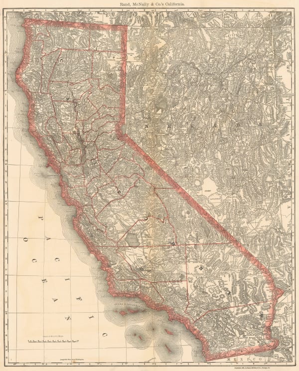
Rand McNally, California, 1881£ 545.00
-
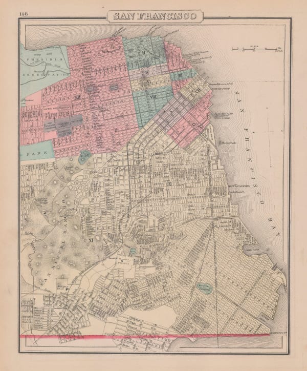
O.W. Gray & Son, San Francisco, 1881£ 495.00
-
Henry Cuthbert Tunison, Tunison's California, Oregon, and Nevada, 1884£ 695.00
-
Henry Cuthbert Tunison, Tunison's Texas and Oklahoma, 1884£ 695.00
-
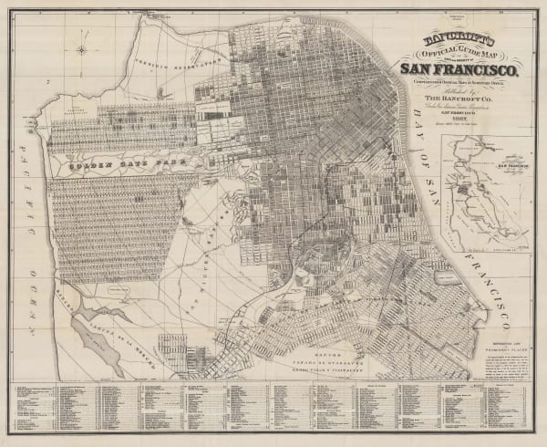
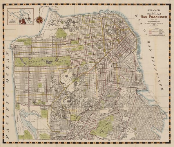
Bancroft's Official Guide Map of City and County San Francisco, 1887Bancroft Co.Series: San FranciscoBancroft Co., Bancroft's Official Guide Map of City and County San Francisco, 1887£ 1,850.00
-
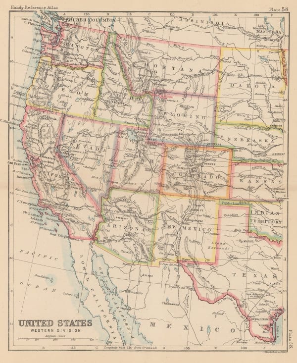
John Bartholomew, United States Western Division, 1887Sold
-
G.W. & C.B. Colton & Co., Atchison, Topeka and Santa Fe Railroad System, 1889£ 595.00
-
Arbuckle Brothers Company, California, 1889£ 365.00
-
British Admiralty, Sea Chart of the California Coast, 1895£ 750.00
-
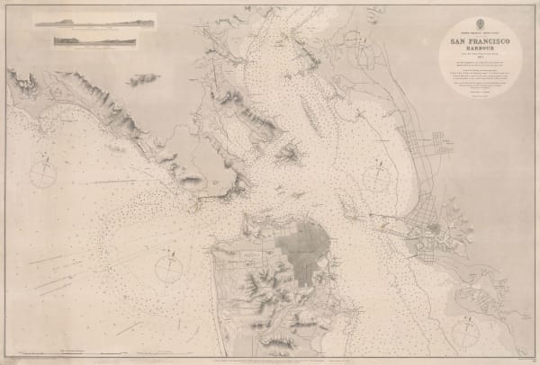
British Admiralty, San Francisco Harbour, 1895£ 1,850.00
-
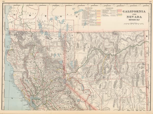
George Cram, California and Nevada Northern Half, 1897£ 225.00
-
Mast Crowell & Kirkpatrick, California and Nevada, 1897£ 195.00
-
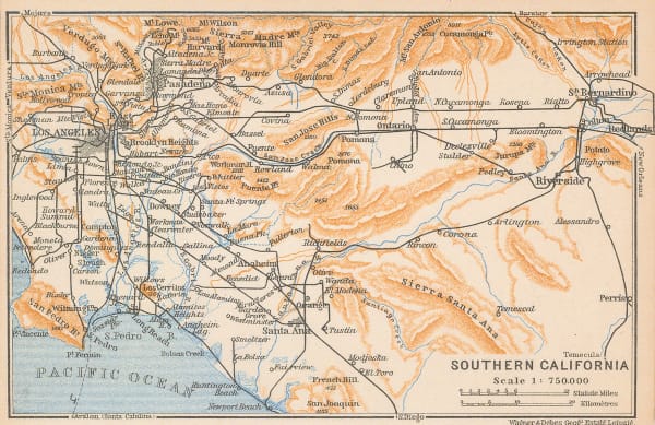
Karl Baedeker, Southern California, 1909£ 68.00
-
Karl Baedeker, Northern California, 1909£ 88.00
-
Karl Baedeker, Los Angeles, 1909£ 125.00
-
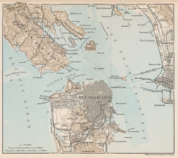
Karl Baedeker, San Francisco Bay, 1909£ 68.00
-
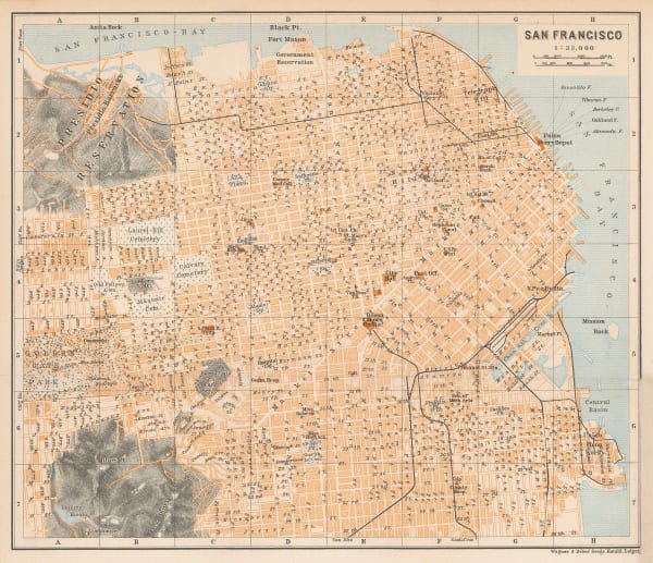
Karl Baedeker, San Francisco , 1909£ 195.00
-
Rand McNally, California, 1911£ 825.00
-
James Perrin Smith, Geological Map of California, 1916£ 4,000.00
-
Relief Map of the Territory Served by the Lines of the Pacific Electric Railway in Southern California, 1920O.A. SmithO.A. Smith, Relief Map of the Territory Served by the Lines of the Pacific Electric Railway in Southern California, 1920£ 950.00
-
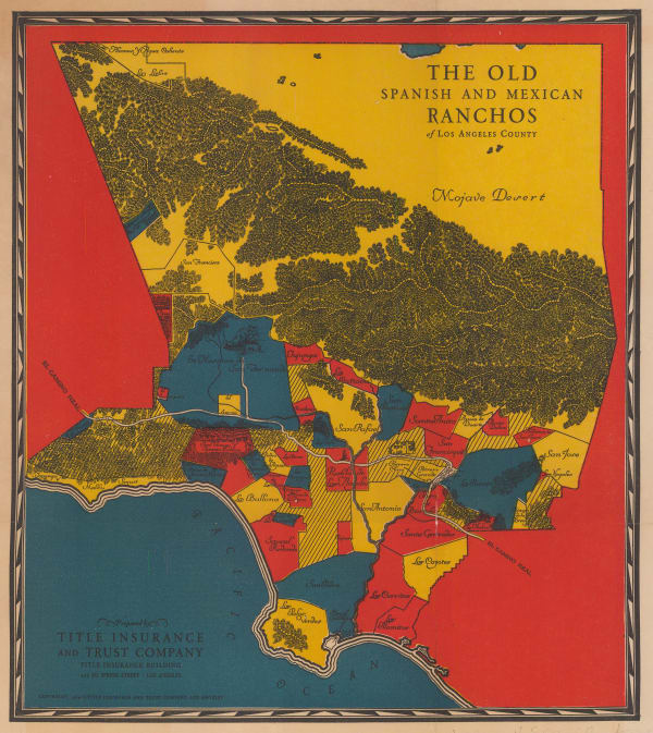
Gerald Allen Eddy, The Ranchos of Los Angeles County, 1929£ 525.00
-
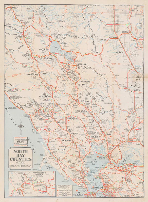
California State Automobile Association, North Bay Counties, 1930 c£ 395.00
-
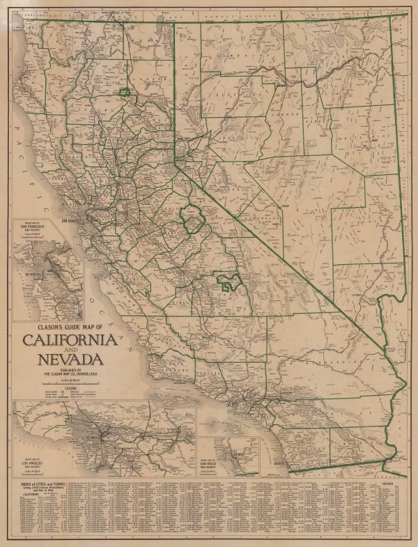
Clason Map Co., Clason's Guide Map of California and Nevada, 1930 c.£ 645.00
-
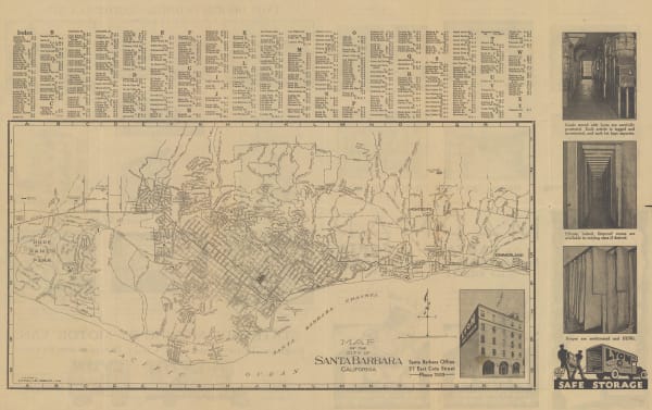
E. F. Hill, Map of the City of Santa Barbara, 1934£ 375.00
-
Schwabacher-Frey, California & Nevada, 1935£ 195.00
-
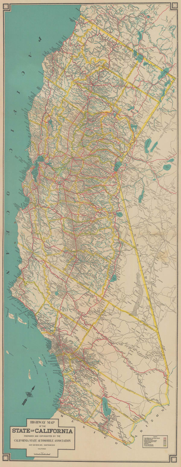
California State Automobile Association, California, 1935 c£ 750.00
-
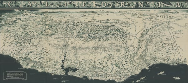
Charles Owens, California Official Tourist Picture Map, 1936£ 495.00
-
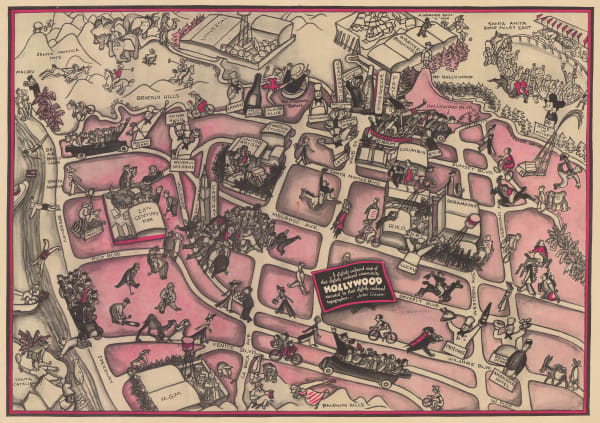
A Slightly Cockeyed map of that slightly Cockeyed Community Hollywood, 1937John GrothSeries: Los AngelesJohn Groth, A Slightly Cockeyed map of that slightly Cockeyed Community Hollywood, 1937£ 950.00
-
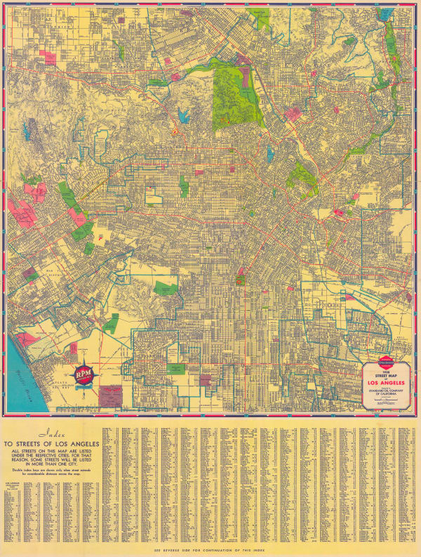
H. M. Gousha & Co, Street Map of Los Angeles, 1938£ 575.00
-
Redwood Empire Association, Northern California, 1938£ 285.00
-
Kohnke Printing Co., Map of the City and County of San Francisco, 1939£ 785.00
-
Mitt Schenkofsky, Merry-maker's Map of San Francisco, 1940£ 2,950.00
-
Ruth Taylor, San Francisco, 1940£ 295.00


Page
1
of 2