-
 Valk & Schenk, New England and Virginia, 1710 c.£ 2,300.00
 -
London Magazine, Connecticut and Rhode Island, 1758£ 685.00
-
Marco Coltellini, New England, 1763£ 775.00
-
-
John Bew, New York and part of the Jerseys, New England and Canada, 1780£ 1,495.00
-
Louis Capitaine du Chesne, Northeastern USA, 1789 (c.)£ 475.00
-
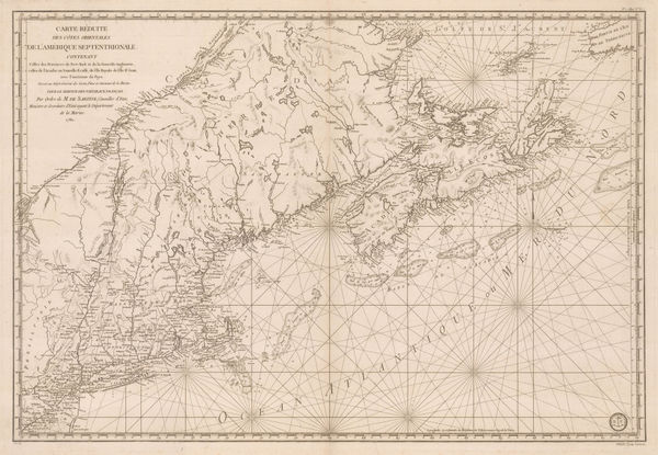
Important map of the east coast of the United States and Canada, 1792 (c.)Antoine de SartineSeries: ParisAntoine de Sartine, Important map of the east coast of the United States and Canada, 1792 (c.)£ 3,250.00
-
Amos Doolittle, A Correct Map of Connecticut from an Actual Survey, 1797£ 985.00
-
Thomas and Andrews, Connecticut, 1805£ 265.00
-
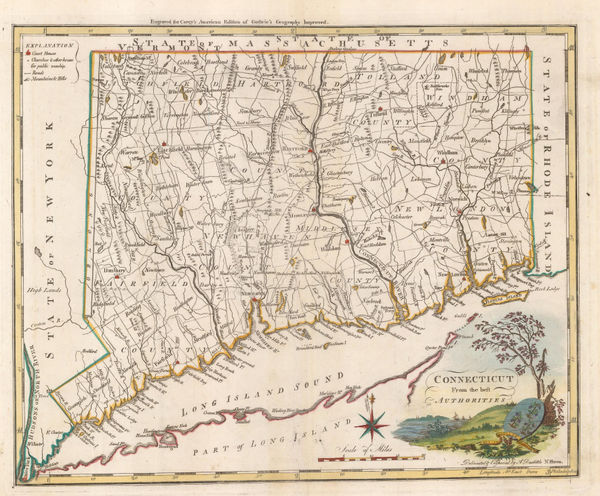
Matthew Carey, Connecticut from the Best Authorities, 1805 c.£ 1,350.00
-
Tardieu, North-eastern United States, 1810 c.£ 495.00
-
Matthew Carey, Connecticut, 1813£ 285.00
-
Carey & Lea, Geographical, Statistical, and Historical Map of Connecticut, 1823£ 1,650.00
-
Geographical, Statistical, and Historical Map of Connecticut, 1825Geographisches Institut WeimarSeries: WeimarGeographisches Institut Weimar, Geographical, Statistical, and Historical Map of Connecticut, 1825£ 200.00
-
Philippe Vandermaelen, Cape Cod to Chesapeake Bay, 1827£ 350.00
-
Society for the Diffusion of Useful Knowledge (SDUK), New England, 1844£ 145.00
-
Joseph Meyer, Connecticut, 1846£ 285.00
-
Samuel Augustus Mitchell, Connecticut, 1846 c.£ 375.00
-
Morse & Gaston, Connecticut, Rhode Island, and Long Island, 1857£ 38.00
-
Joseph Hutchins Colton, Connecticut, 1861£ 295.00
-
Vermont, New Hampshire, Massachusetts, Rhode Island, and Connecticut, 1864Johnson & WardSeries: New YorkJohnson & Ward, Vermont, New Hampshire, Massachusetts, Rhode Island, and Connecticut, 1864£ 185.00
-
Henry Cuthbert Tunison, Massachusetts, Connecticut & Rhode Island, 1882£ 225.00
-
Arbuckle Brothers Company, Connecticut, 1889£ 195.00
-
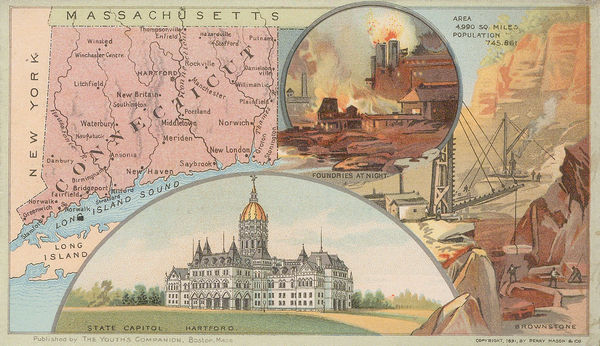
Perry Mason & Co., Connecticut, 1891£ 225.00
-
Karl Baedeker, New Haven, 1909£ 42.00
-
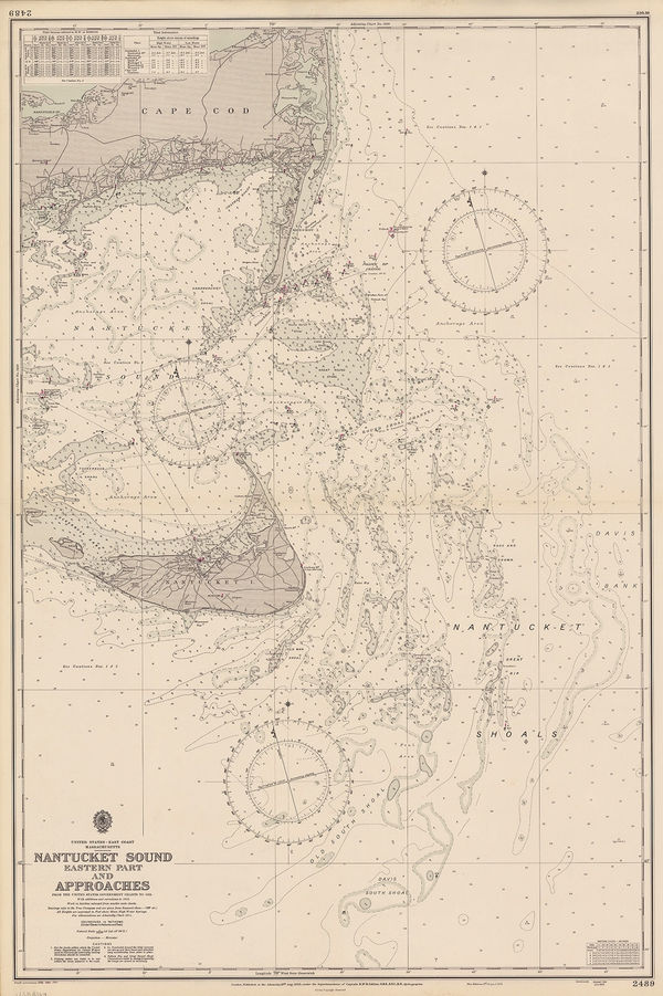
British Admiralty, Nantucket Sound (Eastern Part) and Approaches, 1958£ 495.00
-
British Admiralty, Nantucket Sound (Western Part) Buzzard's Bay and Approaches, 1958£ 495.00
Connecticut
Our entire inventory of over 10,000 antique and vintage maps is now available to browse by region, date, cartographer, and subject