-
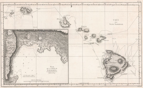
 Rigobert Bonne, Early map of Hawaii based on Capt. Cook, 1780 c.£ 745.00
 -
Capt. James Cook, Hawaii, 1785£ 1,850.00
-
Joseph Hutchins Colton, Hawaii, New Zealand & Pacific Islands, 1861£ 295.00
-
Arbuckle Brothers Company, Hawaii, 1889£ 350.00
-
John Murray, Hawai'i (Sandwich Islands), 1890£ 395.00
-
Hawaiian Government Survey, Maui - Hawaiian Islands, 1903£ 3,450.00
-
General Land Office (GLO), Map of the Territory of Hawaii, 1905£ 885.00
-
Hawaiian Government Survey, Oahu - Hawaiian Islands, 1906£ 4,450.00
-
Marcel Couttreau & H. le Chartier, Hawaii, 1911£ 92.00
-
Drainage Map of the Island of Hawaii, 1913United States Geological Survey (USGS)Series: Washington, D.C.United States Geological Survey (USGS), Drainage Map of the Island of Hawaii, 1913£ 375.00
-
Parker Edwards, Hawaiian Islands, 1937£ 850.00
-
Hawaiian Pineapple Co., Dole Map of Hawaii, 1950£ 985.00
-
Hawaii Visitors Bureau, Island of Oahu, 1955 (c.)£ 175.00
-
British Admiralty, Southern Part of Oahu, 1961£ 325.00
-
British Admiralty, Hawaiian or Sandwich Islands, 1962£ 445.00
Hawaii
Our entire inventory of over 10,000 antique and vintage maps is now available to browse by region, date, cartographer, and subject