-
 North America - Sheet IX, Parts of Missouri, Illinois and Indiana, 1833Society for the Diffusion of Useful Knowledge (SDUK)Series: LondonSociety for the Diffusion of Useful Knowledge (SDUK), North America - Sheet IX, Parts of Missouri, Illinois and Indiana, 1833£ 85.00
 -
Map - Illustrating the plan of the defences of the Western & North-Western Frontier, 1837Washington HoodSeries: Washington, D.C.Washington Hood, Map - Illustrating the plan of the defences of the Western & North-Western Frontier, 1837£ 625.00
-
Hydrographical Basin of the Upper Mississippi River, 1843Joseph Nicolas NicolletSeries: Washington, D.C.Joseph Nicolas Nicollet, Hydrographical Basin of the Upper Mississippi River, 1843£ 3,450.00
-
Samuel Augustus Mitchell, Iowa, 1849£ 345.00
-
General Land Office (GLO), Sketch Map of the Public Surveys in Iowa Territory, 1850£ 125.00
-
Joseph Hutchins Colton, Iowa, 1855£ 165.00
-
Map Illustrating the plan of the defences of the Western & North Western Frontier, 1861Washington HoodSeries: PhiladelphiaWashington Hood, Map Illustrating the plan of the defences of the Western & North Western Frontier, 1861£ 525.00
-
US Government, Sketch of the Public Surveys of Iowa and Dakota, 1861£ 295.00
-
Johnson & Ward, Johnson's Iowa and Nebraska, 1863£ 150.00
-
Johnson & Ward, Johnson's Iowa and Nebraska, 1864£ 295.00
-
General Land Office (GLO), Iowa, 1866£ 345.00
-
Samuel Augustus Mitchell, County Map of the States of Iowa and Missouri, 1867£ 90.00
-
Archibald Fullarton, United States - The North Central Section, 1870 c.£ 75.00
-
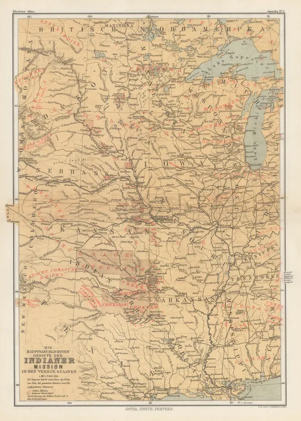
Justus Perthes, Indigenous Map of Central and Midwest USA, 1871£ 125.00
-
County and Township Map of the States of Iowa and Missouri, 1882Samuel Augustus MitchellSeries: PhiladelphiaSamuel Augustus Mitchell, County and Township Map of the States of Iowa and Missouri, 1882£ 140.00
-
Letts & Son, Illinois with parts of Iowa, Missouri and Indianan, 1882£ 75.00
-
Justus Perthes, Dakotas, Minnesota, Iowa, Nebraska and part of Wisconsin., 1885£ 85.00
-
George Cram, Official Map of Sioux City, 1889£ 20.00
-
Arbuckle Brothers Company, [Iowa], 1889£ 88.00
-
Perry Mason & Co., Iowa, 1891£ 95.00
-
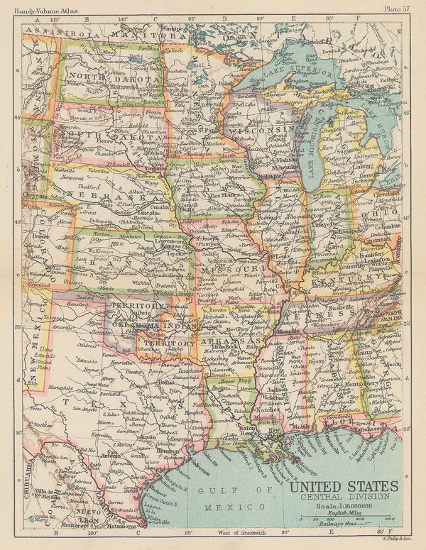
George Philip & Son Ltd., United States - Central Division, 1896£ 36.00
Iowa
Our entire inventory of over 10,000 antique and vintage maps is now available to browse by region, date, cartographer, and subject


![Arbuckle Brothers Company, [Iowa], 1889](https://static-assets.artlogic.net/w_600,c_limit,f_auto,fl_lossy,q_auto/artlogicstorage/themaphouse/images/view/ae23a4380ff801538686cae1c4a69197j/themaphouse-arbuckle-brothers-company-iowa-1889.jpg)