-
 Antonio Zatta, The confluences of the Ohio, Missouri and Mississippi Rivers, 1779£ 685.00
 -
A Map of the States of Virginia, North Carolina, South Carolina and Georgia, 1795Joseph PurcellSeries: EdinburghJoseph Purcell, A Map of the States of Virginia, North Carolina, South Carolina and Georgia, 1795£ 1,925.00
-
John Thomson, Eastern United States, 1817£ 1,250.00
-
Morris Birkbeck, Early map of Ohio, Indiana and the Territory of Illinois, 1818£ 1,250.00
-
Carey & Lea, Geographical, Statistical, and Historical Map of Kentucky, 1823£ 1,250.00
-
Philippe Vandermaelen, Indiana, Kentucky, Ohio and West Virginia, 1827£ 550.00
-
I.T. Hinton, Map of the States of Kentucky and Tennessee, 1831£ 220.00
-
Joseph Meyer, Kentucky, 1845£ 275.00
-
Samuel Augustus Mitchell, A New Map of Kentucky, 1846£ 375.00
-
George Woolworth Colton, Kentucky and Tennessee, 1855£ 125.00
-
Morse & Gaston, Kentucky and Tennessee, 1857£ 36.00
-
Samuel Augustus Mitchell, County Map of Kentucky and Tennessee, 1860£ 95.00
-
Johnson & Browning, Johnson's Kentucky and Tennessee, 1861£ 160.00
-
Joseph Hutchins Colton, Louisville and New Orleans, 1861£ 295.00
-
Johnson & Ward, Johnson's Kentucky and Tennessee, 1865£ 285.00
-
Letts & Son, Eastern United States, 1882£ 75.00
-
Henry Cuthbert Tunison, Kentucky, 1882£ 85.00
-
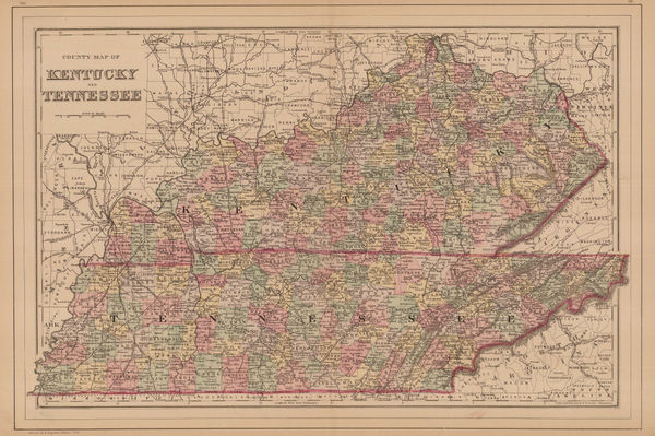
Samuel Augustus Mitchell, Kentucky and Tennessee, 1884£ 125.00
-
Arbuckle Brothers Company, [Kentucky], 1889£ 95.00
-
Perry Mason & Co., Kentucky, 1891£ 115.00
-
George Cram, Kentucky and Tennessee, 1897£ 185.00
-
George Cram, Kentucky Tennessee, 1897£ 195.00
-
Century Company, The Century Atlas - Kentucky, 1897£ 28.00
-
Rand McNally, Kentucky, 1907£ 395.00
-
Elmer & Berta Hader, Kentucky and Tennessee, 1932£ 95.00
-
Dore Ogrizek, Kentucky, 1946£ 68.00
Kentucky
Our entire inventory of over 10,000 antique and vintage maps is now available to browse by region, date, cartographer, and subject


![Arbuckle Brothers Company, [Kentucky], 1889](https://static-assets.artlogic.net/w_600,c_limit,f_auto,fl_lossy,q_auto/artlogicstorage/themaphouse/images/view/d12961894cb2a3ae523605877adf8b46j/themaphouse-arbuckle-brothers-company-kentucky-1889.jpg)


