-
 Alain Manesson Mallet, Floride, 1683£ 695.00
 -
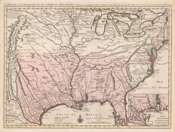
Covens (Jean) & Mortier (Cornelius), Louisiana and the Mississippi River, 1730 (c.)£ 3,450.00
-
Herman Moll, Florida and Louisiana, 1750 c.£ 1,250.00
-
Jacques-Nicolas Bellin, Florida and Louisiana coast, 1764£ 4,950.00
-
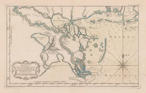
Jacques-Nicolas Bellin, The Mississippi and Red Rivers, 1764£ 650.00
-
Jacques-Nicolas Bellin, Mouth of the Mississippi River, 1764£ 1,250.00
-
Jacques-Nicolas Bellin, Mouth of the Mississippi River, 1764£ 495.00
-
London Magazine, Louisiana, as formerly claimed by France, 1765£ 375.00
-
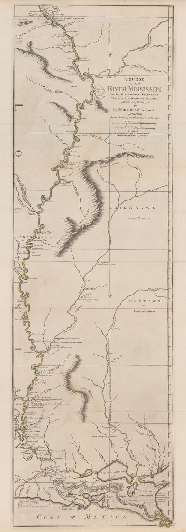
Gentleman's Magazine, Coastal chart from the Mississippi to Pensacola Bay, 1772£ 495.00
-
-
Thomas Jefferys, The Coast of West Florida and Louisiana, 1775£ 1,250.00
-
Francois Santini, Louisiana, Florida and the Carolinas, 1776£ 985.00
-
Southern United States just after the signing of the Declaration of Independence, 1778Antonio ZattaSeries: VeniceAntonio Zatta, Southern United States just after the signing of the Declaration of Independence, 1778£ 545.00
-
-
A Map of the States of Virginia, North Carolina, South Carolina and Georgia, 1795Joseph PurcellSeries: EdinburghJoseph Purcell, A Map of the States of Virginia, North Carolina, South Carolina and Georgia, 1795£ 1,925.00
-
Jean-Baptiste Poirson, Texas, Louisiana, Alabama, Mississippi, Florida and Georgia, 1807£ 2,500.00
-
Aaron Arrowsmith & Samuel Lewis, Louisiana, 1812£ 875.00
-
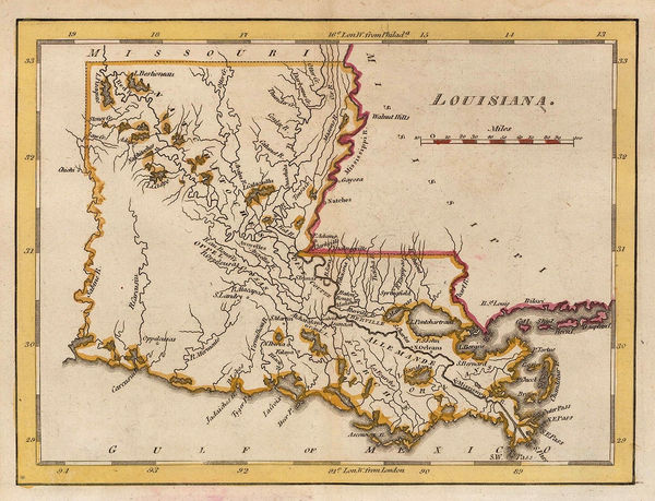
Matthew Carey, Louisiana, 1813£ 245.00
-
Matthew Carey, Louisiana, 1818£ 1,450.00
-
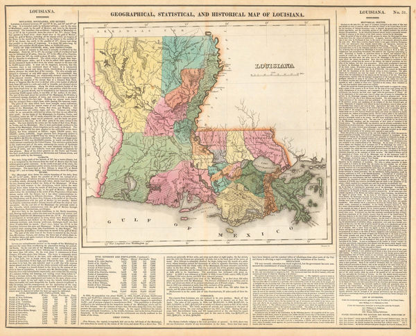
Carey & Lea, Geographical, Statistical and Historical map of Louisiana, 1822£ 1,750.00
-
John Cary, South-eastern United States, 1825£ 1,675.00
-
Philippe Vandermaelen, Mississippi and Alabama, 1827£ 650.00
-
Map - Illustrating the plan of the defences of the Western & North-Western Frontier, 1837Washington HoodSeries: Washington, D.C.Washington Hood, Map - Illustrating the plan of the defences of the Western & North-Western Frontier, 1837£ 625.00
-
Samuel Augustus Mitchell, Southeastern United States, 1839£ 145.00
-
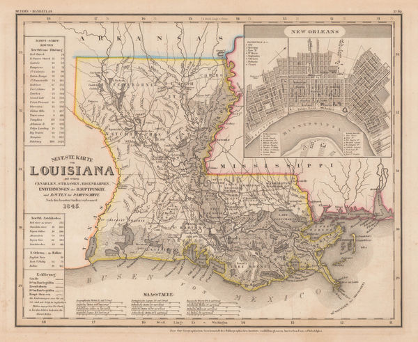
Joseph Meyer, Louisiana and New Orleans, 1845£ 325.00
-
Samuel Augustus Mitchell, A New Map of Louisiana, 1847£ 395.00
-
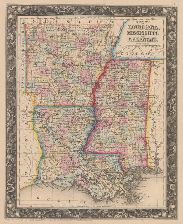
Samuel Augustus Mitchell, County Map of Louisiana, Mississippi and Arkansas, 1860£ 145.00
-
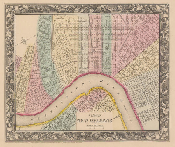
Samuel Augustus Mitchell, Plan of New Orleans, 1860£ 225.00
-
Map Illustrating the plan of the defences of the Western & North Western Frontier, 1861Washington HoodSeries: PhiladelphiaWashington Hood, Map Illustrating the plan of the defences of the Western & North Western Frontier, 1861£ 525.00
-
Joseph Hutchins Colton, Louisville and New Orleans, 1861£ 295.00
-
Joseph Hutchins Colton, Louisiana, 1862£ 245.00
-
Charles Magnus, Civil War Panorama of the Mississippi River, 1863 (c.)£ 950.00
-
Johnson & Ward, Johnson's Arkansas, Mississippi and Louisiana, 1866£ 295.00
-
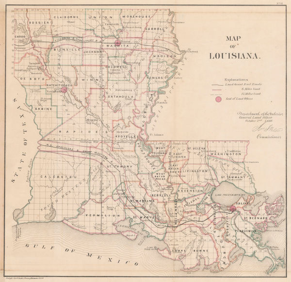
General Land Office (GLO), Louisiana, 1866£ 475.00
-
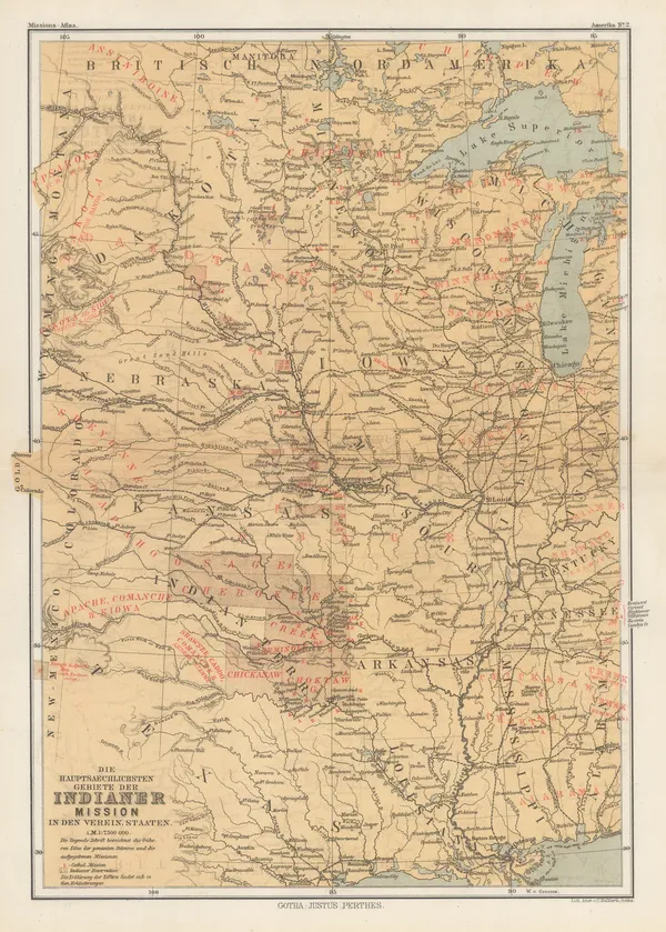
Justus Perthes, Indigenous Map of Central and Midwest USA, 1871£ 125.00
-
Society for the Diffusion of Useful Knowledge (SDUK), North America, 1879£ 195.00
-
O.W. Gray & Son, Louisiana, 1881£ 395.00
-
County Map of the States of Arkansas, Mississippi and Louisiana, 1882Samuel Augustus MitchellSeries: PhiladelphiaSamuel Augustus Mitchell, County Map of the States of Arkansas, Mississippi and Louisiana, 1882£ 160.00
-
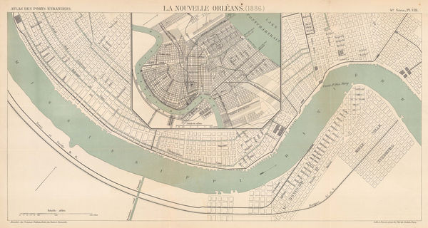
A. Simon, Chart of New Orleans harbour, 1886£ 345.00
-
Arbuckle Brothers Company, Louisiana, 1889£ 125.00
-
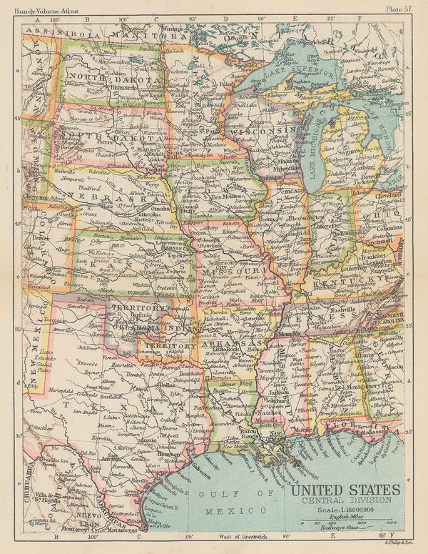
George Philip & Son Ltd., United States - Central Division, 1896£ 36.00
-
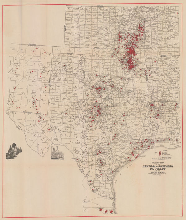
F.E. Gallup, Map of the Central-Southern Oil Fields, 1920£ 3,450.00
-
A. H. Guillot and L. J. Adam, New Orleans, 1929£ 875.00
-
British Admiralty, Cape San Blas to Vermilion Bay, 1942£ 750.00
-
Dore Ogrizek, Louisiana, 1946£ 75.00
Louisiana
Our entire inventory of over 10,000 antique and vintage maps is now available to browse by region, date, cartographer, and subject