-

-
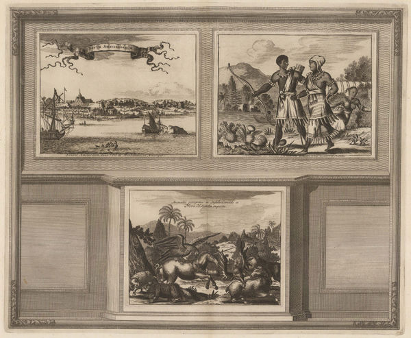
Giuseppe Maria Terreni, New York Harbour, 1763£ 1,150.00
-
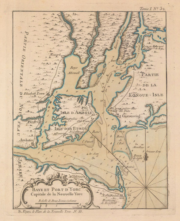
Jacques-Nicolas Bellin, New York Bay, 1764£ 975.00
-
Jacques-Nicolas Bellin, St Lawrence River and Lake Champlain , 1764£ 445.00
-
Jacques-Nicolas Bellin, The Earliest Obtainable Map of New York City, 1764£ 3,750.00
-
Revolutionary War map of New York island north of Harlem, 1777Gabriel Nikolaus RaspeSeries: NurembergGabriel Nikolaus Raspe, Revolutionary War map of New York island north of Harlem, 1777£ 2,850.00
-
A Plan of the Operations of the King's Army under the Command of Sir William Howe in New York and East New Jersey, 1793Charles StedmanSeries: LondonCharles Stedman, A Plan of the Operations of the King's Army under the Command of Sir William Howe in New York and East New Jersey, 1793£ 2,750.00
-
Charles Stedman, Sketch of General Grants Position on Long Island, 1793£ 1,250.00
-
Laurie & Whittle, Chart of the Entrance of Hudson's River, 1794£ 3,750.00
-
John Luffman, New York, 1810 c.£ 545.00
-
Joseph Meyer, New York City, 1844£ 845.00
-
Samuel Augustus Mitchell, City of New-York, 1845 c.£ 695.00
-
Joseph Hutchins Colton, Map of New York with Adjacent Cities, 1857£ 825.00
-
D.T. Valentine, Map of the City & County of New York, 1860£ 875.00
-
James Miller, New York City Map, 1860 (c.)£ 1,150.00
-
Society for the Diffusion of Useful Knowledge (SDUK), New York, 1860 c.£ 595.00
-
Archibald Fullarton, New York Harbour and Vicinity, 1860 c.£ 85.00
-
Matthew Dripps, New York City , 1863£ 2,750.00
-
Matthew Dripps, New York City & Vicinity, 1865£ 2,450.00
-
Joseph Shannon, Map of New York City, 1868£ 1,750.00
-
Map of the Upper Part of the Island of Manhattan above eighty-sixth street arranged to illustrate the Battle of Harlem Heights, 1868Joseph ShannonJoseph Shannon, Map of the Upper Part of the Island of Manhattan above eighty-sixth street arranged to illustrate the Battle of Harlem Heights, 1868£ 395.00
-
-
Alvin J. Johnson, New York and Brooklyn, 1872 c£ 825.00
-
Citizens & Travelers Guide Map in, to, and from the City of New York and Adjacent Places, 1877D.A. EdsallSeries: New YorkD.A. Edsall, Citizens & Travelers Guide Map in, to, and from the City of New York and Adjacent Places, 1877£ 1,450.00
-
Arthème Fayard, New York, 1880 c.£ 275.00
-
W. & A.K. Johnston, New York - City (Lower Part), 1884£ 125.00
-
W. & A.K. Johnston, New York - City and Vicinity, 1884£ 125.00
-
A. Simon, New-York (1886), 1886£ 745.00
-
Henry William Blair, New York City's Drinking Problem, 1888£ 1,250.00
-
Brooks Bank Note Co., New Map of New York City, 1890 c.£ 625.00
-
Rand McNally, New Map of New York City, 1900 (c.)£ 375.00
-
New Map, with compliments of the Broadway Central Hotel, 1900 c.Tilly HaynesSeries: Springfield, Mass.Tilly Haynes, New Map, with compliments of the Broadway Central Hotel, 1900 c.£ 175.00
-
Karl Baedeker, Vicinity of New York, 1909£ 58.00
-
Karl Baedeker, Brooklyn, 1909£ 98.00
-
C.S. Hammond & Co., A Guide to Jewish New York, 1912 c.£ 1,950.00
-
Redfield-Kendrick Odell Co., Sunrise Trails on Long Island, 1926£ 545.00
-
Hagstrom Co. Inc., New York and Routes to the New York World's Fair, 1939£ 325.00
-
Ernest Dudley Chase, Pictorial Map of Manhattan, 1939£ 1,800.00
-
Hagstrom Co. Inc., New York World's Fair by Subway and Automobile, 1939£ 495.00
-
Hagstrom Co. Inc., Map of New York Theatres, Hotels, Shopping District, 1940 c£ 495.00
-
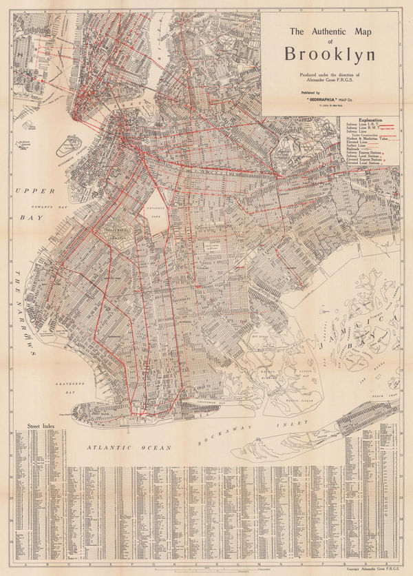
Geographia Map Co., The Authentic Map of Brooklyn, 1942£ 1,350.00
-
The Seamen's Bank for Savings: Rapid Transit map of Greater New York, 1943General Drafting Co.Series: New YorkGeneral Drafting Co., The Seamen's Bank for Savings: Rapid Transit map of Greater New York, 1943£ 325.00
-
Dore Ogrizek, The Shopper's New York, 1946£ 75.00
-
Air France, Air France Postcard - 'Amerique du Nord', 1946 c.£ 250.00
-
Alexander Gross, New York, 1950 (c.)£ 600.00
-
Nils Hansell, The Wonders of New York, 1955 c.£ 2,950.00
-
Hagstrom's Map of New York Financial District and Manhattan Civic Center, 1957Hagstrom Co. Inc.Series: New YorkHagstrom Co. Inc., Hagstrom's Map of New York Financial District and Manhattan Civic Center, 1957£ 425.00
-
Herman Bollman, New York, 1962£ 650.00
-
Geographia Map Co., Visitor's Guide to New York, 1963£ 375.00
-
C&E Research and Design Co., "Hi-Spots" of Greenwich Village New York, 1964 c.£ 550.00
-
Lewis J. Nesterman, Nester's New York City Maps, 1965 c.£ 325.00
New York City
Our entire inventory of over 10,000 antique and vintage maps is now available to browse by region, date, cartographer, and subject