-
 Robert de Vaugondy, West coast of North America, 1772£ 695.00
 -
Antonio Zatta, Alaska, the Pacific Northwest, and the Bering Strait, 1776£ 1,250.00
-
Jacques-Nicolas Bellin, North Pacific, Alaska & the Bering Strait, 1795 c£ 3,450.00
-
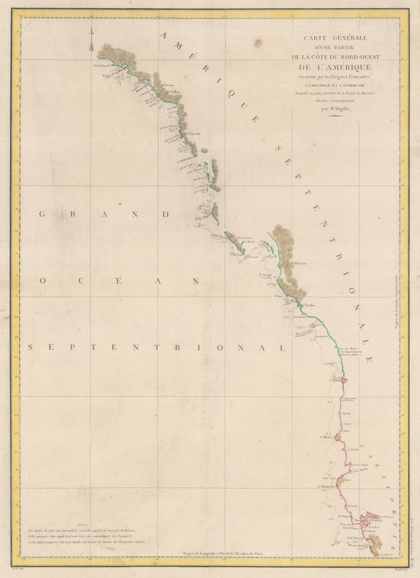
Comte de la Perouse's voyage, western coast of North America, 1797Jean Francois de La PerouseSeries: ParisJean Francois de La Perouse, Comte de la Perouse's voyage, western coast of North America, 1797£ 675.00
-
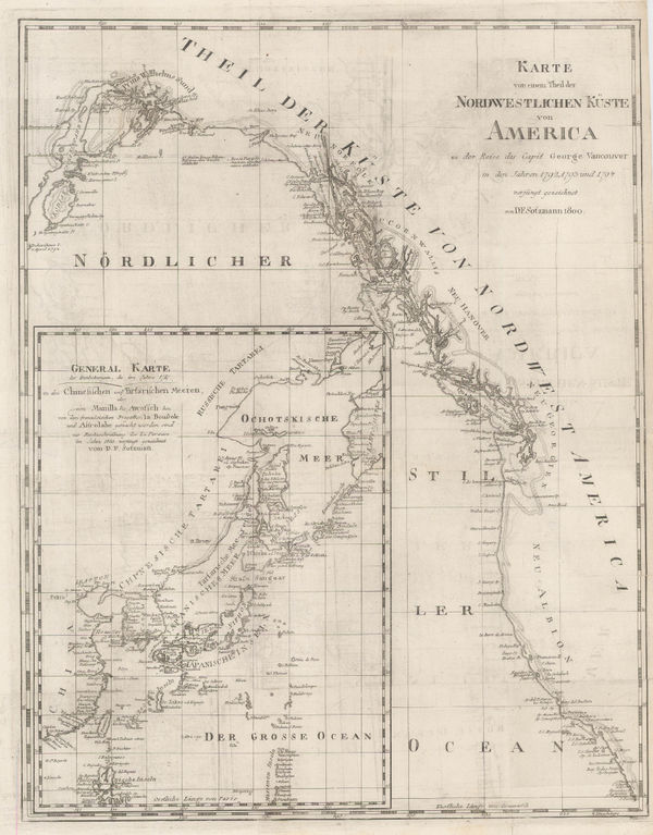
Daniel Friedrich Sotzmann, North West Pacific coast of America, 1800£ 795.00
-
Philippe Vandermaelen, Coast of Oregon and Washington State, 1827£ 2,450.00
-
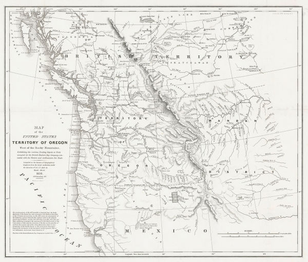
Washington Hood, Territory of Oregon West of the Rocky Mountains, 1838£ 2,450.00
-
-
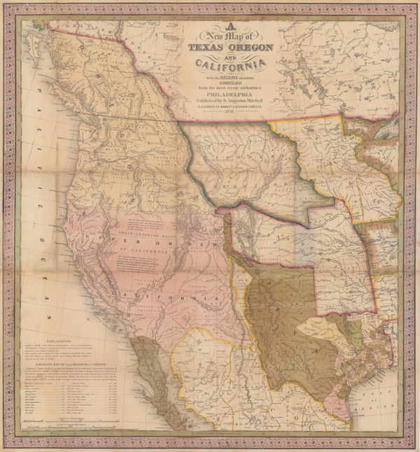
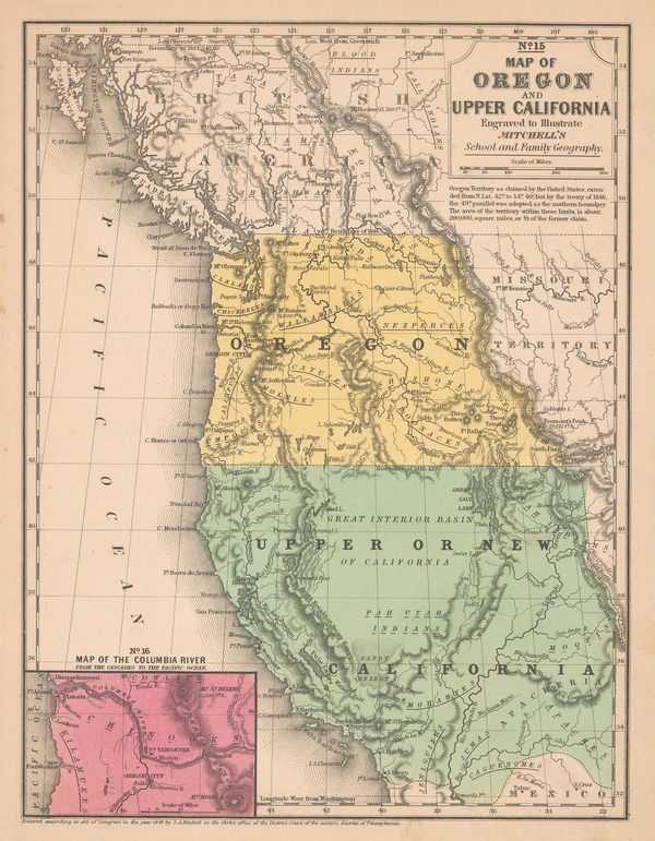
Samuel Augustus Mitchell, Map of Oregon and Upper California, 1847 (c.)£ 1,150.00
-
-
Carl Flemming, California, Oregon, Utah and New Mexico, 1857£ 395.00
-
Archibald Fullarton, Oregon and California, 1860 c.£ 265.00
-
Roswell C. Smith, Civil War-Era Map of the Western US, 1861£ 745.00
-
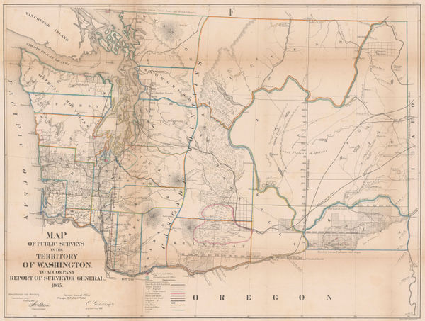
General Land Office (GLO), Map of the Public Surveys of the Territory of Washington, 1866£ 1,450.00
-
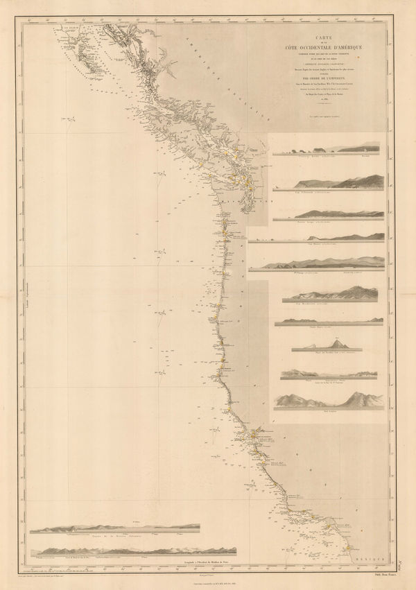
French Admiralty, Chart of the west coast of North America, 1881£ 825.00
-
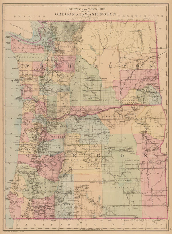
Samuel Augustus Mitchell, County and Township Map of Oregon and Washington, 1884£ 225.00
-
H.R. Page & Co., Washington Territory, 1886£ 850.00
-
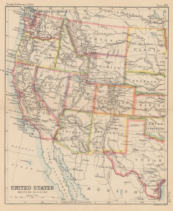
John Bartholomew, United States Western Division, 1887£ 62.00
-
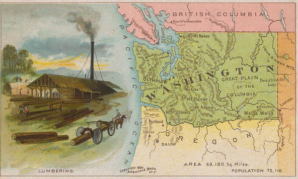
Arbuckle Brothers Company, Washington, 1889£ 225.00
-
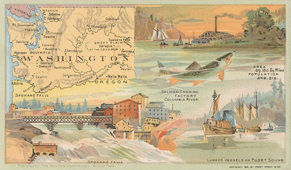
Perry Mason & Co., Washington, 1891£ 195.00
-
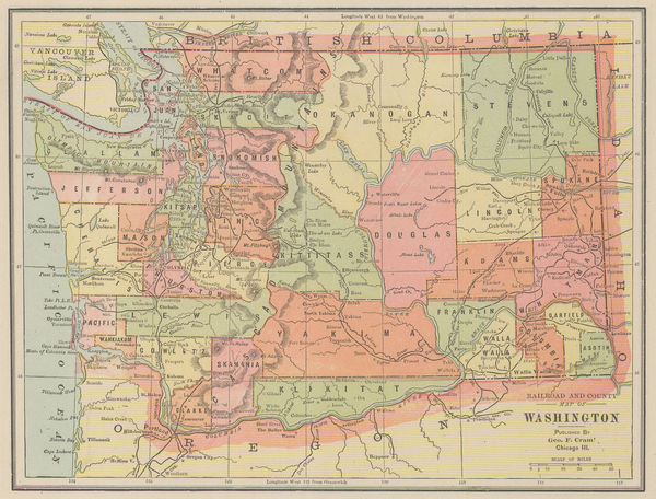
Eugenia & Henry Goff, Railroad and County Map of Washington, 1893£ 36.00
-
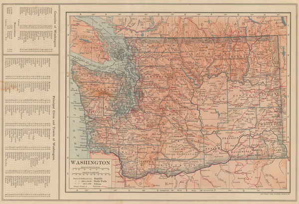
George Cram, Washington, 1897£ 225.00
-
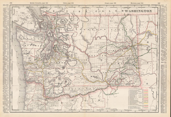
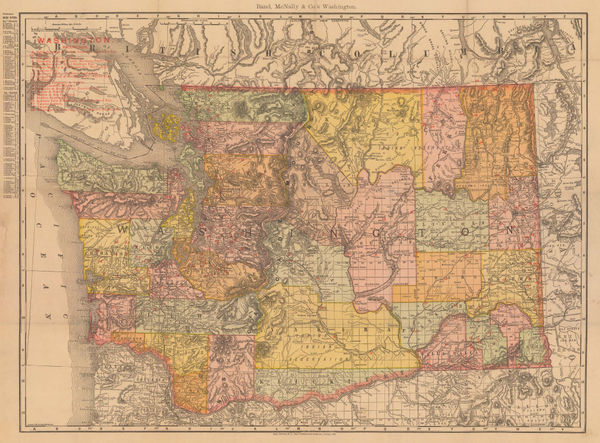
Rand, McNally & Co., Washington, 1900£ 400.00
-
British Admiralty, Sea Chart of Seattle & Tacoma, 1902£ 1,950.00
-
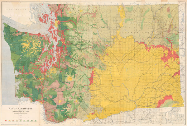
George Howard Plummer, Timber Map of Washington State, 1902£ 2,750.00
-
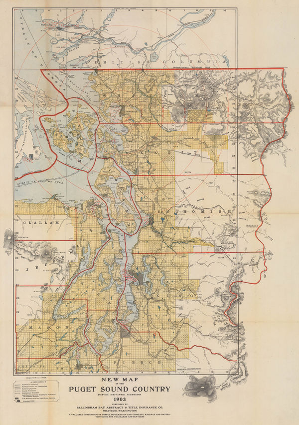
New Map of the Puget Sound Country - Seattle, 1903Bellingham Bay Abstract & Title Insurance Co.Series: WashingtonBellingham Bay Abstract & Title Insurance Co., New Map of the Puget Sound Country - Seattle, 1903£ 1,950.00
-
Rand, McNally & Co., Washington, 1903£ 445.00
-
Dodd, Mead & Co., Washington, 1906£ 95.00
-
O.P. Anderson, Map of Puget Sound Country, 1910£ 2,750.00
-
Clason Map Co., Clason's Guide Map of Washington, 1914 c.£ 195.00
-
Kroll Map Co., Guide Map to Seattle, 1930 c.£ 725.00
-
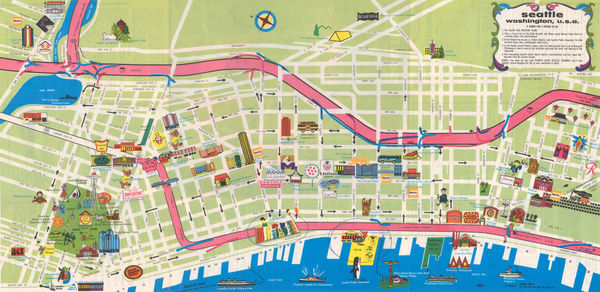
Tourmap Company, Seattle, 1970£ 95.00
Washington
Our entire inventory of over 10,000 antique and vintage maps is now available to browse by region, date, cartographer, and subject