-
 Capt. James Cook, James Cook's Map of New South Wales & Queensland, 1774£ 1,250.00
 -
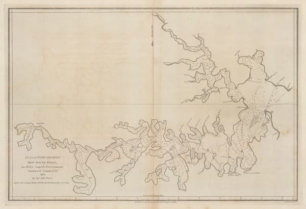
John Stockdale, Plan of Port Jackson, New South Wales, 1789£ 1,250.00
-
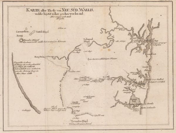
Franz Anton Schraembl, Rare, very early map of Port Jackson and environs, 1795£ 825.00
-
Louis-Claude de Freycinet, Port Jackson and Sydney Harbour, 1811£ 4,950.00
-
-
Matthew Flinders, Sea Chart from Brisbane to Port Macquarie, 1814£ 3,500.00
-
Philippe Vandermaelen, The colony of New South Wales, 1827£ 985.00
-
Justus Perthes, New South Wales, 1828£ 395.00
-
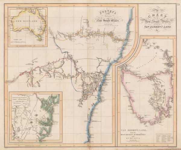
John Thomson, New South Wales and Tasmania, 1828£ 1,250.00
-
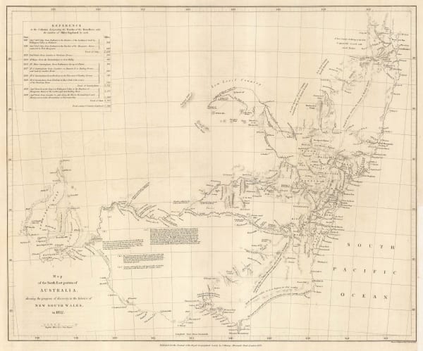
Royal Geographical Society (RGS), New South Wales and South Eastern Australia, 1832£ 795.00
-
Justus Perthes, Southeastern Australia, 1834£ 375.00
-
Rest Fenner, Colony of New South Wales, 1836£ 125.00
-
Society for the Diffusion of Useful Knowledge (SDUK), New South Wales, 1844£ 395.00
-
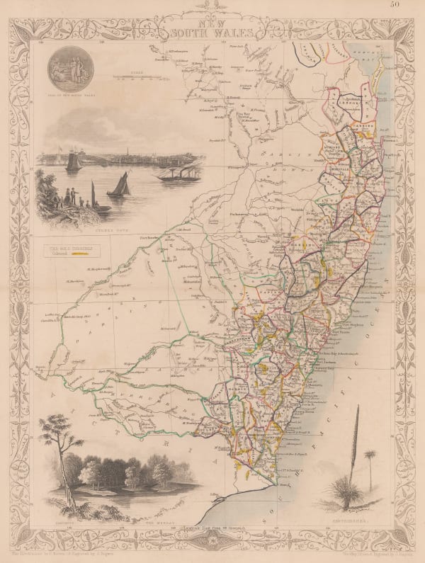
John Tallis, New South Wales, 1851£ 385.00
-
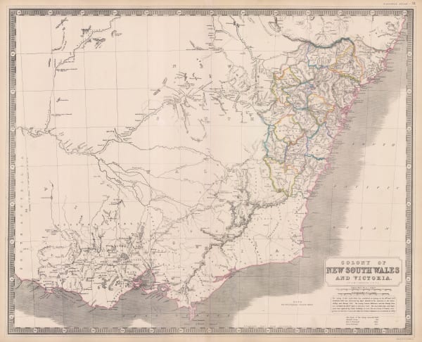
Alexander Keith Johnston, New South Wales and Victoria, 1858 c.£ 495.00
-
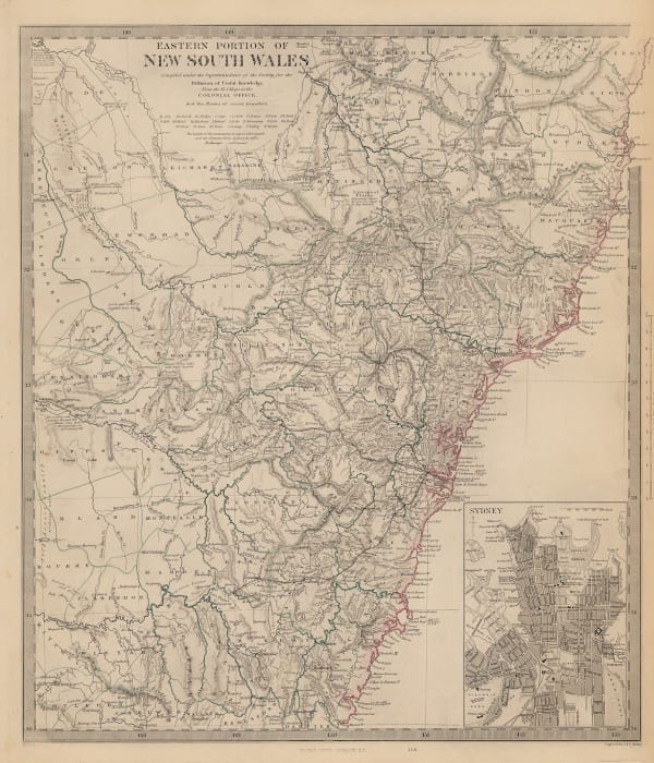
Royal Geographical Society (RGS), Expeditions in Search of Burke and Wills, 1863£ 1,250.00
-
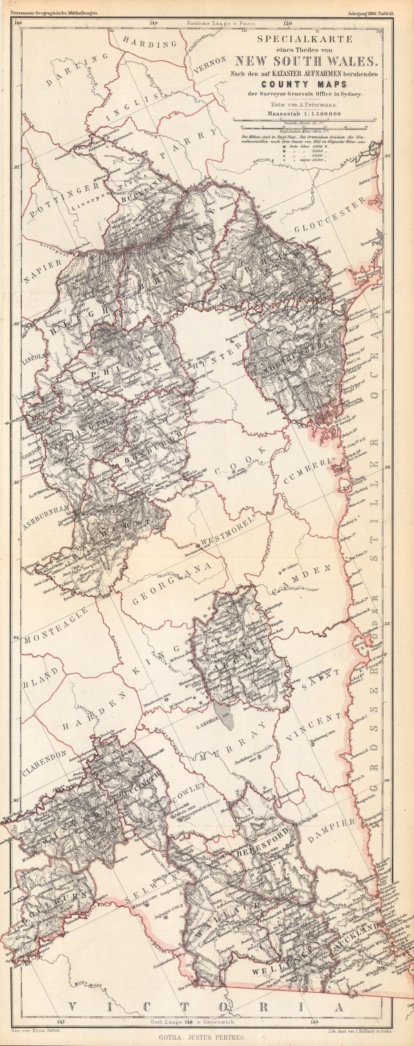
Justus Perthes, New South Wales, 1867£ 88.00
-
Thomas Richards, Mineral and Gold deposits, New South Wales, 1876£ 885.00
-
Society for the Diffusion of Useful Knowledge (SDUK), New South Wales, 1879£ 345.00
-
Letts & Son, Northern New South Wales & Southern Queensland, 1892£ 66.00
-
Edward Fisher Pittman, Geological Map of New South Wales, 1914£ 1,450.00
-
Dept. of Lands, Sydney and South eastern New South Wales, 1932£ 425.00
-
Dept. of Lands, North eastern New South Wales, 1938£ 325.00
-
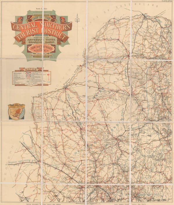
Dept. of Lands, North central New South Wales, 1939£ 225.00
-
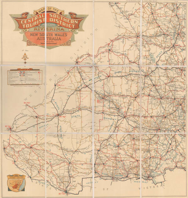
Dept. of Lands, South central New South Wales, 1940£ 295.00
New South Wales
Our entire inventory of over 10,000 antique and vintage maps is now available to browse by region, date, cartographer, and subject