-
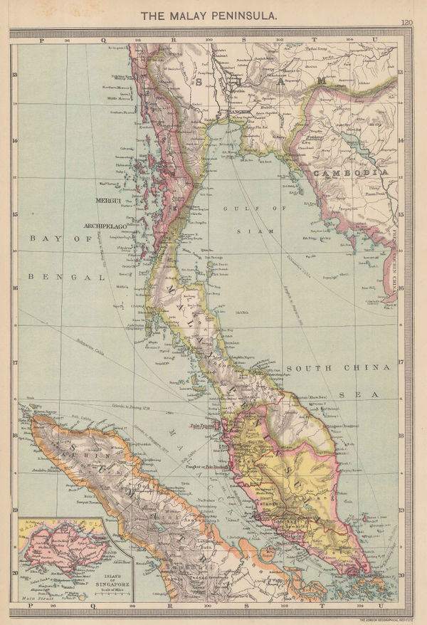
 Royal Geographical Society (RGS), Malay Peninsula, Thailand, 1898£ 180.00
 -
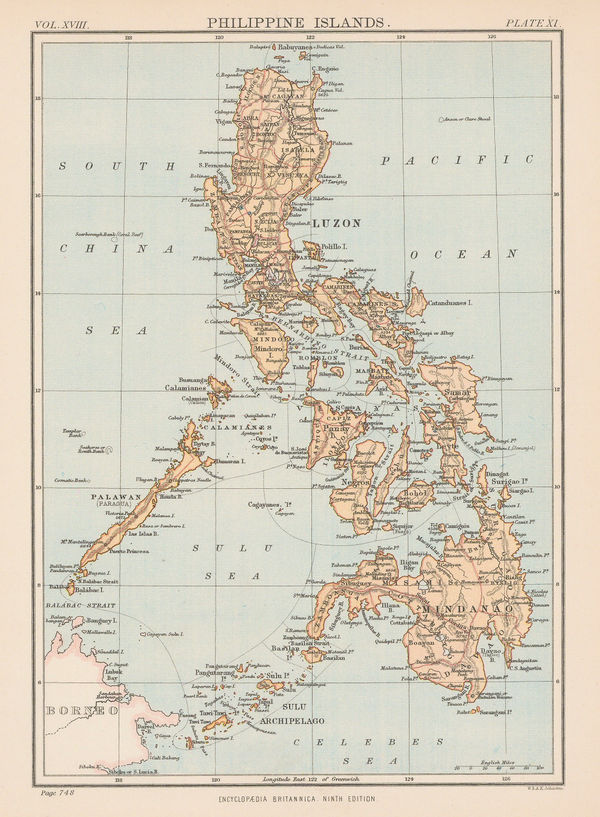
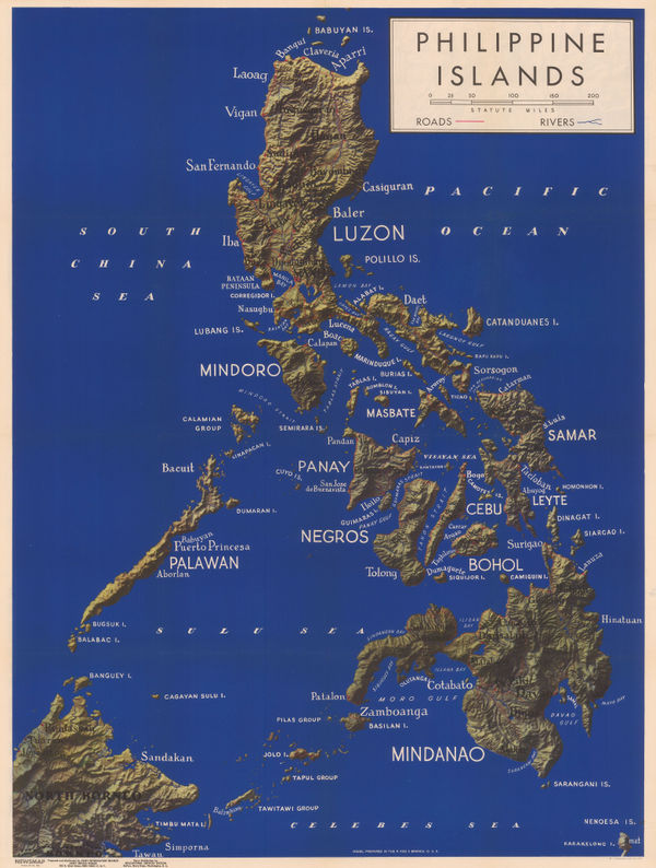
W. & A.K. Johnston, The Philippines, 1898£ 85.00
-
Map of the Baram District, Sarawak, Northern Borneo, 1900Royal Geographical Society (RGS)Series: LondonRoyal Geographical Society (RGS), Map of the Baram District, Sarawak, Northern Borneo, 1900£ 1,150.00
-
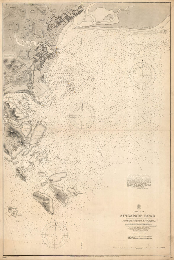
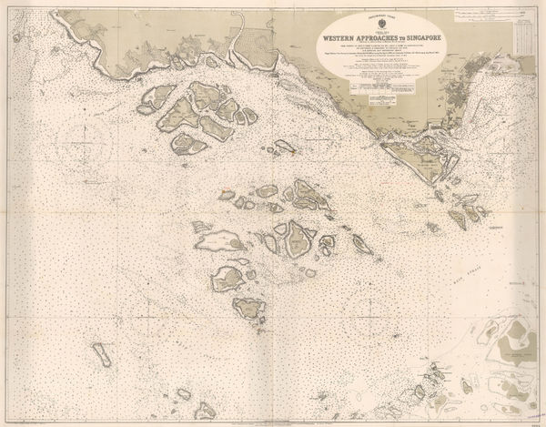
British Admiralty, Singapore Sea Chart, 1900£ 3,750.00
-
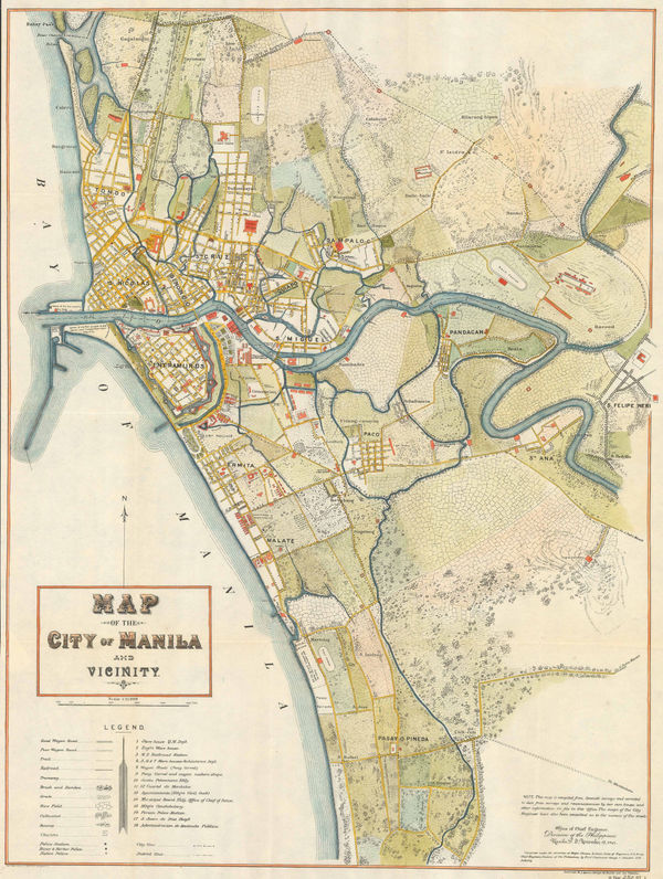
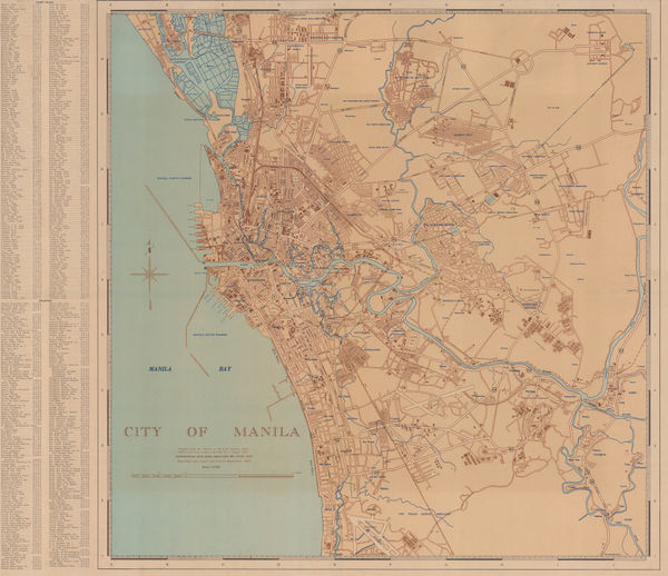
George F. Stewart, Map of the City of Manila and Vicinity, 1901£ 2,450.00
-
-
Emil Reich, Campaigns in India 1802-1852, 1903£ 62.00
-
Edward Stanford, Borneo, 1904£ 345.00
-
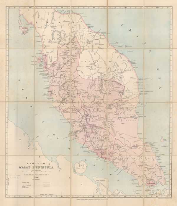
Edward Stanford, A Map of the Malay Peninsula, 1906£ 1,250.00
-
John Bartholomew & Co., Rangoon (Yangon), 1909£ 85.00
-
Edward Stanford, A Map of the British Territories in Malaysia, 1909£ 825.00
-
The Financial Times Map showing the position of the Rubber Estates in British Malaya, 1910 (c.)The Financial TimesSeries: LondonThe Financial Times, The Financial Times Map showing the position of the Rubber Estates in British Malaya, 1910 (c.)£ 950.00
-
George Philip & Son Ltd., The Malay Peninsula, 1910 c.£ 195.00
-
-
Edward Stanford, Large scale map of Myanmar (Burma) , 1912£ 295.00
-
Official Tourist Bureau (OTB), Vintage tourist map of Java, 1918£ 165.00
-
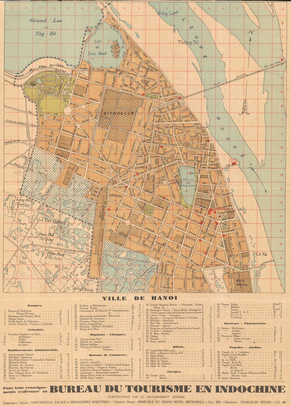
Anonymous, Hanoi, 1920£ 1,650.00
-
Survey Dept. F.M.S., Wall map of the Malaysian Peninsula and Singapore, 1921£ 1,650.00
-
John Bartholomew, India & Southeast Asia - Political, 1922£ 145.00
-
British Admiralty, Malacca Straits, 1923£ 1,150.00
-
British Admiralty, Singapore Sea Chart, 1924£ 3,250.00
-
British Admiralty, Anamba Islands, 1927£ 325.00
-
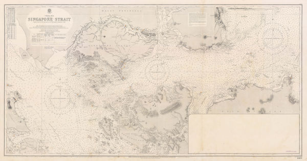
British Admiralty, Singapore Strait Sea Chart, 1927£ 3,950.00
-
War Office, Indonesia and New Guinea, 1928£ 875.00
-
Fed. Malay States, Folding map of the Malay Peninsula, 1929£ 675.00
-
Geographia Ltd., Indonesia, Borneo, Brunei, and the Philippines, 1930 (c.)£ 195.00
-
Alexander Gross, Thailand, Malaysia, Laos, Cambodia and Vietnam, 1930 c.£ 625.00
-
British Admiralty, Bassein River to Pulo Penang, 1932£ 1,550.00
-
British Admiralty, Gulf of Siam, 1932£ 2,850.00
-
Dutch Topographical Service, Vintage map of Eastern Java and Bali, 1932£ 925.00
-
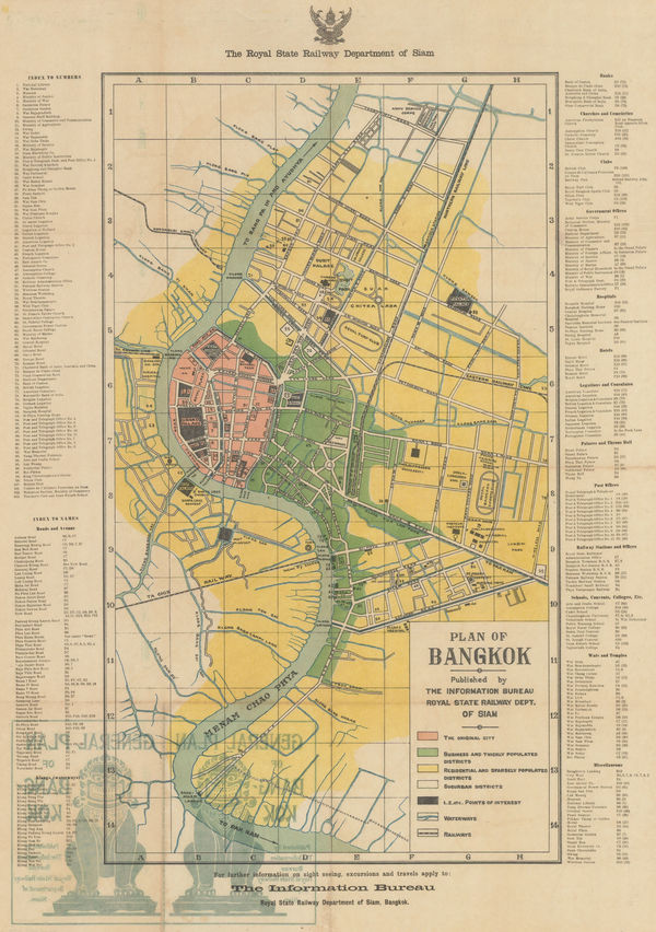
Siam Railways, Bangkok, 1932£ 895.00
-
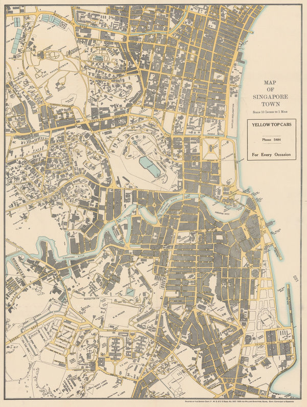
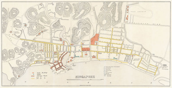
A.C. Willis, Map of Singapore Town, 1935£ 2,000.00
-
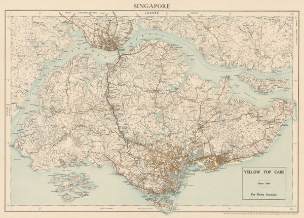
A.C. Willis, Map of Singapore, 1935£ 2,500.00
-
MacDonald Gill, A Great Industry - Where Our Tea Comes From, 1937£ 4,950.00
-
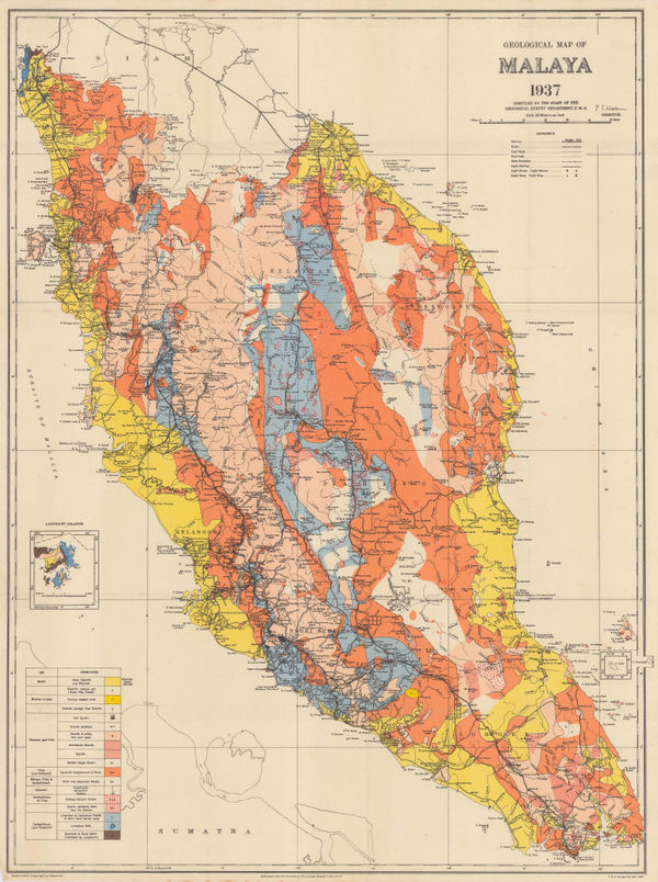
Fed. Malay States, Geological map of the Malay Peninsula, 1937£ 695.00
-
Service géographique de l'Indochine, Vintage archaeological map of the Angkor region, Cambodia, 1939£ 3,250.00
-
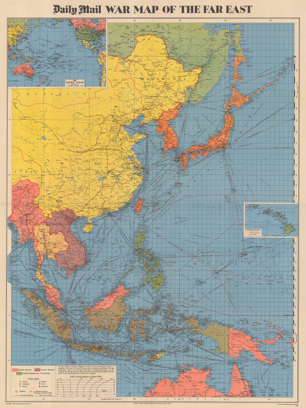
Edward Stanford, Map of the Far East, 1941£ 1,450.00
-
Miyahara Takeo, The Natural Resources of Thailand, 1941£ 750.00
-
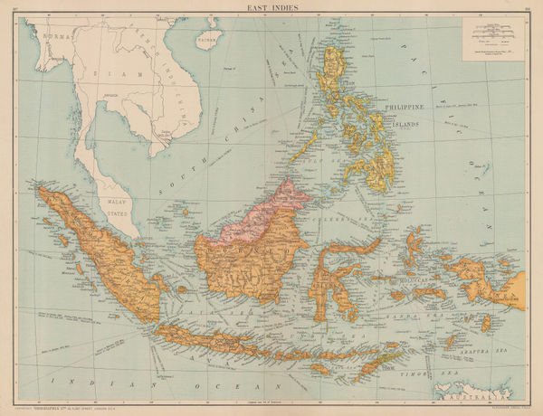
Geographical Section, General Staff (GSGS), WW2 Map of the East Indies, 1942£ 450.00
-
US Army, Philippine Islands, 1944£ 980.00
-
George Philip & Son Ltd., WW2 Map of the Far East, 1944£ 495.00
-
War Office, Myanmar (Burma) and western Thailand, 1944£ 450.00
-
Survey of India, Bangkok, 1944£ 495.00
-
National War Front, WW2 Map of the Pacific Theatre, 1944 c.£ 485.00
-
US Army, City of Manila, 1945£ 625.00
-
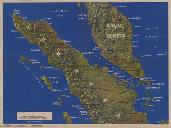
WW2-era terrain map of the Malay Peninsula, Singapore, and Sumatra, 1945US GovernmentSeries: New YorkUS Government, WW2-era terrain map of the Malay Peninsula, Singapore, and Sumatra, 1945£ 575.00
-
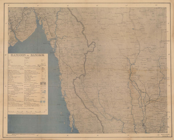
War Office, Yangon (Rangoon) to Bangkok, 1945£ 245.00
-
-
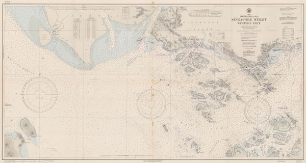
United States Hydrographic Office, Singapore Strait Sea Chart, 1945£ 1,250.00
-
Allied Land Forces South East Asia (ALFSEA), WWII map of southwest Malaysia, 1945£ 295.00
-
Survey of India, Port Dickson, 1945£ 125.00
-
-
USAFFE, Central Manila, 1946 c£ 495.00
-
-
Service géographique de l'Indochine, Cambodia, Laos and Vietnam (French Indochina), 1948£ 625.00
-
Air France, Air France Postcard - Extréme Orient, 1949 c.£ 250 (framed)
-
-
-
Havas, Ho Chi Minh City (Saigon), 1950£ 3,500.00
-
Jules Moniot, Singapore, 1950 c£ 545.00
-
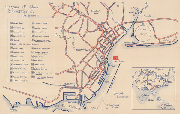
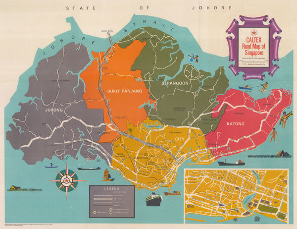
Anonymous, Main Thoroughfares in Singapore, 1950 c.£ 675.00
-
Automobile Association of Malaya, Kuala Lumpur, 1951£ 95.00
-
Automobile Association of Malaya, Penang Town, 1951£ 85.00
-
Automobile Association of Malaya, Ipoh, 1951£ 65.00
-
Automobile Association of Malaya, Seremban, 1951£ 65.00
-
Peter Kents, Penang, 1951£ 325.00
-
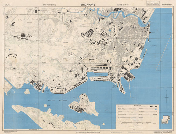
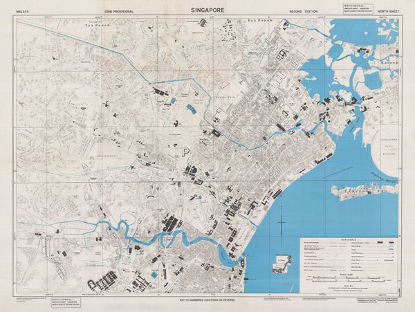
Survey Dept. F.M.S., City of Singapore, 1952£ 1,450.00
-
Service géographique de l'Indochine, Cambodia, Laos and Vietnam (French Indochina), 1954£ 650.00
-
Survey Dept. Malaya, Singapore & Johore Bahru, 1954£ 2,750.00
-
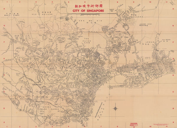
Singapore Improvement Trust (SIT), 新加坡市街詳圖 City of Singapore, 1955£ 4,250.00
-
Bureau of Tourist Promotion (Thailand), Vintage travel poster of Thailand, 1955 (c.)£ 2,500.00
-
LPE, Ltd., Kuala Lumpur, 1956£ 145.00
-
LPE, Ltd., Road Map of Singapore, 1956£ 1,450.00
-
LPE, Ltd., Road Map of West Malaysia, 1956£ 1,150.00
-
British Admiralty, Chart of Koh Kood (Koh Kut) and Koh Chang, Gulf of Thailand, 1957£ 345.00
-
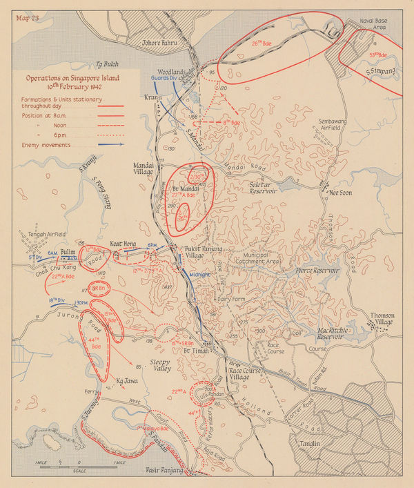
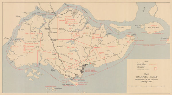
Operations on Singapore Island 10th February 1942, 1957Her Majesty's Stationery Office (HMSO)Series: LondonHer Majesty's Stationery Office (HMSO), Operations on Singapore Island 10th February 1942, 1957£ 295.00
-
Her Majesty's Stationery Office (HMSO), WWII battle plan of Selangor, 1957£ 145.00
-
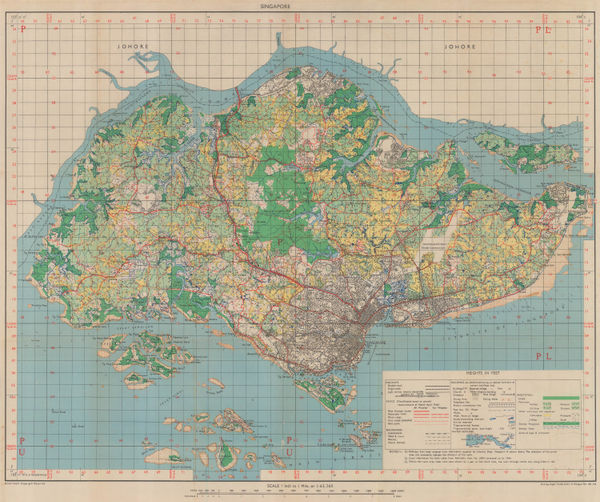
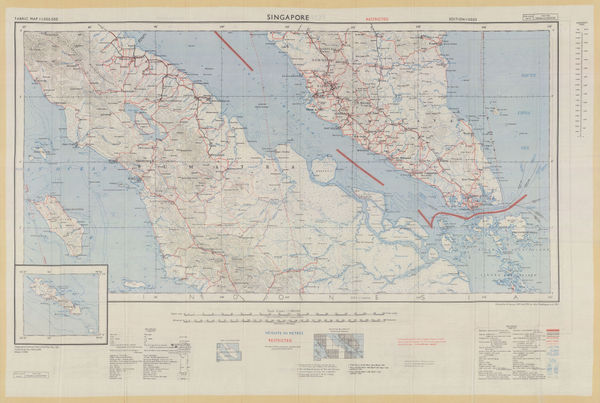
Singapore and Southern Malay Peninsula, 1957Geographical Section, General Staff (GSGS)Series: LondonGeographical Section, General Staff (GSGS), Singapore and Southern Malay Peninsula, 1957£ 595.00
-
Her Majesty's Stationery Office (HMSO), WW2 Map of Singapore Island, 1957£ 425.00
-
Her Majesty's Stationery Office (HMSO), WW2 Map of Malaysia, 1957£ 195.00


Page
4
of 5