-
 J.G. Bartholomew, West Bengal and Sikkim, 1909£ 75.00
 -
Uttar Pradesh and Uttarakhand (The United Provinces of Agra and Oudh), 1909J.G. BartholomewSeries: EdinburghJ.G. Bartholomew, Uttar Pradesh and Uttarakhand (The United Provinces of Agra and Oudh), 1909£ 68.00
-
John Bartholomew & Co., Railways of Northeast India & Bengal, 1909£ 125.00
-
John Bartholomew & Co., The Indian Empire and Surrounding Countries, 1909£ 95.00
-
John Bartholomew & Co., Principal Economic Minerals of India, 1909£ 95.00
-
John Bartholomew & Co., Railway Map of India, 1909£ 68.00
-
John Bartholomew & Co., Railways of South India & Sri Lanka, 1909£ 95.00
-
John Bartholomew & Co., Nepal & Part of Tibet, 1909£ 125.00
-
John Bartholomew & Co., Afghanistan, 1909£ 95.00
-
John Bartholomew & Co., Northwest Pakistan & Kashmir, 1909£ 78.00
-
John Bartholomew & Co., Gujarat & Sindh , 1909£ 68.00
-
John Bartholomew & Co., Western India & Maharashtra, 1909£ 74.00
-
John Bartholomew & Co., Karachi, 1909£ 125.00
-
John Bartholomew & Co., Lahore, 1909£ 125.00
-
John Bartholomew & Co., Delhi, 1909£ 125.00
-
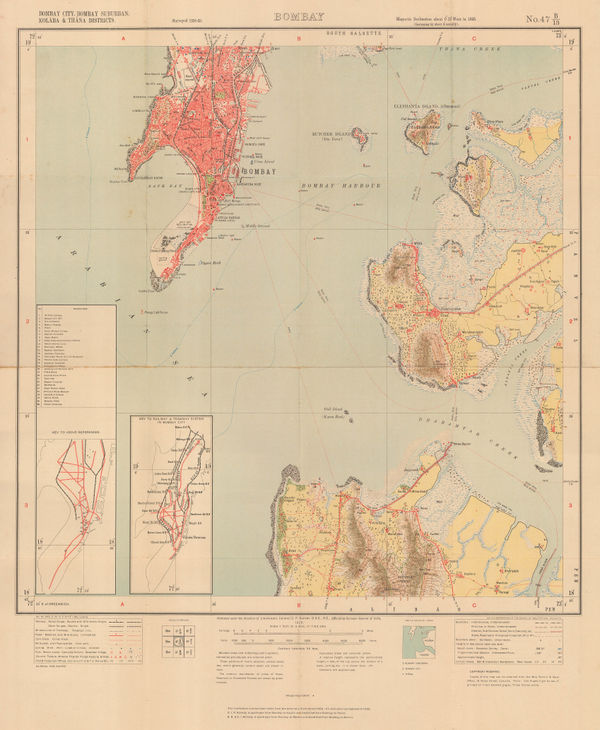
John Bartholomew & Co., City of Bombay (Mumbai), 1909£ 125.00
-
John Bartholomew & Co., Environs of Bombay (Mumbai), 1909£ 95.00
-
R.S. Templeton, Sri Lanka (Ceylon), 1910£ 850.00
-
W. Thacker & Co., Reduced Survey Map of India, 1910£ 885.00
-
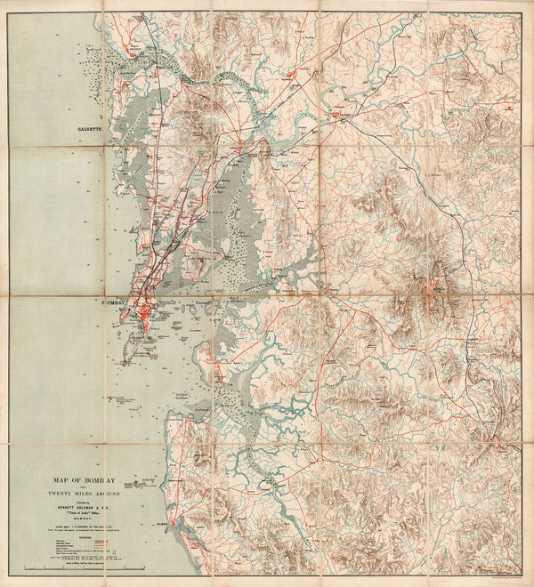
Bennett Coleman & Co, Mumbai (Bombay) and environs, 1910 c.£ 1,150.00
-
Archibald Constable, Murree, 1910 c.£ 36.00
-
John Murray, Ooty (Ootacamund), 1910 c.£ 26.00
-
Edward Stanford, Sri Lanka (Ceylon), 1911£ 275.00
-
Marcel Couttreau & H. le Chartier, Sri Lanka, 1911£ 68.00
-
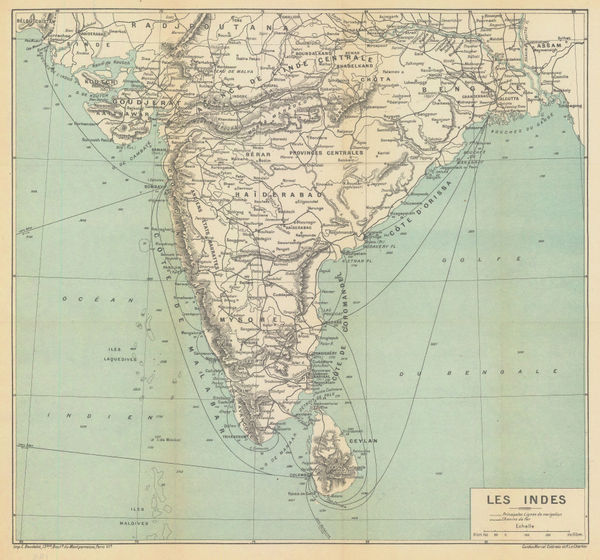
Marcel Couttreau & H. le Chartier, India & Sri Lanka, 1911£ 75.00
-
Cottreau & Le Chartier, M & H., Mumbai (Bombay), 1911£ 88.00
-
E. Baudelot, Small plan of Kandy, 1911£ 75.00
-
D.G. Hatchell, Kurnool District map for the use of Touring Officers, 1912£ 495.00
-
D.G. Hatchell, South Canara District Map for the use of Touring Officers, 1912£ 495.00
-
Survey of India, Railway, Canal, and Road Map of India, 1912£ 3,600.00
-
John Murray, Agra and Environs, 1913 c.£ 55.00
-
British Admiralty, Karachi Harbour, 1914£ 2,500.00
-
Part of the North-Eastern Frontier and Tibet showing the routes of Captains Morshead and Bailey 1913, 1914Royal Geographical Society (RGS)Series: LondonRoyal Geographical Society (RGS), Part of the North-Eastern Frontier and Tibet showing the routes of Captains Morshead and Bailey 1913, 1914£ 285.00
-
D.G. Hatchell, Malabar District Map for the use of Touring Officers, 1916£ 495.00
-
Survey of India, India and Adjacent Countries - Baroda, 1917£ 795.00
-
W.C.S. Ingles, Motoring map of Sri Lanka (Ceylon), 1920£ 750.00
-
John Murray, Fort of Gwalior, 1920£ 38.00
-
John Murray, Lucknow Intrenched Position of the British Garrison, 1920£ 48.00
-
Survey of India, The Himalaya Mountains and Surrounding Regions, 1920£ 4,450.00
-
George Philip & Son Ltd., India, 1920 (c.)£ 275.00
-
George Philip & Son Ltd., Commercial Map of the Indian Empire, 1920 (c.)£ 2,500.00
-
Alexander Gross, North West India, Pakistan & Afghanistan, 1920 c£ 425.00
-
Map Showing the Position of the Rubber Estates in South India and Ceylon, 1920 c.The Financial TimesSeries: LondonThe Financial Times, Map Showing the Position of the Rubber Estates in South India and Ceylon, 1920 c.£ 495.00
-
British Admiralty, Chart of the Island of Ceylon with the Adjacent Coast of India, 1922£ 3,450.00
-
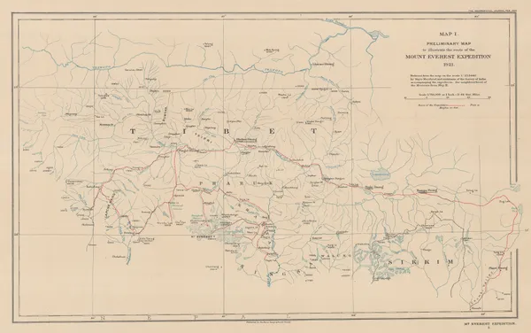
Preliminary Map to Illustrate the Route of the Mount Everest Expedition, 1922Royal Geographical Society (RGS)Series: LondonRoyal Geographical Society (RGS), Preliminary Map to Illustrate the Route of the Mount Everest Expedition, 1922£ 675.00
-
Royal Geographical Society (RGS), The Geology of the Mount Everest Region, 1922£ 675.00
-
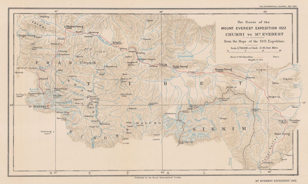
The Route of the Mount Everest Expedition 1922, Chumbi to Mt. Everest from the maps of the 1921 Expedition, 1922Royal Geographical Society (RGS)Series: LondonRoyal Geographical Society (RGS), The Route of the Mount Everest Expedition 1922, Chumbi to Mt. Everest from the maps of the 1921 Expedition, 1922£ 675.00
-
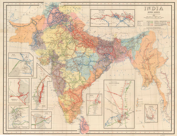
John Bartholomew, India & Southeast Asia - Political, 1922£ 145.00
-
-
Geographical Section, General Staff (GSGS), Bannu and Dera Ismail Khan Divisions, 1923£ 545.00
-
Survey of India, Kolkata (Calcutta), 1925£ 825.00
-
Edward Stanford, Colombo, 1925 c.£ 68.00
-
Madras Survey, Map of the Madras Presidency Showing the Roads & Distances, 1926£ 950.00
-
Plan of Anuradhapura and Environs shewing Ancient Ruins, 1926Ceylon Survey DepartmentSeries: AnuradhapuraCeylon Survey Department, Plan of Anuradhapura and Environs shewing Ancient Ruins, 1926£ 645.00
-
Alexander's Campaign on Indian North-West Frontier, 1927Royal Geographical Society (RGS)Series: LondonRoyal Geographical Society (RGS), Alexander's Campaign on Indian North-West Frontier, 1927£ 145.00
-
Survey of India, Tourist map of Delhi, 1927£ 1,450.00
-
Survey of India, Road Map of India (excluding Burma), 1930£ 495.00
-
Edward Stanford, Vintage guide map of Mumbai (Bombay), 1930 (c.)£ 95.00
-
Edward Stanford, P&O Ports of Call - Colombo, 1930 (c.)£ 85.00
-
John Murray, Varanasi (Benares), 1930 c.£ 48.00
-
Survey of India, Lahore and environs, 1931£ 585.00
-
Survey of India, Mumbai (Bombay), 1932£ 950.00
-
Survey of India, India Showing Railways, 1932£ 475.00
-
John Murray, Prayagraj (Allahabad), 1933£ 38.00
-
John Murray, Vijayapura (Bijarpur), 1933£ 28.00
-
John Murray, Kanpur (Cawnpore), 1933£ 45.00
-
John Murray, Darjeeling, 1933£ 24.00
-
John Murray, Nagpur, 1933£ 48.00
-
Macdonald Gill, Map of Ceylon showing its Tea Industry, 1933 c.£ 175.00
-
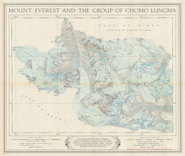
Ordnance Survey, Mount Everest and the Group of Chomo Lungma, 1934£ 1,500.00
-
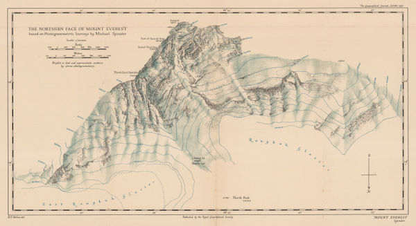
Royal Geographical Society (RGS), The Northern Face of Mount Everest, 1936£ 675.00
-
MacDonald Gill, A Great Industry - Where Our Tea Comes From, 1937£ 4,950.00
-
Edward Stanford, The Indian Ocean with Routes and Distances, 1937 c.£ 375.00
-
Survey of India, Sikkim, 1941£ 425.00
-
Survey of India, Road Map of India, 1942£ 375.00
-
Survey of India, Kolkata (Calcutta) and Howrah, 1943£ 785.00
-
T.S. Duraiswami Ayyar, Map of the Madras Presidency, 1943£ 495.00
-
Geographical Section, General Staff (GSGS), Road map of Sri Lanka (Ceylon), 1945£ 325.00
-
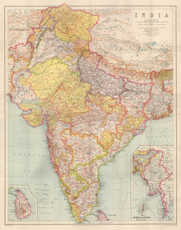
Alf Cooke Ltd., India, 1946 c.£ 2,950.00
-
John Murray, Bombay Island, 1949£ 175.00


Page
5
of 6