-
 Martin Waldseemüller & Laurent Fries, India, 1535£ 2,550.00
 -
Sebastian Münster, India, 1545£ 625.00
-
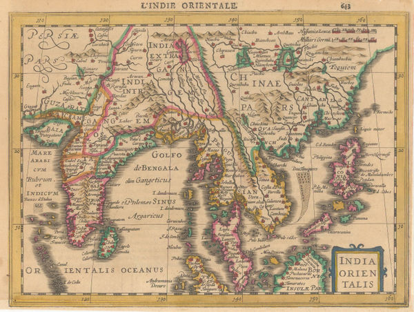
Mercator Hondius, India and Southeast Asia, 1630£ 825.00
-
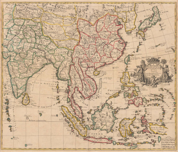
Important early map of India, Sri Lanka, Southeast Asia, and the Philippines, 1636 c.Mercator HondiusSeries: AmsterdamMercator Hondius, Important early map of India, Sri Lanka, Southeast Asia, and the Philippines, 1636 c.£ 2,950.00
-
Johann Christoph Wagner, Die Halb Insul Indiens, 1685£ 975.00
-
Pierre Mortier, Chart of the Indian Ocean, 1690 c.£ 3,450.00
-
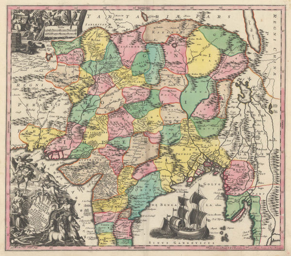
Vincenzo Coronelli, Impero Del Gran Mogol, 1692 c.£ 1,450.00
-
Penisola Dell' Indo Di Qua Del Gange E L'Isola di Ceilan Nell' Indie Orientali, 1696Vincenzo CoronelliSeries: VeniceVincenzo Coronelli, Penisola Dell' Indo Di Qua Del Gange E L'Isola di Ceilan Nell' Indie Orientali, 1696£ 995.00
-
Nicolas Sanson, L'Empire du Grand Mogol, 1700£ 640.00
-
Valk & Schenk, Magni Mogolis Imperium, 1700£ 1,400.00
-
-
Nicolas & Guillaume Sanson, T'Half Eilandt van Indien, 1705£ 325.00
-
John Senex, A New Map of India & China from the Latest Observations, 1721£ 2,850.00
-
Covens (Jean) & Mortier (Cornelius), Magni Mogolis Imperivm, 1730 c.£ 985.00
-
Homann Heirs, Malabar & Coromandel, 1733£ 765.00
-
Imperii Magni Mogolis sive Indici Padschah juxta recentissimas Navi gationaes accurata delineatio Geographica, 1740 c.Matthaus SeutterSeries: AugsburgMatthaus Seutter, Imperii Magni Mogolis sive Indici Padschah juxta recentissimas Navi gationaes accurata delineatio Geographica, 1740 c.£ 1,150.00
-
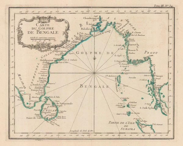
Jacques-Nicolas Bellin, Carte du Golphe de Bengale, 1747£ 345.00
-
Herman Moll, India proper or the Empire of the Great Mogul, 1750 c.£ 595.00
-
Carte des Côtes de Malabar et de Coromandel, 1757Covens (Jean) & Mortier (Cornelius)Series: AmsterdamCovens (Jean) & Mortier (Cornelius), Carte des Côtes de Malabar et de Coromandel, 1757£ 795.00
-
Jacques-Nicolas Bellin, Gulf of Bengal, 1764£ 245.00
-
Emanuel Bowen, India, Ceylon and part of South East Asia, 1766£ 975.00
-
Thomas Jefferys, The East Indies with the Roads, 1768£ 2,950.00
-
Willem Albert Bachiene, Ryk des Grooten Mogols en dier Indien, 1774£ 985.00
-
A General Map of Indostan or the Great Mogol's Empire with the Adjacent Countries, 1775Robert OrmeSeries: LondonRobert Orme, A General Map of Indostan or the Great Mogol's Empire with the Adjacent Countries, 1775£ 385.00
-
Jean Lattré, India, Sri Lanka & the Maldives, 1780 c.£ 785.00
-
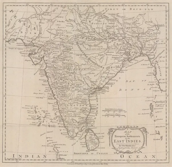
Thomas Kitchin, European Settlements in the East Indies, 1783£ 645.00
-
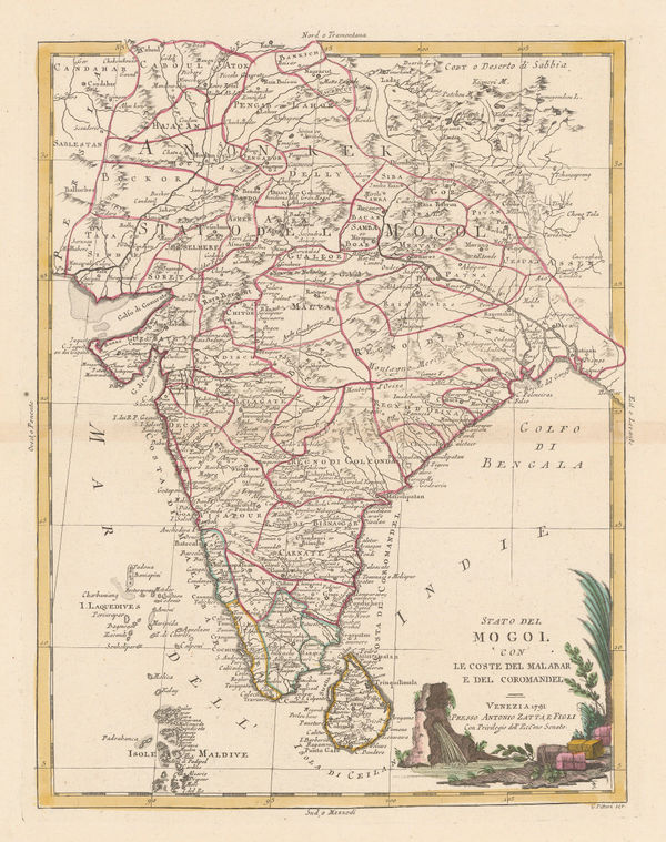
Antonio Zatta, Stato del Mogol, 1785£ 795.00
-
Charles Theodore Middleton, India and the East Indies, 1790 c.£ 325.00
-
William Faden, The Southern Countries of India from Madrass to Cape Comorin, 1791£ 3,950.00
-
James Rennell, Afghanistan, Pakistan, India and Turkestan, 1792£ 445.00
-
William Faden, India and Southeast Asia, 1798£ 175.00
-
John Walker, Hindoostan, or India, 1798£ 75.00
-
George Cooke, Hindoostan, 1800£ 325.00
-
-
Jean-Baptiste Poirson, India, 1803£ 525.00
-
-
India & the Middle East as it was known during the Classical Era, 1807Robert WilkinsonSeries: LondonRobert Wilkinson, India & the Middle East as it was known during the Classical Era, 1807£ 115.00
-
Aaron Arrowsmith & Samuel Lewis, Hindoostan, 1812£ 125.00
-
Aaron Arrowsmith, Map of Hindoostan, Drawn for Mill's History of British India, 1817£ 875.00
-
John Thomson, Northern India, Nepal & Afghanistan, 1817£ 495.00
-
Richard Phillips, Hindoostan, 1820£ 98.00
-
Charles Smith, Map of India Exhibiting its Present Political Divisions, 1835£ 695.00
-
Adrien Brue, Indian and Southeast Asia showing European colonial possessions, 1836£ 245.00
-
James Wyld, Map of the Countries lying between Turkey and Burmah, 1839£ 2,450.00
-
James Wyld, Map of India, 1843£ 2,250.00
-
-
John Arrowsmith, India, 1850 (c.)£ 850.00
-
W. & A.K. Johnston, India, 1850 c£ 495.00
-
Samuel Augustus Mitchell, Hindoostan, 1850 c.£ 225.00
-
Justus Perthes, Geological Map of India, 1855£ 145.00
-
Hansard, Railway and Cotton District Map of India, 1857£ 950.00
-
George Frederick Cruchley, India during the Mutinies, 1857£ 3,750.00
-
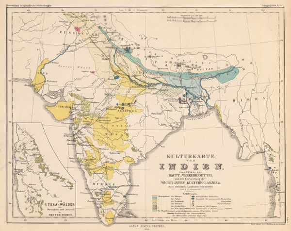
Justus Perthes, Commodity map of India, 1859£ 125.00
-
Auguste-Henri Dufour, Southeast Asia showing French and Portuguese Colonies, 1860£ 375.00
-
-
Heinrich C. Kiepert, India, 1867£ 395.00
-
Edward Stanford, Stanford's Portable Map of India, 1874£ 985.00
-
Survey of India, Preliminary Sketch of the Geology of India, 1877£ 1,750.00
-
The Graphic Magazine, The British and Russian Frontiers in Central Asia, 1879£ 95.00
-
Map of India shewing Railways open to traffic, under construction and under survey onm 31st March 1885, 1885Survey of IndiaSeries: LondonSurvey of India, Map of India shewing Railways open to traffic, under construction and under survey onm 31st March 1885, 1885£ 585.00
-
Henry Cuthbert Tunison, India, 1885 (c.)£ 125.00
-
George W. Bacon, India, 1885 (c.)£ 175.00
-
George W. Bacon, India, or Hindustan, 1885 (c.)£ 395.00
-
Royal Geographical Society (RGS), Map of the River Systems of South India, 1886£ 445.00
-
Edward Stanford, A New Map of the Civil Divisions of India, 1889£ 1,250.00
-
J.G. Bartholomew, India Prevailing Races, 1893£ 68.00
-
Edward Stanford, India, 1896£ 175.00
-
George W. Bacon, India, 1898£ 88.00
-
Arthur Cotton, Irrigation and Navigation Map of India, 1900£ 695.00
-
Survey of India, Railway System of India, 1902£ 585.00
-
Emil Reich, India in 1804, 1903£ 65.00
-
-
Edward Stanford, Stanford's Portable Map of India, 1908 (c.)£ 995.00
-
J.G. Bartholomew, India - Geological features, 1909£ 88.00
-
John Bartholomew & Co., The Indian Empire and Surrounding Countries, 1909£ 95.00
-
John Bartholomew & Co., Principal Economic Minerals of India, 1909£ 95.00
-
John Bartholomew & Co., Railway Map of India, 1909£ 68.00
-
W. Thacker & Co., Reduced Survey Map of India, 1910£ 885.00
-
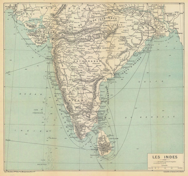
Marcel Couttreau & H. le Chartier, India & Sri Lanka, 1911£ 75.00
-
D.G. Hatchell, South Canara District Map for the use of Touring Officers, 1912£ 495.00


Page
1
of 2