-
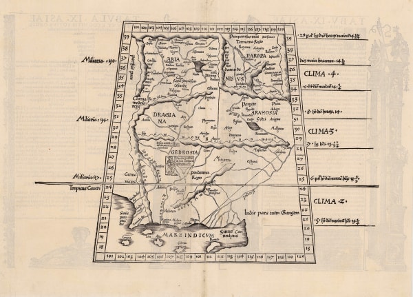
 Claudius Ptolemy, Rare woodcut map of Pakistan and Afghanistan, 1535£ 2,250.00
 -
Sebastian Münster, Pakistan & Afghanistan, 1552£ 575.00
-
James Rennell, Afghanistan, Pakistan, India and Turkestan, 1792£ 445.00
-
Alexandre Emile Lapie, The Middle East, 1831£ 495.00
-
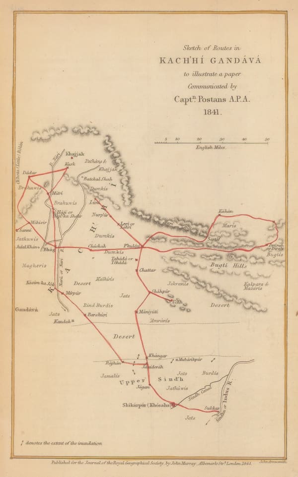
Royal Geographical Society (RGS), Sketch of Routes in Kachhi Gandava, 1844£ 76.00
-
William Houghton Allen & Co., The Punjab, Pakistan & Afghanistan, 1844£ 950.00
-
Society for the Diffusion of Useful Knowledge (SDUK), Punjab & the Sikh Empire, 1844£ 850.00
-
James Wyld, Sketch of the Battle of Chilleanwala, 1849£ 2,500.00
-
John Tallis, Cabool, The Punjab and Beloochistan, 1851£ 525.00
-
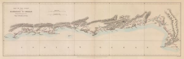
Royal Geographical Society (RGS), Map of the Coast from Kurrachee to Gwadur, 1863£ 335.00
-
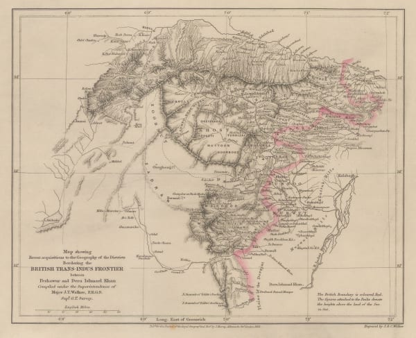
Map Showing Recent Acquisitions to the Geography of the Districts Bordering the British Trans-Indus Frontier between Peshawur and DeraIshmael Khan, 1863Royal Geographical Society (RGS)Series: LondonRoyal Geographical Society (RGS), Map Showing Recent Acquisitions to the Geography of the Districts Bordering the British Trans-Indus Frontier between Peshawur and DeraIshmael Khan, 1863£ 295.00
-
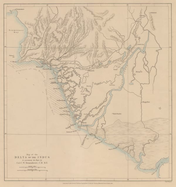
Royal Geographical Society (RGS), Indus River Delta, 1867£ 195.00
-
Sir H. Bartle. Frere's Notes on the Rann of Kutch, Pakistan, 1871Royal Geographical Society (RGS)Series: LondonRoyal Geographical Society (RGS), Sir H. Bartle. Frere's Notes on the Rann of Kutch, Pakistan, 1871£ 245.00
-
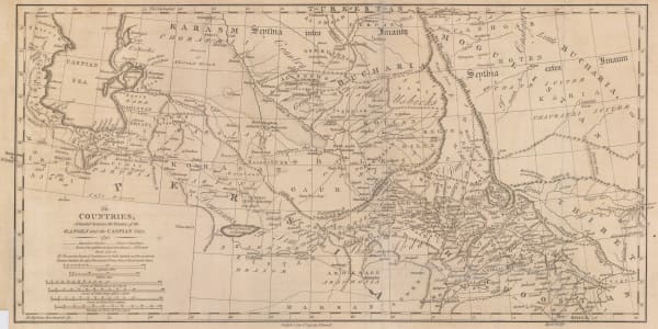
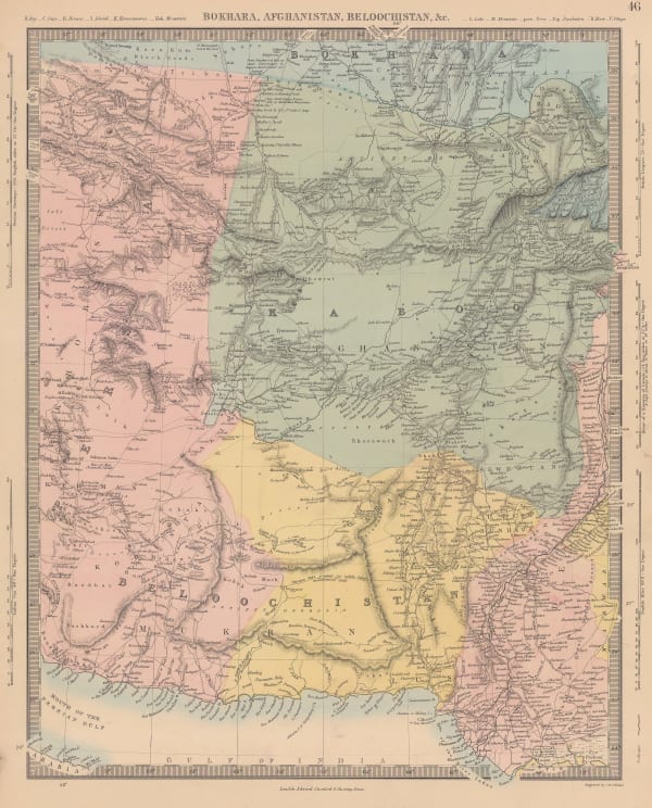
Bokhara, Afghanistan, Beloochistan, &c., 1875Society for the Diffusion of Useful Knowledge (SDUK)Series: LondonSociety for the Diffusion of Useful Knowledge (SDUK), Bokhara, Afghanistan, Beloochistan, &c., 1875£ 325.00
-
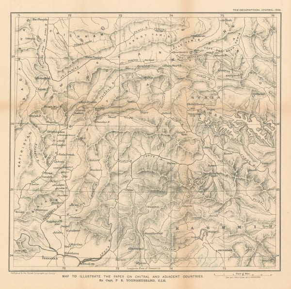
Map to Illustrate the Paper on Chitral and Adjacent Countries, 1895Royal Geographical Society (RGS)Series: LondonRoyal Geographical Society (RGS), Map to Illustrate the Paper on Chitral and Adjacent Countries, 1895£ 425.00
-
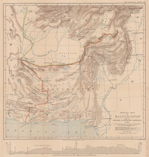
Sketch map of Beluchistan and its Afghan and Persian Borders, 1897Royal Geographical Society (RGS)Series: LondonRoyal Geographical Society (RGS), Sketch map of Beluchistan and its Afghan and Persian Borders, 1897£ 175.00
-
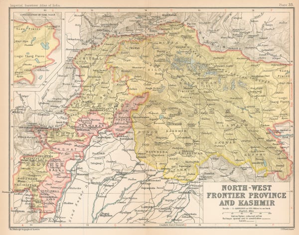
John Bartholomew & Co., Northwest Pakistan & Kashmir, 1909£ 78.00
-
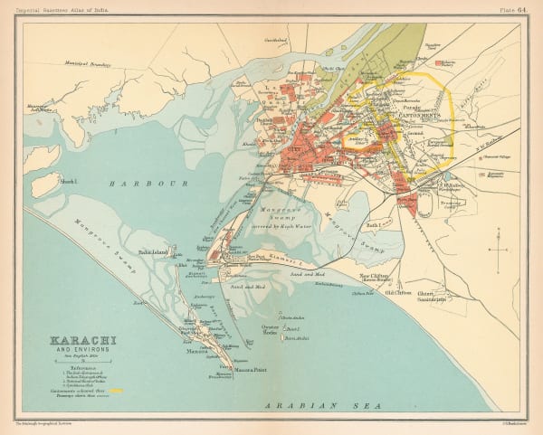
John Bartholomew & Co., Karachi, 1909£ 125.00
-
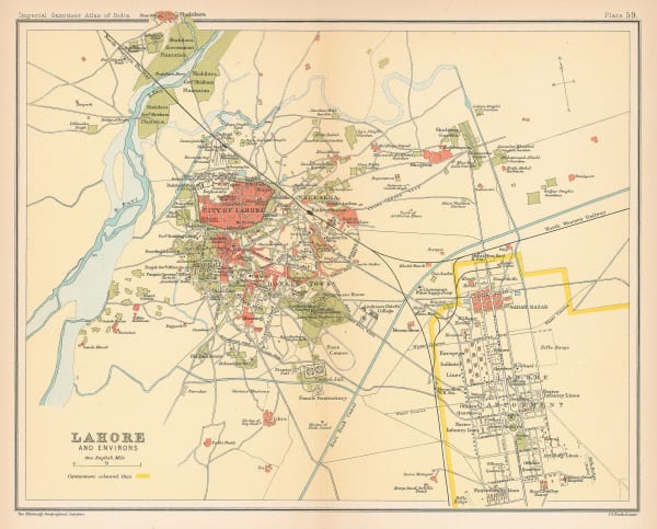
John Bartholomew & Co., Lahore, 1909£ 125.00
-
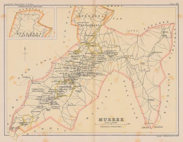
Archibald Constable, Murree, 1910 c.£ 36.00
-
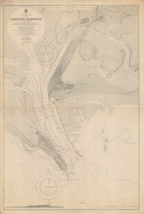
British Admiralty, Karachi Harbour, 1914£ 2,500.00
-
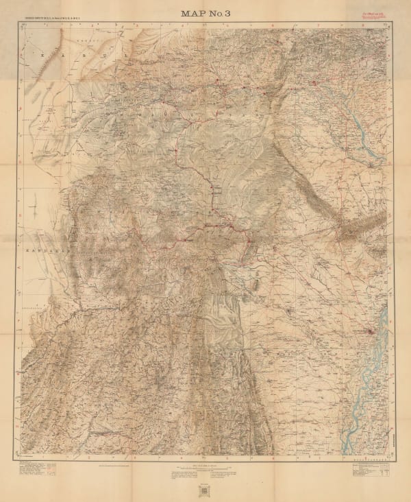
Geographical Section, General Staff (GSGS), Bannu and Dera Ismail Khan Divisions, 1923£ 545.00
-
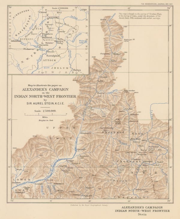
Alexander's Campaign on Indian North-West Frontier, 1927Royal Geographical Society (RGS)Series: LondonRoyal Geographical Society (RGS), Alexander's Campaign on Indian North-West Frontier, 1927£ 145.00
-
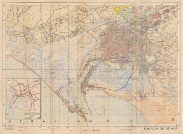
Survey of Pakistan, Karachi Guide Map, 1951£ 1,500.00
-
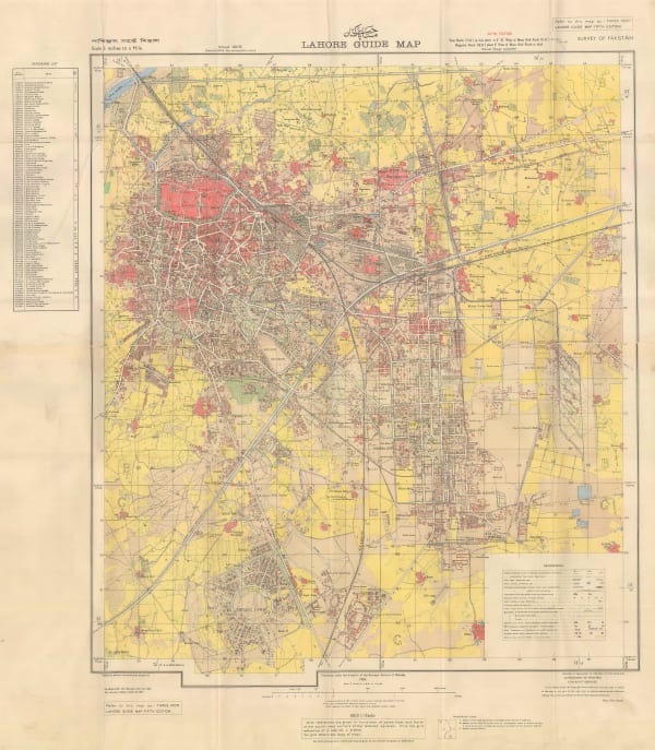
Survey of Pakistan, Lahore Guide Map, 1954£ 4,950.00
-
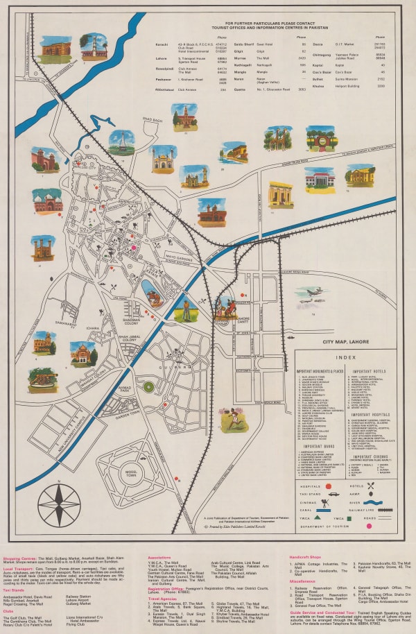
Pakistan Department of Tourism, Pakistan Lahore Tourist Map & Guide, 1960 c.£ 90.00
-
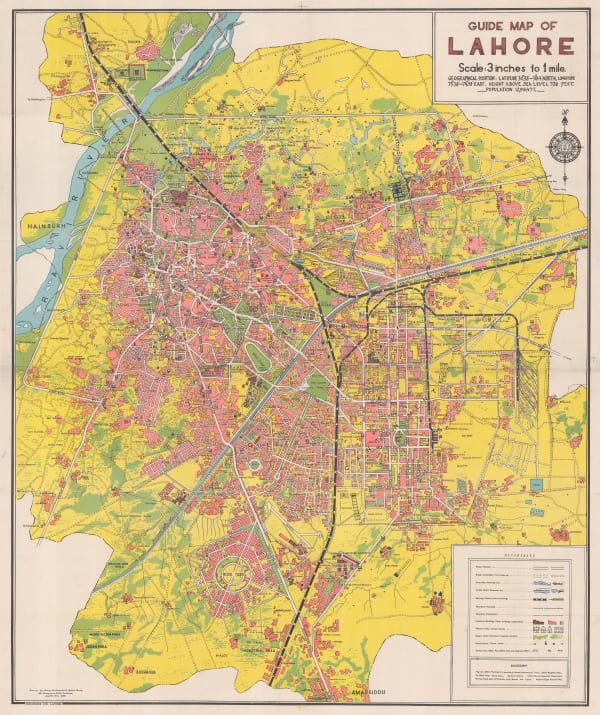
Ferozsons Ltd., Guide Map of Lahore, 1966£ 2,500.00
-
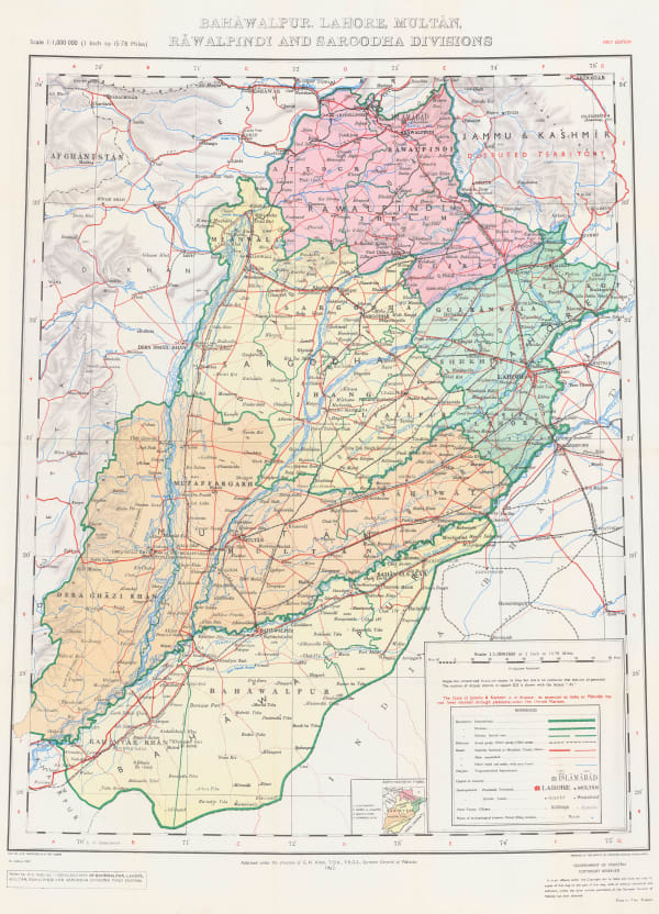
Survey of Pakistan, Bahawalpur, Lahore, Multan, Rawalpindi and Sarcodha, 1967£ 395.00
Pakistan
Our entire inventory of over 10,000 antique and vintage maps is now available to browse by region, date, cartographer, and subject