-
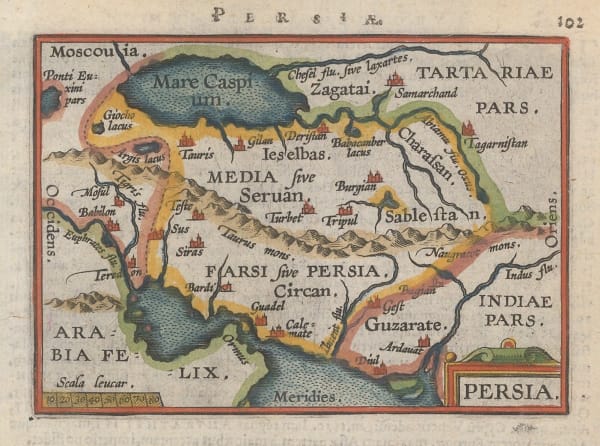
 Claudius Ptolemy & Laurent Fries, Ptolemaic woodcut map of Iran (Persia), 1541£ 3,250.00
 -
Sebastian Münster, Pakistan & Afghanistan, 1552£ 575.00
-
Abraham Ortelius, Persia, 1601£ 295.00
-
Samuel Purchas, Persian Empire (Iran), 1625£ 295.00
-
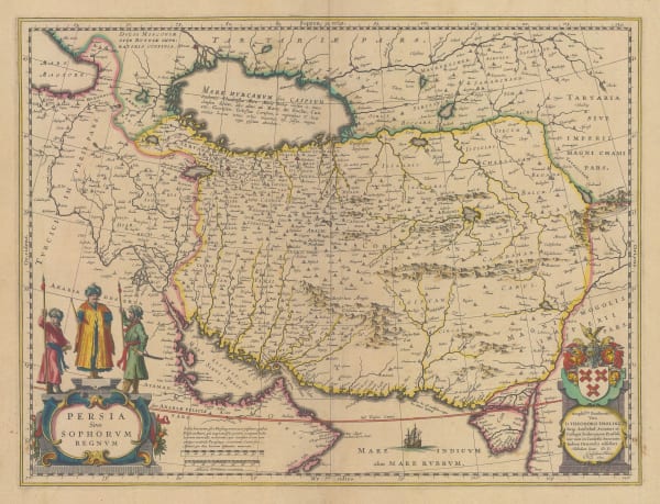
Willem & Jan Blaeu, Iran, 1634£ 1,450.00
-
Nicolas & Guillaume Sanson, Description de L' Empire du Sophi des Perses, 1658 c.£ 645.00
-
Jan Jansson, Persian Empire (Iran) during the Classical period, 1661£ 195.00
-
Adam Olearius, A Map of ye Province of Kilan as it lies on ye Caspian Sea, 1662Sold
-
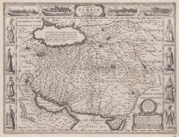
John Speed, The Kingdome of Persia, 1676£ 3,450.00
-
Alain Manesson Mallet, Iran, 1683£ 175.00
-
Robert Morden, Miniature map of Iran (Persia), 1688Sold
-
Pierre Duval, Persia, 1694£ 225.00
-
Pieter Schenk, Persian Empire (Iran), 1705 c£ 1,950.00
-
Pieter van der Aa, La Rade de Gammeron, 1714Sold
-
Johann Baptist Homann, Persian Empire, 1722 c£ 1,250.00
-
Covens (Jean) & Mortier (Cornelius), Persia, 1757£ 1,150.00
-
Jacques-Nicolas Bellin, The Persian Gulf, 1764£ 875.00
-
Tobias Conrad Lotter, Persia (Iran), 1765 c.£ 850.00
-
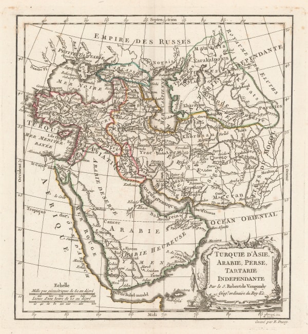
Robert de Vaugondy, West Asia & The Middle East, 1778£ 445.00
-
Francois Santini, The Persian Empire (Iran), 1779£ 595.00
-
John Cary, A New Map of Persia from the Latest Authorities, 1801£ 425.00
-
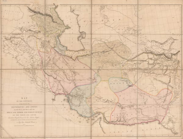
Aaron Arrowsmith, Monumental wall map of Iran, 1813£ 4,950.00
-
Daniel & William Lizars, Persia, 1820 c.£ 295.00
-
Carl Weiland, Iran, Afghanistan and Beludschistan, 1828£ 345.00
-
Alexandre Emile Lapie, The Middle East, 1831£ 495.00
-
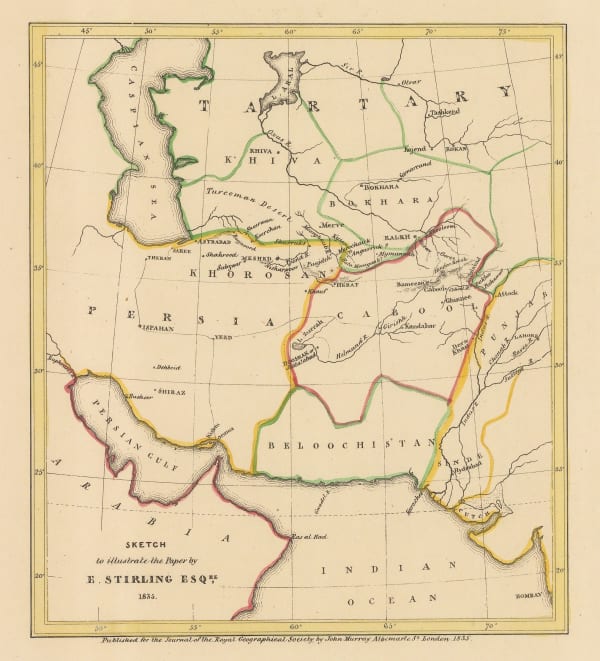
Sketch to Illustrate the Paper by E. Stirling Esq, 1835Royal Geographical Society (RGS)Series: LondonRoyal Geographical Society (RGS), Sketch to Illustrate the Paper by E. Stirling Esq, 1835£ 58.00
-
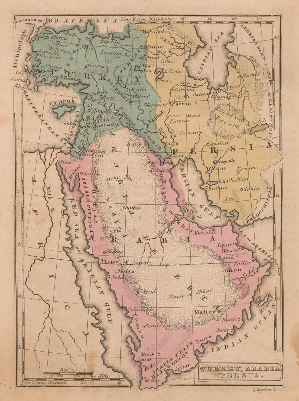
George Washington Boynton, Turkey, Arabia & Persia, 1835 c.£ 145.00
-
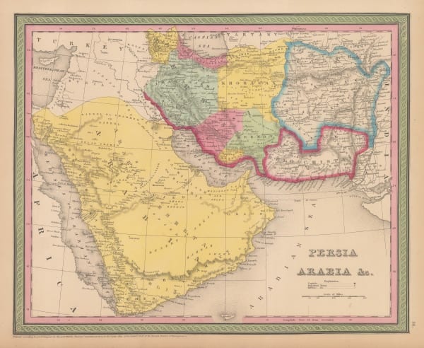
Rest Fenner, Persia and Arabia, 1836£ 98.00
-
Royal Geographical Society (RGS), Sketch map of the Iran and Iraq border, 1839£ 145.00
-
Samuel Augustus Mitchell, Arabia, Persia, 1840 c£ 575.00
-
Royal Geographical Society (RGS), Northwestern Iran, 1842£ 82.00
-
Map to Illustrate Mr. Layard's Paper on Khuzistan, 1846Royal Geographical Society (RGS)Series: LondonRoyal Geographical Society (RGS), Map to Illustrate Mr. Layard's Paper on Khuzistan, 1846£ 98.00
-
-
-
John Tallis, Persia, 1851£ 425.00
-
Map to Illustrate Notes on Routes from Bushire to Shiraz by Lt. Genl. Monteith and from Shiraz to Darab & thence to Kazerin by Consul Keith E.Abbott, 1857Royal Geographical Society (RGS)Series: LondonRoyal Geographical Society (RGS), Map to Illustrate Notes on Routes from Bushire to Shiraz by Lt. Genl. Monteith and from Shiraz to Darab & thence to Kazerin by Consul Keith E.Abbott, 1857£ 98.00
-
Joseph Hutchins Colton, Middle East, 1858£ 245.00
-
Justus Perthes, Mount Damavand, Iran, 1859£ 95.00
-
Route map from the Persian Gulf to Tehran and Herat, 1861Royal Geographical Society (RGS)Series: LondonRoyal Geographical Society (RGS), Route map from the Persian Gulf to Tehran and Herat, 1861£ 84.00
-
Royal Geographical Society (RGS), Persia, Beluchistan and Afghanistan, 1867£ 115.00
-
Justus Perthes, German map of Central Persia (Iran), 1874£ 68.00
-
A Map of The Northern Frontier of Khorassan with parts of Irak & Mazandaran, 1876Royal Geographical Society (RGS)Series: LondonRoyal Geographical Society (RGS), A Map of The Northern Frontier of Khorassan with parts of Irak & Mazandaran, 1876£ 445.00
-
Royal Geographical Society (RGS), Route Map from Jask to Bampūr, 1877£ 125.00
-
A Map of a Route Along the Alburz Mountains Between Tehran, Astrabad and Shahrud, 1883Royal Geographical Society (RGS)Series: LondonRoyal Geographical Society (RGS), A Map of a Route Along the Alburz Mountains Between Tehran, Astrabad and Shahrud, 1883£ 495.00
-
Henry Cuthbert Tunison, The Middle East, 1885 (c.)£ 175.00
-
Royal Geographical Society (RGS), Map of the Afgan and Persian Border, 1886£ 165.00
-
Royal Geographical Society (RGS), Central Iran (Persia), 1888£ 85.00
-
-
Royal Geographical Society (RGS), Persia, Afghanistan and Beluchistan, 1892£ 525.00
-
Royal Geographical Society (RGS), Iran, Arghanistan and Pakistan, 1902£ 325.00
-
Royal Geographical Society (RGS), Country between Bandar Abbas and Shiraz, 1908Sold
-
Royal Geographical Society (RGS), The Tigris Euphrates Delta, 1910£ 195.00
-
Royal Geographical Society (RGS), Sketch map of Northern Iran, 1911£ 125.00
-
Geographical Section, General Staff (GSGS), Persia (Iran) and Afghanistan, 1921£ 375.00
-
J.G. Bartholomew, Middle East, 1922£ 425.00
-
George Philip & Son Ltd., The Middle East, 1935 (c.)£ 195.00
-
British Admiralty, Entrance of the Persian Gulf, 1951£ 4,500.00
-
Geographical Section, General Staff (GSGS), Persian Gulf, 1956£ 750.00
-
Abbas Sahab, Isfahan: Half the World, 1961£ 675.00
Iran / Persia
Our entire inventory of over 10,000 antique and vintage maps is now available to browse by region, date, cartographer, and subject


![Maḥmūd & Qulī Khān, نقشۀ شهر دار الخلافۀ ناصرى طهران صانها الله تعالى عن الحدثان [Map of the city of the Nasserite caliphate of Tehran], 1891 c.](https://artlogic-res.cloudinary.com/w_600,c_limit,f_auto,fl_lossy,q_auto/artlogicstorage/themaphouse/images/view/ba254bcc61572c82a8055bad8e8e68f0j/themaphouse-ma-m-d-qul-kh-n-map-of-the-city-of-the-nasserite-caliphate-of-tehran-1891-c..jpg)