-
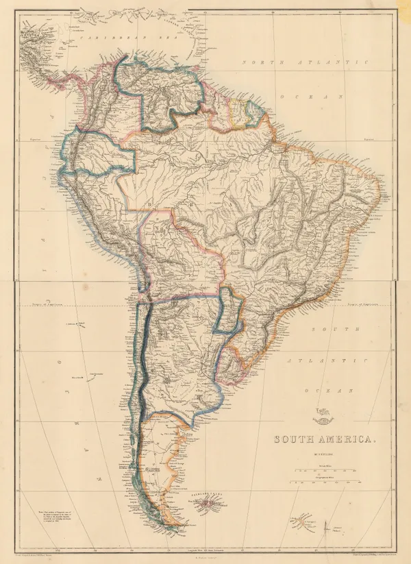
 Edward Weller, South America, 1863£ 145.00
 -
James Wyld, Argentine Confederation, 1863 c.£ 950.00
-
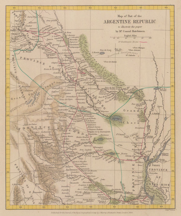
Royal Geographical Society (RGS), Provinces of Entre Rios and Cordova, 1864£ 175.00
-
Royal Geographical Society (RGS), Southern Andes, 1864£ 295.00
-
John Dower, Peru and Bolivia, 1865 c.£ 70.00
-
French Admiralty, Chart of the Falkland Islands, 1868£ 2,450.00
-
Justus Perthes, Northern Chile, 1870£ 195.00
-
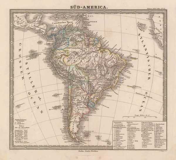
Justus Perthes, South America showing European possessions, 1870 c.£ 55.00
-
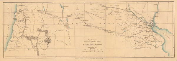
Projected railway route from Buenos Aires to Chile, 1873Royal Geographical Society (RGS)Series: LondonRoyal Geographical Society (RGS), Projected railway route from Buenos Aires to Chile, 1873£ 195.00
-
James Wyld, Republics of Peru and Bolivia, 1874£ 78.00
-
Justus Perthes, Central Chile, 1875£ 78.00
-
Justus Perthes, Northern Chile, 1875£ 125.00
-
Royal Geographical Society (RGS), North-East Brazil, 1876£ 145.00
-
Justus Perthes, The Lost Bolivian Coast, 1876£ 250.00
-
Colombia, Venezuela and Ecuador, 1879Society for the Diffusion of Useful Knowledge (SDUK)Series: LondonSociety for the Diffusion of Useful Knowledge (SDUK), Colombia, Venezuela and Ecuador, 1879£ 295.00
-
Justus Perthes, Southern Chile, 1880£ 195.00
-
Justus Perthes, South America, 1880 c.£ 45.00
-
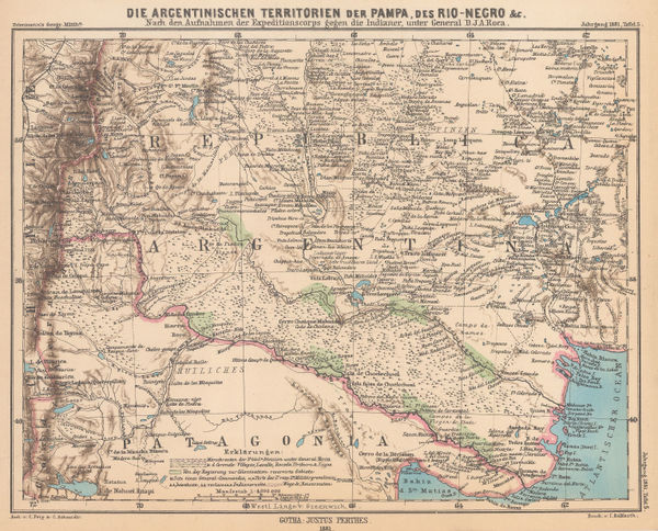
Justus Perthes, The Conquest of the Desert Campaigns, 1881£ 85.00
-
Letts & Son, Colombia and Venezuela, 1882£ 85.00
-
Letts & Son, Patagonia, Chile, Tierra del Fuego and The Falklands, 1883£ 78.00
-
Letts & Son, Southern Peru & Bolivia, 1883£ 74.00
-
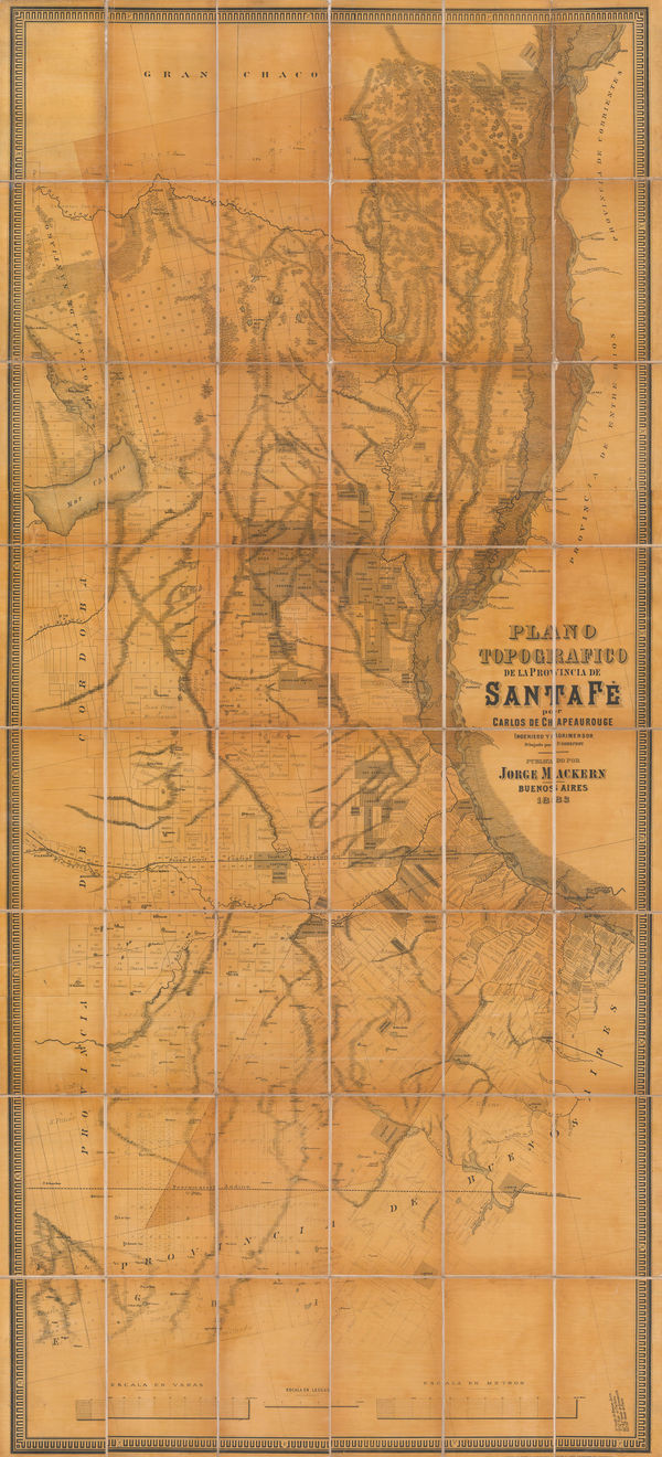
Jorge Mackern, Santa Fe Province, Argentina, 1883£ 375.00
-
Royal Geographical Society (RGS), The Central and Western Provinces of Colombia, 1883£ 375.00
-
Eugène Andriveau-Goujon, Wall map of South America, 1884£ 1,250.00
-
A. Simon, Docks of Rio de Janeiro, 1884£ 395.00
-
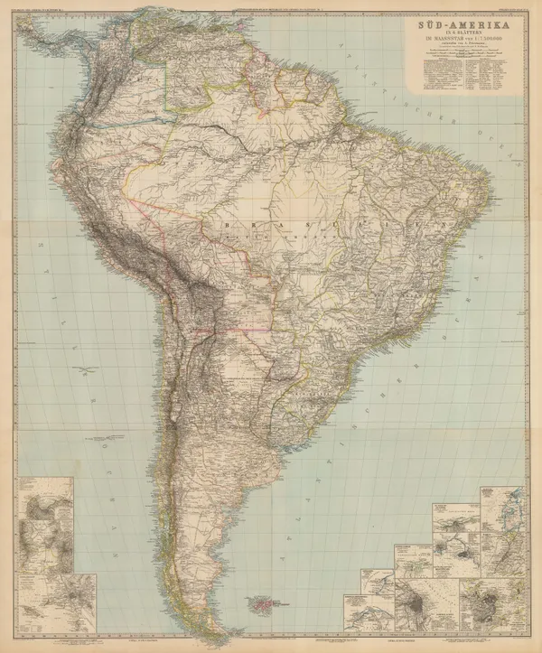
Justus Perthes, South America, 1885£ 625.00
-
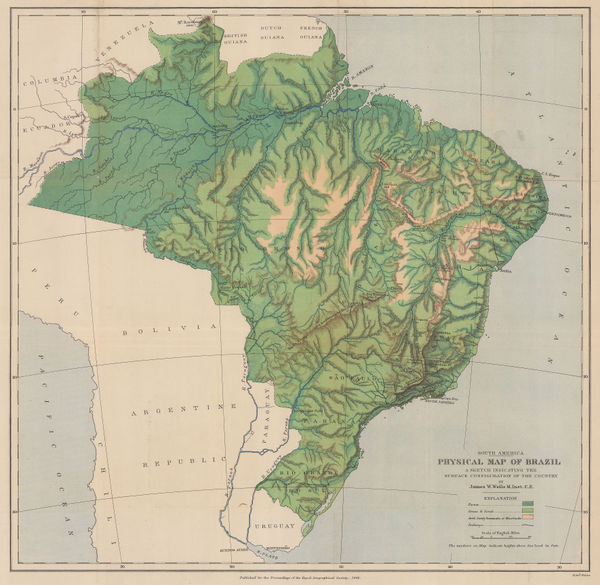
Royal Geographical Society (RGS), Physical Map of Brazil, 1886£ 295.00
-
J.G. Bartholomew, South America, 1886£ 38.00
-
Justus Perthes, German colony of São Lourenço, Brazil, 1887£ 58.00
-
Justus Perthes, Andes in Colombia, 1888£ 445.00
-
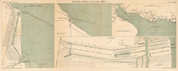
A. Simon, Charts of Río de la Plata and the harbours of Buenos Aires and La Plata, 1889£ 285.00
-
Arbuckle Brothers Company, Bolivia, 1889£ 98.00
-
Arbuckle Brothers Company, Chile, Argentina, and Patagonia, 1889£ 145.00
-
Arbuckle Brothers Company, Ecuador, 1889£ 98.00
-
Arbuckle Brothers Company, Paraguay, 1889£ 125.00
-
Emmanuel de Bourgade, Paraguay, 1889£ 850.00
-
Arbuckle Brothers Company, Argentina, 1889£ 145.00
-
Arbuckle Brothers Company, Uruguay, 1889£ 165.00
-
Arbuckle Brothers Company, [Peru], 1890 c.£ 80.00
-
Justus Perthes, North west Patagonia and southern central Pampa, 1893£ 395.00
-
Edward Stanford, The Falkland Islands, Surveyed by Capt. Robert Fitz Roy, R. N., 1894£ 375.00
-
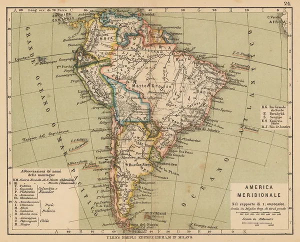
Ulrico Hoepli, South America after the War of the Pacific, 1897£ 36.00
-
Justus Perthes, Tierra del Fuego and the Magellan Straits, 1897£ 95.00
-
Royal Geographical Society (RGS), Route of the first ascent of Aconcagua, 1898£ 155.00
-
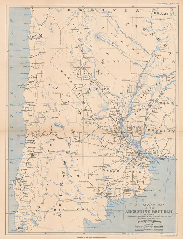
Royal Geographical Society (RGS), A Railway Map of the Argentine Republic, 1898£ 225.00
-
Royal Geographical Society (RGS), La Paz and environs, 1900£ 225.00
-
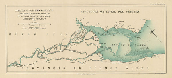
Royal Geographical Society (RGS), Delta of the Rio Parana, 1901£ 225.00
-
Royal Geographical Society (RGS), Delta of the Amazon, 1901£ 195.00
-
-
William Field, Railway map of Argentina, 1908£ 4,750.00
-
Enciclopedia Segui, Plano de Bogotá, 1910 (c.)£ 88.00
-
Enciclopedia Segui, Caracas, Venezuela, 1910 (c.)£ 80.00
-
Enciclopedia Segui, Colombia, 1910 (c.)£ 65.00
-
Enciclopedia Segui, Chile, 1910 (c.)£ 72.00
-
Enciclopedia Segui, Buenos Aires, 1910 (c.)£ 115.00
-
George Philip & Son Ltd., Northwester South America, 1910 c.£ 55.00
-
George Philip & Son Ltd., South America: Industries & Communications, 1910 c.£ 175.00
-
Royal Geographical Society (RGS), State of Bahia and the environs of Salvador, 1911£ 98.00
-
Central Argentine Railways, Map of the Argentine Railways, 1911£ 900.00
-
Gentil De Assis Moura, Wall map of Southern Brazil, 1912£ 925.00
-
-
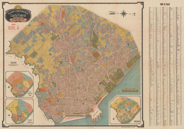
A. Bemporat, Wall map of Buenos Aires, 1915 c.£ 975.00
-
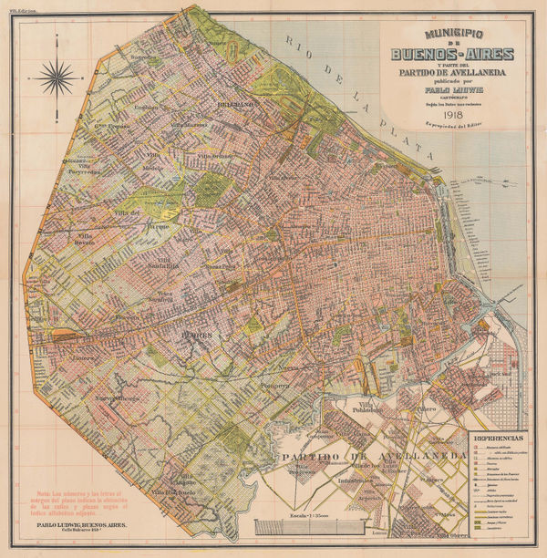
Pablo Ludwig, Municipality of Buenos Aires, 1918£ 1,450.00
-
Edward Stanford, Eastern Brazil, 1920£ 295.00
-
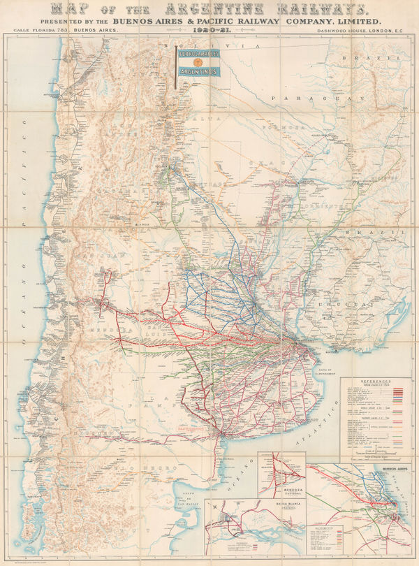
Waterlow & Sons, Railway Map of Argentina, 1921£ 1,350.00
-
John Bartholomew & Son, Guyana, 1927£ 55.00
-
Sifton Praed & Co., Suriname, 1931£ 24.00
-
Lith. Ypiranga, Rio de Janeiro, 1936£ 950.00
-
John Groth, WW2 Pictorial map of South America, 1938£ 950.00
-
The Magellan Straits and southern Patagonia, 1939Instituto Geografico MilitarSeries: Santiago de ChileInstituto Geografico Militar, The Magellan Straits and southern Patagonia, 1939£ 850.00
-
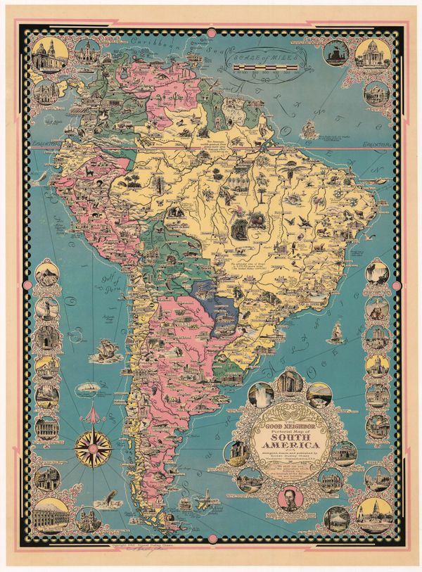
Ernest Dudley Chase, The Good Neighbor Pictorial Map of South America, 1942£ 750.00
-
Anonymous, Buenos Aires, 1950£ 1,650.00
-
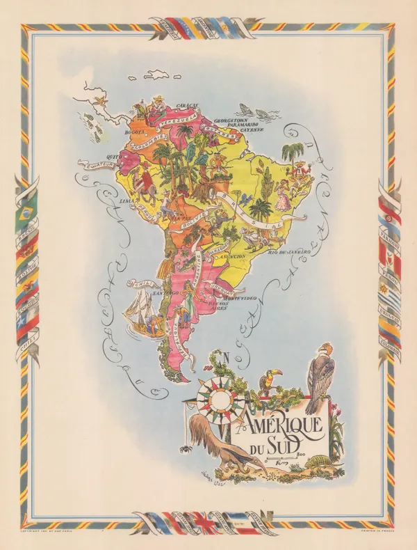
Air France, Air France Postcard - 'Amérique du Sud', 1950 c.£ 250.00
-
Jacques Liozu, Decorative map of South America, 1951£ 195.00
-
Chart of the Brazilian coast from Rio de Janeiro to Cabo Sao Tome, 1958British AdmiraltySeries: LondonBritish Admiralty, Chart of the Brazilian coast from Rio de Janeiro to Cabo Sao Tome, 1958Sold
-
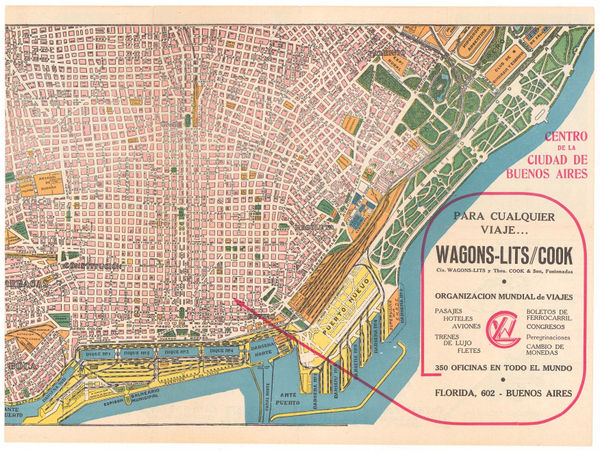
Wagon-Lits and Cook, Buenos Aires, 1965 c.£ 325.00


![Arbuckle Brothers Company, [Peru], 1890 c.](https://static-assets.artlogic.net/w_600,c_limit,f_auto,fl_lossy,q_auto/artlogicstorage/themaphouse/images/view/fc1c3765a84fd0c05ec1cbea7d610128j/themaphouse-arbuckle-brothers-company-peru-1890-c..jpg)


Page
4
of 4