-

-
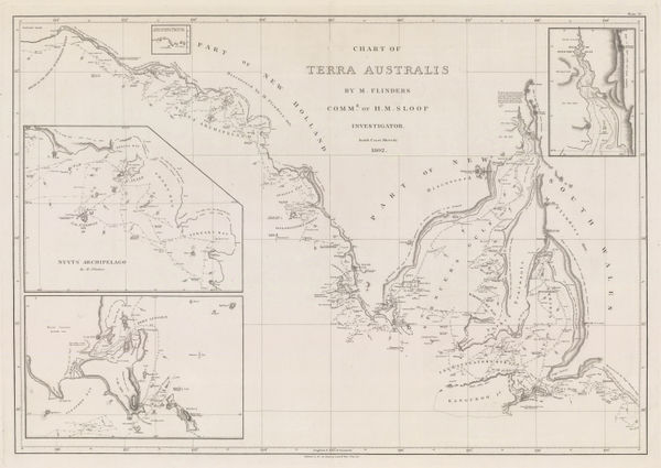
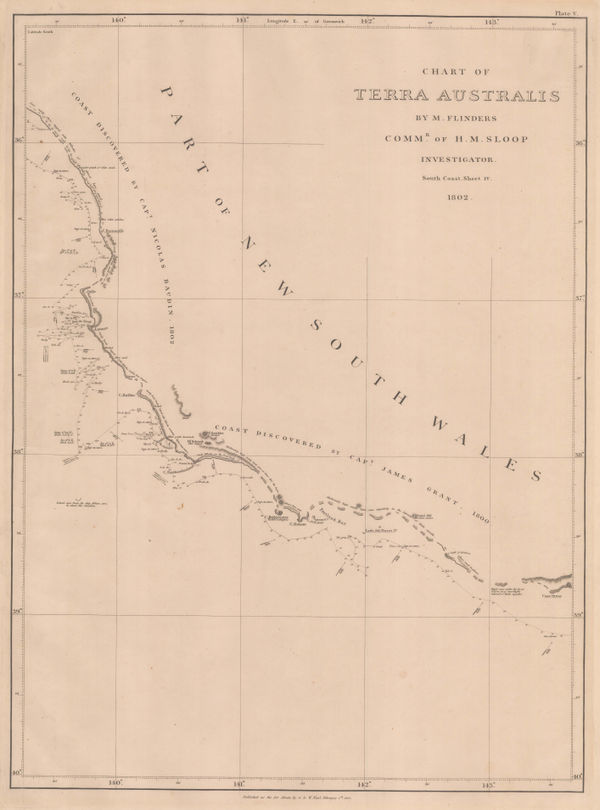
Matthew Flinders, Southern Australian coast from Melbourne to Adelaide, 1814£ 2,500.00
-
Philippe Vandermaelen, South Australia & Adelaide, 1827£ 645.00
-
Justus Perthes, Southeastern Australia, 1834£ 375.00
-
Royal Geographical Society (RGS), South Australia, east of the Flinders Range, 1844£ 98.00
-
John Tallis, South Australia, Spencer Gulf and Kangaroo Island, 1851£ 425.00
-
Justus Perthes, Lakes Torrens and Gairdner, 1860£ 72.00
-
North and east shores of Lake Eyre, routes of Egerton-Warburton, Walder, Kramer, and Meissel, 1867Justus PerthesSeries: GothaJustus Perthes, North and east shores of Lake Eyre, routes of Egerton-Warburton, Walder, Kramer, and Meissel, 1867£ 88.00
-
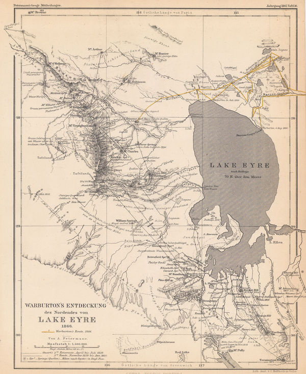
Justus Perthes, Lake Eyre, Stuart's and Warburton's discoveries, 1867£ 65.00
-
Justus Perthes, South Australia between Lake Eyre and Lake Blanche, 1870£ 52.00
-
Royal Geographical Society (RGS), Overland route from Perth to Adelaide , 1871£ 695.00
-
Justus Perthes, J.M. Gilmore's Expeditions in Southwest Queensland, 1872£ 68.00
-
Justus Perthes, Lake Eyre and environs, J. W. Lewis' expedition, 1875£ 64.00
-
Ernest Giles's expedition from Port Augusta to Perth, 1876Royal Geographical Society (RGS)Series: LondonRoyal Geographical Society (RGS), Ernest Giles's expedition from Port Augusta to Perth, 1876£ 585.00
-
Justus Perthes, Ernest Giles's expeditions across Southern Australia, 1876£ 195.00
-
Royal Geographical Society (RGS), Central Australia north of Lake Eyre, 1884£ 115.00
-
John Bartholomew, West Australia | South Australia, 1887£ 58.00
-
W. & A.K. Johnston, South Australia, New South Wales and Victoria, 1890 c.£ 145.00
-
Edward Stanford, South Australia and Northern Territory, 1898£ 58.00
-
E. Baudelot, Adelaide, 1911£ 62.00
-
John Bartholomew & Son, Adelaide - P&O Ports Guide, 1930 (c.)£ 75.00
South Australia
Our entire inventory of over 10,000 antique and vintage maps is now available to browse by region, date, cartographer, and subject