-
 Jacques-Nicolas Bellin, Porto Venere, 1764£ 175.00
 -
Jacques-Nicolas Bellin, Savona, 1764£ 195.00
-
Jacques-Nicolas Bellin, Porto Ercole, 1764£ 195.00
-
Jacques-Nicolas Bellin, Livorno, 1764£ 245.00
-
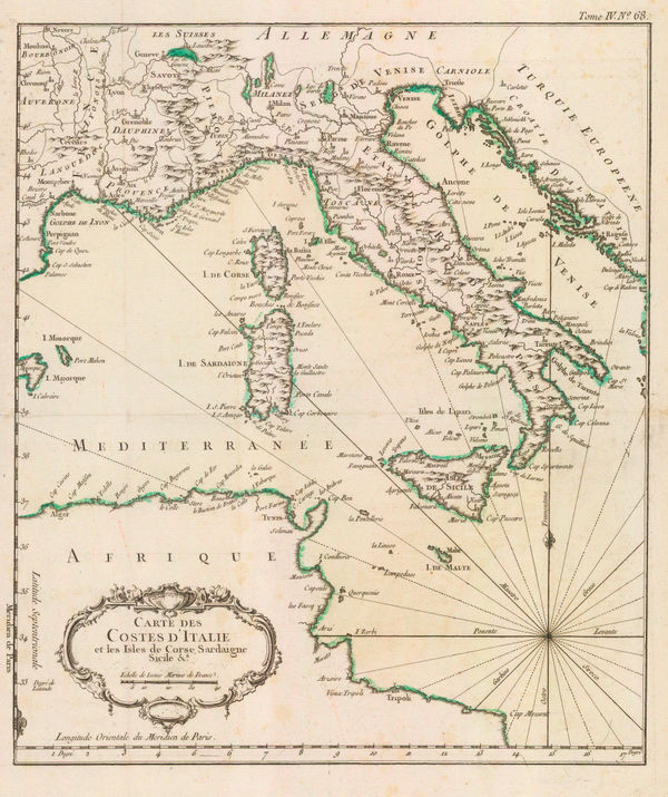
Jacques-Nicolas Bellin, The Coasts of Italy, Sardinia & Corsica, 1764£ 345.00
-
Jacques-Nicolas Bellin, Genoa, 1764£ 325.00
-
Emanuel Bowen, Livorno and Ligurian coast, 1766£ 225.00
-
Étienne André Philippe de Prétot, Southern Italy, Sicily, Sardinia and Corsica, 1768£ 295.00
-
Étienne André Philippe de Prétot, Northern Italy, 1768£ 195.00
-
Guillaume De L'Isle, French-Italian border - Piedmont and Monferrat, 1770 c.£ 700.00
-
John Andrews, A Plan of the City of Turin, 1771£ 240.00
-
Willem Albert Bachiene, Savoy, Piedmont and Montserrat, 1779£ 395.00
-
Francois Santini, Duchy of Milan, 1780£ 345.00
-
Richard William Seale, Italy, 1780 c.£ 675.00
-
John Harrison, Italy, 1783£ 115.00
-
Francois Santini, Italy, Sicily, Sardinia and Corsica, 1784£ 425.00
-
Robert Sayer, Italy, Sicily, Sardinia & Corsica, 1790£ 295.00
-
Charles Francois Delamarche, Italy, 1795£ 285.00
-
Teodore Viero, Venice, 1798£ 2,450.00
-
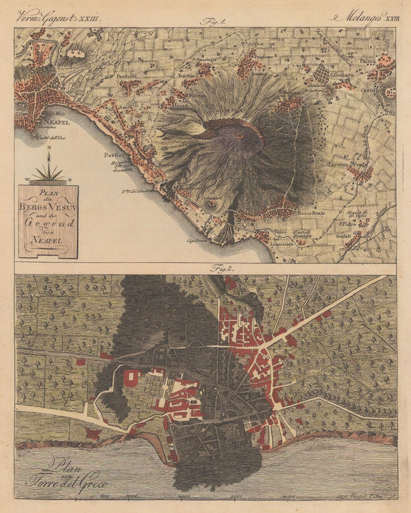
Friedrich Justin Bertuch, Naples and Mt Vesuvius with Torre del Greco, 1798£ 125.00
-
John Stockdale, Venice, 1800£ 375.00
-
Robert Wilkinson, Siciliae Antiquae Tabula, 1800£ 145.00
-
Voyage en Italie, City plan of Parma, 1800 c.£ 240.00
-
Voyage en Italie, City plan of Mantua, 1800 c.£ 240.00
-
Voyage en Italie, City plan of Naples, 1800 c.£ 260.00
-
Joseph Roux, Plan of Messina, 1804£ 95.00
-
Joseph Roux, Chart of Palermo harbour, 1804£ 95.00
-
C. & E. Brightly, Italy, 1807£ 115.00
-
John Cary, Northeast Italy, 1811£ 275.00
-
R. Juigne, Geographical Map of Italy, 1813£ 140.00
-
John Thomson, Italy, 1814£ 245.00
-
-
John Thomson, Northeast Italy, 1816£ 245.00
-
William Faden, The States of Upper Italy, 1819£ 145.00
-
Teodore Viero, Map of the Venetian Lagoon, 1820£ 1,250.00
-
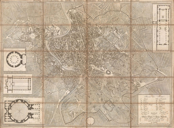
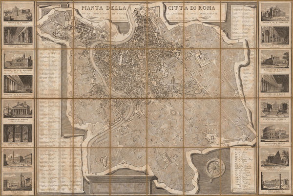
Venanzio Monaldini, City plan of Rome, 1820£ 745.00
-
John Cary, Italy, Sicily, Sardinia and Corsica, 1821£ 425.00
-
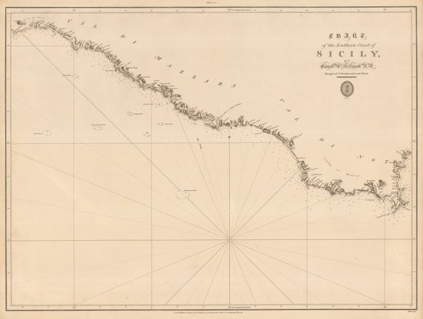
British Admiralty, Chart of the Southern Coast of Sicily, 1823£ 175.00
-
British Admiralty, Plan of the City, Environs and Anchorage of Girgenti, 1823£ 275.00
-
Venanzio Monaldini, Decorative plan of Rome, 1824£ 1,350.00
-
British Admiralty, The Coast of Italy from Naples to Cape Vaticano, 1827£ 200.00
-
C.V. Lavoisne, Geographical and Statistical Map of Italy, 1828£ 165.00
-
John Thomson, Milanese States or Kingdom of Lombardy-Venetia, 1828£ 175.00
-
John Thomson, Southern Italy and Sicily, 1828£ 295.00
-
Society for the Diffusion of Useful Knowledge (SDUK), Rome, 1830£ 195.00
-
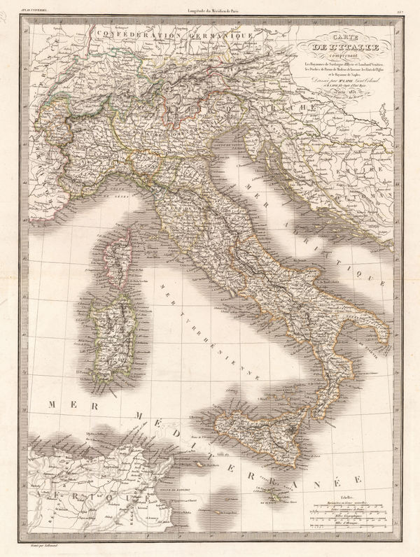
Alexandre Emile Lapie, Italy, 1831£ 120.00
-
Society for the Diffusion of Useful Knowledge (SDUK), Turin, 1833£ 145.00
-
Charles Smith, Northern and Central Italy, 1834£ 88.00
-
Adrien Brue, Italy, Sicily, Sardinia and Corsica, 1836£ 165.00
-
Society for the Diffusion of Useful Knowledge (SDUK), Venice, 1838£ 545.00
-
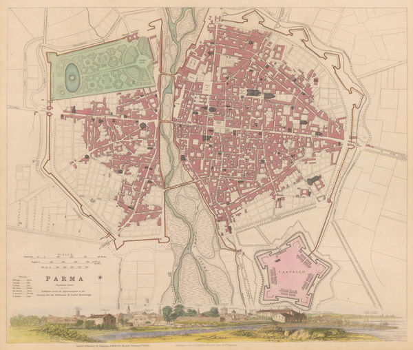
Society for the Diffusion of Useful Knowledge (SDUK), Parma, 1840£ 150.00
-
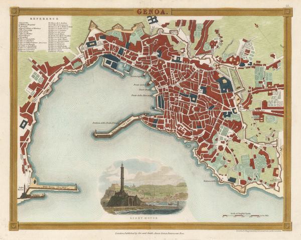
John Dower, Genoa, 1840 c.£ 175.00
-
Thomas Kelly, Italy, 1840 c.£ 125.00
-
W. & A.K. Johnston, Southern Italy and Sicily, 1840 c.£ 145.00
-
Robert Wilkinson, The Heart of the Roman Empire, 1842£ 125.00
-
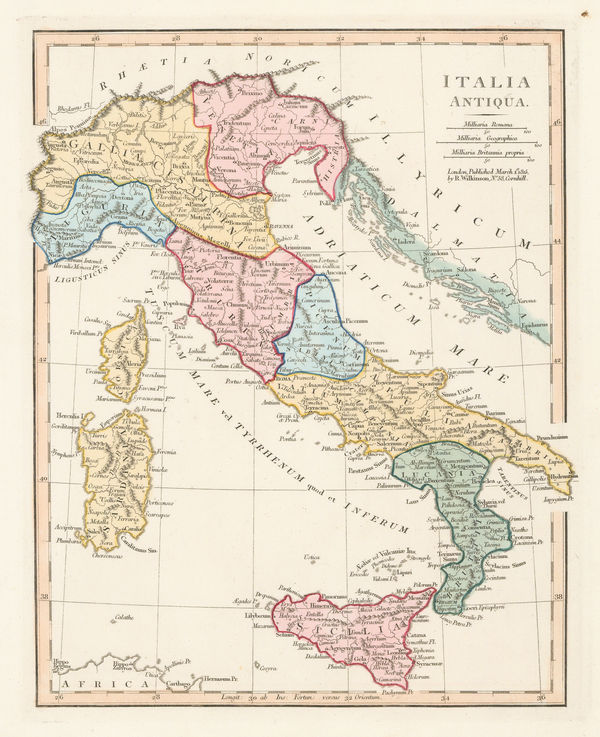
Robert Wilkinson, Ancient Italy, 1842£ 95.00
-
John Arrowsmith, South Italy, 1842£ 195.00
-
Society for the Diffusion of Useful Knowledge (SDUK), Ancient Rome, 1844£ 325.00
-
Society for the Diffusion of Useful Knowledge (SDUK), Florence, 1844£ 425.00
-
Joseph Meyer, Naples, 1845£ 495.00
-
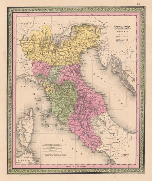
Northern Italy divided into pre-Unification territories, 1849Samuel Augustus MitchellSeries: PhiladelphiaSamuel Augustus Mitchell, Northern Italy divided into pre-Unification territories, 1849£ 125.00
-
James Wyld, Italy post Treaty of Paris, 1850 c.£ 395.00
-
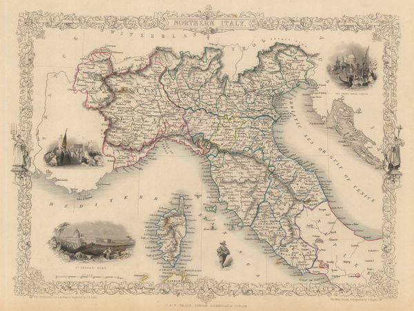
John Tallis, Northern Italy, 1851£ 245.00
-
John Tallis, Southern Italy, Sicily, Sardinia and Corsica, 1851£ 385.00
-
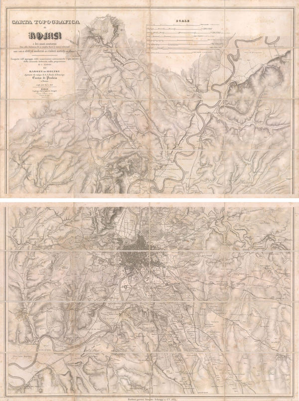
Helmuth von Moltke, Two sheet map of Rome and environs, 1852£ 825.00
-
George Philip, Italy, 1856£ 285.00
-
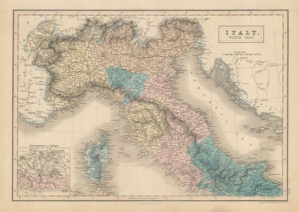
A. & C. Black, Northern Italy and Corsica, 1856£ 42.00
-
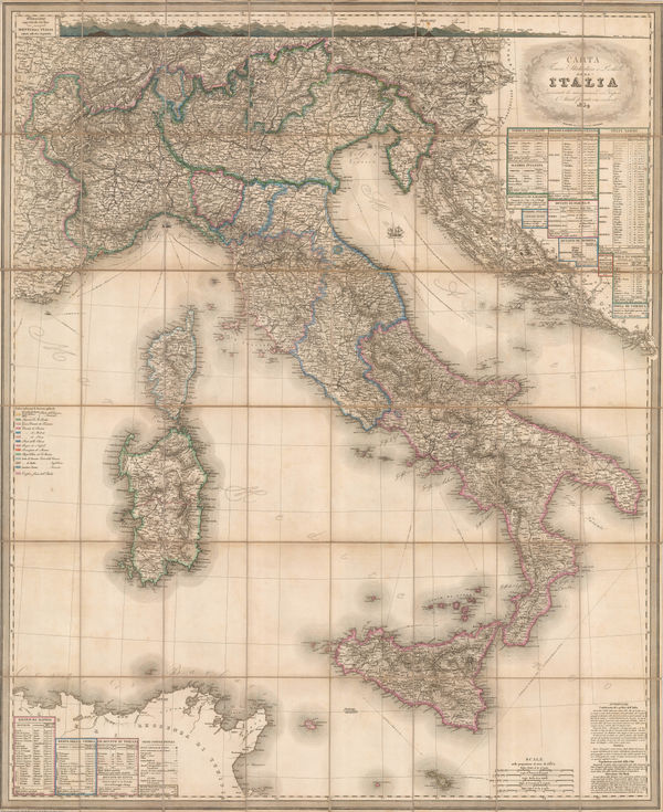
Stanislao Stucchi, Wall Map of Italy prior to Unification, 1859£ 1,350.00
-
Auguste-Henri Dufour, Italy, Sicily, Sardinia and Corsica, 1860£ 345.00
-
Service Hydrographique de la Marine, Rare chart of Panarea, Aeolian Islands, 1860£ 350.00
-
Archibald Fullarton, Rome with its Environs, 1860 c.£ 68.00
-
Joseph Hutchins Colton, Southern Italy, 1861£ 145.00
-
Johnson & Ward, Italy during the Italian Unification, 1863£ 145.00
-
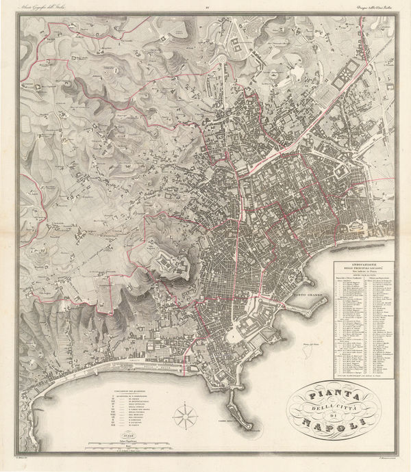
Antonio Vallardi, City plan of Naples, 1867 c.£ 425.00
-
Antonio Vallardi, City plan of Palermo, 1868£ 385.00
-
Aleph, Scarce caricature map of Italy, 1869£ 1,250.00
-
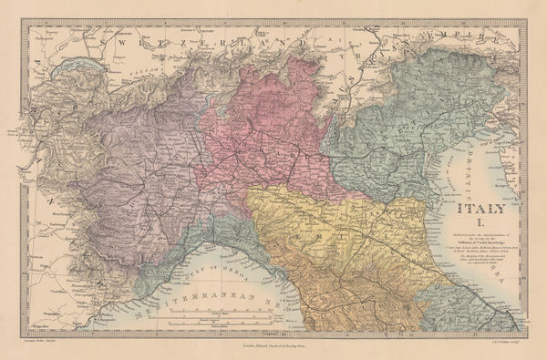
Society for the Diffusion of Useful Knowledge (SDUK), Northern Italy, 1875£ 98.00
-
Society for the Diffusion of Useful Knowledge (SDUK), Italy, 1876£ 175.00
-
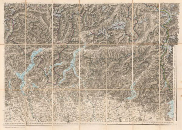
Edward Stanford, The Italian Alps, 1876£ 495.00
-
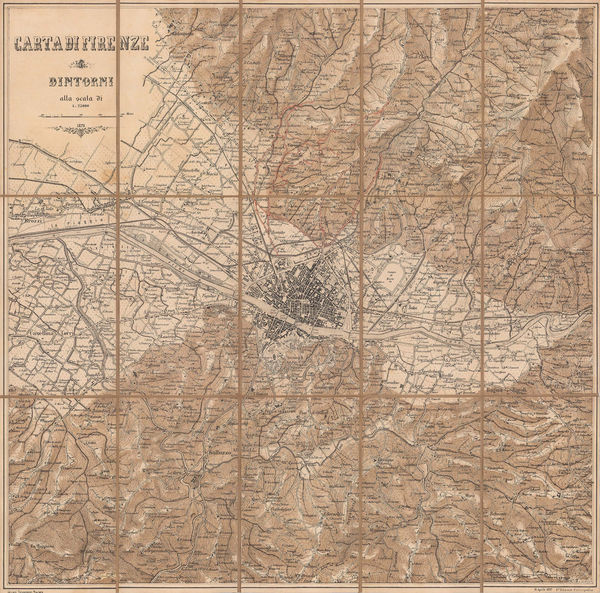
Istituto Geografico Militare (IGM), Florence and environs, 1877£ 325.00


Page
3
of 5