-
 Lilian Tennant, England, 1912£ 385.00
 -
Ordnance Survey, Watford and High Wycombe, 1912 c.£ 115.00
-
Wm. C. Gentry, North-East Kent, 1915 (c.)£ 295.00
-
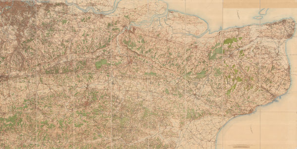
Railway Clearing House, Official Railway Map of the West of England, 1918£ 395.00
-
Ordnance Survey, Canterbury, 1920£ 195.00
-
Ordnance Survey, York, 1920£ 275.00
-
Ordnance Survey, Geological Survey of England and Wales, 1920£ 150.00
-
George W. Bacon, Plan of the Borough of Sunderland, 1920 (c.)£ 125.00
-
George W. Bacon, Halifax, West Yorkshire, 1920 (c.)£ 150.00
-
George W. Bacon, Leeds, 1920 c.£ 295.00
-
George W. Bacon, Bournemouth, 1920 c.£ 325.00
-
Pharus, Leeds, 1920 c.£ 650.00
-
George W. Bacon, Portsmouth, 1920 c.£ 295.00
-
George W. Bacon, Scarborough, 1920 c.£ 325.00
-
George W. Bacon, Tunbridge Wells, 1920 c.£ 195.00
-
George W. Bacon, Eastbourne, 1920 c.£ 95.00
-
Ordnance Survey, South London, Kent & East Sussex, 1920 c.£ 450.00
-
Ordnance Survey, Geological Survey of England and Wales, 1925£ 120.00
-
Alexander Gross, Pictorial Map of the Thames and Medway, 1925 c.£ 945.00
-
Edward Stanford, Beaufort Hunt, Gloucestershire, 1925 c.£ 345.00
-
Edward Stanford, Dorsetshire, Somersetshire and South Wiltshire, 1928£ 56.00
-
Edward Stanford, Hampshire, 1928£ 52.00
-
Edward Stanford, Herefordshire and Monmouthshire, 1928£ 28.00
-
Edward Stanford, Lincolnshire, 1928£ 36.00
-
Edward Stanford, Norfolk, 1928£ 42.00
-
Edward Stanford, Northumberland, 1928£ 28.00
-
Edward Stanford, Suffolk, 1928£ 42.00
-
Edward Stanford, Cheshire, 1928£ 52.00
-
Ordnance Survey, Isle of Wight, 1928£ 150.00
-
Rand, McNally & Co., A Pictorial Chart of English Literature, 1929£ 1,450.00
-
Ordnance Survey, Ordnance Survey Road Map of S.W. Cornwall & Scilly Isles, 1929£ 125.00
-
William Harding Thompson, Map of Cornwall, 1929£ 125.00
-
William Harding Thompson, Map of Cornwall, 1929£ 145.00
-
John Bartholomew & Son, The Thames to Windsor, 1929£ 55.00
-
Ward, Lock & Co, The Cotswolds - North, 1930 (c.)£ 175.00
-
Ward, Lock & Co, The Cotswolds - South, 1930 (c.)£ 145.00
-
Hadlow & Sons, Brighton & Hove, 1930 c.£ 225.00
-
Ward, Lock & Co, The Cotswolds, 1930 c.£ 55.00
-
J.W. Harding & Co., Touring Map of the Cornish Riviera, 1930 c.£ 375.00
-
Royal Geographical Society (RGS), South Haven Peninsula : Studland Heath, 1933£ 225.00
-
William Harding Thompson, Devon, 1934£ 125.00
-
William Harding Thompson, Sussex, 1935£ 145.00
-
James Imray, Needles Channel to Start Point, 1938£ 525.00
-
Ordnance Survey, Stow on the Wold, 1941£ 185.00
-
Ordnance Survey, Bodmin - O.S.Sheet 136, 1942£ 125.00
-
War Office, Brixham Harbour, 1943£ 28.00
-
War Office, Dover, 1943£ 48.00
-
War Office, Hythe, 1943£ 36.00
-
War Office, Looe, 1943£ 45.00
-
War Office, Sheerness, 1943£ 34.00
-
War Office, St. Ives / Hayle, 1943£ 55.00
-
War Office, Tilbury and Gravesend, 1943£ 38.00
-
Anonymous, Portuguese WW2 Propaganda, 1943 c.£ 650.00
-
Royal Geographical Society (RGS), Britain's Areas of Natural Beauty, 1944£ 78.00
-
Ernest Clegg, Kent, Battle of Britain 1940-1941, 1945£ 95.00
-
Ernest Clegg, WW2 Map of Norfolk, 1945£ 250.00
-
Ernest Clegg, Derbyshire, 1946£ 65.00
-
Ward, Lock & Co, Newquay, 1946£ 52.00
-
Ward, Lock & Co, Bude, 1946£ 55.00
-
S.A. Baker, Torquay, 1946£ 125.00
-
Ernest Clegg, Hampshire, 1947£ 150.00
-
Ernest Clegg, Oxfordshire, 1947£ 125.00
-
Ernest Clegg, Somerset, 1947£ 250.00
-
Ernest Clegg, Yorkshire East Riding, 1947£ 250.00
-
Ernest Clegg, Devonshire, 1947£ 250.00
-
George Philip & Son Ltd., Philips' New Map of Surrey, 1950£ 625.00
-
G. I. Barnett, Lewes, 1950 c£ 95.00
-
William Bowyer, Devon, 1950 c.£3,000
-
William Bowyer, Somerset, 1950 c.£ 3,000.00
-
William Bowyer, Cornwall, 1950c£ 2,500.00
-
Leslie Bullock, Bath, 1951£ 595.00
-
Ordnance Survey, Cirencester, 1952£ 120.00
-
Ordnance Survey, Isle of Wight, 1952£ 95.00
-
Geographia Ltd., Margate, 1956£ 175.00
-
War Office, Newquay and Padstow, 1962£ 350.00
-
Ordnance Survey, Brands Hatch Circuit, 1964£ 850.00
-
Norman Killingray, Oxford, 1965 c.£ 195.00
-
Kerry Lee, Cambridge, 1968 c.£ 3,200.00
-
Biles, F.G., Lyme Regis, 1970 c£ 95.00
-
Dearde & Wade, Map of the New Forest, 1970c£ 85.00


Page
14
of 15