-
 Elias Baeck, The River Rhine, 1748£ 145.00
 -
Georges-Louis Le Rouge, Electorate of Brandenburg, 1748£ 50.00
-
Herman Moll, The North East Part of Germany, 1750 c.£ 65.00
-
Herman Moll, The North West Part of Germany, 1750 c.£ 65.00
-
Herman Moll, The South East Part of Germany, 1750 c.£ 65.00
-
Herman Moll, The South West Part of Germany, 1750 c.£ 65.00
-
Tobias Conrad Lotter, Germany and the Holy Roman Empire, 1755 c.£ 95.00
-
London Magazine, A Plan of the City of Berlin, 1760£ 285.00
-
Étienne André Philippe de Prétot, Circle of Bavaria, 1769£ 145.00
-
John Andrews, A Plan of the City of Hamburg, 1771£ 325.00
-
Antonio Zatta, Ansbach and Bayreuth, 1779£ 65.00
-
Thomas Kitchin, Poland, Lithuania and Prussia, 1785£ 155.00
-
William Faden, Germany and the Holy Roman Empire, 1788£ 195.00
-
John Thomson, Prussian Dominions, 1815£ 120.00
-
William Faden, The Kingdom of Prussia, 1819£ 65.00
-
William Faden, German Confederation, 1820£ 445.00
-
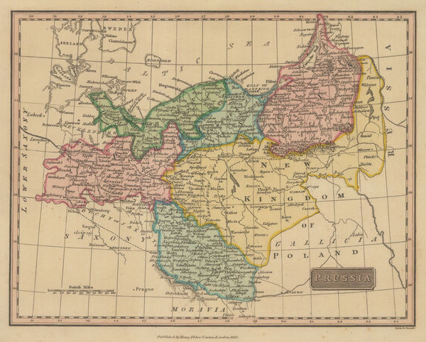
Henry Fisher, Prussia, 1823£ 55.00
-
Anthony Finley, Prussia, 1824£ 60.00
-
Society for the Diffusion of Useful Knowledge (SDUK), Munich, 1832£ 275.00
-
Society for the Diffusion of Useful Knowledge (SDUK), Dresden, 1833£ 165.00
-
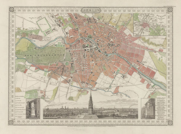
Society for the Diffusion of Useful Knowledge (SDUK), Berlin, 1833£ 295.00
-
James Wyld, German Confederation, 1844£ 375.00
-
Joseph Meyer, Munich, 1844£ 495.00
-
Joseph Meyer, Frankfurt, 1845£ 485.00
-
Joseph Meyer, Brandenburg, 1849£ 85.00
-
Samuel Augustus Mitchell, Prussia, 1850£ 40.00
-
Joseph Meyer, Berlin, 1850 c.£ 645.00
-
John Dower, Kingdom of Prussia , 1850 c.£ 65.00
-
John Tallis, Prussia, 1851£ 195.00
-
George Woolworth Colton, Prussia and Saxony, 1855£ 40.00
-
Aleph, Caricature map of Prussia, 1869£ 750.00
-
Society for the Diffusion of Useful Knowledge (SDUK), Hamburg, 1879£ 225.00
-
Society for the Diffusion of Useful Knowledge (SDUK), Frankfurt, 1879£ 265.00
-
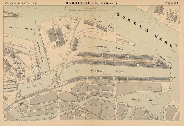
A. Simon, Ports of Hamburg, 1889£ 95.00
-
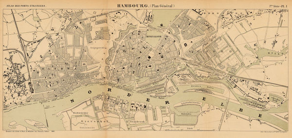
A. Simon, Port of Hamburg, 1889£ 195.00
-
Arbuckle Brothers Company, German Empire, 1889£ 88.00
-
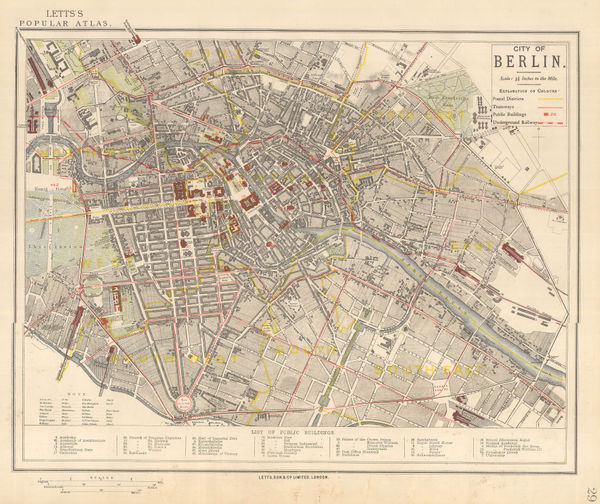
Letts & Son, City of Berlin, 1892£ 195.00
-
J.G. Bartholomew, Plan of Berlin, 1893£ 68.00
-
J.G. Bartholomew, Munich, 1893£ 68.00
-
J.G. Bartholomew, Plan of Hamburg, 1893£ 48.00
-
Oscar Brunn, Munich, 1912£ 650.00
-
Pharus, Berlin, 1914£ 225.00
-
Walter Riemer, Romanian Map of Germany for the 1936 Berlin Olympics, 1935£ 750.00
-
Rudolf Seeland, Berlin, 1936£ 165.00
-
Elite Autofahrt GmbH, Berlin to Potsdam tour map, 1937 c.£ 120.00
-
J.G. Bartholomew, The Western Front at the Outbreak of WW2, 1939£ 175.00
-
US Army Information Branch, Your War from D-Day On, 1945£ 4,500.00
-
Harold Sims, Berlin Airlift, 1949£ 1,500.00
-
Herman Bollman, Frankfurt am Main, 1957£ 250.00
-
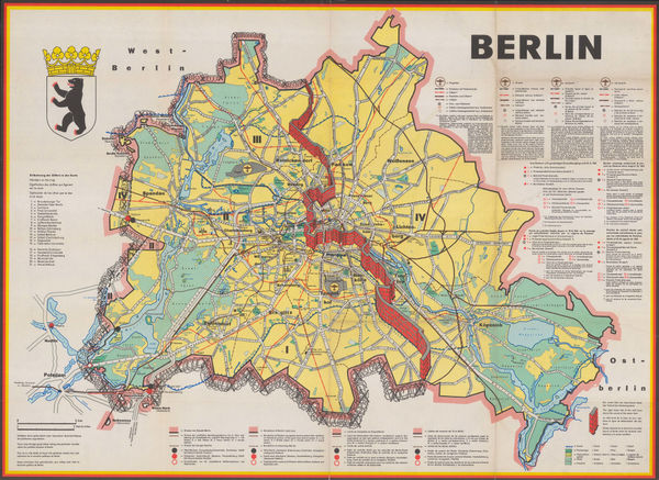
Gustav Fochler-Hauke, East and West Berlin, 1962£ 600.00


Page
2
of 2