-
 Samuel Augustus Mitchell, Switzerland, 1846£ 68.00
 -
W. & A.K. Johnston, Illustrations of the Glacier Systems of the Alps, 1848£ 425.00
-
James Wyld, Switzerland, 1850 c.£ 645.00
-
Samuel Augustus Mitchell, Austrian Empire, 1850 c.£ 125.00
-
George Philip, Austria, 1853£ 245.00
-
Charles V. Monin, Austrian or Austro-Hungarian Empire, 1853£ 52.00
-
John Dower, Geneva, 1855 c.£ 240.00
-
Heinrich Keller, Road Map of Switzerland, 1856£ 135.00
-
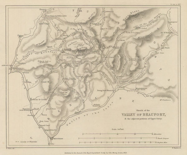
Royal Geographical Society (RGS), Valley of Beaufort and parts of Upper Savoy, 1856£ 175.00
-
Justus Perthes, Switzerland, 1860 c.£ 62.00
-
Victor Levasseur, Switzerland and North Italy, 1860 c.£ 175.00
-
W. & A.K. Johnston, Switzerland, 1860 c.£ 125.00
-
Justus Perthes, Geological Map of Austria-Hungary, 1863£ 125.00
-
Jean Joseph Mieulet, Controversial survey map of the Mont Blanc peaks., 1865£ 1,750.00
-
Bernhard Studer, Geological map of Switzerland, 1869 c.£ 1,650.00
-
J. Goubaud, Austrian or Austro-Hungarian Empire, 1870 c.£ 55.00
-
Justus Perthes, Northwest Switzerland, 1875£ 145.00
-
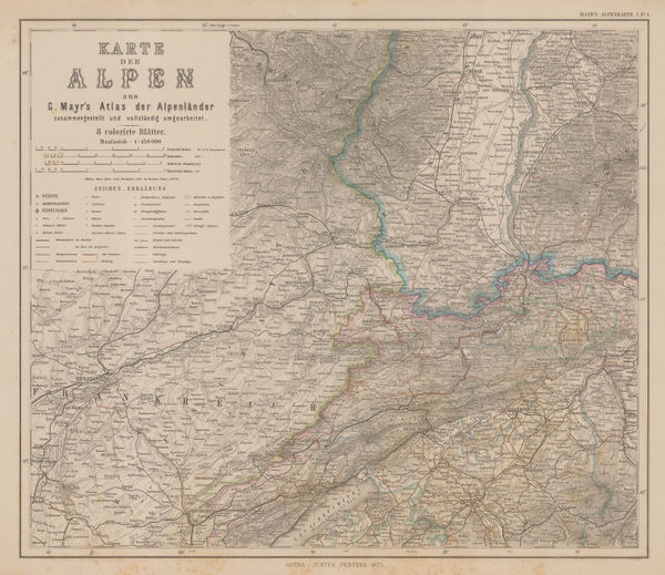
Justus Perthes, Swiss and Italian Alps, 1875£ 185.00
-
Justus Perthes, Salzburg, 1875£ 125.00
-
Edward Stanford, The Alpine Club Map of Switzerland, 1876£ 2,500.00
-
Society for the Diffusion of Useful Knowledge (SDUK), Vienna, 1879£ 145.00
-
Justus Perthes, The Alps, 1880 c£ 175.00
-
Blackie & Son, The Austrian Empire, 1880 c.£ 80.00
-
George Bradshaw, Vienna, 1880 c.£ 195.00
-
Adolphe Joanne, Haute Savoie & Mont Blanc, 1882£ 165.00
-
Letts & Son, The City of Vienna, 1882£ 225.00
-
J.G. Bartholomew, Austria-Hungary, 1887£ 55.00
-
George Bradshaw, Geneva, 1889£ 68.00
-
George Bradshaw, Vienna, 1889£ 225.00
-
Arbuckle Brothers Company, Switzerland, 1889£ 155.00
-
Arbuckle Brothers Company, Austria-Hungary, 1889£ 90.00
-
J.G. Bartholomew, Plan of Vienna, 1893£ 68.00
-
Karl Baedeker, Geneva, 1900 c.£ 58.00
-
Wagner & Debes, Lausanne, 1900 c.£ 32.00
-
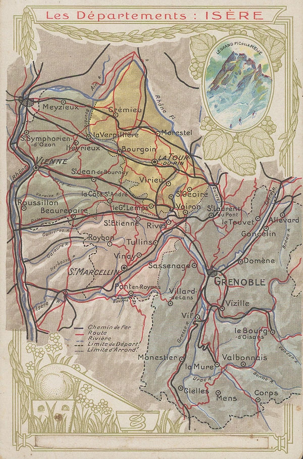
Chocolat d'Aiguebelle, Isère, 1900 c.£ 48.00
-
Wagner & Debes, Lucerne, 1900 c.£ 45.00
-
Karl Baedeker, Lake Lugano, 1900 c.£ 38.00
-
George Philip & Son Ltd., Austria-Hungary: Industries & Communications, 1910 c.£ 145.00
-
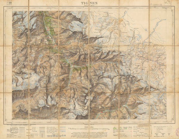
Service Géographique de l'Armée, Tignes/Val d'Isere, 1911£ 2,450.00
-
Kummerly & Frey, Montreux and environs, 1911£ 275.00
-
Edward Stanford, Zurich, 1912£ 65.00
-
Kummerly & Frey, Switzerland, 1920 c.£ 125.00
-
A. Trüb & Cie, Interlaken & Environs - Wengen, 1920 c.£ 295.00
-
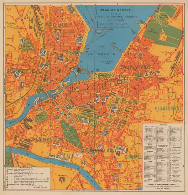
Association des intérêts de Genève, Plan of Geneva, 1925 (c.)£ 145.00
-
R Bakalla, Plan of Innsbruck, 1930£ 195.00
-
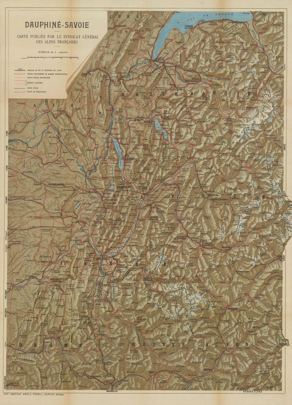
Orell Füssli, Dauphine-Savoie, 1930 c£ 650.00
-
Orell Füssli, Zurich, 1930 c.£ 325.00
-
Roto-Sadag, Geneva, 1937£ 175.00
-
Swiss Federal Railways, Switzerland, 1939£ 2,200.00
-
Orell Fussli & Co, Zurich, 1951£ 485.00
-
Wassermann, Basel, 1952£ 275.00
-
Orell Fussli & Co, Geneva, 1957£ 485.00
-
Louis Koller, Simmental - Gstaad, 1960 c.£ 2,450.00


Page
2
of 2