-
 Royal Geographical Society (RGS), Chart of the Currents Off the Cape of Good Hope, 1865£ 345.00
 -
British Admiralty, Chart of the Curves of Equal Magnetic Variation 1858., 1867£ 825.00
-
Alexander George Findlay, Chart of the North Sea, 1868£ 1,200.00
-
James Imray, Gulf of Mexico, 1868£ 3,500.00
-
Spanish Admiralty, Spanish Admiralty chart of the Chesapeake Bay, 1871£ 1,450.00
-
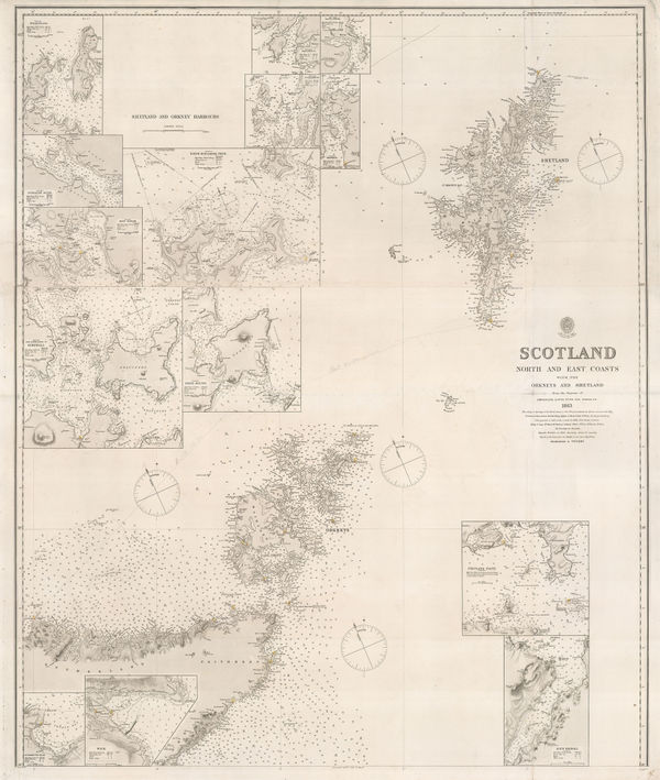
British Admiralty, Orkneys and Shetland Isles, 1872£ 325.00
-
Chart of Europe Shewing the Wrecks & Casualties to British Vessels Elsewhere than on the Coast of United Kingdom, 1875Board of Trade Wreck RegisterSeries: LondonBoard of Trade Wreck Register, Chart of Europe Shewing the Wrecks & Casualties to British Vessels Elsewhere than on the Coast of United Kingdom, 1875£ 385.00
-
Board of Trade Wreck Register, Shipwreck Chart of Britain & Ireland, 1875£ 425.00
-
Chart Shewing the Wrecks & Casualties on the Coasts of England & Wales, 1875Board of Trade Wreck RegisterSeries: LondonBoard of Trade Wreck Register, Chart Shewing the Wrecks & Casualties on the Coasts of England & Wales, 1875£ 345.00
-
Board of Trade Wreck Register, Shipwreck Chart of Britain & Ireland, 1875£ 425.00
-
British Admiralty, Isle of Skye, 1878£ 695.00
-
British Admiralty, Bay of Biscay, 1881£ 950.00
-
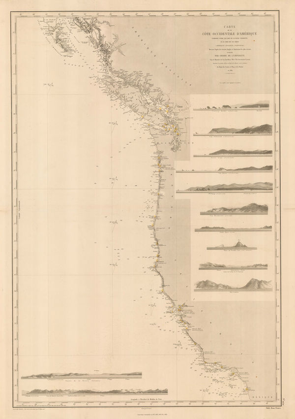
French Admiralty, Chart of the west coast of North America, 1881£ 825.00
-
-
British Admiralty, Cowes Harbour, 1882£ 1,150.00
-
James Imray, The Indian Ocean, 1882£ 52.00
-
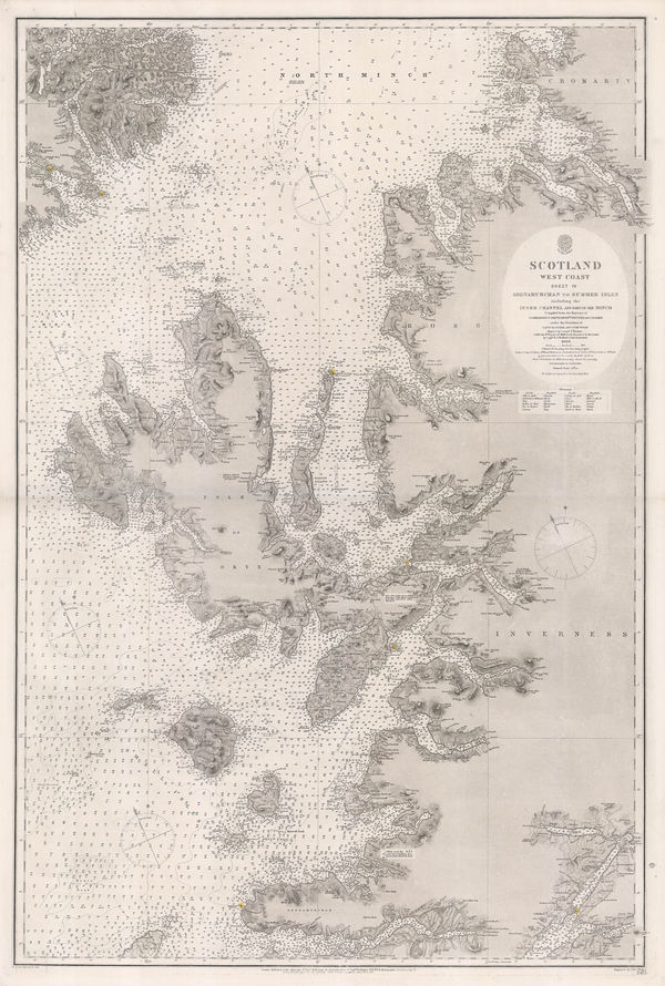
British Admiralty, Western Scotland, 1882£ 885.00
-
British Admiralty, Gulf of Mexico, 1891£ 1,550.00
-
British Admiralty, Sea Chart of the California Coast, 1895£ 750.00
-
British Admiralty, San Francisco Harbour, 1895£ 1,850.00
-
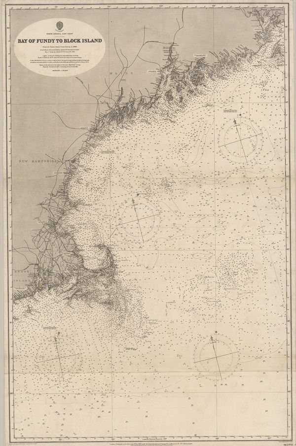
British Admiralty, Bay of Fundy to Block Island, 1896£ 2,150.00
-
British Admiralty, Cape Fear to Sapelo Sound, 1898£ 2,500.00
-
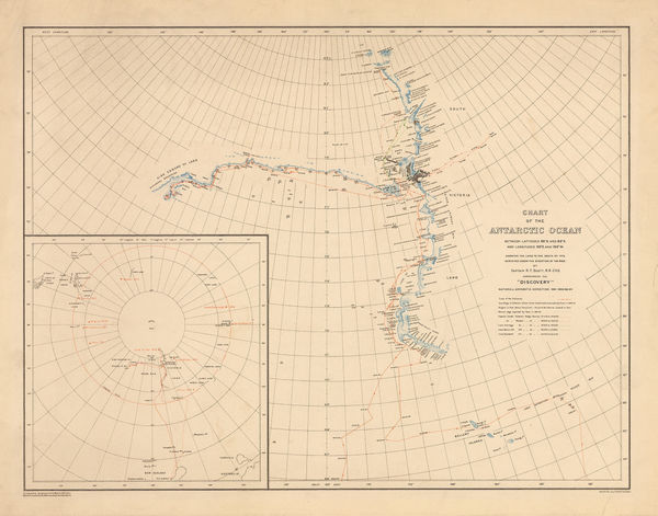
George F. A. Mulock, Chart of the Antarctic Ocean, 1904£ 1,750.00
-
British Admiralty, Hong Kong to Gulf of Liau-Tung, 1904£ 595.00
-
Anguilla to Puerto Rico shewing the Approaches to the Virgin Islands, 1905British AdmiraltySeries: LondonBritish Admiralty, Anguilla to Puerto Rico shewing the Approaches to the Virgin Islands, 1905£ 3,000.00
-
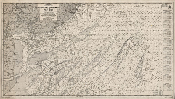
British Admiralty, River Thames, Kentish Knock and the Naze, 1913£ 175.00
-
British Admiralty, Turks Islands, 1917£ 945.00
-
Ordnance Survey, Heligoland 28th August 1914 General Chart of the Action, 1919£ 225.00
-
British Admiralty, Aegean Sea and Islands, 1922£ 1,450.00
-
James Reynolds, Reynolds's New Chart of the Thames Estuary, 1923£ 265.00
-
James Imray, Mouth of the River Thames, 1924£ 525.00
-
British Admiralty, Anamba Islands, 1927£ 325.00
-
British Admiralty, Guernsey, Herm and Sark, 1927£ 675.00
-
British Admiralty, Island of Jersey, 1927£ 675.00
-
British Admiralty, Mediterranean France - South Coast - Approaches to Toulon, 1927£ 225.00
-
British Admiralty, Chart of Sardinia on two sheets, 1927£ 1,250.00
-
British Admiralty, The Channel Islands and Adjacent Coasts of France, 1928£ 675.00
-
-
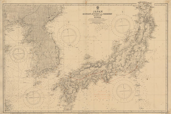
British Admiralty, Japan, Honshu, Kyushu & Shikoku and part of the Korea, 1934£ 895.00
-
British Admiralty, Malta and Gozo Islands, 1934£ 1,750.00
-
Edward Stanford, Chart of the Thames Estuary, 1936£ 345.00
-
James Imray, Needles Channel to Start Point, 1938£ 525.00
-
British Admiralty, Chart of the Windward Islands from Guadeloupe to Trinidad, 1941£ 445.00
-
British Admiralty, North America East Coast - Delaware Bay to Florida Strait, 1942£ 950.00
-
United States Hydrographic Office, Time Zone Chart of the World, 1944£ 785.00
-
British Admiralty, Mumbai (Bombay) Harbour, 1950£ 2,450.00
-
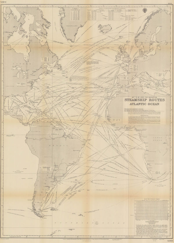
British Admiralty, Steamship Routes Atlantic Ocean, 1951£ 475.00
-
British Admiralty, Steamship Routes Indian Ocean, 1951£ 575.00
-
British Admiralty, Steamship Routes Pacific Ocean, 1951£ 575.00
-
British Admiralty, Entrance of the Persian Gulf, 1951£ 4,500.00
-
Bahama and Abaco Islands with the north west Providence Channel, 1953British AdmiraltySeries: LondonBritish Admiralty, Bahama and Abaco Islands with the north west Providence Channel, 1953£ 850.00
-
British Admiralty, South Eastern Portion of the Bahama Islands, 1953£ 850.00
-
British Admiralty, Chart of the Aeolian Islands, 1954£ 750.00
-
Atlantic and Indian Oceans with the Western Portion of the Pacific Ocean, 1957British AdmiraltySeries: LondonBritish Admiralty, Atlantic and Indian Oceans with the Western Portion of the Pacific Ocean, 1957£ 2,850.00
-
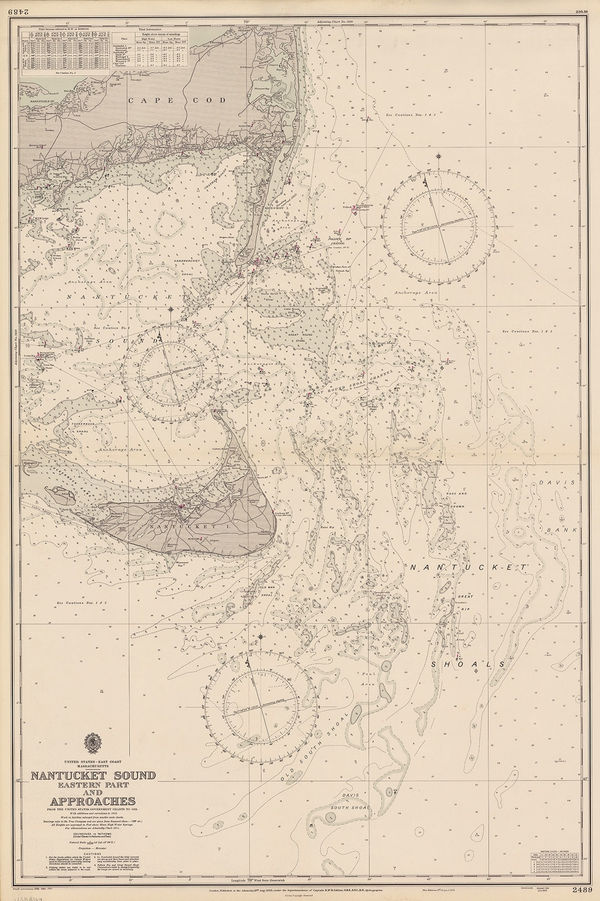
British Admiralty, Nantucket Sound (Eastern Part) and Approaches, 1958£ 495.00
-
British Admiralty, Nantucket Sound (Western Part) Buzzard's Bay and Approaches, 1958£ 495.00
-
British Admiralty, Turks and Caicos and the South Eastern Bahamas, 1958£ 675.00
-
British Admiralty, Tampa Bay, 1958£ 595.00
-
British Admiralty, China Sea, 1959£ 375.00
-
British Admiralty, Southern Part of Oahu, 1961£ 325.00
-
British Admiralty, Hawaiian or Sandwich Islands, 1962£ 445.00
-
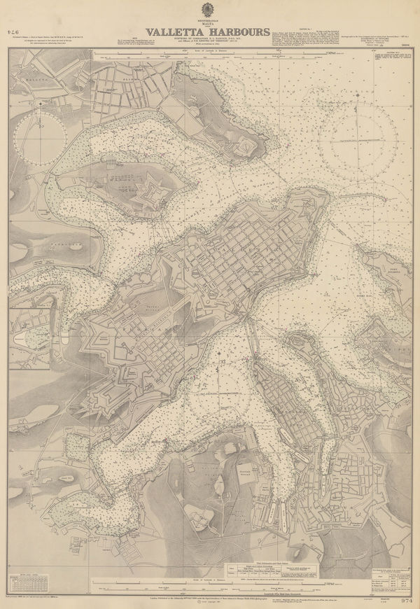
British Admiralty, Valletta Harbours, 1964£ 325.00
-
British Admiralty, Cayman Islands, 1966£ 1,400.00
-
Spanish Admiralty, Chart of Ibiza and Formentera, 1976£ 2,500.00
-
British Admiralty, The Maldives, 1976£ 650.00
-
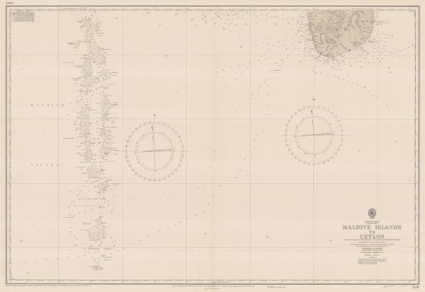
British Admiralty, Sea Chart of the Maldives to Sri Lanka, 1977£ 650.00


Page
2
of 2