-
 British Admiralty, Fiji - Nukulau Island to Namuka Island, 1914£ 475.00
 -
Royal Geographical Society (RGS), Geological Map of New Caledonia, 1917£ 285.00
-
US Navy Educational Services Section, WW2-era map of the Pacific, 1944£ 3,000.00
-
British Admiralty, Steamship Routes Pacific Ocean, 1951£ 575.00
-
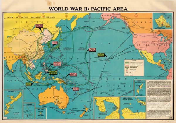
Franklin Scott, World War II: Pacific Area, 1954£ 445.00


Page
2
of 2